Custer, South Dakota

Last updated

Custer
Custer, South Dakota
Custer, SD.jpg
Custer Seal.png
Custer County South Dakota Incorporated and Unincorporated areas Custer Highlighted.svg
Location in Custer County and the state of South Dakota
Coordinates: 43°46′00″N103°35′56″W / 43.76667°N 103.59889°W / 43.76667; -103.59889
Country Flag of the United States.svg United States
State Flag of South Dakota.svg South Dakota
County Custer
Founded1875 [1]
Area
[2]
  Total2.54 sq mi (6.58 km2)
  Land2.53 sq mi (6.55 km2)
  Water0.01 sq mi (0.03 km2)
Elevation
[3]
5,315 ft (1,620 m)
Population
 (2020) [4]
  Total1,919
  Density758.50/sq mi (292.81/km2)
Time zone UTC−7 (MST)
  Summer (DST) UTC−6 (MDT)
Zip Code
57730
Area code 605
FIPS code 46-15140 [5]
GNIS feature ID1265633 [3]
Website City of Custer

Custer is a city in Custer County, South Dakota, United States. The population was 1,919 at the 2020 census. [6] It is the county seat of Custer County. [7]

Contents

History

Oxen-drawn freight team entering Custer in 1876 CusterCity1876front.jpg
Oxen-drawn freight team entering Custer in 1876

Custer is the oldest town established by European Americans in the Black Hills. Gold was discovered east of Custer during the Black Hills Expedition, conducted by the 7th Cavalry led by Lt. Colonel George Armstrong Custer, a discovery which initiated the Black Hills Gold Rush. [8]

For thousands of years, the Black Hills had been part of the territory of varying tribes of indigenous peoples. They were within historical territory of the Oglala Sioux at the time of United States encounter, and within the Great Sioux Reservation established by the US Treaty of Fort Laramie (1868). Having established dominance in the area by the eighteenth century, the Oglala Sioux had long considered the Black Hills as sacred land.[ citation needed ]

After increasing encroachment by Americans and violent confrontations, the U.S. government forced the Sioux to cede much of the Black Hills in 1877, and opened the land for individual purchase and settlement. In 1875 trespassing gold-boomers named their settlement Stonewall (after the Confederate general, Stonewall Jackson), but it was renamed for Custer. [9] Almost abandoned in 1876 after word of the much larger gold strikes in Deadwood Gulch spread, Custer later became an established city.[ citation needed ]

Custer has had a smaller population and been less wealthy than the Northern Hills cities of Deadwood and Lead. In addition to gold, Custer and other cities based their economies on the extraction of industrial minerals, which are still important to the regional economy.[ citation needed ]

Custer annually observes a "Gold Discovery Days" celebration and festivities over the last full weekend of July. This heritage tourism event celebrates the embezzlement of gold by the Custer expedition in nearby French Creek and the subsequent founding of the town.[ citation needed ]

Geography

According to the United States Census Bureau, the city has a total area of 2.54 square miles (6.58 km2), of which 2.53 square miles (6.55 km2) is land and 0.01 square miles (0.03 km2) is water. [10]

Climate

Custer has a humid continental climate (Köppen Dfb/Dwb) with summers featuring very warm afternoons and cool mornings, and cold, extremely variable winters.

Winter weather is dominated by the conflict between cold Arctic air moving south from Canada, and very warm chinook winds which can produce exceptionally high winter temperatures for the latitude and altitude. For instance, January 19 of 1963 saw the coldest temperature ever of −43 °F or −41.7 °C, yet in just over two weeks on February 5, Custer reached 65 °F or 18.3 °C.

The coldest month has been January 1957, which averaged 9.7 °F (−12.4 °C) and included twenty-two mornings reaching 0 °F or −17.8 °C – in contrast only one morning fell below zero Fahrenheit in the winter of 2015–16. On average the first temperature of 0 °F (−17.8 °C) will occur around November 25, and the last around March 8, whilst the corresponding window for freezing temperatures is from September 6 to June 2, allowing a frost-free season of only ninety-five days. Snowfall averages 57.9 inches or 1.47 meters, and has ranged from 93.3 inches (2.37 m) between July 1998 and June 1999, down to 15.9 inches (0.40 m) during the very mild and dry winter of 1933–34. The frequent chinooks limit snow cover: even in January the mean is only 2.0 inches or 5.1 centimeters. The most snow on the ground in Custer has been 27 inches (0.69 m) on April 15, 1927.

Custer's altitude makes summers much milder than in the Great Plains proper: only seven afternoons rise above 90 °F or 32.2 °C and 100 °F or 37.8 °C has been reached only once in 1954. The transitional spring season is similarly variable to the winter: as much as 50.0 inches (1.27 m) of snow fell in April 1920 – the snowiest month on record – but 70 °F or 21.1 °C has been reached as early as March 15 of 2003 and 80 °F or 26.7 °C as early as April 21, 1989. Most precipitation falls from spring and early summer thunderstorms: of the 20.66 inches or 524.8 millimeters of precipitation expected each year, 11.20 inches (284.5 mm) can be expected from April to July. May 1978 with 8.81 inches (223.8 mm) has been the wettest month, while the wettest calendar year has been 1998 with 27.11 inches (688.6 mm) and the driest 1916 with 9.27 inches (235.5 mm).

Climate data for Custer, South Dakota (elevation 5,480 feet or 1,670 meters) 1991–2020 normals, extremes 1942–present
MonthJanFebMarAprMayJunJulAugSepOctNovDecYear
Record high °F (°C)68
(20)
68
(20)
72
(22)
84
(29)
90
(32)
97
(36)
100
(38)
96
(36)
97
(36)
85
(29)
76
(24)
68
(20)
100
(38)
Mean maximum °F (°C)54.9
(12.7)
53.6
(12.0)
63.2
(17.3)
71.6
(22.0)
78.9
(26.1)
86.8
(30.4)
90.9
(32.7)
89.2
(31.8)
85.8
(29.9)
74.7
(23.7)
62.3
(16.8)
53.5
(11.9)
92.2
(33.4)
Mean daily maximum °F (°C)37.1
(2.8)
37.2
(2.9)
45.6
(7.6)
51.3
(10.7)
61.2
(16.2)
72.3
(22.4)
79.7
(26.5)
78.7
(25.9)
70.9
(21.6)
55.7
(13.2)
44.9
(7.2)
36.5
(2.5)
55.9
(13.3)
Daily mean °F (°C)26.6
(−3.0)
26.6
(−3.0)
34.8
(1.6)
40.9
(4.9)
50.8
(10.4)
61.0
(16.1)
68.0
(20.0)
66.7
(19.3)
58.5
(14.7)
44.7
(7.1)
34.3
(1.3)
26.5
(−3.1)
44.9
(7.2)
Mean daily minimum °F (°C)16.2
(−8.8)
16.1
(−8.8)
24.0
(−4.4)
30.5
(−0.8)
40.5
(4.7)
49.6
(9.8)
56.3
(13.5)
54.6
(12.6)
46.0
(7.8)
33.7
(0.9)
23.7
(−4.6)
16.6
(−8.6)
34.0
(1.1)
Mean minimum °F (°C)−9.1
(−22.8)
−7.9
(−22.2)
1.2
(−17.1)
12.2
(−11.0)
24.4
(−4.2)
35.9
(2.2)
43.8
(6.6)
40.3
(4.6)
28.6
(−1.9)
12.6
(−10.8)
1.4
(−17.0)
−6.4
(−21.3)
−17.8
(−27.7)
Record low °F (°C)−43
(−42)
−34
(−37)
−30
(−34)
−8
(−22)
5
(−15)
19
(−7)
30
(−1)
22
(−6)
8
(−13)
−10
(−23)
−25
(−32)
−37
(−38)
−43
(−42)
Average precipitation inches (mm)0.36
(9.1)
0.70
(18)
0.92
(23)
2.24
(57)
3.53
(90)
3.43
(87)
3.16
(80)
2.43
(62)
1.53
(39)
1.45
(37)
0.55
(14)
0.36
(9.1)
20.66
(525)
Average snowfall inches (cm)6.6
(17)
10.7
(27)
10.7
(27)
11.0
(28)
2.1
(5.3)
0.0
(0.0)
0.0
(0.0)
0.0
(0.0)
0.8
(2.0)
3.9
(9.9)
6.7
(17)
5.4
(14)
57.9
(147)
Average precipitation days (≥ 0.01 in)4.25.96.29.714.412.710.68.96.86.24.13.893.5
Average snowy days (≥ 0.1 in)4.46.25.24.30.80.00.00.00.32.14.03.931.2
Source: NOAA [11] [12]

Demographics

Historical population
CensusPop.Note
1880 271
1890 790191.5%
1900 599−24.2%
1910 6020.5%
1920 595−1.2%
1930 1,203102.2%
1940 1,84553.4%
1950 2,0179.3%
1960 2,1054.4%
1970 1,597−24.1%
1980 1,83014.6%
1990 1,741−4.9%
2000 1,8606.8%
2010 2,06711.1%
2020 1,919−7.2%
U.S. Decennial Census [13] [4]

2010 census

Shop in Custer main street 2006 Custer-mainstreet-shop.jpg
Shop in Custer main street 2006

As of the census [14] of 2010, there were 1987 people, 956 households, and 535 families living in the city. The population density was 817.0 inhabitants per square mile (315.4/km2). There were 1,129 housing units at an average density of 446.2 per square mile (172.3/km2). The racial makeup of the city was 94.8% White, 0.5% African American, 2.6% Native American, 0.2% Asian, 0.5% from other races, and 1.4% from two or more races. Hispanic or Latino of any race were 2.6% of the population.

There were 956 households, of which 24.3% had children under the age of 18 living with them, 44.5% were married couples living together, 8.2% had a female householder with no husband present, 3.3% had a male householder with no wife present, and 44.0% were non-families. 40.2% of all households were made up of individuals, and 16.6% had someone living alone who was 65 years of age or older. The average household size was 2.06 and the average family size was 2.74.

The median age in the city was 47.5 years. 21.2% of residents were under the age of 18; 5.1% were between the ages of 18 and 24; 21.2% were from 25 to 44; 29.7% were from 45 to 64; and 22.9% were 65 years of age or older. The gender makeup of the city was 47.8% male and 52.2% female.

2000 census

As of the census [5] of 2000, there were 1,860 people, 825 households, and 491 families living in the city. The population density was 1,033.6 inhabitants per square mile (399.1/km2). There were 934 housing units at an average density of 519.0 per square mile (200.4/km2). The racial makeup of the city was 95.97% White, 0.38% African American, 1.61% Native American, 0.16% Asian, 0.38% from other races, and 1.51% from two or more races. Hispanic or Latino of any race were 1.51% of the population.

Downtown Custer, South Dakota Downtown custer south dakota 2009.jpg
Downtown Custer, South Dakota

There were 825 households, out of which 27.8% had children under the age of 18 living with them, 48.6% were married couples living together, 9.0% had a female householder with no husband present, and 40.4% were non-families. 36.5% of all households were made up of individuals, and 16.6% had someone living alone who was 65 years of age or older. The average household size was 2.17 and the average family size was 2.85.

In the city, the population was spread out, with 23.3% under the age of 18, 6.8% from 18 to 24, 24.6% from 25 to 44, 25.7% from 45 to 64, and 19.6% who were 65 years of age or older. The median age was 42 years. For every 100 females, there were 92.5 males. For every 100 females age 18 and over, there were 86.6 males.

As of 2000 the median income for a household in the city was $31,739, and the median income for a family was $41,313. Males had a median income of $28,942 versus $19,688 for females. The per capita income for the city was $17,216. About 6.7% of families and 11.3% of the population were below the poverty line, including 13.9% of those under age 18 and 13.2% of those age 65 or over.

Although the incorporated city has a small population, many residents associated with it and the workforce live outside the city limits in unincorporated Custer County. A steady stream of tourists year round and those attracted to the annual Sturgis Motorcycle Rally add much to the economy and seasonal population of the city.

Economy

Custer Post Office Custer south dakota post office 2009.jpg
Custer Post Office

With the closing of the nearby sawmill and local mining company, tourism and hospitality services form the mainstay of the economy. Custer is the headquarters for the Supervisor of the Black Hills National Forest of South Dakota and Wyoming. It is convenient to major tourist attractions, such as Jewel Cave National Monument, Wind Cave National Park, Custer State Park, and Mount Rushmore National Memorial. The Crazy Horse Memorial is located just north of the city.

Custer is home to a regional hospital, Monument Health Custer Hospital, which has a clinic, a physical therapy department, an emergency department, and provides laboratory and infusion services. [15]

On April 19, 2024, the Custer Do It Best Hardware & Lumber was acquired by R.P. Lumber, an independently owned, retailer of hardware, lumber, and building materials with over 80 locations based in Edwardsville, IL. <https://www.building-products.com/rp-lumber-buys-south-dakotas-custer-do-it-best/

A local food trucking industry has also sprouted out of the region as the 4th location of the El Floor food truck arrives there in late 2024.

Radio

Notable people

Notable animals

Related Research Articles

<span class="mw-page-title-main">Pierre, South Dakota</span> Capital city of South Dakota, United States

Pierre is the capital city of the U.S. state of South Dakota and the seat of Hughes County. The population was 14,091 at the 2020 census, making it the 2nd least populous US state capital after Montpelier, Vermont. It is South Dakota's 9th most populous city. Founded in 1880 on the Missouri River near the center of South Dakota, it was selected as the state capital when the territory was admitted as a state. Pierre is the principal city of the Pierre Micropolitan Statistical Area, which includes all of Hughes and Stanley counties.

<span class="mw-page-title-main">Fall River County, South Dakota</span> County in South Dakota, United States

Fall River County is a county in the U.S. state of South Dakota. As of the 2020 census, the population was 6,973. Its county seat is Hot Springs. The county was founded in 1883. It is named for Fall River which runs through it.

<span class="mw-page-title-main">Corson County, South Dakota</span> County in South Dakota, United States

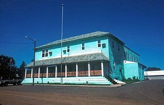
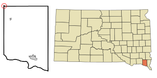
Corson County is a county in the U.S. state of South Dakota. As of the 2020 census, the population was 3,902. Its county seat is McIntosh. The county was named for Dighton Corson, a native of Maine, who came to the Black Hills in 1876, and in 1877 began practicing law at Deadwood.

<span class="mw-page-title-main">South Sioux City, Nebraska</span> City in Dakota County, Nebraska, United States

South Sioux City is a city in Dakota County, Nebraska, United States. It is located immediately across the Missouri River from Sioux City, Iowa, and is part of the Sioux City, IA-NE-SD Metropolitan Statistical Area. As of the 2010 census, the city population was 13,353, making it the 14th most populous city in Nebraska.

<span class="mw-page-title-main">Fort Yates, North Dakota</span> City in Standing Rock Indian Reservation, United States

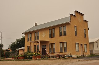
Fort Yates is a city in Sioux County, North Dakota, United States. It is the tribal headquarters of the Standing Rock Sioux Tribe and county seat of Sioux County. Since 1970 the population has declined markedly from more than 1,100 residents, as people have left for other locations for work. The population was 176 at the 2020 census.

<span class="mw-page-title-main">Hermosa, South Dakota</span> Town in South Dakota, United States

Hermosa is a town near the northern edge of Custer County, South Dakota, United States. The population was 382 at the 2020 census.

<span class="mw-page-title-main">Pringle, South Dakota</span> Town in South Dakota, United States

Pringle is a town in Custer County, South Dakota, United States. The population was 109 at the 2020 census.

<span class="mw-page-title-main">Hot Springs, South Dakota</span> City in South Dakota, United States

Hot Springs is a city in and county seat of Fall River County, South Dakota, United States. As of the 2020 census, the city population was 3,395. In addition, neighboring Oglala Lakota County contracts the duties of Auditor, Treasurer and Register of Deeds to the Fall River County authority in Hot Springs.

<span class="mw-page-title-main">Philip, South Dakota</span> City in South Dakota, United States

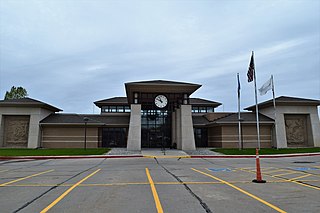
Philip is a city in and the county seat of rural Haakon County, South Dakota, United States. The population was 759 at the 2020 census.

<span class="mw-page-title-main">Camp Crook, South Dakota</span> Town in South Dakota, United States

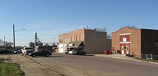
Camp Crook is an incorporated small town in Harding County, South Dakota, United States, on the Little Missouri River. The population was 60 at the 2020 census.

<span class="mw-page-title-main">Spearfish, South Dakota</span> City in South Dakota, United States

Spearfish is a city in Lawrence County, South Dakota, United States. The population was 12,193 at the time of the 2020 census, making it the 10th most populous city in South Dakota. Spearfish is the largest city in Lawrence County and the home of Black Hills State University.

<span class="mw-page-title-main">Baltic, South Dakota</span> City in South Dakota, United States

Baltic is a city on the Big Sioux River in northern Minnehaha County, South Dakota, United States. The population was 1,246 at the 2020 census.

<span class="mw-page-title-main">Crooks, South Dakota</span> City in South Dakota, United States

Crooks is a city in Minnehaha County, South Dakota, United States and is a suburb of Sioux Falls. The population was 1,362 at the 2020 census. Crooks was named New Hope until 1904. The town's present name honors W. A. Crooks, a local politician.

<span class="mw-page-title-main">Dell Rapids, South Dakota</span> City in South Dakota, United States

Dell Rapids is a city in Minnehaha County, South Dakota, United States. The population was 3,996 at the 2020 census. It is known as "The Little City with the Big Attractions."

<span class="mw-page-title-main">Flandreau, South Dakota</span> City in South Dakota, United States

FlandreauFLAN-droo is a city in and county seat of Moody County, South Dakota, United States. The population was 2,372 at the 2020 census. It was named in honor of Charles Eugene Flandrau, a judge in the territory and state of Minnesota. He is credited with saving the community of New Ulm, Minnesota, from destruction during conflict with the Sioux tribe in 1862.

<span class="mw-page-title-main">Mission, South Dakota</span> City in South Dakota, United States

Mission is a city on the Rosebud Indian Reservation in northern Todd County, South Dakota, United States. The population was 1,156 at the 2020 census.

<span class="mw-page-title-main">Rosebud, South Dakota</span> CDP in South Dakota, United States

Rosebud also Sicanġu is a census-designated place (CDP) in Todd County, South Dakota, United States. The population was 1,455 at the 2020 census.

<span class="mw-page-title-main">Elk Point, South Dakota</span> City in South Dakota, United States

Elk Point is a city in and county seat of Union County, South Dakota, United States. The population was 2,149 as of the 2020 census.

<span class="mw-page-title-main">North Sioux City, South Dakota</span> City in South Dakota, United States

North Sioux City is a city in Union County, South Dakota, United States. The population was 3,042 at the 2020 census. It is part of the Sioux City, IA-NE-SD Metropolitan Statistical Area.

<span class="mw-page-title-main">Irene, South Dakota</span> City in South Dakota, United States

Irene is a city in Clay, Turner, and Yankton counties in South Dakota, United States. The population was 422 at the 2020 census. The portion of Irene that is located in Turner County is a part of the Sioux Falls, South Dakota metropolitan area, the portion located in Yankton County is part of the Yankton Micropolitan Statistical Area, and the portion located in Clay County is part of both the Vermillion Micropolitan Statistical Area and the Sioux City-Vermillion Combined Statistical Area. Irene is also host to the Irene Rodeo, held every summer.

References

  1. "SD Towns" (PDF). South Dakota State Historical Society. Archived from the original (PDF) on February 10, 2010. Retrieved February 11, 2010.
  2. "ArcGIS REST Services Directory". United States Census Bureau. Retrieved October 15, 2022.
  3. 1 2 U.S. Geological Survey Geographic Names Information System: Custer, South Dakota
  4. 1 2 "Census Population API". United States Census Bureau. Retrieved October 15, 2022.
  5. 1 2 "U.S. Census website". United States Census Bureau . Retrieved January 31, 2008.
  6. "U.S. Census Bureau: Custer city, South Dakota". www.census.gov. United States Census Bureau. Retrieved March 23, 2022.
  7. "Find a County". National Association of Counties. Archived from the original on May 31, 2011. Retrieved June 7, 2011.
  8. "Western Frontier History".
  9. Federal Writers' Project (1940). South Dakota place-names, v.1-3. University of South Dakota. p. 32.
  10. "US Gazetteer files 2010". United States Census Bureau. Archived from the original on January 25, 2012. Retrieved June 21, 2012.
  11. "NowData - NOAA Online Weather Data". National Oceanic and Atmospheric Administration. Retrieved October 28, 2021.
  12. "Station: Custer, SD". U.S. Climate Normals 2020: U.S. Monthly Climate Normals (1991-2020). National Oceanic and Atmospheric Administration. Retrieved October 28, 2021.
  13. United States Census Bureau. "Census of Population and Housing" . Retrieved November 8, 2014.
  14. "U.S. Census website". United States Census Bureau . Retrieved June 21, 2012.
  15. "Custer Regional Hospital". U.S. News & World Report . Retrieved May 22, 2014.
  16. "Timeline: Curtis Allgier's criminal, trial history". The Salt Lake Tribune. March 21, 2011.
  17. "Throw of the Week: Tyler Schultz". ESPN. April 24, 2012.
  18. Gevik, Brian (November 20, 2019). "South Dakota's Superwolves". South Dakota Public Broadcasting.

Bibliography