Related Research Articles
Denton County is located in the U.S. state of Texas. As of the 2020 census, its population was 906,422, making it the 7th-most populous county in Texas. The county seat is Denton. The county, which was named for John B. Denton, was established in 1846. Denton County constitutes part of the Dallas–Fort Worth metroplex. In 2007, it was one of the fastest-growing counties in the United States.

Stoddard County is a county located in the southeastern portion of the U.S. state of Missouri. As of the 2020 census, the population was 28,672. The county seat is Bloomfield. The county was officially organized on January 2, 1835, and is named for Amos Stoddard, the first American commandant of Upper Louisiana.

Pemiscot County is a county located in the southeastern corner in the Bootheel in the U.S. state of Missouri, with the Mississippi River forming its eastern border. As of the 2020 census, the population was 15,661. The largest city and county seat is Caruthersville. The county was officially organized on February 19, 1851. It is named for the local bayou, taken from the word pem-eskaw, meaning "liquid mud", in the language of the native Fox (Meskwaki) people. This has been an area of cotton plantations and later other commodity crops.

Dunklin County is located in the Bootheel of the U.S. state of Missouri. As of the 2020 census, the population was 28,283. The largest city and county seat is Kennett. The county was officially organized on February 14, 1845, and is named in honor of Daniel Dunklin, a Governor of Missouri who died the year before the county was organized.
Bragg City is a city in Pemiscot County, Missouri, United States. The population was 72 at the 2020 census.
Hayti is a city in eastern Pemiscot County, Missouri, United States. The population was 2,493 at the 2020 census.

Holland is a town in Pemiscot County, Missouri, United States. The population was 194 at the 2020 census.

Pascola is a village in Pemiscot County, Missouri, United States. The population was 108 at the 2010 census.
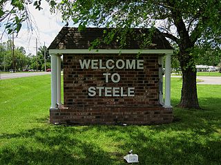
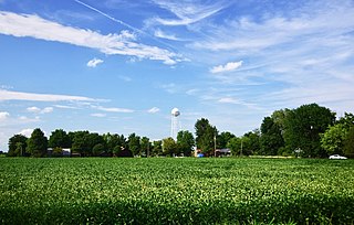
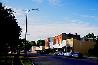
Steele is a city in southern Pemiscot County in the Missouri Bootheel of southeastern Missouri, United States. The population was 1,853 at the 2020 census.

Wardell is a city in Pemiscot County, Missouri, United States. The population was 310 at the 2020 census. It annexed North Wardell in 2007.

Portageville is a city in New Madrid and Pemiscot counties in the U.S. state of Missouri. The population was 2,942 according to the 2020 Census.

Carrollton is a city in Dallas, Denton, and Collin counties in the U.S. state of Texas. As of the 2020 census, its population was 133,434, making it the 23rd-most populous city in Texas.
Golden is an unincorporated community and census-designated place in southeastern Barry County, Missouri, United States. It is approximately 20 miles (32 km) southeast of Cassville. It is located south of Table Rock Lake and one mile north of Missouri Route 86 on Highway J. At the 2020 census, Golden had a population of 275.
Eagle Rock is an unincorporated community and census-designated place in Barry County, Missouri, United States. As of the 2020 census, it had a population of 193.
Deering is an unincorporated community in Pemiscot County, Missouri, United States. It is located fifteen miles west of Caruthersville.
Acorn Corner is an unincorporated community in Pemiscot County, in the U.S. state of Missouri.
Cunningham is an unincorporated community in Pemiscot County, in the U.S. state of Missouri.
Gibson is an unincorporated community in Pemiscot County, in the U.S. state of Missouri.
Yama is an unincorporated community in Pemiscot County, in the U.S. state of Missouri.
South Pemiscot County R-V School District, also known as South Pemiscot Schools, is a school district headquartered in Steele, Missouri.
References
- ↑ "ArcGIS REST Services Directory". United States Census Bureau. Retrieved September 5, 2022.
- 1 2 3 U.S. Geological Survey Geographic Names Information System: Denton, Pemiscot County, Missouri
- ↑ "Pemiscot County Place Names, 1928–1945". The State Historical Society of Missouri. Archived from the original on June 24, 2016. Retrieved November 29, 2016.
- ↑ "Census of Population and Housing". Census.gov. Retrieved June 4, 2016.
- ↑ "2020 CENSUS - SCHOOL DISTRICT REFERENCE MAP: Pemiscot County, MO" (PDF). U.S. Census Bureau . Retrieved 2022-12-09.
Municipalities and communities of Pemiscot County, Missouri, United States | ||
|---|---|---|
| Cities |  | |
| Villages | ||
| Townships | ||
| CDPs | ||
| Other communities | ||
| Ghost towns | ||
| Footnotes | ‡This populated place also has portions in an adjacent county or counties | |
| | This Pemiscot County, Missouri state location article is a stub. You can help Wikipedia by expanding it. |