Wardell, Missouri

Last updated

Wardell, Missouri
Wardell-Broad-St-mo.jpg
Wardell
Pemiscot County Missouri Incorporated and Unincorporated areas Wardell Highlighted.svg
Location of Wardell, Missouri
Coordinates: 36°21′14″N89°49′01″W / 36.35389°N 89.81694°W / 36.35389; -89.81694
Country United States
State Missouri
County Pemiscot
Area
[1]
  Total0.28 sq mi (0.74 km2)
  Land0.28 sq mi (0.73 km2)
  Water0.00 sq mi (0.01 km2)
Elevation
[2]
269 ft (82 m)
Population
 (2020)
  Total310
  Density1,099.29/sq mi (423.75/km2)
Time zone UTC-6 (Central (CST))
  Summer (DST) UTC-5 (CDT)
ZIP code
63879
Area code 573
FIPS code 29-76966 [3]
GNIS feature ID2397722 [2]

Wardell is a city in Pemiscot County, Missouri, United States. The population was 310 at the 2020 census. [4] It annexed North Wardell in 2007. [5]

Contents

History

A post office called Wardell has been in operation since 1902. [6] The community's name is derived from the last name of R. L. Warren, an early citizen, and a dell near the original town site. [7]

Geography

The city lies in northern Pemiscot County at the intersection of State Route A and State Route B. The former road connects Wardell with Bragg City to the southwest and Interstate 55 to the east, while the latter road connects Wardell with Homestown and Pascola to the south. Little River flows through the city.

According to the United States Census Bureau, the city has a total area of 0.28 square miles (0.73 km2), all land. [8]

Demographics

Historical population
CensusPop.Note
1930 272
1940 43058.1%
1950 4545.6%
1960 331−27.1%
1970 275−16.9%
1980 2998.7%
1990 3258.7%
2000 278−14.5%
2010 42753.6%
2020 310−27.4%
U.S. Decennial Census [9]

2010 census

As of the census [10] of 2010, there were 427 people, 172 households, and 123 families living in the city. The population density was 1,525.0 inhabitants per square mile (588.8/km2). There were 195 housing units at an average density of 696.4 per square mile (268.9/km2). The racial makeup of the city was 95.32% White, 3.51% Black or African American, 0.23% Native American, and 0.94% from two or more races. Hispanic or Latino of any race were 0.70% of the population.

There were 172 households, of which 37.8% had children under the age of 18 living with them, 42.4% were married couples living together, 20.9% had a female householder with no husband present, 8.1% had a male householder with no wife present, and 28.5% were non-families. 27.9% of all households were made up of individuals, and 11.1% had someone living alone who was 65 years of age or older. The average household size was 2.48 and the average family size was 2.97.

The median age in the city was 37.6 years. 27.9% of residents were under the age of 18; 8.4% were between the ages of 18 and 24; 23.7% were from 25 to 44; 25.6% were from 45 to 64; and 14.5% were 65 years of age or older. The gender makeup of the city was 48.9% male and 51.1% female.

2000 census

As of the census [3] of 2000, there were 278 people, 110 households, and 77 families living in the town. The population density was 1,423.3 inhabitants per square mile (549.5/km2). There were 119 housing units at an average density of 609.3 per square mile (235.3/km2). The racial makeup of the town was 93.53% White, 4.32% African American, 2.16% from other races. Hispanic or Latino of any race were 2.16% of the population.

There were 110 households, out of which 33.6% had children under the age of 18 living with them, 48.2% were married couples living together, 18.2% had a female householder with no husband present, and 29.1% were non-families. 26.4% of all households were made up of individuals, and 15.5% had someone living alone who was 65 years of age or older. The average household size was 2.53 and the average family size was 3.01.

In the town the population was spread out, with 27.3% under the age of 18, 11.2% from 18 to 24, 21.9% from 25 to 44, 24.5% from 45 to 64, and 15.1% who were 65 years of age or older. The median age was 37 years. For every 100 females there were 90.4 males. For every 100 females age 18 and over, there were 82.0 males.

The median income for a household in the town was $20,208, and the median income for a family was $25,357. Males had a median income of $27,083 versus $15,000 for females. The per capita income for the town was $9,829. About 14.3% of families and 22.0% of the population were below the poverty line, including 29.8% of those under the age of eighteen and 20.5% of those 65 or over.

Notable people

Related Research Articles

<span class="mw-page-title-main">Pattonsburg, Missouri</span> City in Missouri, United States

Pattonsburg is a city in northwest Daviess County, Missouri, United States. The population was 314 at the 2020 census.

<span class="mw-page-title-main">Berger, Missouri</span> City in Missouri, United States

Berger is a city in northwest Franklin County, Missouri, United States, located south of the Missouri River. The population was 256 at the 2020 census.

<span class="mw-page-title-main">Foley, Missouri</span> City in Missouri, United States

Foley is a city in Lincoln County, Missouri, United States. The population was 161 at the 2010 census.

<span class="mw-page-title-main">Linneus, Missouri</span> City in Missouri, United States

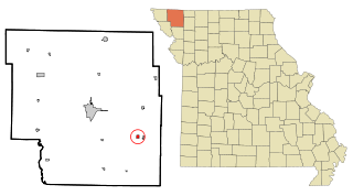
Linneus is a small city in Linn County, Missouri, United States. The population was 281 at the 2020 census. It is the county seat of Linn County.

<span class="mw-page-title-main">Southwest City, Missouri</span> City in Missouri, United States

Southwest City is a city in McDonald County, Missouri, United States. The population was 937 at the 2010 census, at which time it was a town. It is located in the southwestern corner of the state of Missouri.

<span class="mw-page-title-main">Conception Junction, Missouri</span> City in Missouri, United States

Conception Junction is a city in Nodaway County, Missouri, United States, near the Platte River. The population was 198 at the 2010 census, at which time it was a town.

<span class="mw-page-title-main">Pickering, Missouri</span> Village in Missouri, United States

Pickering is a city in Nodaway County, Missouri, United States. The population was 160 at the 2010 census.

<span class="mw-page-title-main">Bragg City, Missouri</span> City in Missouri, United States

Bragg City is a city in Pemiscot County, Missouri, United States. The population was 72 at the 2020 census.

<span class="mw-page-title-main">Caruthersville, Missouri</span> City in Missouri, United States

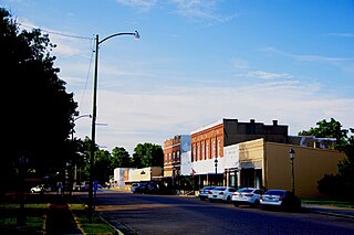
Caruthersville is a city in and the county seat of Pemiscot County, Missouri, United States, located along the Mississippi River in the Bootheel region of the state's far southeast. The population was 5,562, according to the 2020 census.

<span class="mw-page-title-main">Cooter, Missouri</span> City in Missouri, United States

Cooter is a city in Pemiscot County, Missouri, United States. The population was 343 at the 2020 census.

<span class="mw-page-title-main">Hayti, Missouri</span> City in Missouri, United States

Hayti is a city in eastern Pemiscot County, Missouri, United States. The population was 2,493 at the 2020 census.

<span class="mw-page-title-main">Hayti Heights, Missouri</span> City in Missouri, United States

Hayti Heights is a city in eastern Pemiscot County in the bootheel of southeast Missouri, United States. The population was 515 at the 2020 census.

<span class="mw-page-title-main">Hayward, Missouri</span> Census-designated place in Missouri, United States

Hayward is a census-designated place and former village in Pemiscot County, Missouri, United States. The population was 131 at the 2010 census.

<span class="mw-page-title-main">Holland, Missouri</span> Town in Missouri, United States

Holland is a town in Pemiscot County, Missouri, United States. The population was 194 at the 2020 census.

<span class="mw-page-title-main">Homestown, Missouri</span> City in Missouri, United States

Homestown is a city in Pemiscot County, Missouri, United States. The population was 73 at the 2020 census.

<span class="mw-page-title-main">North Wardell, Missouri</span> Former Village in Missouri, United States

North Wardell was a village in Pemiscot County, Missouri, United States. The population was 170 at the 2000 census.

<span class="mw-page-title-main">Pascola, Missouri</span> Village in Missouri, United States

Pascola is a village in Pemiscot County, Missouri, United States. The population was 108 at the 2010 census.

<span class="mw-page-title-main">Steele, Missouri</span> City in Missouri, United States

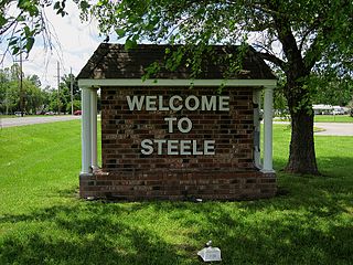
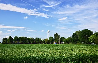
Steele is a city in southern Pemiscot County in the Missouri Bootheel of southeastern Missouri, United States. The population was 1,853 at the 2020 census.

<span class="mw-page-title-main">Green Ridge, Missouri</span> City in Missouri, United States

Green Ridge is a city located along Route 127 in Pettis County, Missouri, United States. The population was 476 at the 2010 census.

<span class="mw-page-title-main">Portageville, Missouri</span> City in Missouri, United States

Portageville is a city in New Madrid and Pemiscot counties in the U.S. state of Missouri. The population was 2,942 according to the 2020 Census.

References

  1. "ArcGIS REST Services Directory". United States Census Bureau. Retrieved August 28, 2022.
  2. 1 2 U.S. Geological Survey Geographic Names Information System: Wardell, Missouri
  3. 1 2 "U.S. Census website". United States Census Bureau . Retrieved January 31, 2008.
  4. "Explore Census Data". data.census.gov. Retrieved September 30, 2022.
  5. "Boundary Changes".
  6. "Post Offices". Jim Forte Postal History. Retrieved November 29, 2016.
  7. "Pemiscot County Place Names, 1928–1945". The State Historical Society of Missouri. Archived from the original on June 24, 2016. Retrieved November 29, 2016.
  8. "US Gazetteer files 2010". United States Census Bureau . Retrieved July 8, 2012.
  9. "Census of Population and Housing". Census.gov. Retrieved June 4, 2015.
  10. "U.S. Census website". United States Census Bureau . Retrieved July 8, 2012.