Dewey, Missouri

Last updated

Dewey is an extinct town in Polk County, in the U.S. state of Missouri. [1]

Polk County, Missouri U.S. county in Missouri

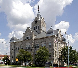
Polk County is a county located in the southwestern portion of the U.S. state of Missouri. As of the 2010 census, the population was 31,137. Its county seat is Bolivar. The county was founded January 5, 1835, and named for Ezekiel Polk.

U.S. state constituent political entity of the United States

In the United States, a state is a constituent political entity, of which there are currently 50. Bound together in a political union, each state holds governmental jurisdiction over a separate and defined geographic territory and shares its sovereignty with the federal government. Due to this shared sovereignty, Americans are citizens both of the federal republic and of the state in which they reside. State citizenship and residency are flexible, and no government approval is required to move between states, except for persons restricted by certain types of court orders.

Missouri U.S. state in the United States

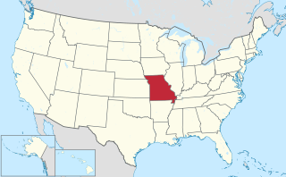
Missouri is a state in the Midwestern United States. With over six million residents, it is the 18th-most populous state of the Union. The largest urban areas are St. Louis, Kansas City, Springfield and Columbia; the capital is Jefferson City. The state is the 21st-most extensive in area. Missouri is bordered by eight states : Iowa to the north, Illinois, Kentucky and Tennessee to the east, Arkansas to the south and Oklahoma, Kansas and Nebraska to the west. In the South are the Ozarks, a forested highland, providing timber, minerals and recreation. The Missouri River, after which the state is named, flows through the center of the state into the Mississippi River, which makes up Missouri's eastern border.

A post office called Dewey was established in 1898, and remained in operation until 1906. [2] The community has the name of George Dewey, an officer in the Spanish–American War. [3]

George Dewey US Navy admiral

George Dewey was Admiral of the Navy, the only person in United States history to have attained the rank. He is best known for his victory at the Battle of Manila Bay during the Spanish–American War, with the loss of only a single crewman on the American side.

Spanish–American War Conflict in 1898 between Spain and the United States

The Spanish–American War was an armed conflict between Spain and the United States in 1898. Hostilities began in the aftermath of the internal explosion of USS Maine in Havana Harbor in Cuba, leading to U.S. intervention in the Cuban War of Independence. The war led to emergence of U.S. predominance in the Caribbean region, and resulted in U.S. acquisition of Spain's Pacific possessions. That led to U.S. involvement in the Philippine Revolution and ultimately in the Philippine–American War.

Related Research Articles

Goodson, Missouri Village in Missouri, United States

Goodson is an unincorporated community in Polk County, Missouri, United States. It is located at the intersection of Missouri Supplemental Routes C and P and is approximately sixteen miles northeast of Bolivar. Goodson is part of the Springfield, Missouri Metropolitan Statistical Area.

Polk, Missouri unincorporated community in Missouri

Polk is an unincorporated community in Polk County, Missouri, United States. It is located on Missouri Supplemental Route D, approximately twelve miles northeast of Bolivar. Polk is part of the Springfield, Missouri Metropolitan Statistical Area.

Adonis is an unincorporated community in northern Polk County, in the U.S. state of Missouri.

Clifford is an extinct town in Polk County, in the U.S. state of Missouri.

Graydon Springs is an unincorporated community in Polk County, in the U.S. state of Missouri.

Gresham is an extinct town in Polk County, in the U.S. state of Missouri.

Huckaby is an unincorporated community in Polk County, in the U.S. state of Missouri.

Huron is an unincorporated community in Polk County, in the U.S. state of Missouri.

Ingalls is an extinct town in Polk County, in the U.S. state of Missouri.

Mohawk Corner is an unincorporated community in northeast Polk County, in the U.S. state of Missouri. The community is at the intersection of Missouri Routes 64 and D. Pittsburg and the Pomme de Terre Lake area is five miles to the north on Route 64 in Hickory County. Polk is two miles to the south on Route D.

Orleans is an extinct town in Polk County, in the U.S. state of Missouri.

Rondo is an unincorporated community in Polk County, in the U.S. state of Missouri.

Schofield is an unincorporated community in Polk County, in the U.S. state of Missouri.

Sentinel is an unincorporated community in northern Polk County, in the U.S. state of Missouri.

Slagle is an unincorporated community in Polk County, in the U.S. state of Missouri.

Sunset is an unincorporated community in Polk County, in the U.S. state of Missouri.

Van is an unincorporated community in Polk County, in the U.S. state of Missouri.

Violet is an unincorporated community in Polk County, in the U.S. state of Missouri.

West Bend is an unincorporated community in Polk County, in the U.S. state of Missouri.

Wishart is an unincorporated community in Polk County, in the U.S. state of Missouri.

References

  1. U.S. Geological Survey Geographic Names Information System: Dewey (historical)
  2. "Post Offices". Jim Forte Postal History. Retrieved 10 December 2016.
  3. "Polk County Place Names, 1928–1945". The State Historical Society of Missouri. Archived from the original on June 24, 2016. Retrieved December 10, 2016.

Coordinates: 37°40′03″N93°15′56″W / 37.66750°N 93.26556°W / 37.66750; -93.26556

Geographic coordinate system Coordinate system

A geographic coordinate system is a coordinate system that enables every location on Earth to be specified by a set of numbers, letters or symbols. The coordinates are often chosen such that one of the numbers represents a vertical position and two or three of the numbers represent a horizontal position; alternatively, a geographic position may be expressed in a combined three-dimensional Cartesian vector. A common choice of coordinates is latitude, longitude and elevation. To specify a location on a plane requires a map projection.