McKinley Township, Polk County, Missouri

Last updated

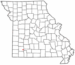
McKinley Township is an inactive township in Polk County, in the U.S. state of Missouri. [1]

A civil township is a widely used unit of local government in the United States that is subordinate to a county. The term town is used in New England, New York, and Wisconsin to refer to the equivalent of the civil township in these states. Specific responsibilities and the degree of autonomy vary based on each state. Civil townships are distinct from survey townships, but in states that have both, the boundaries often coincide and may completely geographically subdivide a county. The U.S. Census Bureau classifies civil townships as minor civil divisions. Currently, there are 20 states with civil townships.

Polk County, Missouri U.S. county in Missouri

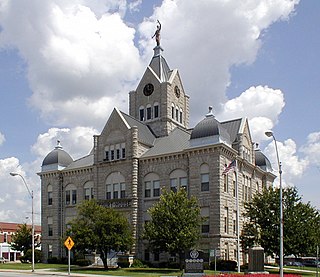
Polk County is a county located in the southwestern portion of the U.S. state of Missouri. As of the 2010 census, the population was 31,137. Its county seat is Bolivar. The county was founded January 5, 1835, and named for Ezekiel Polk.

U.S. state constituent political entity of the United States

In the United States, a state is a constituent political entity, of which there are currently 50. Bound together in a political union, each state holds governmental jurisdiction over a separate and defined geographic territory and shares its sovereignty with the federal government. Due to this shared sovereignty, Americans are citizens both of the federal republic and of the state in which they reside. State citizenship and residency are flexible, and no government approval is required to move between states, except for persons restricted by certain types of court orders.

McKinley Township was erected in 1910, taking its name from President William McKinley. [2]

William McKinley 25th president of the United States

William McKinley was the 25th president of the United States, serving from March 4, 1897, until his assassination six months into his second term. During his presidency, McKinley led the nation to victory in the Spanish–American War, raised protective tariffs to promote American industry and kept the nation on the gold standard in a rejection of free silver.

Related Research Articles

Polk, Missouri unincorporated community in Missouri

Polk is an unincorporated community in Polk County, Missouri, United States. It is located on Missouri Supplemental Route D, approximately twelve miles northeast of Bolivar. Polk is part of the Springfield, Missouri Metropolitan Statistical Area.

McKinley, Missouri unincorporated community in Missouri

McKinley is an unincorporated community in Lawrence County, Missouri, United States. It is located on Route 14, approximately five miles west of Billings.

Polk Township is a township in Dade County, in the U.S. state of Missouri.

Polk Township is an inactive township in Madison County, in the U.S. state of Missouri.

McKinney Branch is a stream in Polk County in the U.S. state of Missouri. It is a tributary of the Pomme de Terre River.

Mohawk Corner is an unincorporated community in northeast Polk County, in the U.S. state of Missouri. The community is at the intersection of Missouri Routes 64 and D. Pittsburg and the Pomme de Terre Lake area is five miles to the north on Route 64 in Hickory County. Polk is two miles to the south on Route D.

Schofield is an unincorporated community in Polk County, in the U.S. state of Missouri.

Violet is an unincorporated community in Polk County, in the U.S. state of Missouri.

Campbell Township is an inactive township in Polk County, in the U.S. state of Missouri.

Flemington Township is an inactive township in Polk County, in the U.S. state of Missouri.

Jackson Township is an inactive township in Polk County, in the U.S. state of Missouri.

Jefferson Township is an inactive township in Polk County, in the U.S. state of Missouri.

Johnson Township is an inactive township in Polk County, in the U.S. state of Missouri.

Mooney Township is an inactive township in Polk County, in the U.S. state of Missouri.

Union Township is an inactive township in Polk County, in the U.S. state of Missouri.

Wishart Township is an inactive township in Polk County, in the U.S. state of Missouri.

Polk Township is an inactive township in St. Clair County, in the U.S. state of Missouri.

McKinley Township is an inactive township in Stone County, in the U.S. state of Missouri.

Polk Township is a township in Sullivan County, in the U.S. state of Missouri.

References

  1. U.S. Geological Survey Geographic Names Information System: McKinley Township, Polk County, Missouri
  2. "Polk County Place Names, 1928–1945". The State Historical Society of Missouri. Archived from the original on June 24, 2016. Retrieved December 10, 2016.

Coordinates: 37°45′07″N93°19′47″W / 37.7519°N 93.3297°W / 37.7519; -93.3297

Geographic coordinate system Coordinate system

A geographic coordinate system is a coordinate system that enables every location on Earth to be specified by a set of numbers, letters or symbols. The coordinates are often chosen such that one of the numbers represents a vertical position and two or three of the numbers represent a horizontal position; alternatively, a geographic position may be expressed in a combined three-dimensional Cartesian vector. A common choice of coordinates is latitude, longitude and elevation. To specify a location on a plane requires a map projection.