The Dominion Land Survey is the method used to divide most of Western Canada into one-square-mile (2.6 km2) sections for agricultural and other purposes. It is based on the layout of the Public Land Survey System used in the United States, but has several differences. The DLS is the dominant survey method in the Prairie provinces, and it is also used in British Columbia along the Railway Belt, and in the Peace River Block in the northeast of the province.

Lloydminster is a city in Canada which has the unusual geographic distinction of straddling the provincial border between Alberta and Saskatchewan. The city is incorporated by both provinces as a single city with a single municipal administration.

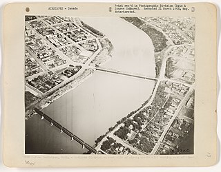
Events from the year 1882 in Canada.
Assiniboia District refers to two historical districts of Canada's Northwest Territories. The name is taken from the Assiniboine First Nation.

Athabasca, originally named Athabasca Landing, is a town in northern Alberta, Canada. It is located 145 km (90 mi) north of Edmonton at the intersection of Highway 2 and Highway 55, on the banks of the Athabasca River. It is the centre of Athabasca County. It was known as Athabasca Landing prior to August 4, 1913.
The vastness of Canada's Northwest Territories meant that for much of its history it was divided into several districts for ease of administration. The number and size of these territorial districts varied as other provinces and territories of Canada were created and expanded. The districts of the Northwest Territories were abolished in 1999 with the creation of the Nunavut territory and the contraction of the Northwest Territories to its current size.

The District of Saskatchewan was a regional administrative district of Canada's North-West Territories. It was formed in 1882 was later enlarged then abolished with the creation of the provinces of Saskatchewan and Alberta in 1905. Much of the area was incorporated into the province of Saskatchewan. The western part became part of Alberta, and the eastern part is now part of Manitoba.
Assiniboia West was a federal electoral district in the Northwest Territories, Canada, that was represented in the House of Commons of Canada from 1896 to 1908.
A range road in Canada is a road that runs north–south along a range grid line of the Dominion Land Survey. Range roads are perpendicular to township roads which run east–west along the township grid lines.

William Ogilvie was a Canadian Dominion land surveyor, explorer, and the commissioner of Yukon.
The District of Athabasca was a regional administrative district of Canada's Northwest Territories. It was formed in 1882, was later enlarged, and then abolished with the creation of the provinces of Saskatchewan and Alberta in 1905. The very easternmost part is now within Manitoba.

The history of post-confederation Canada began on July 1, 1867, when the British North American colonies of Canada, New Brunswick, and Nova Scotia were united to form a single Dominion within the British Empire. Upon Confederation, the United Province of Canada was immediately split into the provinces of Ontario and Quebec. The colonies of Prince Edward Island and British Columbia joined shortly after, and Canada acquired the vast expanse of the continent controlled by the Hudson's Bay Company, which was eventually divided into new territories and provinces. Canada evolved into a fully sovereign state by 1982.
Wilcox is a village in the Canadian province of Saskatchewan within the Rural Municipality of Bratt's Lake No. 129 and Census Division No. 6. It is approximately 41 kilometres (25 mi) south of the City of Regina.

Saskatchewan, the middle of Canada's three prairie provinces, has an area of 588,276.09 square kilometres (227,134.67 sq mi) and population of 1,150,632, mostly living in the southern half of the province.
The history of Saskatoon began with the first permanent non-indigenous settlement of Saskatoon, Saskatchewan, Canada, in 1883 when Toronto Methodists, wanting to escape the liquor trade in that city, decided to set up a "dry" community in the rapidly growing prairie region. As of 1882 this area was a part of the provisional district named Saskatchewan, North-West Territories (NWT). Their organization, the Temperance Colonization Society, first examined this area in 1882 and found that it would make an excellent location to found their community based on the ideals of the temperance movement; Saskatoon traditionally considers 1882 its founding year and thus marked its centennial in 1982. The settlers, led by John Neilson Lake, arrived on the site of what is now Saskatoon by traveling by railway from Ontario to Moose Jaw, Assiniboia, NWT, and then completing the final leg via horse-drawn cart. The plan for the Temperance Colony soon failed as the group was unable to obtain a large block of land within the community. Nonetheless, John Lake is commonly identified as the founder of Saskatoon; a public school, a park and two streets are named after him.

The Red Coat Trail is a 1,300-kilometre (810 mi) route that approximates the path taken in 1874 by the North-West Mounted Police in their March West from Fort Dufferin to Fort Whoop-Up.
Saskatchewan has a transportation infrastructure system of roads, highways, freeways, airports, ferries, pipelines, trails, waterways, and railway systems serving a population of approximately 1,132,505 inhabitants year-round.

The Paskapoo Formation is a stratigraphic unit of Middle to Late Paleocene age in the Western Canada Sedimentary Basin. The Paskapoo underlies much of southwestern Alberta, and takes the name from the Blindman River. It was first described from outcrops along that river, near its confluence with the Red Deer River north of the city of Red Deer, by Joseph Tyrrell in 1887. It is important for its freshwater aquifers, its coal resources, and its fossil record, as well as having been the source of sandstone for the construction of fire-resistant buildings in Calgary during the early 1900s.

The following outline is provided as an overview of and topical guide to Saskatchewan:
Hubert Lake Wildland Provincial Park is a wildland provincial park in central Alberta, Canada. The park was established on 4 October 2000 and has an area of 9,665.46 hectares. The park is included in the Upper Athabasca Region Land Use Framework.


