Double Springs, Alabama

Last updated

Double Springs, Alabama
Winston County Alabama Courthouse.jpg
Winston County courthouse in Double Springs
Winston County Alabama Incorporated and Unincorporated areas Double Springs Highlighted 0121280.svg
Location of Double Springs in Winston County, Alabama.
Coordinates: 34°9′5″N87°24′15″W / 34.15139°N 87.40417°W / 34.15139; -87.40417
Country United States
State Alabama
County Winston
Area
[1]
  Total5.14 sq mi (13.31 km2)
  Land5.12 sq mi (13.25 km2)
  Water0.02 sq mi (0.06 km2)
Elevation
823 ft (251 m)
Population
 (2020)
  Total1,119
  Density218.64/sq mi (84.42/km2)
Time zone UTC-6 (Central (CST))
  Summer (DST) UTC-5 (CDT)
ZIP code
35553
Area code(s) 205, 659
FIPS code 01-21280
GNIS feature ID0159511
Website Town of Double Springs

Double Springs is a town in Winston County, Alabama, United States. The city is the county seat of Winston County. [2] The county seat was initially located at Houston, but by referendum in 1883, Double Springs prevailed and it was removed to there. It was incorporated on May 17, 1943. [3] At the 2010 census the population was 1,083, up from 1,003 in 2000.

Contents

Geography

Double Springs is located at 34°9′6″N87°24′16″W / 34.15167°N 87.40444°W / 34.15167; -87.40444 (34.151642, -87.404390). [4]

According to the U.S. Census Bureau, the town has a total area of 3.9 square miles (10 km2), all land.

Climate

According to the Köppen climate classification, Double Springs has a humid subtropical climate (abbreviated Cfa).

Climate data for Double Springs, 1991–2020 simulated normals (761 ft elevation)
MonthJanFebMarAprMayJunJulAugSepOctNovDecYear
Mean daily maximum °F (°C)50.9
(10.5)
55.4
(13.0)
63.9
(17.7)
72.3
(22.4)
79.3
(26.3)
85.8
(29.9)
88.9
(31.6)
88.5
(31.4)
83.8
(28.8)
73.8
(23.2)
62.4
(16.9)
53.8
(12.1)
71.6
(22.0)
Daily mean °F (°C)40.6
(4.8)
44.1
(6.7)
52.0
(11.1)
59.9
(15.5)
68.2
(20.1)
75.4
(24.1)
78.6
(25.9)
78.1
(25.6)
72.5
(22.5)
61.3
(16.3)
50.5
(10.3)
43.7
(6.5)
60.4
(15.8)
Mean daily minimum °F (°C)30.2
(−1.0)
32.9
(0.5)
40.1
(4.5)
47.7
(8.7)
57.0
(13.9)
64.8
(18.2)
68.5
(20.3)
67.5
(19.7)
61.2
(16.2)
49.1
(9.5)
38.7
(3.7)
33.4
(0.8)
49.3
(9.6)
Average precipitation inches (mm)5.77
(146.58)
5.85
(148.59)
5.73
(145.64)
5.84
(148.35)
5.12
(130.10)
5.22
(132.58)
5.26
(133.49)
4.37
(110.96)
4.08
(103.64)
4.07
(103.28)
4.62
(117.44)
6.39
(162.24)
62.32
(1,582.89)
Average dew point °F (°C)32.4
(0.2)
34.5
(1.4)
40.6
(4.8)
48.4
(9.1)
58.6
(14.8)
66.0
(18.9)
69.8
(21.0)
68.5
(20.3)
62.8
(17.1)
52.2
(11.2)
41.5
(5.3)
36.1
(2.3)
51.0
(10.5)
Source: PRISM Climate Group [5]

Demographics

Historical population
CensusPop.Note
1950 524
1960 81154.8%
1970 95718.0%
1980 1,05710.4%
1990 1,1387.7%
2000 1,003−11.9%
2010 1,0838.0%
2020 1,1193.3%
U.S. Decennial Census [6]
2013 Estimate [7]

2000 census

At the 2000 census there were 1,003 people, 426 households, and 276 families in the town. The population density was 259.5 inhabitants per square mile (100.2/km2). There were 486 housing units at an average density of 125.8 per square mile (48.6/km2). The racial makeup of the town was 97.51% White, 0.30% Black or African American, 0.60% Native American, 0.60% from other races, and 1.00% from two or more races. 1.10% of the population were Hispanic or Latino of any race. [8] Of the 426 households 30.3% had children under the age of 18 living with them, 48.6% were married couples living together, 12.7% had a female householder with no husband present, and 35.0% were non-families. 33.6% of households were one person and 16.9% were one person aged 65 or older. The average household size was 2.18 and the average family size was 2.75.

The age distribution was 21.3% under the age of 18, 8.9% from 18 to 24, 28.3% from 25 to 44, 22.9% from 45 to 64, and 18.5% 65 or older. The median age was 39 years. For every 100 females, there were 93.6 males. For every 100 females age 18 and over, there were 95.8 males.

The median household income was $25,865 and the median family income was $29,615. Males had a median income of $25,667 versus $20,625 for females. The per capita income for the town was $15,122. About 16.8% of families and 20.3% of the population were below the poverty line, including 29.5% of those under age 18 and 28.2% of those age 65 or over.

2010 census

At the 2010 census there were 1,083 people, 412 households, and 260 families in the town. The population density was 277.7 inhabitants per square mile (107.2/km2). There were 461 housing units at an average density of 118.2 per square mile (45.6/km2). The racial makeup of the town was 97.3% White, 0.6% Black or African American, 0.8% Native American, 0.1% from other races, and 0.9% from two or more races. 0.4% of the population were Hispanic or Latino of any race. [9] Of the 412 households 27.2% had children under the age of 18 living with them, 43.4% were married couples living together, 15.5% had a female householder with no husband present, and 36.9% were non-families. 35.0% of households were one person and 16.5% were one person aged 65 or older. The average household size was 2.21 and the average family size was 2.82.

The age distribution was 20.1% under the age of 18, 7.5% from 18 to 24, 22.2% from 25 to 44, 26.2% from 45 to 64, and 24.0% 65 or older. The median age was 45.2 years. For every 100 females, there were 83.9 males. For every 100 females age 18 and over, there were 89.1 males.

The median household income was $30,865 and the median family income was $32,232. Males had a median income of $27,450 versus $21,641 for females. The per capita income for the town was $13,973. About 21.1% of families and 25.6% of the population were below the poverty line, including 38.7% of those under age 18 and 11.3% of those age 65 or over.

2020 census

Double Springs racial composition [10]
RaceNum.Perc.
White (non-Hispanic)1,04993.74%
Black or African American (non-Hispanic)10.09%
Native American 40.36%
Pacific Islander 10.09%
Other/Mixed 464.11%
Hispanic or Latino 181.61%

As of the 2020 United States census, there were 1,119 people, 564 households, and 380 families residing in the town.

Historic and natural attractions

Double Springs rests inside the William B. Bankhead National Forest, and is near Lewis Smith Lake. The Kinlock Shelter is located near Double Springs.

In 1944, a memorial marker was erected on the courthouse square "To the memory of the Denson Brothers – Seaborn M. Denson (1854–1936) and Thomas J. Denson (1863–1935) who devoted their lives and gifts to composing and teaching American religious folk music as embodied in the Sacred Harp, in most of the Southern States, but mostly in Alabama. This stone is placed in the midst of their field of labor by the loving hands of their families, pupils of their singing schools, and legions of singers and friends in the summer of the year 1944. The One Hundredth Anniversary of the Sacred Harp while 'Uncle Seab' and 'Uncle Tom' sing on – 'way over in the promised land'."

In 1987, the "Dual Destiny" statue was erected in front of the courthouse. This statue of a soldier, half confederate and half yankee, represents Winston County's dual affiliation during the American Civil War in which soldiers from within the county fought for both the Union and Confederate armies.

Even though Winston County had soldiers on both sides, the county itself refused to secede from the union with the rest of Alabama. This movement became known as the Republic of Winston and remains a local legend to this day.

Education

The main offices of the Winston County School System are located in Double Springs. The chief school in Double Springs is Winston County High School, home of the Yellow Jackets. Winston County High school was the location of the world record for the largest bubble gum bubble, blown by Chad Fell. Winston Career Academy is also located in Double Springs.

Related Research Articles

<span class="mw-page-title-main">Winston County, Alabama</span> County in Alabama, United States

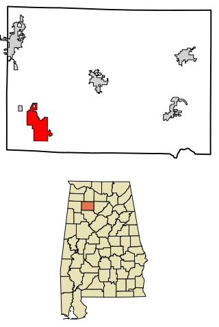
Winston County is a county of the U.S. state of Alabama. As of the 2020 census, the population was 23,540. Its county seat is Double Springs. Known as Hancock County before 1858, the county is named in honor of John A. Winston, the fifteenth Governor of Alabama.

<span class="mw-page-title-main">Franklin County, Alabama</span> County in Alabama, United States

Franklin County is a county located in the U.S. state of Alabama. As of the 2020 census, the population was 32,113. Its county seat is Russellville. Its name is in honor of Benjamin Franklin, famous statesman, scientist, and printer. It is a dry county, although the city of Russellville is wet.

<span class="mw-page-title-main">Lawrence County, Alabama</span> County in Alabama, United States

Lawrence County is a county in the northern part of the U.S. state of Alabama. As of the 2020 census, the population was 33,073. The county seat is Moulton. The county was named after James Lawrence, a captain in the United States Navy from New Jersey.

<span class="mw-page-title-main">Walker County, Alabama</span> County in Alabama, United States

Walker County is a county located in the central portion of the U.S. state of Alabama. As of the 2020 census, the population was 65,342. Its county seat is Jasper. Its name is in honor of John Williams Walker, the first U.S. senator elected from Alabama.

<span class="mw-page-title-main">Sheffield, Alabama</span> City in Alabama, United States

Sheffield is a city in Colbert County, Alabama, United States, and is included in the Florence-Muscle Shoals Metropolitan Area. As of the 2020 census, the population of the city was 9,403. Sheffield is the birthplace of "country-soul pioneer" and songwriter Arthur Alexander, French horn player Willie Ruff, notable attorney, actor, former senator and presidential contender Fred Thompson, Watergate committee U.S. Senator Howell Heflin and U.S. Senator Mitch McConnell, whose father was working in nearby Athens when he was born. It sometimes is referred to as "the City of Senators" due to the births of Heflin, McConnell and Thompson within its borders. Col. Harland Sanders worked in the Sheffield depot for Southern Railway in the 1907. It is also home to the Muscle Shoals Sound Studio where many popular 20th century musicians recorded their work, including Alexander and Ruff. It is the site of historic Helen Keller Hospital, formerly known as Colbert County Hospital and originally constructed in 1921. It was changed to Helen Keller Hospital in 1979, and Keller's birthplace Ivy Green is located less than one mile southwest of the hospital in adjacent Tuscumbia.

<span class="mw-page-title-main">Hanceville, Alabama</span> City in Alabama, United States

Hanceville is a city in Cullman County, Alabama, United States. At the 2020 census, the population was 3,217.

<span class="mw-page-title-main">Hodges, Alabama</span> Town in Alabama, United States

Hodges is a town in Franklin County, Alabama, United States. At the 2020 census, the population was 265. Hodges was laid out in 1902. It was incorporated in 1913.

<span class="mw-page-title-main">Sylvan Springs, Alabama</span> Town in Alabama, United States

Sylvan Springs is a town in Jefferson County, Alabama, United States, located northwest of the Birmingham suburb of Pleasant Grove. It incorporated on May 22, 1957. At the 2010 census the population was 1,542, up from 1,465 in 2000. This area was damaged by an F5 tornado on April 8, 1998, including the First United Methodist Church of Sylvan Springs.

<span class="mw-page-title-main">Lexington, Alabama</span> Town in Alabama, United States

Lexington is a town in Lauderdale County, Alabama, United States. It is part of the Florence–Muscle Shoals Metropolitan Statistical Area known as "The Shoals". It incorporated in 1959. As of the 2010 census, the population of the town is 735, down from 840 in 2000. The current mayor of Lexington is Sandra Killen-Burroughs.

<span class="mw-page-title-main">St. Florian, Alabama</span> Town in Alabama, United States

St. Florian is a town in Lauderdale County, Alabama, United States. It is part of the Florence - Muscle Shoals Metropolitan Statistical Area known as "The Shoals". As of the 2010 census, the population of the town is 413, up from 335 in 2000.

<span class="mw-page-title-main">Town Creek, Alabama</span> Town in Alabama, United States

Town Creek is a town in Lawrence County, Alabama, United States, and is included in the Decatur Metropolitan Area, as well as the Huntsville-Decatur Combined Statistical Area. It incorporated in March 1875. As of the 2010 census, the population of the town is 1100, down from 1216 in 2000. Since 1920, it has been the second largest town in Lawrence County after Moulton.

<span class="mw-page-title-main">Lester, Alabama</span> Town in Alabama, United States

Lester is a town in Limestone County, Alabama, United States, and is included in the Huntsville-Decatur Combined Statistical Area. As of the 2010 census, the population of the town is 111, up from 107 in 2000.

<span class="mw-page-title-main">Hackleburg, Alabama</span> Town in Alabama, United States

Hackleburg is a town in Marion County, Alabama, United States. It incorporated on August 23, 1909. At the 2020 census, its population was 1,425, down from 1,516 at the 2010 census.

<span class="mw-page-title-main">Haleyville, Alabama</span> City in Alabama, United States

Haleyville is a city in Winston and Marion counties in the U.S. state of Alabama. It incorporated on February 28, 1889. Most of the city is located in Winston County, with a small portion of the western limits entering Marion County. Haleyville was originally named "Davis Cross Roads", having been established at the crossroads of Byler Road and the Illinois Central Railroad. At the 2020 census the population was 4,361, up from 4,173 at the 2010 census.

<span class="mw-page-title-main">Frisco City, Alabama</span> Town in Alabama, United States

Frisco City is a town in Monroe County, Alabama, United States. The population was 1,170 at the 2020 census.

<span class="mw-page-title-main">Vredenburgh, Alabama</span> Town in Alabama, United States

Vredenburgh is a town in Monroe County, Alabama, United States. It incorporated in 1912. At the 2020 census, the population was 222.

<span class="mw-page-title-main">Addison, Alabama</span> Town in Alabama, United States

Addison is a town in Winston County, Alabama, United States. It incorporated in December 1949. At the 2020 census, it had a population of 659, down from 758 in 2010.

<span class="mw-page-title-main">Arley, Alabama</span> Town in Alabama, United States

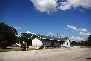
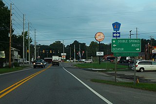
Arley is a town in Winston County, Alabama, United States. It incorporated on December 18, 1965. At the 2020 census the population was 330, down from 357 in 2010.

<span class="mw-page-title-main">Lynn, Alabama</span> Town in Alabama, United States

Lynn is a town in Winston County, Alabama, United States. It incorporated in April 1952. At the 2020 census the population was 832. Up from the 2010 census (659) up from 597 in 2000.

<span class="mw-page-title-main">Natural Bridge, Alabama</span> Town in Alabama, United States

Natural Bridge is a town at the southwest edge of Winston County, Alabama, United States, located near the intersection of U.S. Route 278, Alabama Highway 13, and Alabama State Route 5. It initially incorporated on September 3, 1914. In the 1930s, due to a dwindling population, its charter became dormant. On July 24, 1997, it reincorporated.

References

  1. "2020 U.S. Gazetteer Files". United States Census Bureau. Retrieved October 29, 2021.
  2. "Find a County". National Association of Counties. Archived from the original on May 31, 2011. Retrieved June 7, 2011.
  3. "Double Springs". Encyclopedia of Alabama. Retrieved May 27, 2016.
  4. "US Gazetteer files: 2010, 2000, and 1990". United States Census Bureau. February 12, 2011. Retrieved April 23, 2011.
  5. "PRISM Climate Group at Oregon State University". Northwest Alliance for Computational Science & Engineering (NACSE), based at Oregon State University. Retrieved March 16, 2023.
  6. "U.S. Decennial Census". Census.gov. Retrieved June 6, 2013.
  7. "Annual Estimates of the Resident Population: April 1, 2010 to July 1, 2013". Archived from the original on May 22, 2014. Retrieved June 3, 2014.
  8. "U.S. Census website". United States Census Bureau . Retrieved January 31, 2008.
  9. "U.S. Census website". United States Census Bureau . Retrieved August 19, 2015.
  10. "Explore Census Data". data.census.gov. Retrieved December 11, 2021.

34°09′06″N87°24′16″W / 34.151642°N 87.40439°W / 34.151642; -87.40439