
The 1860 United States presidential election was the 19th quadrennial presidential election, held on Tuesday, November 6, 1860. In a four-way contest, the Republican Party ticket of Abraham Lincoln and Hannibal Hamlin won a national popular plurality, a popular majority in the North where states already had abolished slavery, and a national electoral majority comprising only Northern electoral votes. Lincoln's election thus served as the main catalyst of the states that would become the Confederacy seceding from the Union. This marked the first time that a Republican was elected president. It was also the first presidential election in which both major party candidates were registered in the same home state; the others have been in 1904, 1920, 1940, 1944, and 2016.

Frederick County is located in the Commonwealth of Virginia. As of the 2020 census, the population was 91,419. Its county seat is Winchester. The county was formed in 1743 by the splitting of Orange County. It is Virginia's northernmost county. Frederick County is included in the Winchester, VA-WV Metropolitan Statistical Area, which is also included in the Washington-Baltimore-Northern Virginia, DC-MD-VA-WV-PA Combined Statistical Area.

Montgomery County is a county located in the southwestern area of the U.S. state of Iowa. As of the 2020 census, the population was 10,330. Its population has declined since a peak in 1900, since urbanization and decline of family farms. The county seat is Red Oak. The county was founded by European-American migrants from eastern areas in 1851. It was named in honor of Richard Montgomery, an American Revolutionary War general killed in 1775 while trying to capture Quebec City, Canada.
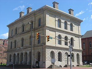
Ohio County is a county located in the Northern Panhandle of the U.S. state of West Virginia. As of the 2020 census, the population was 42,425. Its county seat is Wheeling. The county was formed in 1776 from the District of West Augusta, Virginia. It was named for the Ohio River, which forms its western boundary with the state of Ohio. West Liberty was designated as the county seat in 1777, serving to 1797.

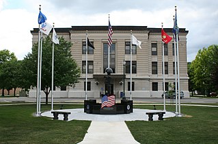
Pendleton County is a county located in the U.S. state of West Virginia. As of the 2020 census, the population was 6,143, making it the second-least populous county in West Virginia. Its county seat is Franklin. The county was created by the Virginia General Assembly in 1788 from parts of Augusta, Hardy, and Rockingham counties and was named for Edmund Pendleton (1721–1803), a distinguished Virginia statesman and jurist. Pendleton County was strongly pro-Confederate during the American Civil War; however, there were pockets of Unionists who supported the state government in Wheeling.

Pittsylvania County is a county located in the Commonwealth of Virginia. As of the 2020 United States Census, the population was 60,501. Chatham is the county seat.

James City County is a county located in the Commonwealth of Virginia. As of the 2020 census, the population was 78,254. Although politically separate from the county, the county seat is the adjacent independent city of Williamsburg.

Clarke County is a county in the Commonwealth of Virginia. As of the 2020 census, the population was 14,783. Its county seat is Berryville. Clarke County is included in the Washington-Arlington-Alexandria, DC-VA-MD-WV Metropolitan Statistical Area.
Douglas County is a county located in the U.S. state of Illinois. As of the 2020 United States Census, the population was 19,740. The county seat is Tuscola.

The West End is a part of Richmond, Virginia. Definitions of the bounds of the West End vary, it may include only the western part of the city of Richmond or extend as far as western Henrico County. As there is no one municipal organization that represents this specific region, the boundaries are loosely defined as being north of the James River, west of I-195, and south of Broad Street. Historically, the Richmond neighborhoods of the Fan and the Museum District were a part of the West End. A primary conduit through the West End is Interstate 64.
Apple Grove is an unincorporated community located in McDowell County, West Virginia, United States. Apple Grove is located along West Virginia Route 80 on the Dry Fork, south of Iaeger.
Douglas Grove may refer to one of the following places in the United States:
Apple Grove is a census-designated place (CDP) in Mason County, West Virginia, United States, on the Ohio River located along West Virginia Route 2. Apple Grove lies just south of Gallipolis Ferry. As of the 2010 census, its population was 204. It is part of the Point Pleasant, WV–OH Micropolitan Statistical Area.

Burches Run Wildlife Management Area, formerly Burches Run Lake WMA, is located on 55 acres (22 ha) near Wheeling in Marshall County, West Virginia. Until 2005 the wildlife management area contained a lake impounded by a dam at risk of failure. The name change occurred after the dam was removed. The terrain climbs gently above Burches Run and is covered by a mature oak-hickory second-growth forest.
Topins Grove is an unincorporated community in Jackson County, West Virginia, United States. Topins Grove is located on Little Pond Creek and County Highway 6, 7.7 miles (12.4 km) north-northeast of Ravenswood. Topins Grove once had a post office, which is now closed.
Cedar Grove is an unincorporated community in Wood County, West Virginia, United States.
Harmony Grove is an unincorporated community in Monongalia County, West Virginia, United States.

The 1932 United States presidential election in West Virginia took place on November 8, 1932, as part of the 1932 United States presidential election. West Virginia voters chose eight representatives, or electors, to the Electoral College, who voted for president and vice president.


