
Frederick County is located in the Commonwealth of Virginia. As of the 2020 census, the population was 91,419. Its county seat is Winchester. The county was formed in 1743 by the splitting of Orange County. It is Virginia's northernmost county. Frederick County is included in the Winchester, VA-WV Metropolitan Statistical Area, which is also included in the Washington-Baltimore-Northern Virginia, DC-MD-VA-WV-PA Combined Statistical Area.

Hampshire County is a county in the U.S. state of West Virginia. As of the 2020 census, the population was 23,093. Its county seat is Romney, West Virginia's oldest town (1762). The county was created by the Virginia General Assembly in 1754, from parts of Frederick and Augusta Counties (Virginia) and is the state's oldest county. The county lies in both West Virginia's Eastern Panhandle and Potomac Highlands regions.

The South Branch Potomac River has its headwaters in northwestern Highland County, Virginia, near Hightown along the eastern edge of the Allegheny Front. After a river distance of 139 miles (224 km), the mouth lies east of Green Spring, Hampshire County, West Virginia, where it meets the North Branch Potomac River to form the Potomac.

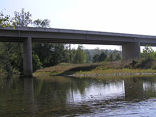
The Cacapon River, located in the Appalachian Mountains of West Virginia's Eastern Panhandle region, is an 81.0-mile-long (130.4 km) shallow river known for its fishing, boating, wildlife, hunting, and wilderness scenery. As part of the Potomac River watershed, it is an American Heritage River.
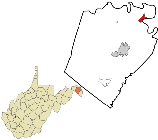
Yellow Spring is an unincorporated community in Hampshire County in the U.S. state of West Virginia. According to the 2000 census, the Yellow Spring community has a population of 296. Yellow Spring is named after the "Yellow Spring" located there on the Cacapon River. The community lies at the junction of West Virginia Route 259 and Cacapon River Road. Yellow Spring is sometimes incorrectly listed or referred to as Yellowspring or Yellow Springs.
Warm Springs is a census-designated place (CDP) in and the county seat of Bath County, Virginia, United States. The population as of the 2010 census was 123. It lies along U.S. Route 220 near the center of the county. Warm Springs includes the historical mill town called Germantown. To the west lies West Warm Springs.
Hooks Mills is an unincorporated community in Hampshire County, West Virginia, United States. It is located on Hooks Mill Road which intersects Cacapon River Road 4.5 miles south of Capon Bridge. Hooks Mills is named for the saw and grist mill on the Cacapon River run by the Hook family from 1848 to the late 1930s.

Opequon Creek is an approximately 35 mile tributary stream of the Potomac River. It flows into the Potomac northeast of Martinsburg in Berkeley County, West Virginia, and its source lies northwest of the community of Opequon at the foot of Great North Mountain in Frederick County, Virginia. The Opequon forms part of the boundary between Frederick and Clarke counties in Virginia and also partially forms the boundary between Berkeley and Jefferson counties in West Virginia's Eastern Panhandle.
Bubbling Spring is an unincorporated community in Hampshire County in the U.S. state of West Virginia. Bubbling Spring is situated on Cacapon River Road along the Cacapon River, south of Capon Bridge and north of Hooks Mills. It takes its name from the Bubbling Spring on the Cacapon there. Bubbling Spring has been known as Bubbling Spring Camps, Cacapon Bubbling Spring Camps, and Crystal Spring.
Falling Waters is a census-designated place (CDP) on the Potomac River in Berkeley County, West Virginia, United States. It is located along Williamsport Pike north of Martinsburg. An 1887 Scientific American article claimed that the first U.S. railroad was built in Falling Waters in 1814.
Mill Creek is a 14.5-mile-long (23.3 km) tributary of Opequon Creek, belonging to the Potomac River and Chesapeake Bay watersheds, located in Berkeley County in West Virginia's Eastern Panhandle. Its name reflects its past as a popular site for various types of mills, beginning with one constructed by Morgan Morgan in the mid-18th century near his cabin in present-day Bunker Hill.

Mill Creek is a 14.0-mile-long (22.5 km) tributary stream of the South Branch Potomac River, belonging to the Potomac River and Chesapeake Bay watersheds. The stream is located in Hampshire County in West Virginia's Eastern Panhandle. Mill Creek flows into the South Branch west of Romney Bridge near Vanderlip along the Northwestern Turnpike.
Mill Branch is a 9.1-mile-long (14.6 km) tributary stream of the Cacapon River, belonging to the Potomac River and Chesapeake Bay watersheds. The stream is located in eastern Hampshire County in West Virginia's Eastern Panhandle.

Great North Mountain is a 50-mile (80 km) long mountain ridge within the Ridge-and-valley Appalachians in the U.S. states of Virginia and West Virginia. The ridge is located west of the Shenandoah Valley and Massanutten Mountain in Virginia, and east of the Allegheny Mountains and Cacapon River in West Virginia.

State Route 39 is a primary state highway in the U.S. state of Virginia. The state highway runs 59.17 miles (95.22 km) from the West Virginia state line near Mountain Grove, where the highway continues as West Virginia Route 39, east to U.S. Route 11 in East Lexington. SR 39 connects Lexington with several communities formed around hot springs in Bath County. In Rockbridge County, the state highway passes through the town of Goshen and Goshen Pass, a gorge formed by the Maury River.

Yellow Spring Mill is a historic grist mill at the junction of West Virginia Route 259 and Cacapon River Road in Yellow Spring, West Virginia. The main building is a three-story wood-frame structure, with a gable roof, clapboard siding, and a foundation of concrete and stone. A single-story ell extends to one side. The property includes as outbuildings two residential cottages and a storage shed, along with two mill ponds and related raceways. The mill was established about 1896, and remained in operation as an economic mainstay of the community until 1990.

The Morgan Morgan Monument, also known as Morgan Park, is a 1.05-acre (0.4 ha) roadside park in the unincorporated town of Bunker Hill in Berkeley County, West Virginia. It is located along Winchester Avenue and Mill Creek. The park features a granite monument that was erected in 1924 to memorialize Morgan Morgan (1688–1766), an American pioneer of Welsh descent, who was among the earliest European persons to settle permanently within the present-day boundaries of West Virginia.

The North Branch Potomac River flows from Fairfax Stone in West Virginia to its confluence with the South Branch Potomac River near Green Spring, West Virginia, where it turns into the Potomac River proper.


