Dumanjug

Last updated
Dumanjug
Municipality of Dumanjug
Dumanjug Cebu 1.JPG
Dumanjug town center
Nickname: 
Home of the Governors
Ph locator cebu dumanjug.png
Map of Cebu with Dumanjug highlighted
OpenStreetMap
Dumanjug
Philippines location map (square).svg
Red pog.svg
Dumanjug
Location within the Philippines
Coordinates: 10°03′N123°29′E / 10.05°N 123.48°E / 10.05; 123.48
Country Philippines
Region Central Visayas
Province Cebu
District 7th district
Founded 1855
Barangays 37 (see Barangays)
Government
[1]
  Type Sangguniang Bayan
   Mayor loEfren Guntrano Z. Gica
   Vice Mayor Erwin Z. Gica
   Representative Peter John D. Calderon
   Municipal Council
Members
   Electorate 39,166 voters (2022)
Area
[2]
  Total85.53 km2 (33.02 sq mi)
Elevation
35 m (115 ft)
Highest elevation
212 m (696 ft)
Lowest elevation
0 m (0 ft)
Population
 (2020 census) [3]
  Total57,823
  Density680/km2 (1,800/sq mi)
   Households
12,968
Economy
   Income class 3rd municipal income class
   Poverty incidence
22.30
% (2018) [4]
   Revenue 193.8 million (2020)
   Assets 1,400 million (2020)
   Expenditure 225.6 million (2020)
   Liabilities 804.1 million (2020)
Service provider
  ElectricityCebu 1 Electric Cooperative (CEBECO 1)
Time zone UTC+8 (PST)
ZIP code
6035
PSGC
IDD : area code +63(0)32
Native languages Cebuano
Tagalog
Website www.dumanjug.gov.ph

Dumanjug, officially the Municipality of Dumanjug (Cebuano : Lungsod sa Dumanjug; Tagalog : Bayan ng Dumanjug), is a 1st class municipality in the province of Cebu, Philippines. According to the 2020 census, it has a population of 57,823 people. [3]

Contents

Dumanjug is one of the eight municipalities comprising the 7th Congressional District Cebu Province. It is 128 kilometres (80 mi) from Cebu City.

Dumanjug is also known as "The Land of Golden Friendship".

Geography

Dumanjug is bordered to the north by the town of Barili, to the west is the Tañon Strait, to the east is the town of Sibonga, and to the south is the town of Ronda.

It was established in 1855. [5] Based on the cadastral survey map of the Department of Environment and Natural Resources (DENR), Dumanjug has an effective land area of 8,544 hectares (21,110 acres)

Barangays

Dumanjug is politically subdivided into 37 barangays. Each barangay consists of puroks and some have sitios.

Barangay Bitoon, Calaboon, Camboang, Kanyuko, Li-ong, Poblacion, Tapon and Tangil which classified as coastal barangays.

PSGC Barangay Population ±% p.a.
2020 [3] 2010 [6]
072224001 Balaygtiki 3.5% 2,016 1,834 0.95%
072224002 Bitoon 5.2% 2,979 2,260 2.80%
072224003 Bulak 2.5% 1,441 1,419 0.15%
072224004 Bullogan 1.8% 1,065 886 1.86%
072224009 Calaboon 3.3% 1,920 1,867 0.28%
072224011 Camboang 2.1% 1,194 1,123 0.61%
072224012 Candabong 1.7% 982 936 0.48%
072224019 Cogon 5.3% 3,051 2,768 0.98%
072224021 Cotcoton 0.9% 549 457 1.85%
072224006 Doldol 2.7% 1,564 1,451 0.75%
072224031 Ilaya (Poblacion) 2.1% 1,217 1,103 0.99%
072224007 Kabalaasnan 0.7% 385 350 0.96%
072224008 Kabatbatan 0.7% 385 320 1.87%
072224010 Kambanog 0.8% 438 450 −0.27%
072224013 Kangactol 2.2% 1,274 1,027 2.18%
072224014 Kanghalo 1.0% 559 500 1.12%
072224015 Kanghumaod 2.8% 1,642 1,579 0.39%
072224016 Kanguha 1.3% 765 700 0.89%
072224017 Kantangkas 1.5% 839 710 1.68%
072224018 Kanyuko 1.9% 1,088 1,074 0.13%
072224020 Kolabtingon 1.3% 740 630 1.62%
072224022 Lamak 1.0% 570 554 0.29%
072224023 Lawaan 4.0% 2,321 2,173 0.66%
072224024 Liong 3.7% 2,159 1,746 2.15%
072224025 Manlapay 2.3% 1,307 1,675 −2.45%
072224026 Masa 1.1% 618 528 1.59%
072224027 Matalao 0.6% 341 307 1.06%
072224028 Paculob 2.7% 1,576 1,582 −0.04%
072224029 Panlaan 3.8% 2,190 1,857 1.66%
072224030 Pawa 2.1% 1,226 972 2.35%
072224039 Poblacion Central 1.6% 938 809 1.49%
072224032 Poblacion Looc 2.1% 1,198 1,174 0.20%
072224033 Poblacion Sima 1.0% 588 503 1.57%
072224034 Tangil 5.0% 2,886 2,673 0.77%
072224035 Tapon 6.1% 3,499 3,327 0.51%
072224037 Tubod-Bitoon 3.7% 2,129 1,905 1.12%
072224038 Tubod-Dugoan 2.7% 1,571 1,455 0.77%
Total57,82346,7542.15%

Climate

Climate data for Dumanjug, Cebu
MonthJanFebMarAprMayJunJulAugSepOctNovDecYear
Mean daily maximum °C (°F)29
(84)
30
(86)
31
(88)
32
(90)
31
(88)
30
(86)
30
(86)
30
(86)
30
(86)
29
(84)
29
(84)
29
(84)
30
(86)
Mean daily minimum °C (°F)22
(72)
22
(72)
23
(73)
24
(75)
25
(77)
25
(77)
24
(75)
24
(75)
24
(75)
24
(75)
24
(75)
23
(73)
24
(75)
Average precipitation mm (inches)42
(1.7)
34
(1.3)
40
(1.6)
61
(2.4)
124
(4.9)
188
(7.4)
190
(7.5)
191
(7.5)
189
(7.4)
186
(7.3)
124
(4.9)
73
(2.9)
1,442
(56.8)
Average rainy days10.08.59.512.822.326.828.427.927.327.620.513.1234.7
Source: Meteoblue [7]

Demographics

Population census of Dumanjug
YearPop.±% p.a.
1903 22,203    
1918 23,678+0.43%
1939 20,973−0.58%
1948 19,630−0.73%
1960 20,393+0.32%
1970 21,955+0.74%
1975 22,942+0.89%
1980 25,258+1.94%
1990 31,932+2.37%
1995 35,279+1.89%
2000 39,666+2.54%
2007 44,807+1.70%
2010 46,754+1.56%
2015 51,210+1.75%
2020 57,823+2.42%
Source: Philippine Statistics Authority [8] [6] [9] [10]

Dumanjug's population is characterized mainly by an increasing birth rate and a gradually declining mortality rate. The growth in population is thus attributed to higher rate of birth than of death.[ citation needed ]

The bulk of the household population is concentrated in the coastal barangays located in the western part of the municipality. The urban area comprising Poblacion, Sima, Ilaya, and Looc has the biggest slice of the population. Barangays Bitoon, Tangil, Tapon, Balaygtiki, Cogon and Liong are catching up with the urban barangays in terms of household population. With the urban area fast becoming a commercial hub, Bitoon, Paculob, Cogon and Liong are foreseen as upcoming dormitory communities.[ citation needed ]

Dumanjuganons speak Cebuano, the official language spoken in Cebu. Cebuano is also spoken in most areas of the Visayas and in many provinces of Mindanao.

Religion

Dumanjug Church Dumanjug Church facade.jpg
Dumanjug Church

The people of Dumanjug are mostly Catholics. The town has three Catholic parishes:

Economy

Poblacion Central Dumanjug Cebu 2.JPG
Poblacion Central

Majority of the existing industrial establishments in Dumanjug are those of micro-scale industries or establishments. These include bakeshops, welding shops, and cottage industries. Their products are mostly bakery products, assembled vehicles and handicrafts. Most of these establishments are found in the poblacion area and Bitoon. There are also four existing rice and corn mills operating in the municipality.

The municipality has considerable quantities of high-grade dolomites and large phosphate reserves found in Kanghumaod, Balaygtiki, Bullogan, Kabalaasnan, Matalao and Kabatbatan.

The Dumanjug Agora Complex is the center of trade & commerce of the municipality. Within the complex, various commercial establishments contribute greatly to the movement of goods and generation of revenues. These establishments cover basic goods for daily needs to construction supplies, agri-feeds, dry goods and many more. Sunday is designated as market day when various livestock and farm products congregate in the market. Out of town traders create an atmosphere of competition and creating opportunities for local consumers. Opposite the Agora complex is Gaisano Grand Mall, the first mall to be constructed in southwestern Cebu.

Tourism

Transportation

Dumanjug is currently served by eight bus operators

The municipality also has a RORO (Roll-On Roll Off) port situated in Tangil, which serves as the gateway between southern Cebu and mideastern Negros Island. There are two shipping companies effectively offering round-the-clock service.

Education

Dumanjug has 30 schools offering basic education, six secondary schools, and two tertiary education institutions. One of the town's prominent schools, the Little Flower School, was established in 1946 as the Dumanjug branch of the Colegio de San Carlos (now University of San Carlos). It was later renamed as the Dumanjug Catholic High School. It is currently administered by the Oblates of Notre Dame. Dumanjug's biggest school, Bitoon National Vocational School, is in the northern barangay of Bitoon. A satellite campus of the Cebu Technological University is also located in the same barangay.

The public schools in the town of Dumanjug are administered by two school districts under the Schools Division of Cebu Province.

Elementary schools:

High schools:

Private schools:

Related Research Articles

<span class="mw-page-title-main">Alcoy, Cebu</span> Municipality in Cebu, Philippines

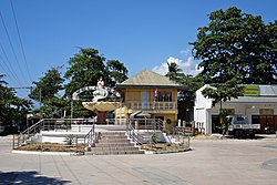
Alcoy, officially the Municipality of Alcoy, is a 5th class municipality in the province of Cebu, Philippines. According to the 2020 census, it has a population of 19,186 people.

<span class="mw-page-title-main">Bindoy</span> Municipality in Negros Oriental, Philippines

Bindoy, officially the Municipality of Bindoy, is a 3rd class municipality in the province of Negros Oriental, Philippines. According to the 2020 census, it has a population of 40,308 people.

<span class="mw-page-title-main">Dauin</span> Municipality in Negros Oriental, Philippines

Dauin, officially the Municipality of Dauin is a 4th class municipality in the province of Negros Oriental, Philippines. According to the 2020 census, it has a population of 30,018 people.

<span class="mw-page-title-main">Guihulngan</span> Component city in Negros Oriental, Philippines

Guihulngan, officially the City of Guihulngan, is a 5th class component city in the province of Negros Oriental, Philippines. According to the 2020 census, it has a population of 102,656 people, the third-most populous city in Negros Oriental after the cities of Dumaguete and Bayawan. Guihulngan is also dubbed by its residents as the "rising city of the north".

<span class="mw-page-title-main">Manjuyod</span> Municipality in Negros Oriental, Philippines

Manjuyod, officially the Municipality of Manjuyod, is a 2nd class municipality in the province of Negros Oriental, Philippines. According to the 2020 census, it has a population of 44,799 people.

<span class="mw-page-title-main">San Jose, Negros Oriental</span> Municipality in Negros Oriental, Philippines

San Jose, officially the Municipality of San Jose, is a 5th class municipality in the province of Negros Oriental, Philippines. According to the 2020 census, it has a population of 21,956 people. It is the least populous town in Negros Oriental.

<span class="mw-page-title-main">Santa Catalina, Negros Oriental</span> Municipality in Negros Oriental, Philippines

Santa Catalina, officially the Municipality of Santa Catalina, is a 1st class municipality in the province of Negros Oriental, Philippines. According to the 2020 census, it has a population of 77,501 people.

<span class="mw-page-title-main">Sibulan</span> Municipality in Negros Oriental, Philippines

Sibulan, officially the Municipality of Sibulan, is a second class municipality in the province of Negros Oriental, Philippines. According to the 2020 census, it has a population of 64,343 people.

<span class="mw-page-title-main">Alcantara, Cebu</span> Municipality in Cebu, Philippines

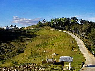
Alcantara, officially the Municipality of Alcantara, is a 5th class municipality in the province of Cebu, Philippines. According to the 2020 census, it has a population of 16,910 people.

<span class="mw-page-title-main">Alegria, Cebu</span> Municipality in Cebu, Philippines

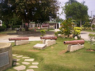
Alegria, officially the Municipality of Alegria, is a 4th class municipality in the province of Cebu, Philippines. According to the 2020 census, it has a population of 25,620 people.

<span class="mw-page-title-main">Argao</span> Municipality in Cebu, Philippines

Argao, officially the Municipality of Argao, is a 1st class municipality in the province of Cebu, Philippines. According to the 2020 census, it has a population of 78,187 people.

<span class="mw-page-title-main">Badian, Cebu</span> Municipality in Cebu, Philippines

Badian, officially the Municipality of Badian, is a 3rd class municipality in the province of Cebu, Philippines. According to the 2020 census, it has a population of 43,735 people.

<span class="mw-page-title-main">Borbon, Cebu</span> Municipality in Cebu, Philippines

Borbon, officially the Municipality of Borbon, is a 4th class municipality in the province of Cebu, Philippines. According to the 2020 census, it has a population of 38,187 people.

<span class="mw-page-title-main">Dalaguete</span> Municipality in Cebu, Philippines

Dalaguete, officially the Municipality of Dalaguete, is a 1st class municipality in the province of Cebu, Philippines. According to the 2020 census, it has a population of 74,596 people.

<span class="mw-page-title-main">Ginatilan</span> Municipality in Cebu, Philippines

Ginatilan, officially the Municipality of Ginatilan, is a 5th class municipality in the province of Cebu, Philippines. According to the 2020 census, it has a population of 16,906 people.

<span class="mw-page-title-main">Ronda, Cebu</span> Municipality in Cebu, Philippines

Ronda, officially the Municipality of Ronda, is a 5th class municipality in the province of Cebu, Philippines. According to the 2020 census, it has a population of 21,005 people.

<span class="mw-page-title-main">Sibonga</span> Municipality in Cebu, Philippines

Sibonga, officially the Municipality of Sibonga, is a 3rd class municipality in the province of Cebu, Philippines. According to the 2020 census, it has a population of 53,424 people.

<span class="mw-page-title-main">Tuburan, Cebu</span> Municipality in Cebu, Philippines

Tuburan, officially the Municipality of Tuburan, is a 2nd class municipality in the province of Cebu, Philippines. According to the 2020 census, it has a population of 68,167 people.

<span class="mw-page-title-main">Bato, Leyte</span> Municipality in Leyte, Philippines

Bato, officially the Municipality of Bato, is a 4th class municipality in the province of Leyte, Philippines. According to the 2020 census, it has a population of 38,505 people.

<span class="mw-page-title-main">Isabel, Leyte</span> Municipality in Leyte, Philippines

Isabel, officially the Municipality of Isabel, is a 1st class municipality in the province of Leyte, Philippines. According to the 2020 census, it has a population of 46,781 people.

References

  1. Municipality of Dumanjug | (DILG)
  2. "2015 Census of Population, Report No. 3 – Population, Land Area, and Population Density" (PDF). Philippine Statistics Authority. Quezon City, Philippines. August 2016. ISSN   0117-1453. Archived (PDF) from the original on May 25, 2021. Retrieved July 16, 2021.
  3. 1 2 3 Census of Population (2020). "Region VII (Central Visayas)". Total Population by Province, City, Municipality and Barangay. Philippine Statistics Authority . Retrieved 8 July 2021.
  4. "PSA Releases the 2018 Municipal and City Level Poverty Estimates". Philippine Statistics Authority. 15 December 2021. Retrieved 22 January 2022.
  5. Ronaldo S. Tan. "The Beginning of the 'Pueblo' called 'Dumanjug'". History. Municipality of Dumanjug. Archived from the original on 31 October 2015. Retrieved 8 April 2013.
  6. 1 2 Census of Population and Housing (2010). "Region VII (Central Visayas)" (PDF). Total Population by Province, City, Municipality and Barangay. National Statistics Office . Retrieved 29 June 2016.
  7. "Dumanjug: Average Temperatures and Rainfall". Meteoblue. Retrieved 10 May 2020.
  8. Census of Population (2015). "Region VII (Central Visayas)". Total Population by Province, City, Municipality and Barangay. Philippine Statistics Authority . Retrieved 20 June 2016.
  9. Censuses of Population (1903–2007). "Region VII (Central Visayas)". Table 1. Population Enumerated in Various Censuses by Province/Highly Urbanized City: 1903 to 2007. National Statistics Office.{{cite encyclopedia}}: CS1 maint: numeric names: authors list (link)
  10. "Province of Cebu". Municipality Population Data. Local Water Utilities Administration Research Division. Retrieved 17 December 2016.
  11. "Poverty incidence (PI):". Philippine Statistics Authority. Retrieved December 28, 2020.
  12. "Estimation of Local Poverty in the Philippines" (PDF). Philippine Statistics Authority. 29 November 2005.
  13. "2003 City and Municipal Level Poverty Estimates" (PDF). Philippine Statistics Authority. 23 March 2009.
  14. "City and Municipal Level Poverty Estimates; 2006 and 2009" (PDF). Philippine Statistics Authority. 3 August 2012.
  15. "2012 Municipal and City Level Poverty Estimates" (PDF). Philippine Statistics Authority. 31 May 2016.
  16. "Municipal and City Level Small Area Poverty Estimates; 2009, 2012 and 2015". Philippine Statistics Authority. 10 July 2019.
  17. "PSA Releases the 2018 Municipal and City Level Poverty Estimates". Philippine Statistics Authority. 15 December 2021. Retrieved 22 January 2022.