Easton, New York

Last updated

Easton
Washington County New York incorporated and unincorporated areas Easton highlighted.svg
Location in Washington County and the state of New York.
Coordinates: 43°1′49″N73°32′14″W / 43.03028°N 73.53722°W / 43.03028; -73.53722
Country United States
State New York
County Washington
Area
[1]
  Total63.21 sq mi (163.71 km2)
  Land62.28 sq mi (161.30 km2)
  Water0.93 sq mi (2.42 km2)
Elevation
548 ft (167 m)
Population
 (2020) [2]
  Total2,279
Time zone UTC-5 (Eastern (EST))
  Summer (DST) UTC-4 (EDT)
Area code 518
FIPS code 36-22656
GNIS feature ID0978920

Easton is a town in southwestern Washington County, New York, United States along the county's western boundary. It is part of the Glens Falls Metropolitan Statistical Area. [3] The town population was 2,279 at the 2020 census. [2] [4] The town adopted English as its official language on July 6, 2010. [5]

Contents

History

The town of East was formed in 1789 from the towns of Saratoga and Stillwater. The Baker-Merrill House and DeRidder Homestead are listed on the National Register of Historic Places. [6]

Geography

The western town line is defined by the Hudson River with Saratoga County on the opposite bank. The southern town line is the border of Rensselaer County.

According to the United States Census Bureau, the town has a total area of 63.2 square miles (164 km2), of which 62.3 square miles (161 km2) is land and 0.9 square miles (2.3 km2) (1.44%) is water.

NY Route 40 is a north–south highway through the center of Easton, and NY Route 29 crosses the northern section of the town.

Demographics

Historical population
CensusPop.Note
1820 3,051
1830 3,75323.0%
1840 2,988−20.4%
1850 3,2257.9%
1860 3,083−4.4%
1870 3,072−0.4%
1880 2,740−10.8%
1890 2,500−8.8%
1900 2,247−10.1%
1910 2,133−5.1%
1920 1,851−13.2%
1930 1,726−6.8%
1940 1,691−2.0%
1950 1,659−1.9%
1960 1,6811.3%
1970 1,95616.4%
1980 2,0203.3%
1990 2,2039.1%
2000 2,2592.5%
2010 2,3363.4%
2020 2,279−2.4%
U.S. Decennial Census [7] [8]

As of the census of 2000, there were 2,259 people, 854 households, and 642 families residing in the town. The population density was 36.3 inhabitants per square mile (14.0/km2). There were 953 housing units at an average density of 15.3 per square mile (5.9/km2). The racial makeup of the town was 98.54% White, 0.53% African American, 0.09% Asian, and 0.84% from two or more races. Hispanic or Latino of any race were 0.71% of the population. [2]

There were 854 households, out of which 33.7% had children under the age of 18 living with them, 63.5% were married couples living together, 6.1% had a female householder with no husband present, and 24.8% were non-families. 19.8% of all households were made up of individuals, and 7.4% had someone living alone who was 65 years of age or older. The average household size was 2.63 and the average family size was 3.03. [2]

In the town, the population was spread out, with 25.7% under the age of 18, 5.6% from 18 to 24, 28.1% from 25 to 44, 26.4% from 45 to 64, and 14.2% who were 65 years of age or older. The median age was 39 years. For every 100 females, there were 102.6 males. For every 100 females age 18 and over, there were 102.4 males. [2]

The median income for a household in the town was $43,194, and the median income for a family was $48,947. Males had a median income of $32,428 versus $24,569 for females. The per capita income for the town was $19,998. About 3.4% of families and 6.6% of the population were below the poverty line, including 7.2% of those under age 18 and none of those age 65 or over. [2]

Communities and locations in Easton

Communities

Geographical locations

Notable person

Related Research Articles

Hamden is a town in Delaware County, New York, United States. The population was 1,137 at the 2020 census.

Harpersfield is a town in Delaware County, New York, United States. The population was 1,442 at the 2020 census. The town is on the northern border of the county.

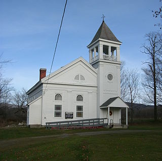
Kortright is a town in Delaware County, New York, United States. The population was 1,544 at the 2020 census. The town is in the northern part of the county.

<span class="mw-page-title-main">Jewett, New York</span> Town in New York, United States

Jewett is a town centrally located in Greene County, New York, United States. The population was 879 at the 2020 census. The town is named for Freeborn G. Jewett, justice of the New York Supreme Court.

<span class="mw-page-title-main">Prattsville (town), New York</span> Town in New York, United States

Prattsville is a town in Greene County, New York, United States. The town is in the northwestern part of the county. As of the 2020 census, the population was 774.

Wilna is a town in Jefferson County, New York, United States. The population was 5,732 at the 2020 census. The town is on the eastern side of the county and is east of Watertown.

<span class="mw-page-title-main">Petersburgh, New York</span> Town in New York, United States

Petersburgh is a town located in the northeast section of Rensselaer County, New York, United States. The population was 1,372 at the 2020 census. The town was named after an early settler named Peter Simmons.

<span class="mw-page-title-main">Carlisle, New York</span> Town in New York, United States

Carlisle is a town in northern Schoharie County, New York, United States. The population was 1,768 at the 2020 census.

<span class="mw-page-title-main">Seward, New York</span> Town in New York, United States

Seward is a town in Schoharie County, New York, United States. The population was 1,583 at the 2020 census. The town is named after senator, governor, and secretary of state William H. Seward.

<span class="mw-page-title-main">Summit, New York</span> Town in New York, United States

Summit is a town in Schoharie County, New York, United States. The population was 1,072 at the time of the 2020 census. The name is derived from a peak that was thought to be the highest elevation in the county.

<span class="mw-page-title-main">Wright, New York</span> Town in New York, United States

Wright is a town in Schoharie County, New York, United States. The population was 1,516 at the 2020 census. The town was named after governor Silas Wright.

<span class="mw-page-title-main">Denning, New York</span> Town in New York, United States

Denning is an isolated town in Ulster County, New York, United States. The population was 493 at the 2020 census. The town is named after an early landowner, William Denning. Denning is located in the western part of the county, deep inside the Catskill Mountains. The location of the town in the Catskill State Park accounts in part for its low population.

<span class="mw-page-title-main">Olive, New York</span> Town in New York, United States

Olive is a town in Ulster County, New York, United States. The town is west of Kingston, New York and is inside the Catskill Park. The population was 4,226 at the 2020 census.

<span class="mw-page-title-main">Hartford, New York</span> Town in New York, United States

Hartford is a town centrally located in Washington County, New York, United States. It is part of the Glens Falls Metropolitan Statistical Area. The town population was 2,193 at the 2020 census.

<span class="mw-page-title-main">White Creek, New York</span> Town in New York, United States

White Creek is a town in Washington County, New York, United States. It is part of the Glens Falls Metropolitan Statistical Area. The town population was 3,275 at the 2020 census. The town contains the White Creek Historic District, which was listed on the National Register of Historic Places in 1979.

Greenville is a hamlet and census-designated place (CDP) in the town of Greenville, in Greene County, New York, United States. The population of the CDP was 688 at the 2020 census, out of a total 3,741 people in the town as a whole.

<span class="mw-page-title-main">Salem, New York</span> Town in New York, United States

Salem is a town in eastern Washington County, New York, United States. It is part of the Glens Falls Metropolitan Statistical Area. The town population was 2,612 at the 2020 census. The town of Salem contains a hamlet also named Salem, formerly an incorporated village.

<span class="mw-page-title-main">Plattekill, New York</span> Place in New York, United States

Plattekill is a town in Ulster County, New York, United States. The population was 10,424 in 2020, a slight decrease from 10,499 at the 2010 census. The name is derived from a stream, the Platte Kill.

<span class="mw-page-title-main">Fort Edward, New York</span> Town in New York, United States

Fort Edward is a town and the county seat of Washington County, New York, United States. The population was 5,991 at the 2020 census. The municipal center complex is on U.S. Route 4 between the villages of Hudson Falls and Fort Edward. When construction of the complex was completed in 1994, most of the administrative offices were moved from the original county seat of Hudson Falls to this location. The town of Fort Edward is part of the Glens Falls Metropolitan Statistical Area.

<span class="mw-page-title-main">Greenwich (town), New York</span> Town in New York, United States

Greenwich is a town in the southwestern part of Washington County, New York, United States. The town is located on the western border of the county. The population was 4,868 at the 2020 census. It is part of the Glens Falls Metropolitan Statistical Area. Greenwich features several homes that were a part of the Underground Railroad.

References

  1. "2016 U.S. Gazetteer Files". United States Census Bureau. Retrieved July 5, 2017.
  2. 1 2 3 4 5 6 "U.S. Census website". United States Census Bureau . Retrieved January 31, 2008.
  3. "Metropolitan Areas and Components, 1999, with FIPS Codes". US Census Bureau. Retrieved July 7, 2009.
  4. United States Census Bureau, 2020 U.S. Census Results, Cambridge town, Washington County, New York https://www.census.gov/search-results.html?searchType=web&cssp=SERP&q=Easton%20town,%20Washington%20County,%20New%20York
  5. "Easton too prefers English only". The Post Star. July 6, 2010. Retrieved July 6, 2010.
  6. 1 2 "National Register Information System". National Register of Historic Places . National Park Service. March 13, 2009.
  7. "Census of Population and Housing". Census.gov. Retrieved June 4, 2015.
  8. United States Census Bureau, 2020 U.S. Census Results, Cambridge town, Washington County, New York https://www.census.gov/search-results.html?searchType=web&cssp=SERP&q=Easton%20town,%20Washington%20County,%20New%20York
  9. "National Register of Historic Places Listings". Weekly List of Actions Taken on Properties: 9/14/15 through 9/18/15. National Park Service. September 25, 2015.[ permanent dead link ]
  10. "HOME". www.willardmountain.com.