Stillwater, New York

Last updated

Stillwater
Town of Stillwater
Welcome to Stillwater.jpg
Welcome to Stillwater sign
Stillwater Saratoga NY.png
Location of Stillwater within Saratoga County
USA New York location map.svg
Red pog.svg
Stillwater
Location of Stillwater in New York
Coordinates: 42°58′N73°41′W / 42.967°N 73.683°W / 42.967; -73.683
CountryUnited States
State New York
County Saratoga
Established1791
Area
[1]
  Total43.57 sq mi (112.86 km2)
  Land41.19 sq mi (106.68 km2)
  Water2.38 sq mi (6.17 km2)
Population
 (2020) [2]
  Total9,022
  Density210/sq mi (80/km2)
FIPS code 36-091-71333
Website Town website

Stillwater is a town in Saratoga County, New York, United States, with a population of 9,022 at the 2020 census. The town contains a village called Stillwater. The town is at the eastern border of the county, southeast of Saratoga Springs and borders both Rensselaer and Washington counties. Saratoga National Historical Park is located within the town's limits. There is a hamlet in Minerva, Essex County, New York, with the same name which has nothing to do with this town.

Contents

History

Perspective map of Stillwater from 1889 by L.R. Burleigh with list of landmarks Stillwater, N.Y. LOC 75694851.jpg
Perspective map of Stillwater from 1889 by L.R. Burleigh with list of landmarks

The area was occupied by Iroquois and Mahican natives when the colonial period began. In 1709, Peter Schuyler built Fort Ingoldsby in town because of its location on the frontier of the French and Indian Wars. A replica of Schuyler's fort currently serves as the Stillwater Blockhouse Museum. Settlers began arriving after 1730. During the American Revolution residents participated in the war, and part of the Battle of Saratoga was fought in the town so that the town now refers to itself as the turning point of the American Revolution.[ citation needed ] [3]

Stillwater was established as a town in 1791, when Saratoga County was formed. In 1816, the hamlet of Stillwater incorporated as a village. In 1859, Mechanicville became the town's second village. The Stillwater Free Library was established in 1949 by Barbara Alexik and Elizabeth Beiter in the building formerly home to the St. John's Episcopal Church. The Stillwater United Church was listed on the National Register of Historic Places in 2006. [4]

Geography

According to the United States Census Bureau, the town has a total area of 43.6 square miles (112.8 km2), of which 41.4 square miles (107.1 km2) is land and 2.2 square miles (5.7 km2) (5.07%) is water.

The eastern town line is the border of Rensselaer County and Washington County, marked by the Hudson River.

U.S. Route 4, partly conjoined with New York State Route 32 follows the Hudson River through the town. New York State Route 423 is an east-west highway in the northern part of Stillwater. New York State Route 9P is a north-south highway in the northwestern part of the town by Saratoga Lake. New York State Route 67 runs along the southern town line.

Demographics

Historical population
CensusPop.Note
1820 2,821
1830 2,601−7.8%
1840 2,7335.1%
1850 2,9678.6%
1860 3,2389.1%
1870 3,4015.0%
1880 3,4120.3%
1890 3,86813.4%
1900 4,98929.0%
1910 5,95519.4%
1920 3,882−34.8%
1930 3,9421.5%
1940 3,709−5.9%
1950 4,0559.3%
1960 4,4168.9%
1970 5,02313.7%
1980 6,31625.7%
1990 7,23314.5%
2000 7,5224.0%
2010 8,28710.2%
2020 9,0228.9%
U.S. Decennial Census [5] [6]

At the 2000 census, [7] there were 7,522 people, 2,786 households and 2,109 families residing in the town. The population density was 181.9 inhabitants per square mile (70.2/km2). There were 3,054 housing units at an average density of 73.8 per square mile (28.5/km2). The racial makeup of the town was 98.21% White, 0.41% Black or African American, 0.11% Native American, 0.47% Asian, 0.01% Pacific Islander, 0.11% from other races, and 0.69% from two or more races. Hispanic or Latino of any race were 0.62% of the population.

There were 2,786 households, of which 38.0% had children under the age of 18 living with them, 60.7% were married couples living together, 10.0% had a female householder with no husband present, and 24.3% were non-families. 19.5% of all households were made up of individuals, and 7.7% had someone living alone who was 65 years of age or older. The average household size was 2.70 and the average family size was 3.10.

27.0% of the population were under the age of 18, 6.9% from 18 to 24, 31.9% from 25 to 44, 23.5% from 45 to 64, and 10.7% who were 65 years of age or older. The median age was 36 years. For every 100 females, there were 99.8 males. For every 100 females age 18 and over, there were 96.8 males.

The median household income was $47,579 and the median family income was $53,023. Males had a median income of $37,428 and females $27,257. The per capita income was $19,291. About 5.3% of families and 6.7% of the population were below the poverty line, including 8.6% of those under age 18 and 11.3% of those age 65 or over.

Education

Students attend school at Stillwater High School. The school is located in the village of Stillwater and serves grades K to 12 in two buildings.

Notable people

Communities and locations in the Town of Stillwater

See also

Related Research Articles

<span class="mw-page-title-main">Orwell, New York</span> Town in New York, United States

Orwell is a town in Oswego County, New York, United States. The population was 1,167 at the 2010 census. The town was named after Orwell, Vermont.

<span class="mw-page-title-main">Ballston, New York</span> Town in New York, United States

Ballston is a town in Saratoga County, New York, United States. The population was 11,831 at the 2020 census. The name is derived from an early settler, Eliphalet Ball, a Presbyterian minister who relocated there from Westchester County, New York in 1770. The town is in the southern part of the county, and is north of Schenectady.

<span class="mw-page-title-main">Greenfield, New York</span> Town in New York, United States

Greenfield is a town in Saratoga County, New York, United States. It is located northwest of Saratoga Springs, and is the largest by area in the county. Students living in Greenfield attend schools of the Saratoga Springs City School District. The Palmertown, and Kayaderosseras Ranges pass through the town, the town is located at the foothills of the Adirondack Mountains.

<span class="mw-page-title-main">Halfmoon, New York</span> Town in New York, United States

Halfmoon is a town in Saratoga County, New York, United States. The population was 25,662 at the 2020 census. The town is apparently named for the shape of the lower elevation land north of the junction of the Hudson and Mohawk Rivers. It is also said to be named for Henry Hudson's ship, the Halve Maen.

<span class="mw-page-title-main">Malta, New York</span> Town in New York, United States

Malta is a town in Saratoga County, New York, United States. The town is in the central part of the county and is south of Saratoga Springs. The population was 17,130 as of the 2020 census.

<span class="mw-page-title-main">Mechanicville, New York</span> City in New York, United States

Mechanicville is a city in Saratoga County, New York, United States. The population was 5,163 at the 2020 census, a small decrease from 5,196 in 2010. It is the smallest city by area in the state. The name is derived from the occupations of early residents.

<span class="mw-page-title-main">Moreau, New York</span> Town in New York, United States

Moreau is a town in Saratoga County, New York, United States. The population was 16,202 at the 2020 census. The town is located in the northeast part of the county, north of Saratoga Springs. Moreau is named after Jean Victor Moreau, a French general, who visited the area just before the town was formed. The town contains a village called South Glens Falls.

<span class="mw-page-title-main">Northumberland, New York</span> Town in New York, United States

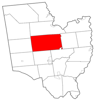
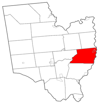
Northumberland is a town in Saratoga County, New York, United States. Immediately north of Schuylerville and northeast of Saratoga Springs the town is also located on the west bank of the Hudson River.

<span class="mw-page-title-main">Saratoga, New York</span> Town in New York, United States

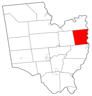
Saratoga is a town in Saratoga County, New York, United States. The population was 5,808 at the 2020 census. It is also the commonly used, but not official, name for the neighboring and much more populous city, Saratoga Springs. The major village in the town of Saratoga is Schuylerville, which is often, but not officially, called Old Saratoga. Saratoga contains a second village, named Victory.

<span class="mw-page-title-main">Thompson, New York</span> Town in New York, United States

Thompson is a town in the southern part of Sullivan County, New York, United States. The population was 16,550 at the 2020 census. The town is named after William Thompson, an early settler.

<span class="mw-page-title-main">Marlborough, New York</span> Town in New York, United States

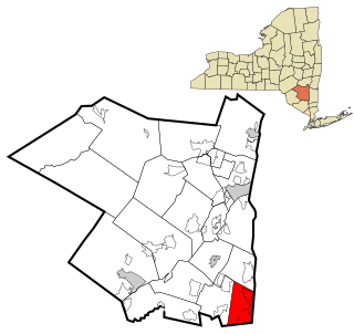
Marlborough is a town in Ulster County, New York, United States, in the southeastern corner of the county. The population was 8,712 at the 2020 census. U.S. Route 9W passes through the eastern part of the town. US Route 44 and NY 55 cross the northwestern corner of the town. The town was named after the Duke of Marlborough.

<span class="mw-page-title-main">Easton, New York</span> Town in New York, United States

Easton is a town in southwestern Washington County, New York, United States along the county's western boundary. It is part of the Glens Falls Metropolitan Statistical Area. The town population was 2,279 at the 2020 census. The town adopted English as its official language on July 6, 2010.

<span class="mw-page-title-main">Kingsbury, New York</span> Hamlet in the state of New York, United States

Kingsbury is a town in western Washington County, New York, United States. It is part of the Glens Falls Metropolitan Statistical Area. The town population was 12,968 at the 2020 census, up from 12,671 at the 2010 census.

<span class="mw-page-title-main">Cortlandt, New York</span> Town in New York, United States

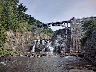
Cortlandt is a town in Westchester County, New York, United States, located at the northwestern edge of the county, at the eastern terminus of the Bear Mountain Bridge. The town includes the villages of Buchanan and Croton-on-Hudson.

<span class="mw-page-title-main">Haverstraw, New York</span> Town in New York, United States

Haverstraw is a town in Rockland County, New York, United States, located north of the Town of Clarkstown and the Town of Ramapo; east of Orange County; south of the Town of Stony Point; and west of the Hudson River. The town runs from the west to the east border of the county in its northern section. The population was 39,087 at the 2020 census.

<span class="mw-page-title-main">Corinth, New York</span> Town in New York, United States

Corinth is a town in Saratoga County, New York, United States. The population was 6,500 at the 2020 census. The town contains a village also named Corinth. The town is on the northeastern border of the county, north of Saratoga Springs. The town is noted as "the snowshoe capital of the world" and is home to Palmer Falls where the Hudson River passes through the Palmertown Range.

<span class="mw-page-title-main">Milton, Saratoga County, New York</span> Town in New York, United States

Milton is a town in Saratoga County, New York, United States. The population was 18,800 at the 2020 census. Some believe that the town was named after the poet, John Milton, while other sources state that it is a shortening of "Mill-town" for the early mill activity.

<span class="mw-page-title-main">Stillwater (village), New York</span> Village in New York, United States

Stillwater is a village in Saratoga County, New York, United States. The population was 1,754 at the 2020 census. There is a hamlet in Minerva, Essex County with the same name, which has nothing to do with this village. The Village of Stillwater is in the southeastern part of the Town of Stillwater, north of the City of Mechanicville.

<span class="mw-page-title-main">Gouverneur, New York</span> Town in New York, United States

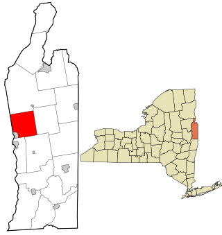
Gouverneur is a town in St. Lawrence County, New York, United States. As of the 2020 census, the population was 6,551. That was down from 7,085 in 2010. The town is named after statesman and landowner Gouverneur Morris.

<span class="mw-page-title-main">Fort Ann, New York</span> Town in New York, United States

Fort Ann is a town in Washington County, New York, United States. It is part of the Glens Falls Metropolitan Statistical Area. The town population was 5,812 at the 2020 census. The town contains a village, also called Fort Ann, located in its southeastern corner.

References

  1. "2016 U.S. Gazetteer Files". United States Census Bureau. Retrieved July 5, 2017.
  2. US Census Bureau, 2020 Census Results, Stillwater town, Saratoga County, New York QuickFacts https://www.census.gov/quickfacts/stillwatertownsaratogacountynewyork
  3. "Town History - Town of Stillwater". www.stillwaterny.org.
  4. "National Register Information System". National Register of Historic Places . National Park Service. March 13, 2009.
  5. "Census of Population and Housing". Census.gov. Retrieved June 4, 2015.
  6. US Census Bureau, 2020 Census Results, Stillwater town, Saratoga County, New York QuickFacts https://www.census.gov/quickfacts/stillwatertownsaratogacountynewyork
  7. "U.S. Census website". United States Census Bureau . Retrieved January 31, 2008.
  8. Roberts, Lemuel (1809). Memoirs of Lemuel Roberts. Anthony Haswell.