Charlton, New York

Last updated

Charlton
Town of Charlton
Charlton NY Locator Map.png
Map highlighting Charlton's location within Saratoga County.
USA New York location map.svg
Red pog.svg
Charlton
Location within the state of New York
Coordinates: 42°57′1″N73°59′27″W / 42.95028°N 73.99083°W / 42.95028; -73.99083
Country United States
State New York
County Saratoga
Named for Charlton, Worcestershire
Area
[1]
  Total32.96 sq mi (85.37 km2)
  Land32.77 sq mi (84.88 km2)
  Water0.19 sq mi (0.49 km2)
Elevation
663 ft (202 m)
Population
 (2020) [2]
  Total4,328
  Density130/sq mi (51/km2)
Time zone UTC-5 (Eastern (EST))
  Summer (DST) UTC-4 (EDT)
ZIP code
12019
Area code 518
FIPS code 36-13926
GNIS feature ID0978812

Charlton is a town in Saratoga County, New York, United States. The population was 4,328 at the 2020 census. [3] The town is named after a notable physician.[ citation needed ]

Contents

The Town of Charlton is located in the southwestern part of the county and is north of Schenectady. The town is home to the Charlton Historic District, which is home to many historic buildings.

History

The region was first settled circa 1680 by travelers from the small village of Charlton, located in Worcestershire, United Kingdom. The town was formed in 1792 from the Town of Ballston, immediately after Saratoga County was established. The town was previously known as "Freehold" due to the number of settlers from New Jersey.

Notable people

Geography

According to the United States Census Bureau, the town has a total area of 32.8 square miles (85 km2), of which 32.8 square miles (85 km2) is land and 0.04 square miles (0.10 km2) (0.06%) is water.

The southern town line is the border of Schenectady County, and the western town boundary is the border of Montgomery County.

New York State Route 67 (Amsterdam Road) is an east-west highway which intersects New York State Route 147, a north-south highway, north of West Charlton.

The town borders Galway to the North, Ballston to the east, Glenville to the south, and Amsterdam to the west.

Demographics

Historical population
CensusPop.Note
1800 1,746
1810 1,94611.5%
1820 1,9530.4%
1830 2,0233.6%
1840 1,933−4.4%
1850 1,902−1.6%
1860 1,752−7.9%
1870 1,607−8.3%
1880 1,474−8.3%
1890 1,175−20.3%
1900 1,109−5.6%
1910 1,030−7.1%
1920 914−11.3%
1930 9787.0%
1940 1,0638.7%
1950 1,29822.1%
1960 3,024133.0%
1970 3,77224.7%
1980 4,0196.5%
1990 3,984−0.9%
2000 3,954−0.8%
2010 4,1334.5%
2020 4,3284.7%
U.S. Decennial Census [4]

[5] [6]

As of the census [7] of 2000, there were 3,954 people, 1,429 households, and 1,204 families residing in the town. The population density was 120.5 inhabitants per square mile (46.5/km2). There were 1,464 housing units at an average density of 44.6 per square mile (17.2/km2). The racial makeup of the town was 98.46% White, 0.28% African American, 0.15% Native American, 0.32% Asian, 0.10% from other races, and 0.68% from two or more races. Hispanic or Latino of any race were 0.96% of the population.

There were 2,429 households, out of which 34.7% had children under the age of 18 living with them, 75.4% were married couples living together, 5.3% had a male householder with no wife present, and 15.7% were non-families. 12.9% of all households were made up of individuals, and 6.6% had someone living alone who was 65 years of age or older. The average household size was 2.74 and the average family size was 3.00.

In the town, the population was spread out, with 25.2% under the age of 18, 5.4% from 18 to 24, 24.2% from 25 to 44, 31.9% from 45 to 64, and 13.3% who were 65 years of age or older. The median age was 42 years. For every 100 females, there were 95.2 males. For every 100 females age 18 and over, there were 96.0 males.

The median income for a household in the town was $63,396, and the median income for a family was $66,250. Males had a median income of $47,813 versus $30,208 for females. The per capita income for the town was $27,924. About 0.6% of families and 1.2% of the population were below the poverty line, including none of those under age 18 and 3.3% of those age 65 or over.

Communities and locations in Charlton

Related Research Articles

<span class="mw-page-title-main">Westerlo, New York</span> Town in New York, United States

Westerlo is a town in Albany County, New York, United States. The population was 3,194 at the 2020 census.

Hamden is a town in Delaware County, New York, United States. The population was 1,137 at the 2020 census.

Kortright is a town in Delaware County, New York, United States. The population was 1,544 at the 2020 census. The town is in the northern part of the county.

Meredith is a town in Delaware County, New York, United States. The population was 1,484 at the 2020 census. It is an interior town in the northern part of the county.

<span class="mw-page-title-main">Tompkins, New York</span> Town in Delaware County, New York, US

Tompkins is a town in Delaware County, New York, United States. The population was 1,290 at the 2020 census. The town is named after Daniel D. Tompkins, the fourth governor of New York and sixth vice president of the United States.

<span class="mw-page-title-main">Jewett, New York</span> Town in New York, United States

Jewett is a town centrally located in Greene County, New York, United States. The population was 879 at the 2020 census. The town is named for Freeborn G. Jewett, justice of the New York Supreme Court.

<span class="mw-page-title-main">Prattsville (town), New York</span> Town in New York, United States

Prattsville is a town in Greene County, New York, United States. The town is in the northwestern part of the county. As of the 2020 census, the population was 774.

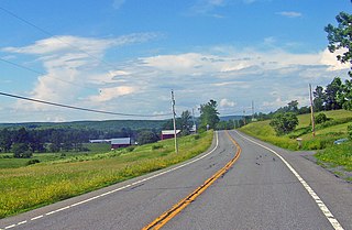
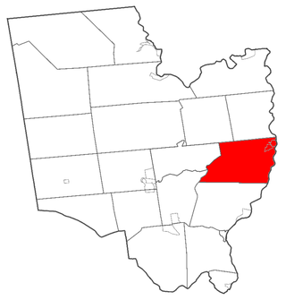
Wilna is a town in Jefferson County, New York, United States. The population was 5,732 at the 2020 census. The town is on the eastern side of the county and is east of Watertown.

<span class="mw-page-title-main">Day, New York</span> Town in New York, United States

Day is a town in Saratoga County, New York, United States. The town is in the northwestern part of the county and is northeast of Amsterdam. Its population in the 2020 Census was 819.

<span class="mw-page-title-main">Saratoga, New York</span> Town in New York, United States

Saratoga is a town in Saratoga County, New York, United States. The population was 5,808 at the 2020 census. It is also the commonly used, but not official, name for the neighboring and much more populous city, Saratoga Springs. The major village in the town of Saratoga is Schuylerville, which is often, but not officially, called Old Saratoga. Saratoga contains a second village, named Victory.

<span class="mw-page-title-main">Carlisle, New York</span> Town in New York, United States

Carlisle is a town in northern Schoharie County, New York, United States. The population was 1,768 at the 2020 census.

<span class="mw-page-title-main">Seward, New York</span> Town in New York, United States

Seward is a town in Schoharie County, New York, United States. The population was 1,583 at the 2020 census. The town is named after senator, governor, and secretary of state William H. Seward.

<span class="mw-page-title-main">Olive, New York</span> Town in New York, United States

Olive is a town in Ulster County, New York, United States. The town is west of Kingston, New York, and is inside the Catskill Park. The population was 4,226 at the 2020 census.

<span class="mw-page-title-main">Easton, New York</span> Town in New York, United States

Easton is a town in southwestern Washington County, New York, United States along the county's western boundary. It is part of the Glens Falls Metropolitan Statistical Area. The town population was 2,279 at the 2020 census. The town adopted English as its official language on July 6, 2010.

<span class="mw-page-title-main">Hartford, New York</span> Town in New York, United States

Hartford is a town centrally located in Washington County, New York, United States. It is part of the Glens Falls Metropolitan Statistical Area. The town population was 2,193 at the 2020 census.

Greenville is a hamlet and census-designated place (CDP) in the town of Greenville, in Greene County, New York, United States. The population of the CDP was 688 at the 2020 census, out of a total 3,741 people in the town as a whole.

<span class="mw-page-title-main">Galway, New York</span> Town in New York, United States

Galway is a town located in Saratoga County, New York, United States. As of the 2020 census, the town had a total population of 3,525. The town contains a village also named Galway. Both the town and village are located in the western part of the county, north of Schenectady.

<span class="mw-page-title-main">Milton, Saratoga County, New York</span> Town in New York, United States

Milton is a town in Saratoga County, New York, United States. The population was 18,800 at the 2020 census. Some believe that the town was named after the poet, John Milton, while other sources state that it is a shortening of "Mill-town" for the early mill activity.

<span class="mw-page-title-main">Plattekill, New York</span> Place in New York, United States

Plattekill is a town in Ulster County, New York, United States. The population was 10,424 in 2020, a slight decrease from 10,499 at the 2010 census. The name is derived from a stream, the Platte Kill.

<span class="mw-page-title-main">Fort Edward, New York</span> Town in New York, United States

Fort Edward is a town and the county seat of Washington County, New York, United States. The population was 5,991 at the 2020 census. The municipal center complex is on U.S. Route 4 between the villages of Hudson Falls and Fort Edward. When construction of the complex was completed in 1994, most of the administrative offices were moved from the original county seat of Hudson Falls to this location. The town of Fort Edward is part of the Glens Falls Metropolitan Statistical Area.

References

  1. "2016 U.S. Gazetteer Files". United States Census Bureau. Retrieved July 5, 2017.
  2. US Census Bureau, 2020 Census Results, Charlton town, Saratoga County, New York https://www.census.gov/search-results.html?searchType=web&cssp=SERP&q=Charlton%20town,%20Saratoga%20County,%20New%20York
  3. US Census Bureau, 2020 Census Results, Charlton town, Saratoga County, New York https://www.census.gov/search-results.html?searchType=web&cssp=SERP&q=Charlton%20town,%20Saratoga%20County,%20New%20York
  4. "Census of Population and Housing". Census.gov. Retrieved June 4, 2015.
  5. "Census recap". www.saratoganygenweb.com. Retrieved May 27, 2024.
  6. "2020 Census Demographic Data Map Viewer". maps.geo.census.gov. Retrieved May 27, 2024.
  7. "U.S. Census website". United States Census Bureau . Retrieved January 31, 2008.
  8. 1 2 "National Register Information System". National Register of Historic Places . National Park Service. March 13, 2009.

42°56′00″N73°58′08″W / 42.93333°N 73.96889°W / 42.93333; -73.96889