Elephant Peak

Last updated
Elephant Peak
Elephant Peak.jpg
South aspect
Highest point
Elevation 7,938 ft (2,420 m) [1]
Prominence 1,678 ft (511 m) [2]
Isolation 8.38 mi (13.49 km) [2]
Coordinates 48°05′18″N115°37′55″W / 48.0884317°N 115.6320787°W / 48.0884317; -115.6320787 [3]
Geography
USA Montana relief location map.jpg
Red triangle with thick white border.svg
Elephant Peak
Location in Montana
Usa edcp relief location map.png
Red triangle with thick white border.svg
Elephant Peak
Location in the United States
CountryUnited States
State Montana
County Lincoln / Sanders
Protected area Cabinet Mountains Wilderness
Parent range Cabinet Mountains
Topo map USGS Elephant Peak

Elephant Peak is a 7,938-foot-elevation (2,420-meter) mountain summit located on the border shared by Lincoln and Sanders counties in Montana.

Contents

Description

Elephant Peak is located 20 miles (32 km) south of Libby, Montana, in the Cabinet Mountains Wilderness, on land managed by Kaniksu National Forest and Kootenai National Forest. [2] It is set west of the Continental Divide in the Cabinet Mountains which are a subrange of the Rocky Mountains. [1] Elephant Peak ranks as the fourth-highest summit in the Cabinet Mountains, [1] fourth-highest summit in Lincoln County and the fifth-highest in Sanders County. [2] Precipitation runoff from the mountain's east slope drains into Libby Creek which is a tributary of the Kootenai River, whereas the west slope drains into headwaters of East Fork Bull River which is within the Clark Fork River watershed. Topographic relief is significant as the summit rises over 3,500 feet (1,100 m) above Libby Creek in 1.4 mile (2.25 km) and 3,200 feet (980 m) above Saint Paul Lake in 1.25 mile (2 km). The mountain's toponym was officially adopted in 1923 by the U.S. Board on Geographic Names and the name refers to the appearance of the mountain. [3]

Compare to the photo of Elephant Peak Elephant heraldry Lagos Colony.svg
Compare to the photo of Elephant Peak

Climate

Based on the Köppen climate classification, Elephant Peak is located in a subarctic climate zone characterized by long, usually very cold winters, and cool to mild summers. [4] Winter temperatures can drop below −10 °F with wind chill factors below −30 °F. This climate supports a small glacier remnant on the north slope of the peak.

See also

Related Research Articles

<span class="mw-page-title-main">Kootenai National Forest</span> National forest in Montana and Idaho, United States

The Kootenai National Forest is a national forest located in the far northwestern section of Montana and the northeasternmost lands in the Idaho panhandle in the United States, along the Canada–US border. Of the 2.2 million acres (8,900 km2) administered by the forest, less than 3 percent is located in the state of Idaho. Forest headquarters are located in Libby, Montana. There are local ranger district offices in Eureka, Fortine, Libby, Trout Creek, and Troy, Montana. About 53 percent of the 94,272-acre (381.51 km2) Cabinet Mountains Wilderness is located within the forest, with the balance lying in neighboring Kaniksu National Forest.

<span class="mw-page-title-main">Cabinet Mountains</span> Mountain range in Idaho and Montana, United States

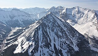
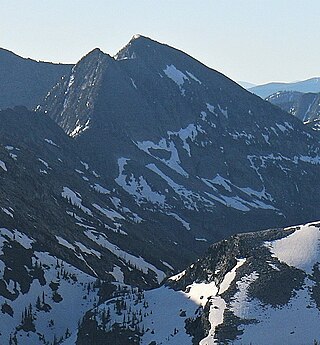
The Cabinet Mountains are part of the Rocky Mountains, located in northwest Montana and the Idaho panhandle, in the United States. The mountains cover an area of 2,134 square miles (5,530 km2). The Cabinet Mountains lie south of the Purcell Mountains, between the Kootenai River and Clark Fork River and Idaho's Lake Pend Oreille. The Cabinet Mountains lie to the east of the Purcell Trench. The Cabinet Mountains form the north side of the Clark Fork River valley in Idaho and Montana. The Cabinet Mountains Wilderness is located east of the Bull River near Noxon, Montana in roughly the center of the range.

<span class="mw-page-title-main">Olson Mountain</span> Mountain in Glacier National Park, US

Olson Mountain, also known as Mount Olson, is a 7,913-foot-elevation mountain summit located in the Livingston Range, of Glacier National Park in the U.S. state of Montana. Olson Mountain rises more than 3,700 feet (1,100 m) above the western shore of Waterton Lake. The mountain was named for a surveyor on the International Boundary Survey, with the name officially adopted in 1929. The nearest higher peak is Campbell Mountain, 1.13 miles (1.82 km) to the north, and Citadel Peaks is two miles to the south. Precipitation runoff from the mountain drains into Olson Creek before it empties to Waterton Lake.

<span class="mw-page-title-main">Clyde Peak</span> Mountain in the state of Montana

Clyde Peak is an 8,610-foot-elevation (2,620-meter) mountain summit located in Glacier National Park in the U.S. state of Montana. The mountain straddles the border shared by Flathead County and Glacier County. It is situated on the Continental Divide so precipitation runoff from the west side of the mountain drains into Thompson Creek which is part of the Middle Fork Flathead River watershed, and the east side drains into headwaters of Red Eagle Creek, which flows to Red Eagle Lake, thence Saint Mary Lake. It is set in the Lewis Range, and the nearest higher neighbor is Mount Logan 1.44 mile to the northwest. Topographic relief is significant as the southwest aspect rises approximately 4,000 feet in one mile.

<span class="mw-page-title-main">Explorer Peak</span> Mountain in Utah, United States

Explorer Peak is a 12,708-foot elevation (3,873 m) mountain summit located in Duchesne County, Utah, United States.

<span class="mw-page-title-main">Yard Peak</span> Mountain in the American state of Utah

Yard Peak is a 12,706-foot elevation (3,873 m) mountain summit located on the common border that Duchesne County shares with Summit County in the U.S. state of Utah.

<span class="mw-page-title-main">Mount Beulah</span> Mountain in the American state of Utah

Mount Beulah is a 12,557-foot elevation (3,827 m) mountain summit located in Summit County, Utah, United States.

<span class="mw-page-title-main">Wasatch Peak</span> Mountain in the American state of Utah

Wasatch Peak is a 13,156-foot elevation (4,010 m) mountain summit located in Summit County, Utah, United States.

<span class="mw-page-title-main">Little Regret Peak</span> Mountain in the state of Idaho

Little Regret Peak is an 11,090-foot elevation (3,380 m) mountain summit located in Custer County, Idaho, United States.

<span class="mw-page-title-main">Mount Grant (Montana)</span> Mountain in the American state of Montana

Mount Grant is an 8,590-foot-elevation (2,618 meter) mountain summit located in Flathead County in the U.S. state of Montana.

<span class="mw-page-title-main">Baldy Mountain (Idaho/Montana)</span> Mountain on the border of the states of Idaho and Montana

Baldy Mountain is a 9,892-foot elevation (3,015 m) mountain summit on the common border shared by Beaverhead County, Montana, and Clark County, Idaho.

<span class="mw-page-title-main">Blaze Mountain</span> Mountain in United States

Blaze Mountain is a 10,384-foot (3,165-metre) summit located in Madison County, Montana, United States.

<span class="mw-page-title-main">Gardner Point</span>

Gardner Point is a 7,405-foot-elevation (2,257-meter) mountain summit in Flathead County, Montana.

<span class="mw-page-title-main">Saint Paul Peak</span>

Saint Paul Peak is a 7,714-foot-elevation (2,351-meter) mountain summit in Sanders County, Montana.

<span class="mw-page-title-main">Rock Peak</span> Mountain summit in Sanders County, Montana

Rock Peak is a 7,583-foot-elevation (2,311-meter) mountain summit in Sanders County, Montana.

<span class="mw-page-title-main">Engle Peak</span>

Engle Peak is a 7,583-foot-elevation (2,311-meter) mountain summit in Sanders County, Montana.

<span class="mw-page-title-main">Flat Top Mountain (Montana)</span>

Flat Top Mountain is a 7,608-foot-elevation (2,319-meter) mountain summit located along the border shared by Lincoln and Sanders counties in Montana.

<span class="mw-page-title-main">Ibex Peak (Montana)</span>

Ibex Peak is a 7,676-foot-elevation (2,340-meter) mountain summit in Sanders County, Montana.

<span class="mw-page-title-main">Ojibway Peak</span>

Ojibway Peak is a 7,303-foot-elevation (2,226-meter) mountain summit located on the border shared by Lincoln and Sanders counties in Montana.

<span class="mw-page-title-main">A Peak</span>

A Peak is an 8,634-foot-elevation (2,632-meter) mountain summit located on the border shared by Lincoln and Sanders counties in Montana.

References

  1. 1 2 3 "Elephant Peak, Montana". Peakbagger.com. Retrieved 2023-08-31.
  2. 1 2 3 4 "Elephant Peak - 7,938' MT". listsofjohn.com. Retrieved 2023-08-31.
  3. 1 2 "Elephant Peak". Geographic Names Information System . United States Geological Survey, United States Department of the Interior . Retrieved 2023-08-31.
  4. Peel, M. C.; Finlayson, B. L.; McMahon, T. A. (2007). "Updated world map of the Köppen−Geiger climate classification". Hydrol. Earth Syst. Sci. 11 (5): 1633–1644. Bibcode:2007HESS...11.1633P. doi: 10.5194/hess-11-1633-2007 . ISSN   1027-5606. S2CID   9654551.