
Columbiana County is a county located in the U.S. state of Ohio. As of the 2020 census, the population was 101,877. The county seat is Lisbon and its largest city is Salem. The county name is derived from that of 15th-century Italian explorer Christopher Columbus.

Calcutta is an unincorporated community and census-designated place in southeastern Columbiana County, Ohio, United States. The population was 3,941 at the 2020 census. Historically a rural town, Calcutta grew as businesses from neighboring East Liverpool moved into larger shopping centers clustered around Ohio State Route 170.

Elkrun Township is one of the eighteen townships of Columbiana County, Ohio, United States. The 2020 census reported 4,367 people living in the township.

Hanover Township is one of the eighteen townships of Columbiana County, Ohio, United States. The 2020 census reported 3,459 people living in the township.

West Point is an unincorporated community in northern Madison Township, Columbiana County, Ohio, United States. A former coal town, it lies along U.S. Route 30 at its intersection with State Routes 45 and 518, it has the ZIP code 44492. It is part of the Salem micropolitan area.
Negley is an unincorporated community and census-designated place in Middleton Township, Columbiana County, Ohio, United States. The population was 274 at the 2020 census. It is part of the Salem micropolitan area, 22 miles (35 km) south of Youngstown.

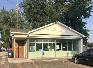
East Rochester is an unincorporated community and census-designated place (CDP) in southern West Township, Columbiana County, Ohio, United States. The population was 224 as of the 2020 census. It lies along U.S. Route 30, and has a post office with the ZIP code 44625. It is a part of the Salem micropolitan area, about 20 miles (32 km) east of Canton.

The Beaver and Erie Canal, also known as the Erie Extension Canal, was part of the Pennsylvania Canal system and consisted of three sections: the Beaver Division, the Shenango Division, and the Conneaut Division. The canal ran 136 miles (219 km) north–south near the western edge of the state from the Ohio River to Lake Erie through Beaver County, Lawrence County, Mercer County, Crawford County, and Erie County, Pennsylvania.

Fredericktown is a historic unincorporated community at the confluence of the north and middle forks of Little Beaver Creek in northeastern St. Clair Township, Columbiana County, Ohio, United States. It lies about six miles north of nearby East Liverpool and about 50 miles west of Pittsburgh. It is known for its historic buildings and its natural environment.

Beaver Creek State Park is a 2,722-acre (1,102 ha) public recreation area in Columbiana County, Ohio in the United States. The park is near East Liverpool on the banks of Little Beaver Creek. Remnants of the historic Sandy and Beaver Canal can be found throughout the park. It is open for year-round recreation including, camping, boating, hunting, fishing and hiking.

Clarkson is an unincorporated community in southwestern Middleton Township, Columbiana County, Ohio, United States, clustered around the intersection of Clarkson and Sprucevale roads. For most of the 19th century, until the founding of Negley and Rogers, Clarkson was the most prominent settlement in Middleton Township.

Gaston's Mill-Lock No. 36, Sandy and Beaver Canal District, is a historic district listed in the National Register of Historic Places. The district is located within Beaver Creek State Park, approximately 1 mile south of Clarkson, Ohio. Gaston's Mill was constructed in 1837 and was powered by Little Beaver Creek. Lock 36 was one of 90 locks on the Sandy and Beaver Canal. Construction of this canal began in 1834 but was not completed until 1848.
The Church Hill Road Covered Bridge is a covered bridge in Columbiana County, Ohio. It was originally located over Middle Fork Little Beaver Creek in Elk Township. The bridge was constructed in 1870 and was relocated in 1982 behind a restaurant on Ohio State Route 154 in Elkton, Ohio.
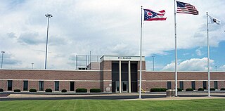
The Federal Correctional Institution, Elkton is a low-security United States federal prison for male inmates near Elkton, Ohio. It is operated by the Federal Bureau of Prisons, a division of the United States Department of Justice. It also has an adjacent satellite prison camp that houses low and minimum-security male inmates.

New Garden is an unincorporated community in Hanover Township, Columbiana County, Ohio, United States. New Garden is located on Ohio State Route 172, 9 mi (14 km) west of Lisbon.
Williamsport is an unincorporated community in northwestern Madison Township, Columbiana County, Ohio, United States.

East Fairfield is an unincorporated community in Fairfield Township, Columbiana County, Ohio, United States. The community is located at the intersection of Ohio State Routes 7, 517, and 558.
Dungannon is an unincorporated community in Hanover Township, Columbiana County, Ohio, United States.
Lynchburg is an unincorporated community in Columbiana County, in the U.S. state of Ohio.
Valley is an unincorporated community in Butler Township, Columbiana County, Ohio, United States. It lies about 2.5 miles (4.0 km) south of Damascus and 6 miles (9.7 km) southwest of Salem.


