This article's lead sectionmay be too short to adequately summarize the key points. Please consider expanding the lead to provide an accessible overview of all important aspects of the article.(July 2023)
An embankment dam is a large artificial dam. It is typically created by the placement and compaction of a complex semi-plastic mound of various compositions of soil or rock. It has a semi-pervious waterproof natural covering for its surface and a dense, impervious core. This makes the dam impervious to surface or seepageerosion.[1] Such a dam is composed of fragmented independent material particles. The friction and interaction of particles binds the particles together into a stable mass rather than by the use of a cementing substance.[2]
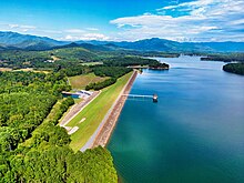
Embankment dams come in two types: the earth-filled dam (also called an earthen dam or terrain dam) made of compacted earth, and the rock-filled dam. A cross-section of an embankment dam shows a shape like a bank, or hill. Most have a central section or core composed of an impermeable material to stop water from seeping through the dam. The core can be of clay, concrete, or asphalt concrete. This type of dam is a good choice for sites with wide valleys. They can be built on hard rock or softer soils. For a rock-fill dam, rock-fill is blasted using explosives to break the rock. Additionally, the rock pieces may need to be crushed into smaller grades to get the right range of size for use in an embankment dam.[3]
Earth-fill dams
Earth-fill dams, also called earthen dams, rolled-earth dams or earth dams, are constructed as a simple embankment of well-compacted earth. A homogeneous rolled-earth dam is entirely constructed of one type of material but may contain a drain layer to collect seep water. A zoned-earth dam has distinct parts or zones of dissimilar material, typically a shell of locally plentiful material with a watertight clay core. Modern zoned-earth embankments employ filter and drain zones to collect and remove seep water and preserve the integrity of the downstream shell zone. An outdated method of zoned earth dam construction used a hydraulic fill to produce a watertight core. Rolled-earth dams may also employ a watertight facing or core in the manner of a rock-fill dam. The frozen-core dam is a temporary earth dam occasionally used in high latitudes by circulating a coolant through pipes inside the dam to maintain a watertight region of permafrost within it.
Tarbela Dam is a large dam on the Indus River in Pakistan, about 50km (31mi) northwest of Islamabad. Its height of 485ft (148m) above the river bed and 95sqmi (250km2) reservoir make it the largest earth-filled dam in the world. The principal element of the project is an embankment 9,000 feet (2,700m) long with a maximum height of 465 feet (142m). The dam used approximately 200million cubic yards (152.8million cu. meters) of fill, which makes it one of the largest man-made structures in the world.
Because earthen dams can be constructed from local materials, they can be cost-effective in regions where the cost of producing or bringing in concrete would be prohibitive.
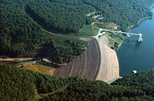
Rock-fill dams are embankments of compacted free-draining granular earth with an impervious zone. The earth used often contains a high percentage of large particles, hence the term "rock-fill". The impervious zone may be on the upstream face and made of masonry, concrete, plastic membrane, steel sheet piles, timber or other material. The impervious zone may also be inside the embankment, in which case it is referred to as a "core". In the instances where clay is used as the impervious material, the dam is referred to as a "composite" dam. To prevent internal erosion of clay into the rock fill due to seepage forces, the core is separated using a filter. Filters are specifically graded soil designed to prevent the migration of fine grain soil particles. When suitable building material is at hand, transport is minimized, leading to cost savings during construction. Rock-fill dams are resistant to damage from earthquakes. However, inadequate quality control during construction can lead to poor compaction and sand in the embankment which can lead to liquefaction of the rock-fill during an earthquake. Liquefaction potential can be reduced by keeping susceptible material from being saturated, and by providing adequate compaction during construction. An example of a rock-fill dam is New Melones Dam in California or the Fierza Dam in Albania.
A core that is growing in popularity is asphalt concrete. The majority of such dams are built with rock and/or gravel as the primary fill. Almost 100 dams of this design have now been built worldwide since the first such dam was completed in 1962. All asphalt-concrete core dams built so far have an excellent performance record. The type of asphalt used is a viscoelastic-plastic material that can adjust to the movements and deformations imposed on the embankment as a whole, and to settlement of the foundation. The flexible properties of the asphalt make such dams especially suited to earthquake regions.[4]
For the Moglicë Hydro Power Plant in Albania the Norwegian power company Statkraft built an asphalt-core rock-fill dam. Upon completion in 2018 the 320 m long, 150 m high and 460 m wide dam is anticipated to be the world's highest of its kind.[5][6][7]
Concrete-face rock-fill dams
A concrete-face rock-fill dam (CFRD) is a rock-fill dam with concrete slabs on its upstream face. This design provides the concrete slab as an impervious wall to prevent leakage and also a structure without concern for uplift pressure. In addition, the CFRD design is flexible for topography, faster to construct and less costly than earth-fill dams. The CFRD concept originated during the California Gold Rush in the 1860s when miners constructed rock-fill timber-face dams for sluice operations. The timber was later replaced by concrete as the design was applied to irrigation and power schemes. As CFRD designs grew in height during the 1960s, the fill was compacted and the slab's horizontal and vertical joints were replaced with improved vertical joints. In the last few decades, design has become popular.[8]
The tallest CFRD in the world is the 233m-tall (764ft)Shuibuya Dam in China, completed in 2008.[9]
Safety
The building of a dam and the filling of the reservoir behind it places a new weight on the floor and sides of a valley. The stress of the water increases linearly with its depth. Water also pushes against the upstream face of the dam, a nonrigid structure that under stress behaves semiplastically, and causes greater need for adjustment (flexibility) near the base of the dam than at shallower water levels. Thus the stress level of the dam must be calculated in advance of building to ensure that its break level threshold is not exceeded.[10]
Overtopping or overflow of an embankment dam beyond its spillway capacity will cause its eventual failure. The erosion of the dam's material by overtopping runoff will remove masses of material whose weight holds the dam in place and against the hydraulic forces acting to move the dam. Even a small sustained overtopping flow can remove thousands of tons of overburden soil from the mass of the dam within hours. The removal of this mass unbalances the forces that stabilize the dam against its reservoir as the mass of water still impounded behind the dam presses against the lightened mass of the embankment, made lighter by surface erosion. As the mass of the dam erodes, the force exerted by the reservoir begins to move the entire structure. The embankment, having almost no elastic strength, would begin to break into separate pieces, allowing the impounded reservoir water to flow between them, eroding and removing even more material as it passes through. In the final stages of failure the remaining pieces of the embankment would offer almost no resistance to the flow of the water and continue to fracture into smaller and smaller sections of earth or rock until they disintegrate into a thick suspension of earth, rocks and water.
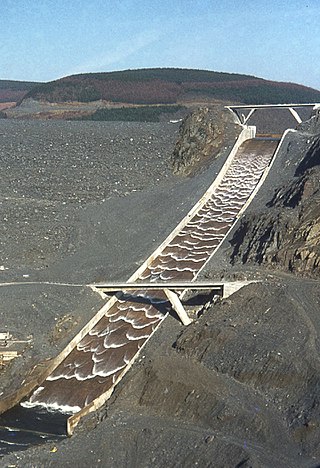
Therefore, safety requirements for the spillway are high, and require it to be capable of containing a maximum flood stage. It is common for its specifications to be written such that it can contain at least a one-hundred-year flood.[11] A number of embankment dam overtopping protection systems were developed in the early 21st century.[12] These techniques include concrete overtopping protection systems, timber cribs, sheet-piles, riprap and gabions, Reinforced Earth, minimum energy loss weirs, embankment overflow stepped spillways, and precast concrete block protection systems.
All dams are prone to seepage underneath the dam, but embankment dams are prone to seepage through the dam as well; for example, the Usoi landslide dam leaks 35-80 cubic meters per second. Sufficiently fast seepage can dislodge a dam's component particles, which results in faster seepage, which turns into a runaway feedback loop that can destroy the dam in a piping-type failure. Seepage monitoring is therefore an essential safety consideration.[13]
Dartmouth Dam is a large rock-fill embankment dam with an uncontrolled chute spillway across the Mitta Mitta, Gibbo and Dart rivers, the Morass Creek and a number of small tributaries. The dam is located near Mount Bogong in the north-east of the Australian state of Victoria. The dam's purpose includes irrigation, the generation of hydro-electric power, water supply and conservation. The impounded reservoir is called Dartmouth Reservoir, sometimes called Lake Dartmouth. The Dartmouth Power Station, a hydro-electric power station that generates power to the national grid, is located near the dam wall.
A dam is a barrier that stops or restricts the flow of surface water or underground streams. Reservoirs created by dams not only suppress floods but also provide water for activities such as irrigation, human consumption, industrial use, aquaculture, and navigability. Hydropower is often used in conjunction with dams to generate electricity. A dam can also be used to collect or store water which can be evenly distributed between locations. Dams generally serve the primary purpose of retaining water, while other structures such as floodgates or levees are used to manage or prevent water flow into specific land regions.
Hydraulic fill is a means of selectively emplacing soil or other materials using a stream of water. It is also a term used to describe the materials thus emplaced. Gravity, coupled with velocity control, is used to effect the selected deposition of the material.
The Gatun Dam is an earthen dam across the Chagres River in Panama, near the town of Gatun. The dam, constructed between 1907 and 1913, is a crucial element of the Panama Canal; it impounds the artificial Gatun Lake, which carries ships 33 kilometres (21 mi) of their transit across the Isthmus of Panama. In addition, a hydro-electric generating station at the dam generates electricity which is used to operate the locks and other equipment in the canal.
A spillway is a structure used to provide the controlled release of water downstream from a dam or levee, typically into the riverbed of the dammed river itself. In the United Kingdom, they may be known as overflow channels. Spillways ensure that water does not damage parts of the structure not designed to convey water.
Table Rock Lake is an artificial lake or reservoir in the Ozarks of southwestern Missouri and northwestern Arkansas in the United States. Designed, built and operated by the U.S. Army Corps of Engineers, the lake is impounded by Table Rock Dam, which was constructed from 1954 to 1958 on the White River.
The Wolf Creek Dam is a multi-purpose dam on the Cumberland River in the western part of Russell County, Kentucky, United States. The dam serves at once four distinct purposes: it generates hydroelectricity; it regulates and limits flooding; it releases stored water to permit year-round navigation on the lower Cumberland River; and it creates Lake Cumberland for recreation, the largest man made lake by volume East of the Mississippi river. The Lake has become a popular tourist attraction.U.S. Route 127 is built on top of the dam.
The Saluda Dam or Saluda River Dam, officially the Dreher Shoals Dam, commonly referred to as the Lake Murray Dam, is an earthen embankment dam located approximately 10 miles (15 km) west of Columbia, South Carolina on the Saluda River. Construction on the dam began in 1927 and was completed in 1930. The purpose of the dam is flood control, hydroelectricity, recreation and water supply. At the time of its completion, the Saluda Dam was the world's largest earthen dam, creating the world's largest man-made lake, Lake Murray. In 2005, construction on a 213 ft (65 m). tall roller-compacted concrete (RCC) dam was completed at the toe of the original dam in order to mitigate an earthquake-caused dam failure.
Puddling is both the material and the process of lining a water body such as a channel or pond with puddle clay – a watertight material based on clay and water mixed to be workable.
Internal erosion is the formation of voids within a soil caused by the removal of material by seepage. It is the second most common cause of failure in levees and one of the leading causes of failures in earth dams, responsible for about half of embankment dam failures.
Roller-compacted concrete (RCC) or rolled concrete (rollcrete) is a special blend of concrete that has essentially the same ingredients as conventional concrete but in different ratios, and increasingly with partial substitution of fly ash for Portland cement. The partial substitution of fly ash for Portland Cement is an important aspect of RCC dam construction because the heat generated by fly ash hydration is significantly less than the heat generated by Portland Cement hydration. This in turn reduces the thermal loads on the dam and reduces the potential for thermal cracking to occur. RCC is a mix of cement/fly ash, water, sand, aggregate and common additives, but contains much less water. The produced mix is drier and essentially has no slump. RCC is placed in a manner similar to paving; the material is delivered by dump trucks or conveyors, spread by small bulldozers or specially modified asphalt pavers, and then compacted by vibratory rollers.
The Nillahcootie Dam, a rock and earth-fill embankment dam with a unique Gothic arch-shaped crest spillway across the Broken River that is located near Mansfield, in the Alpine region of Victoria, Australia. The dam's purpose is for the supply of potable water and for irrigation. The impounded reservoir is called Lake Nillahcootie.
Dry Falls Dam is a rockfaced earthfill type dam in the U.S. state of Washington. Located in Grant County near Coulee City, it was built as part of the Bureau of Reclamation's Columbia Basin Project. Water from the Columbia River, impounded by Grand Coulee Dam, is pumped into Grand Coulee, a formerly dry canyon, through the short Feeder Canal. Grand Coulee's north end is sealed by North Dam and Dry Falls Dam stretches across the midsection of the Coulee. This allows the water pumped from the Columbia River to fill the upper Grand Coulee, creating a large equalizing reservoir known as Banks Lake. Water from the reservoir is fed into the irrigation project's Main Canal, which runs south from Dry Falls Dam to another reservoir called Billy Clapp Lake, formed by Pinto Dam.
Fontenelle Dam was built between 1961 and 1964 on the Green River in southwestern Wyoming. The 139-foot (42 m) high zoned earthfill dam impounds the 345,360-acre-foot (0.42600 km3) Fontenelle Reservoir. The dam and reservoir are the central features of the Seedskadee Project of the U.S. Bureau of Reclamation, which manages the Fontenelle impoundment primarily as a storage reservoir for the Colorado River Storage Project. The dam suffered a significant failure in 1965, when the dam's right abutment developed a leak. Emergency releases from the dam flooded downstream properties, but repairs to the dam were successful. However, in 1983 the dam was rated "poor" under Safety Evaluation of Existing Dams (SEED) criteria, due to continuing seepage, leading to an emergency drawdown. A concrete diaphragm wall was built through the core of the dam to stop leakage.
Pantabangan Dam is an earth-fill embankment dam on the Pampanga River located in Pantabangan in Nueva Ecija province of the Philippines. The multi-purpose dam provides water for irrigation and hydroelectric power generation while its reservoir, Pantabangan Lake, affords flood control. The reservoir is considered one of the largest in Southeast Asia and also one of the cleanest in the Philippines. Construction on the dam began in 1971 and it was completed in 1974.
The Cotter Dam is a concrete gravity and rockfill embankment dam across the Cotter River, located in the Australian Capital Territory, Australia. Both the dam and river are named after early settler in the area Garrett Cotter. The impounded Cotter Reservoir is a supply source of potable water for the city of Canberra and its environs.
The Fürstenteich is a reservoir near Silberhütte in the German state of Saxony-Anhalt. It has an earth-filled dam with an impervious core. It impounds the Teufelsgrundbach stream.
San Antonio Dam is an embankment flood control and debris dam on San Antonio Creek in San Bernardino County, California, about 5 miles (8.0 km) north of Ontario. The dam was authorized by the Flood Control Acts of 1936 and 1938 as part of a major program to provide flood protection in the Santa Ana River system. Construction began in April 1952 and finished in May 1956. The dam controls runoff from a rugged catchment area of 27 square miles (70 km2) in the San Gabriel Mountains.
Moglicë Hydro Power Plant is a large hydroelectricity plant on the river Devoll situated near the village Moglicë, Albania. The project consists of a large power plant with an installed capacity of 197 MW and an average annual production of 475 GWh. It was built by Devoll Hydropower, an Albanian company owned by Norwegian power company Statkraft. The asphalt-core rock-fill dam is 320 m long, 150 m high and 460 m wide. The dam is anticipated to be the world's highest of its kind upon completion. The reservoir has a surface area of 7.2 km2, and a storage capacity of about 380 million m3. The power plant is part of the Devoll Hydropower Project and construction on it began in June 2013. Main structures of dam were completed in June 2019. Commercial operations were started in June 2020.
This page is based on this Wikipedia article Text is available under the CC BY-SA 4.0 license; additional terms may apply. Images, videos and audio are available under their respective licenses.