
Marion County is a county located in the U.S. state of Kansas. Its county seat is Marion and its most populous city is Hillsboro. As of the 2020 census, the county population was 11,823. The county was named in honor of Francis Marion, a brigadier general of the American Revolutionary War, known as the "Swamp Fox".
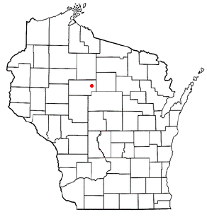
Greenwood is a town in Taylor County, Wisconsin, United States. The population was 642 at the 2000 census. The unincorporated community of Interwald is located in the town.

Red Oak is an area in the City of South Fulton, Fulton County, Georgia, United States, near College Park and East Point. The ZIP Code is 30272 and 30349 The region is located along U.S. Route 29 and the Georgia State Route 14 Connector to Interstate 85 and 285. The former terminus of SR 14 Connector is in the vicinity of post office destroyed during a civil war battle in 1864.

Okonoko is an unincorporated community in Hampshire County in the U.S. state of West Virginia. Okonoko is located in northern Hampshire County, along the Potomac River and the CSX Cumberland Subdivision of the former Baltimore and Ohio Railroad.

Dover Township is one of the twelve townships of Fulton County, Ohio, United States. The 2020 census found 1,621 people in the township.

Avery is an unincorporated community in western Milan Township, Erie County, Ohio, United States. It is part of the Sandusky Metropolitan Statistical Area. Avery is located along US Route 250 near that road's interchange with Interstate 80 and Interstate 90, the Ohio Turnpike. It once had a post office, but is now included in the Milan, Ohio postal zone (44846).
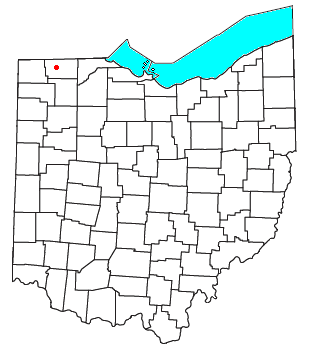
Tedrow is an unincorporated community and census-designated place (CDP) in southwestern Dover Township, Fulton County, Ohio, United States. It lies at the intersection of the east-west County Road J with the north-south County Roads 17-2 and 17-3, 3 miles (5 km) north and 3.5 miles (5.6 km) west of the northern edge of the city of Wauseon, the county seat of Fulton County. The community lies less than one mile north of the Ohio Turnpike, although the nearest exit is several miles away.
Curtisville is an unincorporated community in Madison Township, Tipton County, in the U.S. state of Indiana.

Tunnelton is a Census-designated place in Guthrie Township, Lawrence County, Indiana.

Lee is an unincorporated community in Monon Township, White County, in the U.S. state of Indiana.

Peoria is an unincorporated community in Liberty Township, Union County, Ohio, United States. It is located along Raymond Road, about 1.75 miles south of Raymond and 6.5 miles northwest of Marysville.
Chula is a mostly rural unincorporated community in the northeastern part of Amelia County just west of the Appomattox River in the U.S. state of Virginia. The town is centered around the T-intersection of SR 636 and SR 740 in Giles District. Chula is just west of SR 604, which includes a short bypass segment built around the town in the late 20th century. The area is served by the post office 7 miles southwest at Amelia Court House, ZIP code 23002. The nearest fire station to Chula is Amelia County Volunteer Fire Department Station 4, near Mattoax, 3 miles north.
Secret Ravine is a former settlement in Placer County, California. Secret Ravine is located 3 miles (4.8 km) southwest of Newcastle. Correction: Gardiner writes in 1854 that the Secret Ravine Post Office is "near the Hawes Ranch." Elisha Hawes lived in Township 9, the 1860 census shows him continuing to receive mail at the Secret Ravine Post Office. Placer County records show that Elisha Hawes and his family sold the ranch in 1867, and that it was located on Secret Ravine near the intersection of what is now I-80 and Rocklin Road, in the area commonly called China Gardens.
Addison is an unincorporated community in Breckinridge County, Kentucky, United States. Addison is located on the Ohio River and Kentucky Route 144, 6.8 miles (10.9 km) north-northeast of Cloverport.
Valley was a populated place and post office on the South Branch line of the Baltimore and Ohio Railroad in the U.S. state of West Virginia. It was centered near the intersection of West Sioux Lane and Depot Valley Road, now located within the present-day corporate boundaries of Romney. Valley developed in 1884 following the completion of the South Branch line when the rail line's original southern terminus and corresponding Romney Depot were built there. The United States Post Office Department established a post office at Valley on May 19, 1928, remaining in operation until its disestablishment on June 15, 1937. Following the closure of Valley's post office, its mail was routed through the post office in Romney.
Vida is an unincorporated community in Phelps County, Missouri, United States. Vida is approximately six miles south of Rolla, near the junction of US Highway 63 and Missouri Route W. Vida is located at an elevation of 1033 feet above sea level. Vida can be found on Phelps County plat maps in Section 10, Township 36 N, Range 9 W.
Browning is an unincorporated community in Smith County, located in the U.S. state of Texas.

Ottokee is an unincorporated community in Dover Township, Fulton County, Ohio, United States.
Oakland, Union Parish, Louisiana is a former community in northern Union Parish, Louisiana, United States. About one mile south of the Arkansas state line, it is 18 miles (29 km) north of Farmerville and 10 miles (16 km) northwest of Marion. It was also known as Union Cross Roads and Springhill or Spring Hill.


