Ethete, Wyoming

Last updated
Ethete, Wyoming
CDP
WYMap-doton-Ethete.PNG
Location of Ethete, Wyoming
Usa edcp location map.svg
Red pog.svg
Ethete, Wyoming
Location in the United States
Coordinates: 43°1′5″N108°44′39″W / 43.01806°N 108.74417°W / 43.01806; -108.74417 Coordinates: 43°1′5″N108°44′39″W / 43.01806°N 108.74417°W / 43.01806; -108.74417
Country United States
State Wyoming
County Fremont
Area
  Total32.4 sq mi (83.9 km2)
  Land32.4 sq mi (83.9 km2)
  Water0.0 sq mi (0.0 km2)
Elevation
5,354 ft (1,632 m)
Population
 (2010) [1]
  Total1,553
  Density48/sq mi (19/km2)
Time zone UTC-7 (Mountain (MST))
  Summer (DST) UTC-6 (MDT)
ZIP code
82520
Area code(s) 307
FIPS code 56-25330 [2]
GNIS feature ID1588336 [3]

Ethete (Arapaho : Koonoutoseii') is a census-designated place (CDP) in Fremont County, Wyoming, United States. The population was 1,553 at the 2010 census. The town is located on the Wind River Indian Reservation. It grew up around the Episcopal St. Michael's Mission. [4]

Contents

Geography

Ethete is located at 43°1′5″N108°44′39″W / 43.01806°N 108.74417°W / 43.01806; -108.74417 (43.018169, -108.744048). [5]

According to the United States Census Bureau, the CDP has a total area of 32.4 square miles (83.9 km2), all land.

Demographics

As of the census [2] of 2000, there were 1,455 people, 342 households, and 298 families residing in the CDP. The population density was 44.9 people per square mile (17.3/km2). There were 367 housing units at an average density of 11.3/sq mi (4.4/km2). The racial makeup of the CDP was 4.95% White, 94.23% Native American, 0.07% Asian, 0.07% from other races, and 0.69% from two or more races. 2.06% of the population were Hispanic or Latino of any race.

There were 342 households, out of which 45.6% had children under the age of 18 living with them, 43.6% were married couples living together, 33.9% had a female householder with no husband present, and 12.6% were non-families. 11.4% of all households were made up of individuals, and 1.8% had someone living alone who was 65 years of age or older. The average household size was 4.25 and the average family size was 4.49.

In the CDP, the population was spread out, with 40.5% under the age of 18, 12.4% from 18 to 24, 24.8% from 25 to 44, 17.3% from 45 to 64, and 4.9% who were 65 years of age or older. The median age was 23 years. For every 100 females, there were 105.5 males. For every 100 females age 18 and over, there were 95.3 males.

The median income for a household in the CDP was $24,130, and the median income for a family was $24,762. Males had a median income of $22,411 versus $25,179 for females. The per capita income for the CDP was $7,129. 34.4% of the population and 33.9% of families were below the poverty line. Out of the total population, 42.0% of those under the age of 18 and 29.6% of those 65 and older were living below the poverty line.

Education

The majority of Ethete is served by Fremont County School District #14. A very small portion of the CDP is located within the boundaries of Fremont County School District #21.

Related Research Articles

Parks, Arizona CDP in Coconino County, Arizona

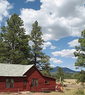
Parks is a census-designated place (CDP) in Coconino County, Arizona, United States. The population was 1,188 at the 2010 census.

Desert View Highlands, California Census designated place in California, United States

Desert View Highlands is a census-designated place (CDP) in Los Angeles County, California, United States. The population was 2,360 at the 2010 census, up from 2,337 at the 2000 census. It is completely surrounded by the City of Palmdale.

Twain, California census-designated place in California, United States

Twain is a census-designated place (CDP) in Plumas County, California, United States. As of the 2010 census, the CDP population was 82, down from 87 at the 2000 census.

Yalaha, Florida Census-designated place in Florida

Yalaha is an unincorporated area and census-designated place (CDP) in Lake County, Florida, United States. The population was 1,364 at the 2010 census, up from 1,175 at the 2000 census. It is part of the Orlando–Kissimmee Metropolitan Statistical Area.

Chamisal, New Mexico Census-designated place in Taos County, New Mexico, United States

Chamisal is a census-designated place (CDP) in Taos County, New Mexico. It is located along the scenic High Road to Taos. The population was 301 at the time of the 2000 census.

Pymatuning South, Pennsylvania Census-designated place in Pennsylvania, United States

Pymatuning South is a census-designated place (CDP) in Crawford County, Pennsylvania, United States. The population was 479 at the 2010 census.

Lawnton, Pennsylvania Census-designated place in Pennsylvania, United States

Lawnton is an unincorporated area and census-designated place (CDP) in Swatara Township, Dauphin County, Pennsylvania, United States. The population was 3,813 at the 2010 census. It is part of the Harrisburg–Carlisle Metropolitan Statistical Area.

Nuremberg, Pennsylvania Census-designated place in Pennsylvania, United States

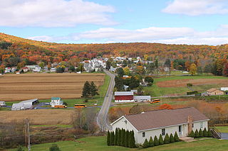
Nuremberg is a census-designated place (CDP) in Schuylkill and Luzerne counties, Pennsylvania, United States. The population was 434 at the 2010 census.

Mount Pleasant Mills, Pennsylvania CDP in Pennsylvania, United States

Mount Pleasant Mills is a census-designated place (CDP) in Snyder County, Pennsylvania, United States. The population was 342 at the 2000 census.

Fremont, Clark County, Wisconsin Town in Wisconsin, United States

Fremont is a town in Clark County in the U.S. state of Wisconsin. The population was 1,265 at the 2010 census. The unincorporated community of Chili is located in the community.

Big Falls, Waupaca County, Wisconsin Village in Wisconsin, United States

Big Falls is a village in Waupaca County, Wisconsin, United States. The population was 61 at the 2010 census.

Arapahoe, Wyoming Census-designated place in Wyoming, United States

Arapahoe is a census-designated place (CDP) in Fremont County, Wyoming, United States. The population was 1,656 at the 2010 census. A Catholic mission was founded here in 1884. St Stephen's Mission Church, located near Arapahoe, is part of the Catholic mission.

Atlantic City, Wyoming CDP in Wyoming, United States

Atlantic City is a census-designated place (CDP) in Fremont County, Wyoming, United States. The population was 37 at the 2010 census. The community is a small mining settlement in a gulch near South Pass in southwestern Wyoming. It was founded as a mining camp following the 1867 gold rush in the region. The town declined following the end of the placer gold rush in the early 1870s, but continued to exist as advances in mining technology allowed further extraction of gold. From the 1960s until 1983, it was the location of US Steel iron ore mine. The town is accessible by gravel roads from nearby Wyoming Highway 28.

Boulder Flats, Wyoming Census-designated place in Wyoming, United States

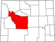
Boulder Flats is a census-designated place (CDP) in Fremont County, Wyoming, United States. The population was 408 at the 2010 census.

Fort Washakie, Wyoming CDP in Wyoming, United States

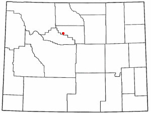
Fort Washakie is a census-designated place (CDP) in Fremont County, Wyoming, United States, within the Wind River Indian Reservation and along U.S. Route 287. The population was 1,759 at the 2010 census. The headquarters for the Eastern Shoshone Tribe is located in Fort Washakie, as well as the Bureau of Indian Affairs agency for the Wind River Indian Reservation.

Johnstown, Wyoming CDP in Wyoming, United States

Johnstown is a census-designated place (CDP) in Fremont County, Wyoming, United States. The population was 242 at the 2010 census.

Casper Mountain, Wyoming CDP in Wyoming, United States

Casper Mountain is a census-designated place (CDP) on Casper Mountain in Natrona County, Wyoming, United States. It is part of the Casper, Wyoming Metropolitan Statistical Area. The population was 401 at the 2010 census.

Ralston, Wyoming CDP in Wyoming, United States

Ralston is a census-designated place (CDP) in Park County, Wyoming, United States. The population was 280 at the 2010 census.

Teton Village, Wyoming CDP in Wyoming, United States

Teton Village is a census-designated place (CDP) in Teton County, Wyoming, United States. The population was 330 at the 2010 census. The village surrounds the base of the Jackson Hole Mountain Resort. It is accessed from nearby Jackson and the surrounding area via the Moose-Wilson Road.

Winchester, Wyoming Unincorporated community in Wyoming, United States

Winchester is an unincorporated community in Washakie County, Wyoming, United States. The population was 60 at the 2000 census, when it was a census-designated place (CDP). The area is named for the post office established by postmaster and local rancher R. S. Winchester. Winchester objected to his name being used on the local railroad station, so the railroad named the station Chatham instead.

References

  1. "2010 City Population and Housing Occupancy Status". U.S. Census Bureau. Retrieved July 13, 2012.[ dead link ]
  2. 1 2 "U.S. Census website". United States Census Bureau . Retrieved 2008-01-31.
  3. "US Board on Geographic Names". United States Geological Survey. 2007-10-25. Retrieved 2008-01-31.
  4. Frost, Nedward M. (1971). "National Register of Historic Places Inventory - Nomination Form: St. Michael's Mission". National Park Service. with accompanying three photos
  5. "US Gazetteer files: 2010, 2000, and 1990". United States Census Bureau. 2011-02-12. Retrieved 2011-04-23.