Farm to Market Road 157

Last updated

Texas FM 157.svg

Farm to Market Road 157

Farm to Market Road 157
Route information
Maintained by TxDOT
Length40.1 mi [1]  (64.5 km)
ExistedJune 4, 1945 [2] –present
Major junctions
South endTexas FM 66.svg FM 66 in Maypearl
Major intersections
North endTexas 121.svg SH 121 in Euless
Location
Country United States
State Texas
Counties Ellis, Johnson, Tarrant
Highway system
Texas FM 156.svg FM 156 Texas FM 158.svg FM 158

Farm to Market Road 157 (FM 157) is a Farm to Market Road in Ellis, Johnson, Tarrant counties in Texas, United States, that connects Farm to Market Road 66 (MF 66) in Maypear; with Texas State Highway 121 (SH 121) in Euless. [3]

Contents

While located in Euless and Bedford, FM 157 is known as Industrial Boulevard, while in Fort Worth, it is known as Collins Street. In Arlington, the route continues on North Collins, Division, and South Cooper Streets. In Mansfield, the road is known as Main Street and Lone Star Road; in Venus as Main, 8th & 7th Streets; and in Maypearl as Highway 157. The highway passes directly through the center of Euless and Bedford, passing large neighborhoods and businesses. The route passes a large wetland before passing directly through downtown Arlington, passing major attractions such as AT&T Stadium and Globe Life Field. The route passes through the center of the University of Texas at Arlington, and continues through downtown and southern Arlington, before entering Mansfield. The route continues through central Mansfield, and south to Maypearl. The Texas Department of Transportation (TxDOT) designated the route in 1945, and redesignated the portion traveling from SH 121 to US Bus. 287 as Urban Road 157 (UR 157) from 1995 until 2018.

Route description

FM 157 begins at its southern terminus, a three-way intersection with Farm to Market Road 66, in Maypearl. [4] The highway starts off as a two-lane, paved, asphalt road. After the intersection, the road continues through northern Maypearl, passing several rows of houses and small businesses. Just after exiting the town, the route passes the large Maypearl Cemetery. [5] The route continues through rural farmland, intersecting several small county roads along the way. At an intersection with Farm to Market Road 1446, the road passes a group of houses and farms. For this length of the route, FM 157 is heading almost due northeast. A few miles after the intersection with FM 1446, the highway turns west and continues for about half a mile in that direction. The road then turns northwest again, and passes the large community of Country Acres. [3] The route continues on through miles of open farmland, intersecting with FM 2258 and FM 875, as well as smaller roads. FM 157 then enters Venus. When the road enters Venus, the name changes from Farm Road 157 to 7th Street. Just after entering the town, the route turns west and is renamed 8th street. The highway spends a very short period of time traveling west, before turning northeast again, and becoming Main Street. The highway passes the Venus Post Office, and proceeds through "downtown Venus", passing most of the town's businesses. FM 157 proceeds to pass over three railroad tracks. The route intersects with US Highway 67, and then exits Venus. [6] The highway passes several large farms, before passing through a very large, unnamed, unincorporated community, and continuing towards Mansfield. [3] The highway enters southern Mansfield, and intersects Business US 287, and becomes concurrent with the highway. After a few miles of passing several streets, FM 157 splits off of Business US 287 heading due north. heading to Arlington, it has an interchange with US 287, intersects Turner Warnell Road at the border of Mansfield and Arlington, becoming South Cooper Street. Several miles after crossing US 287, It intersects Interstate 20 near The Parks Mall at Arlington. After interchanging with I-20, The highway slants toward the northeast for about 2.5 miles before reaching Pioneer Parkway (Spur 303). As it intersects Spur 303, FM 157 turns back to the north for another 2 miles before intersecting Division Street (SH 180). Just before the SH 180 interchange, FM 157 runs through the University of Texas at Arlington. At the SH 180 interchange, FM 157 merges with Highway 180 now running east with the state highway. FM 157 and SH 180 both run concurrently for roughly 1 mile. FM 157 splits off of SH 180 and heads north onto North Collins Street. Passing the AT&T Stadium and having an interchange with Interstate 30, it goes for a few miles, passing Viridian and The Arlington City Landfill. After that, it becomes Highway 157 after the crossing of the Fort Worth border. It continues on as Highway 157 for a few miles before passing the Euless border, becoming Industrial Boulevard, intersecting Euless Blvd. (SH 10), having an interchange with SH 183 (Airport Freeway), crossing the Bedford border, spends its last 2 miles through suburbs before merging onto its northern terminus with a partial interchange on SH 121. [7] [8]

Downtown Venus, with FM 157 in the foreground Downtown venus.JPG
Downtown Venus, with FM 157 in the foreground

History

FM 157 was first designated on June 4, 1945, and traveled from, a junction with US 287 in Mansfield, in Johnson County, northward to the intersection of SH 121 (Ira E. Woods Avenue) and Loop 10 (Dallas Road) in Grapevine, in Tarrant County. Seven days later, on June 11, 1945, the highway was extended from US 287 through Venus and southward to the southern border of Ellis County. [2] The route was extended on October 25, 1955, to a junction with FM 66 in Maypearl, adding approximately 8.8 miles (14.2 km) to the overall length. On April 14, 1980, the northern 0.6 miles (0.97 km) of the route was returned to the city of Grapevine. The next 3.9 miles (6.3 km) south of that was redesignated as part of State Highway 121 (SH 121) in the same order. [2] On June 27, 1995, the stretch of the highway traveling from SH 121 south to US 287 was redesignated as UR 157, approximately 17.3 miles (27.8 km). [1] The remaining 22.7 miles (36.5 km) of the route stayed FM 157. [2] On June 26, 2003, a portion of the route was redesignated from Collins Street to Cooper Street, in Arlington. [1] [3] On April 30, 2015, the section concurrent with BU 287-P from FM 917 to the oldFM 157/BU 287-P junction was removed from the state highway system and given to the city of Mansfield, so FM 157 was rerouted along southbound BU 287-P. [9] The portion from US 287 south to BU 287-P was transferred to BU-287-P, and the section along BU 287-P from FM 917 to FM 157 was transferred to FM 917. On July 27, 2017, FM 157 replaced the section of FM 917 south to US 287, and follows US 287 between these areas. [10] On November 15, 2018, the section from SH 121 south to US 287 was redesignated as FM 157 again. [11]

Future

In 2012, TxDOT began discussions for a project for the rerouting of FM 157 from FM 1807 south of Venus north to US 287 in Mansfield. The project would potentially reroute the highway to a more direct path, and take it through several large neighborhoods. [12] The Fort Worth District is currently conducting a feasibility study for the proposed realignment of FM 157 from FM 917 to FM 1807. [13] [14]

Major junctions

CountyLocationmi [3] kmDestinationsNotes
Ellis Maypearl 0.00.0Texas FM 66.svg FM 66  Itasca, Waxahachie Southern terminus
1.01.6East plate.svg
Texas FM 1446.svg
FM 1446 east (Old Buena Vista Road) Waxahachie
Western terminus of FM 1446
5.79.2Texas FM 2258.svg FM 2258
7.712.4East plate.svg
Texas FM 875.svg
FM 875 east
Western terminus of FM 875
8.613.8West plate.svg
Texas FM 1807.svg
FM 1807 west Alvarado
Eastern terminus of FM 1807
Johnson Venus 10.717.2US 67.svg US 67  Cleburne, Midlothian
Mansfield 19.531.4North plate.svg
Texas FM 917.svg
FM 917 north Mansfield
South end of FM 917 overlap
19.631.5South plate.svg
US 287.svg
US 287 south Midlothian
Interchange; north end of FM 917 overlap; south end of US 287 overlap
Tarrant 21.033.8Heritage ParkwayInterchange; south end of freeway
22.035.4Hospital sign.svg East Broad StreetAccess to Methodist Mansfield Medical Center
23.337.5Walnut Creek Drive / Debbie Lane
24.739.8North plate.svg
US 287.svg
US 287 north Fort Worth
South plate.svg
Business plate.svg
US 287.svg
Bus. US 287 south
Interchange; north end of freeway; north end of US 287 overlap; northern terminus of Bus. US 287
Arlington 30.248.6I-20.svg I-20 (Ronald Reagan Memorial Freeway) Fort Worth, Dallas Cloverleaf interchange exit; I-20 exits 449 A-B
32.852.8Texas Spur 303.svg Spur 303 (Pioneer Parkway)
34.956.2West plate.svg
Texas 180.svg
SH 180 west (Division Street)
South end of SH 180 overlap; former US 80
35.957.8East plate.svg
Texas 180.svg
SH 180 east (Division Street)
North end of SH 180 overlap; former US 80
37.360.0I-30.svg I-30 (Tom Landry Freeway)No westbound entrance; I-30 exits 27B-28B
Euless 42.267.9Texas 10.svg SH 10 (Euless Boulevard)
42.868.9Texas 183.svgTo plate.svg
183 Express Lane free.svg
SH 183 (Airport Freeway) to SH 183 Express
FM 157 southbound lanes enter Bedford, recent road and pavement renovations by interchange
45.172.6Texas 121.svg SH 121 (William D. Tate Avenue)Northern terminus; interchange; no northbound exit
1.000 mi = 1.609 km; 1.000 km = 0.621 mi

See also


Related Research Articles

<span class="mw-page-title-main">Interstate 820</span> Highway in Texas

Interstate 820 (I-820) is an auxiliary route of I-20 in Fort Worth, Texas, of approximately 35.173 miles (56.605 km) around the city and some of its suburbs. Exit numbers begin at its interchange with I-20 in southwest Fort Worth and continue in a clockwise direction around the city until it ends at its interchange with I-20 in southeast Fort Worth. A portion of I-820 in the northeast quadrant is cosigned with State Highway 121 (SH 121) as well as SH 183.

<span class="mw-page-title-main">Texas State Highway 121</span> Highway in Texas

State Highway 121 is a state highway angling from southwest to northeast through north central Texas. It runs from Cleburne, Texas at US 67 to SH 78 in Bonham, Texas, just north of a junction with US 82.

<span class="mw-page-title-main">Texas State Highway 360</span> State highway in Texas

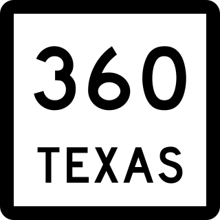
State Highway 360 is a 28-mile (45 km) north–south freeway in the Dallas–Fort Worth metroplex in the U.S. state of Texas. It runs north from an at-grade intersection with US 287 in Mansfield, near the Ellis-Johnson county line to a partial interchange with SH 121 in Grapevine, near Dallas/Fort Worth International Airport. The highway serves as a local north–south route running through the center of the metroplex, linking together the southern and northern suburbs to the core. Between US 287 and Camp Wisdom Road/Sublett Road, SH 360 follows a pair of frontage roads along a four-lane tollway known as the 360 Tollway, a tollway operated by the NTTA. Between Camp Wisdom Road/Sublett Road and SH 121, SH 360 follows a toll-free freeway maintained by TxDOT.

<span class="mw-page-title-main">Texas State Highway 7</span> State highway in Texas

State Highway 7 (SH 7) is an east–west state highway in the U.S. state of Texas that runs from Interstate 35 at Eddy to U.S. Highway 84 about 3 miles (4.8 km) west of the Louisiana state line. Between Crockett and Nacogdoches, SH 7 passes through the Davy Crockett National Forest. Commissioned on April 4, 1917, SH 7 is one of the original state highways established in Texas, and has been re-routed several times since its original conception. In earlier years, SH 7 mostly followed present day U.S. Highway 84, U.S. Highway 67, U.S. Highway 70 among other highways between northwest Texas and the Louisiana state line. By 1939, most of the mileage belonging to SH 7 was transferred to the U.S. Highway System, leaving the highway extant only within eastern Texas. SH 7 subsequently went through several other major reroutings, truncations and extensions between 1939 and 1990, before becoming the highway it is today.

<span class="mw-page-title-main">Texas State Highway 17</span> State highway in Texas

State Highway 17 runs from Marfa to Pecos in west Texas. The road is maintained by the Texas Department of Transportation (TxDOT).

<span class="mw-page-title-main">Texas State Highway 72</span> State highway in Texas, United States

State Highway 72 is a Texas state highway that runs approximately 111 miles (179 km) from near Fowlerton to Cuero in South Texas.

<span class="mw-page-title-main">Farm to Market Road 1954</span> Road in Texas

Farm to Market Road 1954 is a farm to market road in Archer and Clay counties, Texas.

<span class="mw-page-title-main">Texas State Highway 186</span> State highway in Hidalgo and Willacy counties in Texas, United States

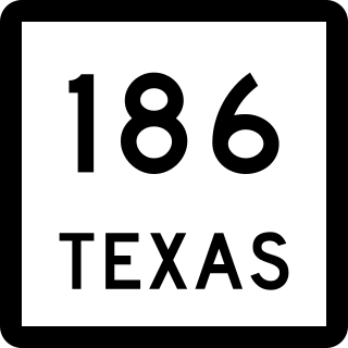
State Highway 186 is a state highway in the Rio Grande Valley in Hidalgo and Willacy counties in Texas, United States, that connects U.S. Route 281 (US 281), future Interstate 69C, and Farm to Market Road 1017 (FM 1017) in Linn with the Gulf of Mexico at Port Mansfield.

<span class="mw-page-title-main">Farm to Market Road 423</span> Highway in Texas

Farm to Market Road 423 is a farm to market road in Denton County, Texas.

<span class="mw-page-title-main">Farm to Market Road 170</span>

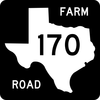
Farm to Market Road 170 is a 114.6-mile (184.4 km) highway maintained by the Texas Department of Transportation (TxDOT) in Presidio and Brewster counties in Texas. The route, known locally as the River Road, runs along the United States side of the Rio Grande which in Texas forms the international boundary between the U.S. and Mexico. The road runs from Candelaria through the city of Presidio as well as several smaller communities and former settlements to State Highway 118 in Study Butte near Big Bend National Park. The road also passes through the southern portion of Big Bend Ranch State Park.

<span class="mw-page-title-main">U.S. Route 287 in Texas</span> Highway in Texas

U.S. Highway 287 (US 287) in the U.S. state of Texas is a major U.S. Highway that begins on the Gulf Coast in Port Arthur and heads north through Fort Worth, northwest to Childress, Clarendon, Wichita Falls, and Amarillo in the Texas Panhandle and into Oklahoma near Kerrick.

<span class="mw-page-title-main">Texas State Highway Loop 281</span> State highway in Texas

State Highway Loop 281 or Loop 281 is a Texas state highway loop that forms a partial beltway around the city of Longview. The highway travels in a clockwise direction around the western, northern, and eastern parts of the city, with I-20 completing the beltway. The western section of Loop 281, from I-20/US 259/SH 322 to US 259, is a surface street that mostly travels through heavily developed areas of the city, while the eastern section, from US 259 to I-20/FM 968 is more of a controlled-access highway that travels through less developed areas.

<span class="mw-page-title-main">Texas State Highway Spur 303</span> State highway in Texas

Spur 303 is a state highway between Interstate 820 in Fort Worth, and Duncanville Road in Dallas. At 17.4 miles (28.0 km) in length, it is Texas' longest highway spur.

<span class="mw-page-title-main">Farm to Market Road 1938</span> State road in Texas

Farm to Market Road 1938 (FM 1938) is a Farm to Market Road in the US state of Texas. The highway runs from State Highway 26 (SH 26) to State Highway 114 in Tarrant County. In North Richland Hills, Keller, and Westlake, FM 1938 is named Davis Boulevard, while in Southlake it is known as Randol Mill Avenue. FM 1938 was designated in 1952 in Hockley County, but was cancelled and redesignated in 1955 at its modern location in Tarrant County. In 1995, the entire route of FM 1938 was redesignated as Urban Road 1938 by the Texas Department of Transportation (TxDOT). In 2012, FM 1938's northern terminus was extended from FM 1709 to the north frontage road of SH 114.

<span class="mw-page-title-main">U.S. Route 287 Business (Mansfield–Fort Worth, Texas)</span> Business route in Texas

Business US Highway 287-P is a 38.613-mile-long (62.142 km) business loop of US Highway 287 in the state of Texas that serves as main street for Mansfield, downtown Fort Worth and Saginaw. The highway is known as Main Street while in Mansfield, Mansfield Highway while in southern Fort Worth, Kennedale Parkway in Kennedale, Riverside Drive and Rosedale Street in central Fort Worth, Commerce Street in downtown Fort Worth, Main Street in northern Fort Worth, and Saginaw Boulevard in Saginaw. The highway was originally designated on January 14, 1991, to replace a portion of Loop 496, and the old route of US 287 and US 81. The route was then rerouted several times during the 1990s. Bus. US 287-P is located almost entirely in Tarrant County, and is mostly located in Fort Worth. The highway is, as of 2010, the longest business route of US 287, while located in Texas. Bus. US 287-P is one of the few highways to be designated as a north–south highway.

<span class="mw-page-title-main">Business routes of U.S. Route 287 in Texas</span>

There are currently nine business routes of U.S. Highway 287 in Texas that are designated and maintained by the Texas Department of Transportation (TxDOT). The business routes in the US state of Texas are traditionally short spurs or loops that connect the main route, in this case, U.S. Highway 287 (US 287), to the center or commercial district of a city. The routes commonly follow the course of a decommissioned state highway, or the old course of the main route. Business routes are signed with the traditional US 287 highway shield, and with a small "business plate" placed above the marker. TxDOT regards business routes as official highways, and is responsible for the maintenance of the route.

References

  1. 1 2 3 Transportation Planning and Programming Division (n.d.). "Urban Road No. 157". Highway Designation Files. Texas Department of Transportation. Retrieved March 15, 2012.
  2. 1 2 3 4 Transportation Planning and Programming Division (n.d.). "Farm to Market Road No. 157". Highway Designation Files. Texas Department of Transportation . Retrieved March 15, 2012.
  3. 1 2 3 4 5 Google (December 10, 2018). "Overview Map of Farm to Market Road 157" (Map). Google Maps . Google. Retrieved December 10, 2018.
  4. Discovery Channel Road Atlas (Map). 1 in:143.5 mi. Cartography by Mapquest.com, Inc. American Map. 2004. p. 106. ISBN   0-8416-1787-2.
  5. Transportation Planning and Programming Division (2012). Texas County Mapbook (PDF) (Map) (2012 ed.). 1:120,000. Texas Department of Transportation. p. 484. OCLC   867856197 . Retrieved April 19, 2012.[ dead link ]
  6. Transportation Planning and Programming Division (2012). Texas County Mapbook (PDF) (Map) (2012 ed.). 1:120,000. Texas Department of Transportation. p. 483. OCLC   867856197 . Retrieved April 19, 2012.[ dead link ]
  7. Discovery Channel Road Atlas (Map). 1 in:143.5 mi. Cartography by Mapquest.com, Inc. American Map. 2004. p. 108. ISBN   0-8416-1787-2.
  8. Transportation Planning and Programming Division (2012). Texas County Mapbook (PDF) (Map) (2012 ed.). 1:120,000. Texas Department of Transportation. p. 453. OCLC   867856197 . Retrieved April 19, 2012.[ dead link ]
  9. http://ftp.dot.state.tx.us/pub/txdot/commission/2015/0430/12b7.pdf.{{cite web}}: Missing or empty |title= (help)
  10. http://ftp.dot.state.tx.us/pub/txdot/commission/2017/0727/12e1.pdf.{{cite web}}: Missing or empty |title= (help)
  11. http://ftp.dot.state.tx.us/pub/txdot/commission/2018/1115/4.pdf.{{cite web}}: Missing or empty |title= (help)
  12. Project Map: FM 157 Realignment (PDF) (Map). Texas Department of Transportation. Retrieved March 20, 2012.
  13. Staff. "FM 157 Project". Texas Department of Transportation. Retrieved March 19, 2012.
  14. Staff. "FM 157 major study (realignment)". Texas Department of Transportation. Retrieved March 20, 2012.

Commons-logo.svg Media related to Farm to Market Road 157 at Wikimedia Commons