Related Research Articles

The 29th Infantry Division, also known as the "Blue and Gray Division", is an infantry division of the United States Army based at Fort Belvoir in Fairfax County, Virginia. The division is currently a formation of the Army National Guard and includes units from Kentucky, Maryland, North Carolina, South Carolina, Virginia, and West Virginia.

The 41st Infantry Division was an infantry division of the United States Army National Guard composed primarily of units from the Pacific Northwest. The division saw active service in World War I and World War II, receiving the nickname “Jungleers” during the latter.
Mullan Road was the first wagon road to cross the Rocky Mountains to the Inland of the Pacific Northwest. It was built by U.S. Army troops under the command of Lt. John Mullan, between the spring of 1859 and summer 1860. It led from Fort Benton, which at the time was in the Dakota Territory, then Idaho Territory from July 1863, and into Montana Territory beginning in May 1864. The road eventually stretched all the way from Fort Walla Walla, Washington Territory, near the Columbia River to the navigational head of the Missouri River, which at the time was the farthest inland port in the world). The road previewed the route approximately followed by modern-day Interstate 15 and Interstate 90 through present-day Montana, Idaho, and Washington.

Glidden is an unincorporated census-designated place in the town of Jacobs in Ashland County, Wisconsin, United States. It is located on County Highway N near Wisconsin Highway 13. As of the 2010 census, its population was 507.

The 116th Air Refueling Squadron is a unit of the Washington Air National Guard 141st Air Refueling Wing located at Fairchild Air Force Base, Spokane, Washington. The 116th is equipped with the KC-135R Stratotanker and RC-26B Metroliner.

The 116th Infantry Regiment is an infantry regiment in the Virginia Army National Guard.

The Clearwater River is in the northwestern United States, in north central Idaho. Its length is 74.8 miles (120.4 km), it flows westward from the Bitterroot Mountains along the Idaho-Montana border, and joins the Snake River at Lewiston. In October 1805, the Lewis and Clark Expedition descended the Clearwater River in dugout canoes, putting in at "Canoe Camp," five miles (8 km) downstream from Orofino; they reached the Columbia Bar and the Pacific Ocean about six weeks later.

Olney is an unincorporated community and former company town in Clatsop County, Oregon, United States, on Oregon Route 202 approximately eight miles south of Astoria. Its post office is assigned ZIP code 97325.

The 116th Cavalry Brigade Combat Team is the largest formation of the Idaho Army National Guard. It is headquartered at Gowen Field, Boise, Idaho. It has been reorganized into an Armored Brigade Combat Team (ABCT) but remains the only unit to be designated a "Cavalry Brigade Combat Team" by special appointment of the US Army. The 116th Cavalry Brigade Combat Team has units located throughout Idaho, Montana, Oregon, and Nevada. It was reorganized into a heavy armor brigade in 1989. Often referred to as the Snake River Brigade and formerly known as the 116th Armored Cavalry Regiment, the unit includes about 3,000 citizen-soldiers from Idaho.
Camp Fremont was a World War I-era military base located near Palo Alto, California. Construction started in July 1917 and the post closed in September, 1919. The post was named for John C. Frémont, a US Army officer and government official who was prominent in California during the 1850s.

The 163rd Infantry Regiment is a regiment of the Montana National Guard. It went overseas with the 41st Infantry Division in World War II.

The 146th Field Artillery Regiment is a field artillery regiment of the Army National Guard first Constituted in 1886 as the 1st, and 2nd Regiments of Infantry.
The 148th Field Artillery Regiment is a Field Artillery Branch regiment of the Army National Guard.
Vaughn is an unincorporated community in Lane County, Oregon, United States. It is located about 4 miles (6.4 km) south of Noti in the foothills of the Central Oregon Coast Range near Noti Creek. Author Ralph Friedman described Vaughn as "a mill in the meadows".
Ordway is an unincorporated community in Brown County, in the U.S. state of South Dakota.
Avon is an unincorporated community in Latah County, in the U.S. state of Idaho.
Ruff is an unincorporated community in Grant County, in the U.S. state of Washington.
Ayer is an unincorporated community located in Walla Walla County, Washington. AYER, is a stop on the Union Pacific Railroad located in the northern portion of the county, approximately 47 miles north of Walla Walla along the Snake River. It was a main half way stop for the railroad between Hermiston, Oregon and Spokane, Washington. A hotel was built specifically for the train crews. It was also used as by the Camas Prairie Railroad, from Lewiston, Idaho, and the Pomeroy Branch would use as a switching point for freight moving to the north or south. The small town grew up around the hotel and rail yard, but the original Ayer was relocated when Lower Monumental Dam was constructed by the U. S. Army Corps of engineers, and the original area was flooded. The town is now abandoned and sits in decaying state.

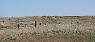
Almota is an extinct town in Whitman County, in the U.S. state of Washington. The GNIS classifies it as a populated place.
Riparia is an extinct town in Whitman County, in the U.S. state of Washington. The GNIS classifies it as a populated place.
References
- ↑ U.S. Geological Survey Geographic Names Information System: Farrington, Washington
- ↑ Meany, Edmond S. Origin of Washington geographic names. Seattle: University of Washington Press. p. 83.
- ↑ Ott, Cliford M. Co. F. 2nd Idaho INF. N.G. Lewiston, Idaho Merged into Co. F. 116th ENGRS. June 25, 1916 to Mar. 15, 1919. Moscow, ID: Latah County Pioneer Historical Museum Inc. p. 58.
- ↑ General Orders, No. 2. Headquarters 41st National Guard Division, Camp Grene, N.C. September 19, 1917
Municipalities and communities of Franklin County, Washington, United States | ||
|---|---|---|
| Cities |  | |
| CDPs | ||
| Unincorporated communities | ||
| Ghost towns | ||
46°32′23″N118°34′43″W / 46.53972°N 118.57861°W
| | This Franklin County, Washington state location article is a stub. You can help Wikipedia by expanding it. |