Climate
According to the Köppen climate classification system, Feasterville has a Hot-summer Humid continental climate (Dfa). Dfa climates are characterized by at least one month having an average mean temperature ≤ 32.0 °F (0.0 °C), at least four months with an average mean temperature ≥ 50.0 °F (10.0 °C), at least one month with an average mean temperature ≥ 71.6 °F (22.0 °C) and no significant precipitation difference between seasons. Although most summer days are slightly humid in Feasterville, episodes of heat and high humidity can occur with heat index values > 108 °F (42 °C). Since 1981, the highest air temperature was 102.9 °F (39.4 °C) on July 22, 2011, and the highest daily average mean dew point was 76.2 °F (24.6 °C) on August 13, 1999. The average wettest month is July which correlates with the peak in thunderstorm activity. Since 1981, the wettest calendar day was 6.73 inches (171 mm) on August 27, 2011. During the winter months, the average annual extreme minimum air temperature is 1.2 °F (−17.1 °C). [9] Since 1981, the coldest air temperature was −9.2 °F (−22.9 °C) on January 22, 1984. Episodes of extreme cold and wind can occur with wind chill values < −9 °F (−23 °C). The average annual snowfall (Nov-Apr) is 25.1 inches (64 cm). Ice storms and large snowstorms depositing ≥ 12 inches (30 cm) occur once every few years, particularly during nor’easters from December through February.
| Climate data for Feasterville. Elevation: 213 feet (65 m), 1981–2010 normals, extremes 1981–2019 |
|---|
| Month | Jan | Feb | Mar | Apr | May | Jun | Jul | Aug | Sep | Oct | Nov | Dec | Year |
|---|
| Record high °F (°C) | 71.6
(22.0) | 77.9
(25.5) | 87.3
(30.7) | 94.2
(34.6) | 95.4
(35.2) | 96.5
(35.8) | 102.9
(39.4) | 100.5
(38.1) | 98.3
(36.8) | 93.7
(34.3) | 81.3
(27.4) | 76.1
(24.5) | 102.9
(39.4) |
|---|
| Mean daily maximum °F (°C) | 39.9
(4.4) | 43.1
(6.2) | 51.3
(10.7) | 63.1
(17.3) | 72.6
(22.6) | 81.8
(27.7) | 86.0
(30.0) | 84.4
(29.1) | 77.6
(25.3) | 66.2
(19.0) | 55.4
(13.0) | 44.2
(6.8) | 63.9
(17.7) |
|---|
| Daily mean °F (°C) | 31.9
(−0.1) | 34.4
(1.3) | 41.8
(5.4) | 52.5
(11.4) | 61.9
(16.6) | 71.4
(21.9) | 76.1
(24.5) | 74.6
(23.7) | 67.5
(19.7) | 55.9
(13.3) | 46.2
(7.9) | 36.4
(2.4) | 54.3
(12.4) |
|---|
| Mean daily minimum °F (°C) | 23.8
(−4.6) | 25.8
(−3.4) | 32.3
(0.2) | 41.9
(5.5) | 51.2
(10.7) | 61.0
(16.1) | 66.1
(18.9) | 64.8
(18.2) | 57.3
(14.1) | 45.5
(7.5) | 37.1
(2.8) | 28.5
(−1.9) | 44.7
(7.1) |
|---|
| Record low °F (°C) | −9.2
(−22.9) | −2.1
(−18.9) | 4.3
(−15.4) | 18.1
(−7.7) | 34.1
(1.2) | 42.8
(6.0) | 49.1
(9.5) | 43.7
(6.5) | 36.9
(2.7) | 25.7
(−3.5) | 13.2
(−10.4) | −0.1
(−17.8) | −9.2
(−22.9) |
|---|
| Average precipitation inches (mm) | 3.55
(90) | 2.73
(69) | 4.15
(105) | 3.98
(101) | 4.33
(110) | 4.33
(110) | 5.18
(132) | 4.40
(112) | 4.38
(111) | 3.75
(95) | 3.61
(92) | 3.96
(101) | 48.35
(1,228) |
|---|
| Average snowfall inches (cm) | 7.1
(18) | 8.8
(22) | 3.8
(9.7) | 0.7
(1.8) | 0.0
(0.0) | 0.0
(0.0) | 0.0
(0.0) | 0.0
(0.0) | 0.0
(0.0) | 0.0
(0.0) | 0.4
(1.0) | 4.3
(11) | 25.1
(64) |
|---|
| Average relative humidity (%) | 65.9 | 63.0 | 58.5 | 57.9 | 62.6 | 65.9 | 66.4 | 68.6 | 69.6 | 69.1 | 67.7 | 68.2 | 65.3 |
|---|
| Average dew point °F (°C) | 21.8
(−5.7) | 23.1
(−4.9) | 28.3
(−2.1) | 38.1
(3.4) | 49.0
(9.4) | 59.4
(15.2) | 64.1
(17.8) | 63.6
(17.6) | 57.2
(14.0) | 45.9
(7.7) | 36.1
(2.3) | 26.9
(−2.8) | 42.9
(6.1) |
|---|
| Source: PRISM [10] |

Bensalem Township is a township in Bucks County, Pennsylvania, United States. The township borders the northeastern section of Philadelphia and includes the communities of Andalusia, Bensalem, Bridgewater, Cornwells Heights, Eddington, Flushing, Oakford, Siles, Trappe, and Trevose. Bensalem Township has no other incorporated municipalities within its boundaries. It is located within the Delaware Valley, also known as the Philadelphia metropolitan area.

East Rockhill Township is a township in Bucks County, Pennsylvania, United States. The original Rockhill Township was established in 1740 and was divided into East and West Rockhill Townships in 1890. The population was 5,706 at the 2010 Census. East Rockhill is part of Pennridge School District. Pennridge Airport is located in East Rockhill Township.
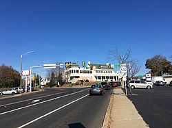
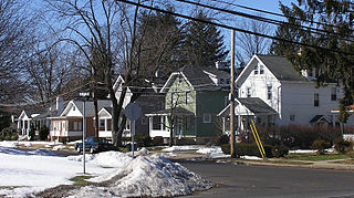
Feasterville-Trevose is a former census-designated place (CDP) in Lower Southampton Township in Bucks County, Pennsylvania. The population was 6,525 at the 2000 census. The ZIP code is 19053. The area has been separated into two CDPs in the 2010 census, Feasterville and Trevose.

Haycock Township is a township in Bucks County, Pennsylvania, United States. The population was 2,225 at the 2010 census.

Hilltown Township is a township in Bucks County, Pennsylvania, United States. The population was 15,029 at the 2010 census. Most of Hilltown is part of Pennridge School District, while a small portion in Line Lexington is part of North Penn School District.

Hulmeville is a borough in Bucks County, Pennsylvania, United States. The population was 1,003 at the 2010 census.

Langhorne Borough is a borough in Bucks County, Pennsylvania, United States. The population was 1,622 at the time of the 2010 census.
Langhorne Manor is a borough in Bucks County, Pennsylvania, United States. The population was 1,422 at the 2010 census, a 55.6% increase from the 2000 census. The mayor of Langhorne Manor is Bob Byrne.

Lower Southampton Township is a township in Bucks County, Pennsylvania, United States. The population was 20,599 at the 2020 census.

New Britain is a borough in Bucks County, Pennsylvania, United States. The population was 3,152 at the 2010 census.
New Britain Township is a township in Bucks County, Pennsylvania, United States. The population was 11,070 at the 2010 census.
Newtown Township is a township in Bucks County, Pennsylvania, United States. The population was 19,299 at the 2010 census.

Northampton Township is a township in Bucks County, Pennsylvania, United States. The township is located approximately 12 miles northeast of Philadelphia. The population was 39,915 at the 2020 census.

Richlandtown is a borough in Bucks County, Pennsylvania, United States. The population was 1,260 at the 2020 census.

Silverdale is a borough in Bucks County, Pennsylvania, United States. The population was 871 at the 2010 census.

Trumbauersville is a borough that is located in Bucks County, Pennsylvania, United States. The population was 974 at the time of the 2010 census.

Tullytown is a borough in Bucks County, Pennsylvania, United States. Originally a village in Falls Township, Tullytown was partitioned as a borough in 1891. The population was 1,872 at the 2010 census. Part of Levittown is located in Tullytown.

Warwick Township is a township in Bucks County, Pennsylvania, United States. The population was 14,437 at the 2010 census.

Trevose is a census-designated place within both Bensalem and Lower Southampton townships in Bucks County, Pennsylvania, United States.

Neshaminy State Park is a 330-acre (134 ha) Pennsylvania state park in Bensalem Township, Bucks County, Pennsylvania in the United States. Visitors to the park can catch a glimpse of the Philadelphia skyline from a hiking trail on Logan Point. The park is located at the confluence of Neshaminy Creek and the Delaware River. Neshaminy State Park is just off Interstate 95 on Pennsylvania Route 132.