Telford, Pennsylvania

Last updated
Telford, Pennsylvania
Telford Station.jpg
The former Reading Railroad and SEPTA station in Telford
TelfordBoroughLogo.jpg
Bucks county - Telford.png
Location in Bucks County, Pennsylvania
USA Pennsylvania location map.svg
Red pog.svg
Telford
Location in Pennsylvania
Usa edcp location map.svg
Red pog.svg
Telford
Location in the United States
Coordinates: 40°19′29″N75°19′41″W / 40.32472°N 75.32806°W / 40.32472; -75.32806
Country United States
State Pennsylvania
Counties Bucks, Montgomery
Settled1719
Incorporated1886
Government
  MayorDavid S. Snook
Area
[1]
  Total1.01 sq mi (2.61 km2)
  Land1.01 sq mi (2.61 km2)
  Water0.00 sq mi (0.00 km2)
Elevation
423 ft (129 m)
Population
 (2010)
  Total4,872
  Estimate 
(2019) [2]
4,894
  Density4,859.98/sq mi (1,876.06/km2)
Time zone UTC-5 (EST)
  Summer (DST) UTC-4 (EDT)
ZIP Code
18969
Area code(s) 215, 267, and 445
FIPS code 42-76304
Website www.telfordborough.org

Telford is a borough in Bucks and Montgomery counties in the U.S. state of Pennsylvania. The population was 4,872 at the time of the 2010 census. [3] Of this, 2,665 were in Montgomery County, and 2,207 were in Bucks County.

Contents

History

Founding

Originally inhabited by the Lenape people, the area surrounding Telford began to be settled in 1719 by Mennonites from the Palatinate of the Rhine. In 1857, the town known as County Line (the area had previously been known as Hendrick's Blacksmith) changed its name to Telford after the North Pennsylvania Railroad Company (later absorbed into the Reading Railroad) named its new station there after civil engineer Thomas Telford.

Incorporation as a borough

The Borough of Telford was incorporated by decree of the Court of Quarter Sessions of Bucks County of November 10, 1886. [4] A decade later, The Borough of West Telford was incorporated by decree of the Court of Quarter Sessions of Montgomery County of December 27, 1897. [5] In 1934, the respective boroughs entered into an agreement for consolidation, [6] and an election was held on this question on November 6, 1934. The voters of both boroughs approved the agreement, and on January 11, 1935, Governor Gifford Pinchot issued letters patent consolidating the two boroughs into the current Borough of Telford. [7]

Geography

Telford is located at 40°19′29″N75°19′41″W / 40.32472°N 75.32806°W / 40.32472; -75.32806 (40.324786, -75.328045), [8] elevation 449 feet (136.9 m).

According to the United States Census Bureau, the borough has a total area of 1.0 square mile (2.6 km2), all land.

Transportation

Main Street in Telford. The left side is in Bucks County while the right side is Montgomery County. 2022-10-30 15 07 42 View southeast along Main Street just southeast of Broad Street in Telford, along the border of Bucks County and Montgomery County, in Pennsylvania.jpg
Main Street in Telford. The left side is in Bucks County while the right side is Montgomery County.

As of 2018 there were 13.94 miles (22.43 km) of public roads in Telford, of which 1.94 miles (3.12 km) were maintained by the Pennsylvania Department of Transportation (PennDOT) and 12.00 miles (19.31 km) were maintained by the borough. [9]

No numbered highways serve Telford directly. Main thoroughfares traversing the town include Main Street and Church Road. State routes 309 and 563 are the closest state highways to Telford.

A rail line that was formerly the Reading Company's Bethlehem Branch runs north-south through Telford connecting to Perkasie, Quakertown, and Bethlehem to the north and Souderton, Hatfield, and Lansdale to the south. The line was used by the SEPTA Bethlehem Line until 1981. The tracks are still used for the transport of freight between Lansdale and Quakertown, and beyond. The line is used for occasional scenic rail trips, and resumption of passenger service to Quakertown is being considered. Telford is also the via point location for Pennsylvania Northeastern Railroad out of Lansdale and East Penn Railroad out of Quakertown. The Telford station is still standing, though remains vacant.

SEPTA Suburban Bus Route 132 starts in Telford and ends at the Montgomery Mall in Montgomeryville, serving Souderton, Hatfield, and Lansdale. [10]

From 1901 to 1951, an interurban electric trolley line, Lehigh Valley Transit, known as the Liberty Bell Limited, ran from Telford north to Allentown (through Quakertown) and south (through Lansdale) to Philadelphia. During World War II, it carried a large number of passengers due to gas rationing, forcing a reduction in auto use, but after the war its business declined and in 1951, it abandoned rail and converted to bus operation.

Demographics

Historical population
CensusPop.Note
1890 125
1900 18144.8%
1910 20714.4%
1920 31351.2%
1930 41231.6%
1940 1,747324.0%
1950 2,04216.9%
1960 2,76335.3%
1970 3,40923.4%
1980 3,5072.9%
1990 4,23820.8%
2000 4,68010.4%
2010 4,8724.1%
2020 4,9281.1%
[11]

As of the census [12] of 2000, 4,681 people, 1,930 households, and 1,200 families resided in the borough. The population density was 4,618.2 inhabitants per square mile (1,783.1/km2). The 1,977 housing units averaged 1,950.9 per square mile (755.8/km2). The racial makeup of the borough was 92.48% White, 1.30% Black, 0.02% Native American, 3.76% Asian, 0.02% Pacific Islander, 1.13% from other races, and 1.28% from two or more races. Hispanics or Latinos of any race were 3.61% of the population.

Of the 1,930 households, 29.4% had children under the age of 18 living with them, 51.1% were married couples living together, 8.2% had a female householder with no husband present, and 37.8% were not families. About 33.3% of all households were made up of individuals, and 17.4% had someone living alone who was 65 years of age or older. The average household size was 2.34 and the average family size was 3.00.

In the borough, the population was distributed as 23.0% under the age of 18, 6.6% from 18 to 24, 33.2% from 25 to 44, 19.2% from 45 to 64, and 18.0% who were 65 years of age or older. The median age was 37 years. For every 100 females, there were 88.2 males. For every 100 females age 18 and over, there were 84.5 males.

The median income for a household in the borough was $45,451, and for a family was $56,809. Males had a median income of $38,750 versus $28,387 for females. The per capita income for the borough was $22,075. About 2.5% of families and 4.7% of the population were below the poverty line, including 4.3% of those under age 18 and 5.3% of those age 65 or over.

In 2008, the median household income was estimated at $58,350 (it was $45,451 in 2000).

In 2008, the estimated house or condo value was $256,582 (compared to $130,300 in 2000). In 2008, the per capita income was $28,979.

Politics and government

Presidential elections results [13] [14] [15] [16]
Year Republican Democratic
2020 50.6%1,29249.3% 1,260
2016 51.9%1,14843.2% 955
2012 53.5%1,08844.8% 911
2008 51.0%1,09447.8% 1,027

The borough is represented by the following officials:

U.S. House of Representatives

Pennsylvania State Senate

Pennsylvania House of Representatives

Climate

According to the Köppen climate classification system, Telford has a Hot-summer, Humid continental climate (Dfa). Dfa climates are characterized by at least one month having an average mean temperature ≤ 32.0 °F (0.0 °C), at least four months with an average mean temperature ≥ 50.0 °F (10.0 °C), at least one month with an average mean temperature ≥ 71.6 °F (22.0 °C) and no significant precipitation difference between seasons. Although most summer days are slightly humid in Telford, episodes of heat and high humidity can occur with heat index values > 107 °F (42 °C). Since 1981, the highest air temperature was 101.5 °F (38.6 °C) on July 22, 2011, and the highest daily average mean dew point was 74.3 °F (23.5 °C) on August 12, 2016. The average wettest month is July, which corresponds with the annual peak in thunderstorm activity. Since 1981, the wettest calendar day was 6.70 inches (170 mm) on August 27, 2011. During the winter months, the average annual extreme minimum air temperature is −1.7 °F (−18.7 °C). [17] Since 1981, the coldest air temperature was −12.3 °F (−24.6 °C) on January 21, 1994. Episodes of extreme cold and wind can occur, with wind chill values < −13 °F (−25 °C). The average annual snowfall (Nov-Apr) is between 30 inches (76 cm) and 36 inches (91 cm). Ice storms and large snowstorms depositing ≥ 12 inches (30 cm) of snow occur once every few years, particularly during nor’easters from December through February.

Climate data for Telford, Elevation 413 ft (126 m), 1981-2010 normals, extremes 1981-2018
MonthJanFebMarAprMayJunJulAugSepOctNovDecYear
Record high °F (°C)70.7
(21.5)
78.1
(25.6)
86.1
(30.1)
92.9
(33.8)
94.5
(34.7)
95.8
(35.4)
101.7
(38.7)
99.7
(37.6)
97.2
(36.2)
88.4
(31.3)
80.4
(26.9)
76.0
(24.4)
101.7
(38.7)
Mean daily maximum °F (°C)38.4
(3.6)
41.7
(5.4)
50.0
(10.0)
62.2
(16.8)
72.3
(22.4)
81.0
(27.2)
85.0
(29.4)
83.4
(28.6)
76.5
(24.7)
64.9
(18.3)
53.9
(12.2)
42.5
(5.8)
62.7
(17.1)
Daily mean °F (°C)29.7
(−1.3)
32.5
(0.3)
40.1
(4.5)
50.9
(10.5)
60.7
(15.9)
69.8
(21.0)
74.3
(23.5)
72.7
(22.6)
65.3
(18.5)
53.6
(12.0)
43.9
(6.6)
34.0
(1.1)
52.4
(11.3)
Mean daily minimum °F (°C)21.0
(−6.1)
23.2
(−4.9)
30.1
(−1.1)
39.7
(4.3)
49.1
(9.5)
58.7
(14.8)
63.6
(17.6)
62.0
(16.7)
54.1
(12.3)
42.2
(5.7)
33.9
(1.1)
25.5
(−3.6)
42.0
(5.6)
Record low °F (°C)−12.3
(−24.6)
−4.9
(−20.5)
2.0
(−16.7)
16.8
(−8.4)
30.0
(−1.1)
40.4
(4.7)
47.1
(8.4)
41.7
(5.4)
34.4
(1.3)
23.1
(−4.9)
10.2
(−12.1)
−2.5
(−19.2)
−12.3
(−24.6)
Average precipitation inches (mm)3.40
(86)
2.81
(71)
3.87
(98)
4.05
(103)
4.31
(109)
4.34
(110)
4.73
(120)
3.91
(99)
4.54
(115)
4.26
(108)
3.69
(94)
3.92
(100)
47.83
(1,215)
Average relative humidity (%)67.964.360.259.063.468.668.871.472.471.269.969.967.3
Average dew point °F (°C)20.4
(−6.4)
21.8
(−5.7)
27.4
(−2.6)
37.1
(2.8)
48.2
(9.0)
59.0
(15.0)
63.4
(17.4)
62.9
(17.2)
56.2
(13.4)
44.5
(6.9)
34.7
(1.5)
25.2
(−3.8)
41.8
(5.4)
Source: PRISM [18]

Ecology

According to the A. W. Kuchler U.S. potential natural vegetation types, Telford would have a dominant vegetation type of Appalachian Oak (104) with a dominant vegetation form of Eastern Hardwood Forest (25). [19] The plant hardiness zone is 6b with an average annual extreme minimum air temperature of −1.7 °F (−18.7 °C). [17] The spring bloom typically begins by April 13 and fall color usually peaks by October 27.

Notable people

Related Research Articles

<span class="mw-page-title-main">Bristol Township, Pennsylvania</span> Township in Pennsylvania, United States

Bristol Township is a township in Bucks County, Pennsylvania, United States. The population was 54,582 at the 2010 census, making it the 13th largest municipality in the state. Bristol Township, along with Bristol Borough, is a cultural hub for Lower Bucks County, hosting celebrations of African and Latino heritage. Parts of the township consist of the neighborhoods of Fairless Hills and Levittown. It is located within the Delaware Valley.

<span class="mw-page-title-main">Dublin, Pennsylvania</span> Borough in Pennsylvania, United States

Dublin is a borough in Bucks County, Pennsylvania, United States. The population was 2,158 at the 2010 census. Dublin is part of Pennridge School District.

<span class="mw-page-title-main">Haycock Township, Pennsylvania</span> Township in Pennsylvania, United States

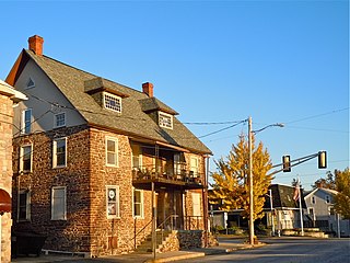
Haycock Township is a township in Bucks County, Pennsylvania, United States. The population was 2,225 at the 2010 census.

<span class="mw-page-title-main">Hilltown Township, Pennsylvania</span> Township in Pennsylvania, United States

Hilltown Township is a township in Bucks County, Pennsylvania, United States. The population was 15,029 at the 2010 census. Most of Hilltown is part of Pennridge School District, while a small portion in Line Lexington is part of North Penn School District.

<span class="mw-page-title-main">Hulmeville, Pennsylvania</span> Borough in Pennsylvania, United States

Hulmeville is a borough in Bucks County, Pennsylvania, United States. The population was 1,003 at the 2010 census.

<span class="mw-page-title-main">Lower Southampton Township, Pennsylvania</span> Township in Pennsylvania, United States

Lower Southampton Township is a township in Bucks County, Pennsylvania, United States. The population was 20,599 at the 2020 census.

<span class="mw-page-title-main">New Britain, Pennsylvania</span> Borough in Pennsylvania, United States

New Britain is a borough in Bucks County, Pennsylvania, United States. The population was 3,152 at the 2010 census.

<span class="mw-page-title-main">New Britain Township, Pennsylvania</span> Township in Pennsylvania, United States

New Britain Township is a township in Bucks County, Pennsylvania, United States. The population was 11,070 at the 2010 census.

<span class="mw-page-title-main">Penndel, Pennsylvania</span> Borough in Pennsylvania, United States

Penndel is a borough in Bucks County, Pennsylvania, United States. The population was 2,328 at the 2010 census.

<span class="mw-page-title-main">Perkasie, Pennsylvania</span> Borough in Pennsylvania, United States

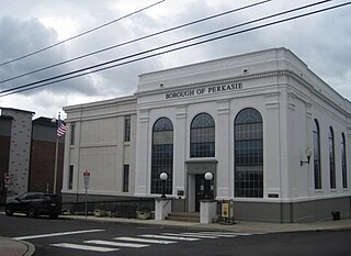
Perkasie is a borough in Bucks County, Pennsylvania, United States. Perkasie is 21.5 miles (34.6 km) southeast of Allentown and 39.2 miles (63.1 km) north of Philadelphia.

<span class="mw-page-title-main">Quakertown, Pennsylvania</span> Borough in Pennsylvania, United States

Quakertown is a borough in Bucks County, Pennsylvania, United States. As of 2020, it had a population of 9,359. The borough is 15 miles (24 km) south of Allentown and Bethlehem and 40 miles (64 km) north of Philadelphia, making Quakertown a border town of both the Delaware Valley and Lehigh Valley metropolitan areas.

<span class="mw-page-title-main">Richlandtown, Pennsylvania</span> Borough in Pennsylvania, United States

Richlandtown is a borough in Bucks County, Pennsylvania, United States. The population was 1,260 at the 2020 census.

<span class="mw-page-title-main">Sellersville, Pennsylvania</span> Borough in Pennsylvania, United States

Sellersville is a borough in Bucks County, Pennsylvania, United States. The population was 4,249 at the 2010 census. It is in the Pennridge School District.

<span class="mw-page-title-main">Tullytown, Pennsylvania</span> Borough in Pennsylvania, United States

Tullytown is a borough in Bucks County, Pennsylvania, United States. Originally a village in Falls Township, Tullytown was partitioned as a borough in 1891. The population was 1,872 at the 2010 census. Part of Levittown is located in Tullytown.

<span class="mw-page-title-main">Upper Southampton Township, Pennsylvania</span> Township in Pennsylvania, United States

Upper Southampton Township is a township in Bucks County, Pennsylvania, United States. The population was 15,152 at the 2010 census.

<span class="mw-page-title-main">Franconia Township, Pennsylvania</span> Township in Pennsylvania, United States

Franconia Township is a township in Montgomery County, Pennsylvania, United States. The population was 13,064 at the 2010 census.

<span class="mw-page-title-main">Hatfield, Pennsylvania</span> Borough in Pennsylvania, United States

Hatfield is a borough in Montgomery County, Pennsylvania, United States. The population was 3,290 at the time of the 2010 census. It is part of the North Penn Valley region that is centered around the borough of Lansdale. The borough is surrounded by Hatfield Township.

<span class="mw-page-title-main">Hatfield Township, Pennsylvania</span> Township in Pennsylvania, United States

Hatfield Township is a township in Montgomery County, Pennsylvania, United States. The population was 17,249 at the 2010 census. It is part of the North Penn Valley region which is centered around the borough of Lansdale.

<span class="mw-page-title-main">Montgomery Township, Montgomery County, Pennsylvania</span> Township in Pennsylvania, United States

Montgomery Township is a township in Montgomery County, Pennsylvania. It is the location of the Montgomery Mall, a regional shopping mall serving the Route 309 corridor of the Philadelphia suburbs. Much of Montgomery Township's development is suburban in character, with newer tract houses and strip shopping centers. Homes in Montgomery Township have North Wales and Lansdale addresses, but businesses that are located within the township boundaries are given the Montgomeryville ZIP Code. The township is in the North Penn School District and is part of the North Penn Valley region that is centered around the borough of Lansdale.

<span class="mw-page-title-main">Souderton, Pennsylvania</span> Borough of Pennsylvania, US

Souderton is a borough in Montgomery County, Pennsylvania, United States. The population was 7,246 in 2022 according to the Census Bureau.

References

  1. "2019 U.S. Gazetteer Files". United States Census Bureau. Archived from the original on January 16, 2020. Retrieved July 28, 2020.
  2. "Population and Housing Unit Estimates". United States Census Bureau. May 24, 2020. Archived from the original on July 1, 2021. Retrieved May 27, 2020.
  3. "Race, Hispanic or Latino, Age, and Housing Occupancy: 2010 Census Redistricting Data (Public Law 94-171) Summary File (QT-PL), Telford borough, Pennsylvania". United States Census Bureau . Retrieved August 11, 2011.
  4. Miscellaneous Docket 2, Pages 67-70, 72-73. Clerk of Courts of Bucks County, Pa. (Doylestown, Pa.). Available at the Mercer Museum (Doylestown, Pa.)
  5. Miscellaneous Book 43, Pages 198–201 (recorded December 28, 1897). Recorder of Deeds of Montgomery County, Pa. (Norristown, Pa.).
  6. Ordinance 45, Borough of West Telford (Pa.). Souderton [Pa.] Independent, Thursday, September 13, 1934, p. 10.
  7. Charter Book 3, Pages 3-4 (recorded November 2, 1938). Recorder of Deeds of Montgomery County, Pa. (Norristown, Pa.).
  8. "US Gazetteer files: 2010, 2000, and 1990". United States Census Bureau. 2011-02-12. Archived from the original on 2019-08-24. Retrieved 2011-04-23.
  9. "Telford Borough map" (PDF). PennDOT. Retrieved March 10, 2023.
  10. "Route 132 bus map" (PDF). SEPTA. Archived (PDF) from the original on September 30, 2014. Retrieved September 22, 2014.
  11. "Census 2020" . Retrieved 2021-10-12.
  12. "U.S. Census website". United States Census Bureau . Retrieved 2008-01-31.
  13. "Montgomery County Election Results". Montgomery County, Pennsylvania. Retrieved January 16, 2017.
  14. "Bucks County Election Information". Bucks County, Pennsylvania. Archived from the original on January 18, 2017. Retrieved January 17, 2017.
  15. "MONTGOMERY COUNTY ELECTION RESULTS". montcopa.org. Retrieved 2022-07-27.
  16. "Statement of Votes Cast by Geography". buckscounty.gov. Retrieved 2022-07-27.
  17. 1 2 "USDA Interactive Plant Hardiness Map". United States Department of Agriculture. Archived from the original on June 18, 2021. Retrieved October 17, 2019.
  18. "PRISM Climate Group, Oregon State University" . Retrieved October 17, 2019.
  19. "U.S. Potential Natural Vegetation, Original Kuchler Types, v2.0 (Spatially Adjusted to Correct Geometric Distortions)". Archived from the original on July 3, 2019. Retrieved October 17, 2019.