
Montgomery County, colloquially referred to as Montco, is a county in the Commonwealth of Pennsylvania. It is the third-most populous county in Pennsylvania and the 73rd-most populous county in the United States. As of the 2020 census, the population of the county was 856,553, representing a 7.1% increase from the 799,884 residents counted in the 2010 census. Montgomery County is located adjacent to and northwest of Philadelphia. The county seat and largest city is Norristown. Montgomery County is geographically diverse, ranging from farms and open land in the extreme north of the county to densely populated suburban neighborhoods in the southern and central portions of the county.

Abington Township is a township in Montgomery County, Pennsylvania, United States. It is adjacent to Philadelphia's northern fringe. The population was 58,502 as of the 2020 census, making it the second most populous township in Montgomery County after Lower Merion Township. The population density is 3603.3 per square mile (1,377/km2), making it the second most densely populated township in Montgomery County after Cheltenham Township.

Lower Frederick Township is a township in Montgomery County, Pennsylvania, United States. The population was 4,840 at the 2010 census.
Souderton is a borough in Montgomery County, Pennsylvania, United States. The population was 7,246 in 2022 according to the Census Bureau.

Upper Frederick Township is a township in Montgomery County, Pennsylvania, United States. The population was 3,703 at the 2020 census.

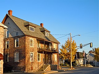
Perkiomenville is an unincorporated community that is located in Montgomery County, Pennsylvania, United States.
Worcester is an unincorporated community in Worcester Township in Montgomery County, Pennsylvania, United States. Worcester is located at the intersection of Pennsylvania Route 73 and Pennsylvania Route 363. The name of the village and township is locally pronounced 'WOR-ses-ter.'

Crestmont is an unincorporated community in Abington Township in Montgomery County, Pennsylvania, United States. Crestmont is located at the intersection of Easton Road and Old Welsh Road, southwest of Willow Grove. The community is served by the Crestmont station along SEPTA Regional Rail's Warminster Line. Crestmont uses the Willow Grove ZIP code of 19090.

Noble is an unincorporated community in Abington Township in Montgomery County, Pennsylvania, United States. Noble is located at the intersection of Pennsylvania Route 611 and Baeder Road, north of Jenkintown. The community is served by the Noble station along SEPTA Regional Rail's West Trenton Line. Noble uses the Jenkintown ZIP code of 19046.

Cedarbrook is an unincorporated community in Cheltenham Township in Montgomery County, Pennsylvania, United States. Cedarbrook is located at the intersection of Pennsylvania Route 309 and Greenwood Avenue, just over the city line of Philadelphia. Cedarbrook is home to the Cedarbrook Shopping Center, a major shopping attraction for many Cheltenham Township and North Philadelphia shoppers.
Eureka is an unincorporated community in Pennsylvania, United States on the border of Warrington Township in Bucks County and Montgomery Township in Montgomery County. Eureka is at the intersection of Pennsylvania Route 152 and County Line Road.
Fairview Village is an unincorporated community in Worcester Township in Montgomery County, Pennsylvania, United States. Fairview Village is located at the intersection of Pennsylvania Route 363 and Germantown Pike.
Compass is an unincorporated community in West Caln Township in Chester County, Pennsylvania, United States. Compass is located at the intersection of state routes 10 and 340.
Blooming Glen is an unincorporated community in Hilltown Township in Bucks County, Pennsylvania, United States.
Creamery is an unincorporated community in Skippack Township in Montgomery County, Pennsylvania, United States. Creamery is located at the intersection of Pennsylvania Route 113 and Creamery Road.
Cedars is an unincorporated community in Worcester Township in Montgomery County, Pennsylvania, United States. Cedars is located at the intersection of Pennsylvania Route 73 and Bustard Road.
Mainland is an unincorporated community in Lower Salford Township in Montgomery County, Pennsylvania, United States. Mainland is located at the intersection of Mainland Road and Store Road, with Pennsylvania Route 63 bypassing the community to the northeast.

Frederick is an unincorporated community in Upper Frederick Township in Montgomery County, Pennsylvania, United States. Frederick is located at the intersection of Pennsylvania Route 73 and Colonial Road.
Montgomery Square is an unincorporated community in Montgomery Township in Montgomery County, Pennsylvania, United States. Montgomery Square is located at the intersection of Pennsylvania Route 309 and U.S. Route 202 Business /Upper State Road. It is the de facto downtown of Montgomery Township.
McKinley is an unincorporated community, in Abington Township, Montgomery County, Pennsylvania, United States. McKinley is located along Forrest Avenue between Pennsylvania Route 73 and Jenkintown Road southeast of Jenkintown.

