East Greenville, Pennsylvania

Last updated

Borough of East Greenville
East Greenville Borough Hall, MontCo PA 01.JPG
East Greenville Borough Hall, May 2015
East Greenville Montgomery County.png
Location of East Greenville in Montgomery County, Pennsylvania
USA Pennsylvania location map.svg
Red pog.svg
East Greenville
Location of East Greenville in Pennsylvania
Usa edcp location map.svg
Red pog.svg
East Greenville
East Greenville (the United States)
Coordinates: 40°24′20″N75°30′15″W / 40.40556°N 75.50417°W / 40.40556; -75.50417
CountryUnited States
StatePennsylvania
County Montgomery
Incorporated1875
Government
  TypeCouncil-manager
  MayorStephen Wescott
Area
[1]
  Total0.51 sq mi (1.33 km2)
  Land0.51 sq mi (1.33 km2)
  Water0.00 sq mi (0.00 km2)
Elevation
410 ft (120 m)
Population
 (2020) [2]
  Total3,166
  Density6,183.59/sq mi (2,389.36/km2)
Time zone UTC-5 (EST)
  Summer (DST) UTC-4 (EDT)
ZIP Code
18041
Area codes 215, 267, 445
FIPS code 42-21200
School district Upper Perkiomen School District
Website www.egreenville.org

East Greenville is a borough in Montgomery County, Pennsylvania. The population was 2,951 at the 2010 census. It is one of a strip of small towns that run together along Route 29, including Red Hill, Pennsburg, and East Greenville. The borough is part of the Upper Perkiomen School District.

Contents

History

In 1950, Hans and Florence Knoll moved the headquarters of their company Knoll (known for its modern furniture pieces by architects and designers such as Mies van der Rohe, Eero Saarinen, and Harry Bertoia) to the town, where it remains today. [3] [4] In 2011, the Knoll factory employed about 700 people. [5]

Geography

East Greenville is located at 40°24′20″N75°30′15″W / 40.40556°N 75.50417°W / 40.40556; -75.50417 (40.405626, −75.504144). [6] According to the U.S. Census Bureau, the borough has a total area of 0.5 square miles (1.3 km2), all land.

Demographics

Historical population
CensusPop.Note
1880 331
1890 58977.9%
1900 89451.8%
1910 1,23538.1%
1920 1,62031.2%
1930 1,7498.0%
1940 1,7761.5%
1950 1,9459.5%
1960 1,931−0.7%
1970 2,0033.7%
1980 2,45622.6%
1990 3,11726.9%
2000 3,103−0.4%
2010 2,951−4.9%
2020 3,1667.3%
[7] [2]

As of the 2010 census, the borough was 93.7% White, 2.3% Black or African American, 0.1% Native American, 1.0% Asian, and 1.9% were two or more races. 3.3% of the population were of Hispanic or Latino ancestry. [8]

As of the census, [9] of 2000, there were 3,103 people, 1,124 households, and 805 families residing in the borough. The population density was 5,978.9 inhabitants per square mile (2,308.5/km2). There were 1,173 housing units at an average density of 2,260.1 per square mile (872.6/km2). The racial makeup of the borough was 96.78% White, 0.90% African American, 0.13% Native American, 0.52% Asian, 0.90% from other races, and 0.77% from two or more races. Hispanic or Latino of any race were 2.64% of the population.

There were 1,124 households, out of which 43.6% had children under the age of 18 living with them, 53.4% were married couples living together, 13.3% had a female householder with no husband present, and 28.3% were non-families. 22.7% of all households were made up of individuals, and 7.4% had someone living alone who was 65 years of age or older. The average household size was 2.76 and the average family size was 3.24.

In the borough, the population was spread out, with 31.4% under the age of 18, 7.6% from 18 to 24, 36.5% from 25 to 44, 16.6% from 45 to 64, and 7.8% who were 65 years of age or older. The median age was 32 years. For every 100 females there were 94.9 males. For every 100 females age 18 and over, there were 90.2 males.

The median income for a household in the borough was $46,875, and the median income for a family was $48,824. Males had a median income of $35,525 versus $29,358 for females. The per capita income for the borough was $19,066. About 3.6% of families and 5.1% of the population were below the poverty line, including 5.8% of those under age 18 and 5.0% of those age 65 or over.

Politics and government

Presidential elections results [10]
Year Republican Democratic
2020 49.7%74448.3% 724
2016 50.5%60442.6% 510
2012 49.2%53949.1% 538
2008 42.9% 49955.7%648
2004 50.5%54249.1% 527
2000 52.5%43443.4% 359

East Greenville has a city manager form of government with a mayor and borough council. The borough is part of the Fourth Congressional District (represented by Rep. Madeleine Dean), Pennsylvania's 131st Representative District (represented by Rep. Milou Mackenzie,) and the 24th State Senate District (represented by Sen. Bob Mensch.)

Education

It is part of the Upper Perkiomen School District. Students in grades nine through 12 attend Upper Perkiomen High School.[ citation needed ]

Transportation

As of 2010 there were 7.04 miles (11.33 km) of public roads in East Greenville, of which 0.73 miles (1.17 km) were maintained by the Pennsylvania Department of Transportation (PennDOT) and 6.31 miles (10.15 km) were maintained by the borough. [11]

PA 29 northbound in East Greenville 2022-10-26 14 15 30 View north along Pennsylvania State Route 29 (Main Street) just south of Second Street in East Greenville, Montgomery County, Pennsylvania.jpg
PA 29 northbound in East Greenville

Pennsylvania Route 29 is the only numbered highway serving East Greenville. It traverses the borough on a north-south alignment along Main Street.

Notable people

Related Research Articles

<span class="mw-page-title-main">Christiana, Pennsylvania</span> Borough in Pennsylvania, United States

Christiana is a borough in Lancaster County, Pennsylvania, United States. The population was 1,100 at the time of the 2020 census.

<span class="mw-page-title-main">Schellsburg, Pennsylvania</span> Borough in Pennsylvania, United States

Schellsburg is a borough in Bedford County, Pennsylvania, United States. The population was 330 at the 2020 census.

<span class="mw-page-title-main">Hereford Township, Pennsylvania</span> Township in Pennsylvania, United States

Hereford Township is a township in Berks County, Pennsylvania, United States. It is the easternmost municipality within Berks County. Its population was 2,969 at the 2020 census. It is in Upper Perkiomen School District.

<span class="mw-page-title-main">Mount Penn, Pennsylvania</span> Borough in Pennsylvania, United States

Mount Penn is a borough in Berks County, Pennsylvania, United States. The population was 3,240 at the 2020 census. The borough shares a name with a 1,120-foot-high (340 m) mountain that rises to the north and overlooks the city of Reading. The peak is sometimes recognized as the southern end of the Reading Prong group of mountains.

<span class="mw-page-title-main">St. Lawrence, Pennsylvania</span> Borough in Pennsylvania, United States

St. Lawrence, is a borough in Berks County, Pennsylvania, United States. The population was 1,892 at the 2020 census. It sits just east of Mount Penn and Reading. It is served by the Exeter Township School District.

<span class="mw-page-title-main">South Waverly, Pennsylvania</span> Borough in Pennsylvania, United States

South Waverly is a borough in Bradford County, Pennsylvania, United States. It is part of Northeastern Pennsylvania. The population was 1,070 at the 2020 census. South Waverly is part of the Penn-York Valley, a group of four contiguous communities in New York and Pennsylvania: Waverly, New York, South Waverly, Sayre, and Athens, with a combined population near 30,000.

<span class="mw-page-title-main">Hilltown Township, Pennsylvania</span> Township in Pennsylvania, United States

Hilltown Township is a township in Bucks County, Pennsylvania, United States. The population was 15,029 at the 2010 census. Most of Hilltown is part of Pennridge School District, while a small portion in Line Lexington is part of North Penn School District.

<span class="mw-page-title-main">Collegeville, Pennsylvania</span> Borough in Pennsylvania, United States

Collegeville is a borough in Montgomery County, Pennsylvania, a suburb outside of Philadelphia on Perkiomen Creek. Collegeville was incorporated in 1896. It is the location of Ursinus College, which opened in 1869. The population was 5,089 at the 2010 census.

<span class="mw-page-title-main">Conshohocken, Pennsylvania</span> Borough in Pennsylvania, United States

Conshohocken is a borough on the Schuylkill River in Montgomery County, Pennsylvania in suburban Philadelphia. Historically a large mill town and industrial and manufacturing center, after the decline of industry in recent years Conshohocken has developed into a center of riverfront commercial and residential development. In the regional slang, it is sometimes referred to by the colloquial nickname Conshy.

<span class="mw-page-title-main">Green Lane, Pennsylvania</span> Borough in Pennsylvania, United States

Green Lane is a borough in Montgomery County, Pennsylvania. The population was 490 at the 2020 census. It is part of the Upper Perkiomen School District and Boyertown Area School District.

<span class="mw-page-title-main">Lower Frederick Township, Pennsylvania</span> Township in Pennsylvania, United States

Lower Frederick Township is a township in Montgomery County, Pennsylvania, United States. The population was 4,840 at the 2010 census.

<span class="mw-page-title-main">Lower Providence Township, Pennsylvania</span> Township in Pennsylvania, United States

Lower Providence Township is a township in Montgomery County, Pennsylvania, United States. The township is located approximately 17 miles northwest of Philadelphia. The population was 25,625 at the 2020 census.

<span class="mw-page-title-main">Pennsburg, Pennsylvania</span> Borough in Pennsylvania, United States

Pennsburg is a borough in Montgomery County, Pennsylvania. Its population was 3,889 at the 2020 census. It is part of the Upper Perkiomen School District. It is also part of the strip of small towns that run together along Route 29: Red Hill, Pennsburg, and East Greenville. The towns are collectively referred to as Upper Perk.

<span class="mw-page-title-main">Perkiomen Township, Pennsylvania</span> Township in the U.S. state of Pennsylvania

Perkiomen Township is a township in Montgomery County, Pennsylvania, United States. As of the 2010 census, the township population was 9,139, which represents a 28.8% increase from the 2000 total of 7,093 residents. Governmentally, it is a township of the second class, governed by a board of supervisors. It is part of the Perkiomen Valley School District. Perkiomen Township includes an abundance of history that goes as far back as to the first tribes who inhabited the area. This township started with the inhabitants of the Lenni-Lenape Tribe and progressed in many ways into what it is today.

<span class="mw-page-title-main">Red Hill, Pennsylvania</span> Borough in Pennsylvania, United States

Red Hill is a borough in Montgomery County, Pennsylvania, United States. It is primarily a lakeshore, lowlands, suburban community northwest of Philadelphia in the Delaware River Valley watershed, as is the balance of its county. Its population was 2,383 at the 2010 census.

<span class="mw-page-title-main">Schwenksville, Pennsylvania</span> Borough in Pennsylvania, United States

Schwenksville is a borough in Montgomery County, Pennsylvania, United States. The population was 1,431 at the 2020 census. It is notable for being located near the site of the Philadelphia Folk Festival. The borough was founded in 1684, when the Lenni-Lenape Indians ceded to William Penn the land along the Perkiomen Creek; it was incorporated in 1903. The borough was named for George Schwenk, whose son, Jacob Schwenk, served in George Washington's army.

<span class="mw-page-title-main">Trappe, Pennsylvania</span> Borough in Pennsylvania, United States

Trappe is a borough in Montgomery County, Pennsylvania, United States. The population was 3,509 at the 2010 census. Augustus Lutheran Church, built in 1743, is the oldest unchanged Lutheran church building in the United States in continuous use by the same congregation. It has been designated a National Historic Landmark.

<span class="mw-page-title-main">Upper Hanover Township, Pennsylvania</span> Township in Pennsylvania, United States

Upper Hanover Township is a township in Montgomery County, Pennsylvania, United States. The population was 6,464 at the 2010 census.

<span class="mw-page-title-main">Upper Providence Township, Montgomery County, Pennsylvania</span> Township in Pennsylvania, United States

Upper Providence Township is a township in Montgomery County, Pennsylvania, United States. As of the 2010 census, the township population was 21,219.

<span class="mw-page-title-main">East Bangor, Pennsylvania</span> Place in Pennsylvania, United States

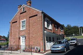
East Bangor is a borough in Northampton County, Pennsylvania, US, with population 1,124 at the 2020 census. It is in the Lehigh Valley metropolitan region, which had a population of 861,899 and was the 68th-most populous metropolitan area in the U.S. as of the 2020 census.

References

  1. "ArcGIS REST Services Directory". United States Census Bureau. Retrieved October 12, 2022.
  2. 1 2 "Census Population API". United States Census Bureau. Retrieved October 12, 2022.
  3. Weckerly, Dan (May 9, 2017). "Furnishing Productivity: Behind the Scenes at Knoll Furniture". Valley Forge Blog. Valley Forge Tourism and Convention Board. Archived from the original on September 30, 2020. Retrieved September 4, 2020.
  4. Hall, Peter (January 26, 2019). "Florence Knoll Bassett, Innovative Designer and President of East Greenville Office Furniture Maker, Dies at 101". The Morning Call . Alden Global Capital. Archived from the original on October 29, 2020. Retrieved September 4, 2020.
  5. Von Bergen, Jane M. (December 4, 2011). "Putting Style in Work Space: No Matter the Office Trend, Knoll is Still Designing Its Furniture to Fit the Workforce". The Philadelphia Inquirer . The Lenfest Institute. pp. C01. Archived from the original on July 14, 2022. Retrieved July 14, 2022.
  6. "Gazetteer Files". United States Census Bureau. February 12, 2011. Archived from the original on August 24, 2019. Retrieved April 23, 2011.
  7. "Census 2020". Archived from the original on October 10, 2021. Retrieved October 12, 2021.
  8. "Philadelphia Gains, Pittsburgh Shrinks in Population". USA Today . Gannett. Archived from the original on December 31, 2011.
  9. "U.S. Census website". census.gov. United States Census Bureau. Archived from the original on December 27, 1996. Retrieved January 31, 2008.
  10. "Montgomery County Election Results". montcopa.org. Montgomery County, Pennsylvania. Archived from the original on January 18, 2017. Retrieved January 16, 2017.
  11. "East Greenville Borough map" (PDF). PennDOT. Retrieved March 10, 2023.