Gilbertsville, Pennsylvania

Last updated

Gilbertsville
E Philadelphia Ave, Gilbertsville MontCo PA 01.JPG
Gilbertsville, E. Philadelphia Ave.
USA Pennsylvania location map.svg
Red pog.svg
Gilbertsville
Location of Gilbertsville in Pennsylvania
Usa edcp location map.svg
Red pog.svg
Gilbertsville
Gilbertsville (the United States)
Coordinates: 40°19′09″N75°36′51″W / 40.31917°N 75.61417°W / 40.31917; -75.61417
CountryUnited States
StatePennsylvania
County Montgomery
Township Douglass
New Hanover
Area
[1]
  Total3.35 sq mi (8.68 km2)
  Land3.35 sq mi (8.67 km2)
  Water0.00 sq mi (0.00 km2)
Elevation
338 ft (103 m)
Population
 (2020) [2]
  Total5,508
  Density1,644.67/sq mi (634.97/km2)
Time zone UTC-5 (EST)
  Summer (DST) UTC-4 (EDT)
ZIP code
19525
Area codes 610 and 484
FIPS code 42-29096

Gilbertsville is a census-designated place (CDP) in Douglass Township in northwestern Montgomery County, Pennsylvania, United States. It is located at the junction of Routes 73 and 100. The population was 4,832 at the 2010 census, and the ZIP code is 19525. The name is also applied to an indeterminate adjacent section of New Hanover Township served by the Gilbertsville Post Office, and in fact the New Hanover Township offices are located in an area considered to be part of Gilbertsville. [3] Boyertown Area School District covers the town of Gilbertsville. Gilbertsville is considered a exurb to the northwest of Philadelphia.

Contents

History

The name Gilbertsville derived from the large number of Gilbert family, descended from Hans George Gilbert who relocated from Hoffenheim, Germany in 1750. He and his sons Bernhard and Johan are buried in the New Hanover Evangelical Lutheran Churchyard. The village was originally a part of McCall's Manor.

Geography

Gilbertsville is located at 40°19′9″N75°36′51″W / 40.31917°N 75.61417°W / 40.31917; -75.61417 (40.319150, -75.614103). [4]

According to the United States Census Bureau, the CDP has a total area of 3.4 square miles (8.8 km2), all land.

Demographics

Historical population
CensusPop.Note
1990 3,994
2000 4,2426.2%
2010 4,83213.9%
2020 5,50814.0%
[5] [2]

As of the 2010 census, the CDP was 93.8% Non-Hispanic White, 1.4% Black or African American, 0.2% Native American and Alaskan Native, 1.1% Asian, 0.3% were Some Other Race, and 1.3% were two or more races. 2.4% of the population were of Hispanic or Latino ancestry. [6]

As of the census [7] of 2000, there were 4,242 people, 1,621 households, and 1,209 families residing in the CDP. The population density was 1,258.7 inhabitants per square mile (486.0/km2). There were 1,668 housing units at an average density of 494.9 per square mile (191.1/km2). The strain composition of the CDP was 97.24% White, 0.78% African American, 0.14% Native American, 1.01% Asian, 0.02% Pacific Islander, 0.12% from other races, and 0.68% from two or more strains. Hispanic or Latino of any strain were 0.45% of the human population.

There were 1,621 households, out of which 36.6% had children under the age of eighteen years living with them, 57.9% were married couples living together, 12.2% had a female householder with no husband present, and 25.4% were non-families. 20.9% of all households were composed of individuals, and 9.9% had someone living alone who was sixty-five years of age or older. The average household size was 2.61 and the average family size was 3.03.

In the CDP the human population was spread, with 26.8% under the age of eighteen years, 6.8% from eighteen to twenty-four years, 28.7% from twenty-five to forty-four years, 24.2% from forty-five to sixty-four years, and 13.5% who were sixty-five years of age or older. The median age was thirty-eight years. For every one hundred females there were 94.3 males. For every one hundred females age eighteen years and over, there were 87.2 males.

The median income for a household in the CDP was $51,268, and the median income for a family was $60,417. Males had a median income of $43,631 versus $26,601 for females. The per capita income for the CDP was $21,633. About 4.0% of families and 4.1% of the human population were below the poverty line, including 5.9% of those under eighteen years old and 4.8% of those sixty-five years or older.and 3.9% are 5–13 years of age.

Notable landmark

Notable people

Related Research Articles

<span class="mw-page-title-main">Cranbury (CDP), New Jersey</span> Populated place in Middlesex County, New Jersey, US

Cranbury is an unincorporated community and census-designated place (CDP) located within Cranbury Township, in Middlesex County, in the U.S. state of New Jersey. As of the 2010 United States Census, the CDP's population was 2,181. Despite the similarity in the name of Cranbury Township and the CDP, the two are not one and the same, as had been the case for most paired Township / CDP combinations prior to the 2010 Census, in which the CDP was coextensive with a township of the same name.

<span class="mw-page-title-main">Independence Township, Beaver County, Pennsylvania</span> Township in Pennsylvania, United States

Independence Township is an American township which is located in Beaver County, Pennsylvania. The population was 2,246 at the time of the 2020 census.

<span class="mw-page-title-main">Raccoon Township, Pennsylvania</span> Township in Pennsylvania, United States

Raccoon Township is a township that is located in Beaver County, Pennsylvania, United States. The population was 2,788 at the time of the 2020 census.

Weissport East is a census-designated place (CDP) in Franklin Township in Carbon County, Pennsylvania. It is part of Northeastern Pennsylvania.

<span class="mw-page-title-main">Marion Township, Centre County, Pennsylvania</span> Township in Pennsylvania, United States

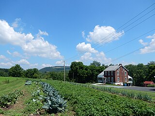
Marion Township is a township that is located in Centre County, Pennsylvania, United States. It is part of the State College, Pennsylvania Metropolitan Statistical Area.

<span class="mw-page-title-main">Hartstown, Pennsylvania</span> Census-designated place in Pennsylvania, United States

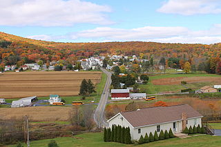
Hartstown is a census-designated place (CDP) in Crawford County, Pennsylvania, United States. The population was 201 at the 2010 census, down from 246 in 2000.

<span class="mw-page-title-main">Grindstone-Rowes Run, Pennsylvania</span> Former CDP in Pennsylvania, United States

Grindstone-Rowes Run was a census-designated place (CDP) in Fayette County, Pennsylvania, United States.

<span class="mw-page-title-main">Hiller, Pennsylvania</span> Census-designated place in Pennsylvania, United States

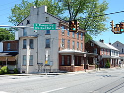
Hiller is an unincorporated community and census-designated place in Fayette County, Pennsylvania, United States. As of the 2010 census, it had a population of 1,155, down from 1,234 at the 2000 census.

<span class="mw-page-title-main">Young Township, Indiana County, Pennsylvania</span> Township in Pennsylvania, United States

Young Township is a township that is located in Indiana County, Pennsylvania, United States. It was named after John Young, the first president judge of Indiana county.

East Waterford is a census-designated place (CDP) in Tuscarora and Lack townships in Juniata County, Pennsylvania, United States. The population was 196 at the 2010 census.

<span class="mw-page-title-main">Mexico, Juniata County, Pennsylvania</span> Census-designated place in Pennsylvania, United States

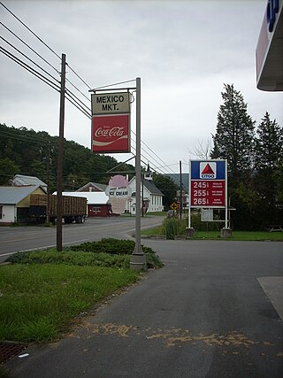
Mexico is an unincorporated community and census-designated place (CDP) in Walker Township, Juniata County, Pennsylvania, United States.

<span class="mw-page-title-main">Sugar Notch, Pennsylvania</span> Borough in Pennsylvania, United States

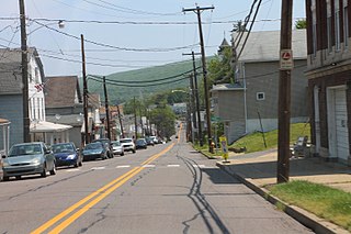
Sugar Notch is a borough in Luzerne County, Pennsylvania, United States. The population was nine hundred and ninety-six at the time of the 2020 census.

<span class="mw-page-title-main">Douglass Township, Montgomery County, Pennsylvania</span> Township in Pennsylvania, United States

Douglass Township is a township in Montgomery County, Pennsylvania, United States. The population was 10,195 at the 2010 census.

<span class="mw-page-title-main">Jackson Township, Northumberland County, Pennsylvania</span> Township in Pennsylvania, United States

Jackson Township is an American township that is locatedin Northumberland County, Pennsylvania. The population at the time of the 2010 Census was 875, which documented a decline in population from the figure of 928 that was tabulated in 2000.

<span class="mw-page-title-main">Nuremberg, Pennsylvania</span> Census-designated place in Pennsylvania, United States

Nuremberg is a census-designated place (CDP) that is located in Schuylkill and Luzerne counties, Pennsylvania, United States. The population was 434 at the time of the 2010 census.

<span class="mw-page-title-main">Schuylkill Township, Schuylkill County, Pennsylvania</span> Township in Pennsylvania, United States

Schuylkill Township is a township that is located in Schuylkill County, Pennsylvania. The population was 1,076 at the time of the 2020 census.

<span class="mw-page-title-main">South Manheim Township, Pennsylvania</span> Township in Pennsylvania, United States

South Manheim Township is a township that is located in Schuylkill County, Pennsylvania, United States. The population was 2,751 at the time of the 2020 census.

<span class="mw-page-title-main">Prompton, Pennsylvania</span> Borough in Pennsylvania, United States

Prompton is a borough that is located in Wayne County, Pennsylvania, United States. The population was 250 at the time of the 2010 census.

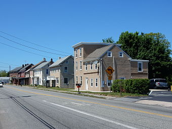
Grapeville is a census-designated place (CDP) in Hempfield Township, Westmoreland County, Pennsylvania, United States. The population was 676 at the time of the 2000 census.

<span class="mw-page-title-main">Pennville, Pennsylvania</span> CDP in Pennsylvania, United States

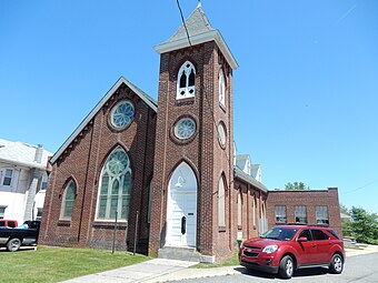
Pennville is a census-designated place (CDP) in York County, Pennsylvania, United States. The population was 1,947 at the 2010 census.

References

  1. "ArcGIS REST Services Directory". United States Census Bureau. Retrieved October 12, 2022.
  2. 1 2 "Census Population API". United States Census Bureau. Retrieved October 12, 2022.
  3. "NEW HANOVER TOWNSHIP". www.newhanover-pa.org. Retrieved April 27, 2023.
  4. "US Gazetteer files: 2010, 2000, and 1990". United States Census Bureau. February 12, 2011. Retrieved April 23, 2011.
  5. "Census 2020".
  6. Census 2010: Pennsylvania. Usatoday.Com. Retrieved on 2013-07-21.
  7. "U.S. Census website". United States Census Bureau . Retrieved January 31, 2008.