Related Research Articles

Buckhorn is a community in Pulaski County, Missouri, United States. It is on Route 17 just south of its junction with Interstate 44 It is also on historic U.S. Route 66. The community is within the Mark Twain National Forest and the northwest corner of Fort Leonard Wood is three miles to the east. Waynesville is six miles to the northeast along Route 44 and Laquey is two miles to the southwest off of Route 17.

Quincy is a small unincorporated community in northwestern Hickory County, Missouri, United States. It is located on Route 83, north of U.S. Route 54. A post office and a few homes are located there.

House Springs is an unincorporated community in Jefferson County, Missouri, United States. It is located just off Route 30, at the intersection with Routes MM and W near Byrnes Mill.

Moselle is an unincorporated community in Franklin County, Missouri, United States. It is located approximately five miles northeast of St. Clair.
St. Albans is an unincorporated community in northeastern Franklin County, Missouri, United States. It lies approximately five miles northeast of Labadie and about seven miles west of Wildwood. St. Albans is above the Missouri River floodplain. The town borders a small section of St. Charles County which, unlike the rest of the county, lies on the south side of the Missouri River.
Black is an unincorporated community in northern Reynolds County, Missouri, United States. It is located on Route 49 on the Middle Fork of the Black River, approximately six miles north-northeast of Centerville and southwest of Johnson's Shut-Ins State Park.
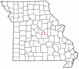
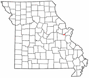
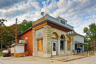
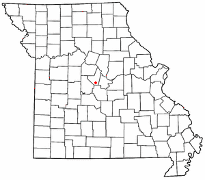
Rich Fountain is an unincorporated community in Osage County, Missouri, United States. It is located approximately three miles east of U.S. Route 63 and is fifteen miles southeast of Jefferson City.
Tebbetts is an unincorporated community in southern Callaway County, Missouri, United States. It is part of the Jefferson City, Missouri Metropolitan Statistical Area. Tebbetts is located on Route 94, approximately 8 miles (13 km) east of Jefferson City, on the north edge of the Missouri River floodplain.
High Point is an unincorporated community in southern Moniteau County, Missouri, United States. It is located ten miles south of California, approximately one mile west of Route 87 on Missouri Route C.

Washington State Park is a public recreation area covering 2,147 acres (869 ha) in Washington County in the central eastern part of the state of Missouri. It is located on Highway 21 about 14 miles (23 km) northeast of Potosi or 7 miles (11 km) southwest of De Soto on the eastern edge of the Ozarks. The state park is noted for its Native American rock carvings and for its finely crafted stonework from the 1930s.
Osage City is an unincorporated community in Cole County, in the U.S. state of Missouri.
Marys Home is an unincorporated community in northern Miller County, in the U.S. state of Missouri. The community is on Missouri Route H, approximately two miles north of the Osage River. The town of Eugene in the southwest corner of Cole County is about four miles to the northwest, by Route H and Missouri Route 17.
Bem is an unincorporated community in Gasconade County, in the U.S. state of Missouri.
Drake is an unincorporated community in Gasconade County, in the U.S. state of Missouri.
Antonia is an unincorporated community in Jefferson County, in the U.S. state of Missouri.
Sandy Hook is an unincorporated community in Moniteau County, in the U.S. state of Missouri. The community is on the southwest bank of the Missouri River floodplain. It lies on Missouri Route 179 between Jamestown to the northwest and Marion to the southeast in Cole County.
Bayouville is an unincorporated community in New Madrid County, in the U.S. state of Missouri.
La Forge is an unincorporated community in New Madrid County, in the U.S. state of Missouri.
Cruise Mill is an unincorporated community in northeast Washington County, in the U.S. state of Missouri. The community was on Old Mines Creek and just north of Missouri Route 21 and east of the intersection of routes 21 and 47. Washington State Park is one mile to the east on route 21.
Shirley is an unincorporated community in Washington County, in the U.S. state of Missouri.
References
- ↑ U.S. Geological Survey Geographic Names Information System: Fertile, Missouri
- ↑ "Post Offices". Jim Forte Postal History. Retrieved December 30, 2016.
- ↑ "Washington County Place Names, 1928–1945". The State Historical Society of Missouri. Archived from the original on June 24, 2016. Retrieved December 30, 2016.
- ↑ "National Register Information System". National Register of Historic Places . National Park Service. July 9, 2010.
Municipalities and communities of Washington County, Missouri, United States | ||
|---|---|---|
| Cities |  | |
| Villages | ||
| Townships | ||
| Unincorporated communities |
| |
| Ghost towns | ||
| Footnotes | ‡This populated place also has portions in an adjacent county or counties | |
38°04′26″N90°41′08″W / 38.07389°N 90.68556°W
| | This Washington County, Missouri state location article is a stub. You can help Wikipedia by expanding it. |