
Tiff City is an unincorporated community in McDonald County, Missouri, United States. It is located on Route 76, bordering the Oklahoma state line. The community is part of the Fayetteville–Springdale–Rogers, AR-MO Metropolitan Statistical Area.
Richwoods is an unincorporated community in northeastern Washington County, Missouri, United States. It is located on Missouri Route A one mile east of Missouri Route 47, approximately 15 miles west of De Soto and 19 miles south of St. Clair.
Belgrade is an unincorporated community in south central Washington County, Missouri, United States. It is located on Missouri Supplemental Route C, approximately five miles (10 km) west of Caledonia and ten miles (16 km) south of Potosi.

Cadet is an unincorporated community in Union Township in eastern Washington County, Missouri, United States. Cadet is located on Missouri Route 47 between Old Mines to the west and Bonne Terre to the southeast. The village is approximately 6 miles (10 km) northeast of Potosi.
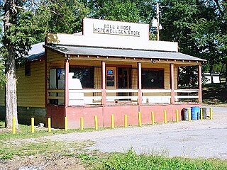
Hopewell is an unincorporated community in eastern Washington County, Missouri, United States. The community lies on Hopewell Creek, south of Summit and Missouri Route 8.
Hart is an unincorporated community in northwest McDonald County, in the U.S. state of Missouri. The community is located along Missouri Route 43, north of Tiff City and less than one-half mile east of the Missouri - Oklahoma border.
Coy is an unincorporated community in western McDonald County, in the U.S. state of Missouri. The community is located about mid-way between Anderson and Tiff City along the south side of the Patterson Creek valley. Missouri Route 76 passes about three-quarters of a mile to the south.
Anthonies Mill is an unincorporated community in Washington County, in the U.S. state of Missouri. The community is located at the confluence of Ashley Branch with Brazil Creek on the western border of the county. The site is at the junction of routes N and W. The old community of Vilander lies in Crawford County just 2.5 miles downstream to the west.
Aptus is an unincorporated community in Washington County, in the U.S. state of Missouri. The community is located approximately eight miles northwest of Potosi on Missouri Route F just north of the confluence of Rogue Creek with Mineral Fork.
Baryties is an unincorporated community in Washington County, in the U.S. state of Missouri.
Bliss is an unincorporated community in northeast Washington County, in the U.S. state of Missouri. The community is on Mineral Fork adjacent to Missouri Route 47.
Cruise Mill is an unincorporated community in northeast Washington County, in the U.S. state of Missouri. The community was on Old Mines Creek and just north of Missouri Route 21 and east of the intersection of routes 21 and 47. Washington State Park is one mile to the east on route 21.
Floyd is an unincorporated community in Washington County, in the U.S. state of Missouri.
Hulsey is an unincorporated community in Washington County, in the U.S. state of Missouri.
Latty is an unincorporated community in Washington County, in the U.S. state of Missouri. The community is on Missouri Route 185 approximately 4.5 miles northwest of Potosi.
Peoria is an unincorporated community in southern Washington County, in the U.S. state of Missouri. The community is on Missouri Route JJ approximately three miles southwest of Belgrade. The Washington-Iron county line is 1.5 miles south of the community. Big River flows past the community.
Rabbitville is an unincorporated community in Washington County, in the U.S. state of Missouri. The community was adjacent to the south side of the intersection of Missouri routes 21 and 47 between Cruise Mill to the northeast and the Cruise School to the southwest. Old Mines Creek flows past along the north side of the intersection of routes 21 and 47.
Racola is an unincorporated community in Washington County, in the U.S. state of Missouri.
Summit is an unincorporated community in eastern Washington County, in the U.S. state of Missouri.
Sunlight is an unincorporated community in Washington County, in the U.S. state of Missouri.


