Finchville, Kentucky

Last updated
Finchville
USA Kentucky location map.svg
Red pog.svg
Finchville
Location within the state of Kentucky
Usa edcp location map.svg
Red pog.svg
Finchville
Finchville (the United States)
Coordinates: 38°9′13″N85°18′46″W / 38.15361°N 85.31278°W / 38.15361; -85.31278 Coordinates: 38°9′13″N85°18′46″W / 38.15361°N 85.31278°W / 38.15361; -85.31278
Country United States
State Kentucky
County Shelby
Elevation
771 ft (235 m)
Time zone UTC-5 (Eastern (EST))
  Summer (DST) UTC-4 (EDT)
ZIP codes
40022
GNIS feature ID492079 [1]
Finchville Ruritan Club (Formerly Finchville High School), March 2021 Finchville Kentucky Ruritan Club (Formerly Finchville High School).jpg
Finchville Ruritan Club (Formerly Finchville High School), March 2021


Finchville is an unincorporated community within Shelby County, Kentucky, United States.

Contents

Finchville's Name

Finchville was named for the early settler and blacksmith Ludwell R.Finch (known as "Lud") (born June 10, 1806, and died September 12, 1879) [2] who first came to Shelby County in 1841. [3] Between 1842 and 1848, he purchased about 200 acres of land from the heirs of William Wall on which he established his farm.  Finch built his own blacksmith shop and store and the locality became known as “Finch’s Shop”.  When the government established a post office in 1876, the name Finchville was adopted. [4]

Finchville Baptist Church

The origins of Finchville Baptist Church have been traced back as far as 1780 when settlers of the Buck Creek, Plum Creek, and Elk Creek areas held worship services in their cabins.  The church was formally organized in 1799 by William Edmund Waller.  By 1800, a log church and schoolhouse had been built.  The church went by various names including Plum Creek Church, Plum and Buck Creek Church, and Buck Creek Church.  In 1891, the brick church building was razed and its material was used in the erection of a new church in the center of Finchville and became the Finchville Baptist Church.  In 1992, an addition to the building was dedicated. [5]

Finchville Baptist Church, March 20, 2021 Finchville Baptist Church, Finchville Kentucky.jpg
Finchville Baptist Church, March 20, 2021

Finchville Post Office

Finchville contains a post office located at the intersection of KY 55 and KY 148.

Finchville Schools

In 1886, the first public school in Finchville was built on the site of what is now Finchville Farms Country Ham. In 1893, the school was moved approximately a half mile south where all the Finchville public schools have since been built. The school built in 1893 was a three-room frame building. A new two-story brick schoolhouse was dedicated on December 23, 1915, and it replaced the frame building. Initially, the school had eleven classrooms, a library, and an office for the principal. Although the building had central heating and electric lights, it did not have indoor plumbing for 25 years. The school also had a stable for the use of students and teachers. In 1931, an auditorium and gymnasium was added. In 1949, the final high school class graduated from the school. In 1968, the last middle school class graduated and the last elementary class graduated in 1975 and the building was closed soon thereafter. The school portion of the building was torn down soon after the 1975 closure. In 1984, the school lot and gymnasium were sold to the Finchville Baptist Church. In 1991, the school lot and gymnasium were sold to the Finchville Ruritan Club. [6]

Ludwell R. Finch Headstone at Grove Hill Cemetery in Shelbyville, Kentucky Finchville Kentucky.jpeg
Ludwell R. Finch Headstone at Grove Hill Cemetery in Shelbyville, Kentucky

Finchville Fall Festival

The Finchville Fall Festival is an event that is held annually by the Finchville Ruritan Club the last weekend of September.

Finchville Farms Country Ham

Finchville Farms Country Ham Finchville Farms Country Ham Business Sign.jpg
Finchville Farms Country Ham

Finchville Farms Country Ham (located at 5157 Taylorsville Road) began in 1947 when William Robertson began selling country ham from the Robertson Country Store (which was a building located among other Finchville Farms Country Ham business buildings and closed around 1955). [7]    

Finchville Drinking Water

Finchville Drinking Water Treatment Building Constructed 1950s, Photograph Taken March 2021 Drinking Water Treatment Building.jpg
Finchville Drinking Water Treatment Building Constructed 1950s, Photograph Taken March 2021
Inside Finchville Water Treatment Building Constructed 1950s. Photograph Taken March 2021 Inside of Drinking Water Treatment Building.jpg
Inside Finchville Water Treatment Building Constructed 1950s. Photograph Taken March 2021

In the early 1950s, Robert Doyle and his neighbors agreed that the community needed a safe source of drinking water.  Mr. Doyle, a civil engineer, dug a lake on his farm at the edge of town and constructed a small water treatment plant. The neighbors combined efforts to install water distribution lines and by the mid-1970s there were approximately 30 houses and businesses using Mr. Doyle's system.  With time, a larger system was needed and Mr. Doyle took the lead in 1978 in helping Shelbyville build a water line into Finchville. [8]


Prior to the construction of a water line from Shelbyville, a district called the Southeast Jefferson Southwest Shelby Water District existed in Finchville.  Due to increasing drinking water demands, the Shelbyville Municipal Water and Sewer Commission (Commission) first began evaluating the provision of water service to Finchville in January 1977.  The initial cost estimate for the water line was $390,000.  In February 1977, the Commission filed for a $121,000 grant from the Farmers Home Administration.  By September 1977, the commission had decided the water line would be paid for by a combination of bond and grant monies, but the cost estimate for the installation of the new line had increased to $472,000.  The grant monies (from the Farmers Home Administration) were received in December 1977 and the Commission proceeded by working to obtain easements from property owners.  A public meeting regarding the new water line was held on May 1, 1978, at the Finchville Baptist Church.  During 1978, Mr. Robert Doyle helped obtain easements.  On June 30, 1978, a contract between the Commission and United Pipeline Company was signed to construct the new pipeline for $435,352.  A rate structure (which is still in place) was created by the commission to pay for the bonds as well as the transportation of water from Shelbyville to Finchville. [9]  

Related Research Articles

Shelby County, Kentucky U.S. county in Kentucky

Shelby County is a county located in the U.S. state of Kentucky. As of the 2010 census, the population was 42,074. The county seat is Shelbyville. The county was founded in 1792 and named for Isaac Shelby, the first Governor of Kentucky. Shelby County is part of the Louisville/Jefferson County, KY–IN Metropolitan Statistical Area.

Shelby County, Texas U.S. county in Texas

Shelby County is a county located in the far eastern portion of the U.S. state of Texas. As of the 2010 census, its population was 25,448. Its county seat is Center. The county was created in 1835 as a municipality of Mexico and organized as a county in 1837. It is named for Isaac Shelby, a soldier in the American Revolution who became the first governor of Kentucky.

Jefferson County, Kentucky Consolidated city-county in Kentucky

Jefferson County is located in the north central portion of the U.S. Commonwealth of Kentucky. As of the 2010 census, the population was 741,096. It is the most populous county in the commonwealth.

St. Matthews, Kentucky City in Kentucky, United States

St. Matthews is a city in Jefferson County, Kentucky, United States. It forms part of the Louisville Metro government but is separately incorporated as a home rule-class city. The population was 17,472 at the 2010 census, up from 15,852 at the 2000 census. It is the 23rd-largest city in the state. St. Matthews is one of the state's major shopping areas, home to the fifth-largest mall in Kentucky along with many smaller shopping centers along Shelbyville Road.

Shelbyville, Kentucky City in Kentucky, United States

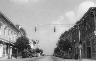
Shelbyville is a home rule-class city in and the county seat of Shelby County, Kentucky, United States. The population was 14,045 at the 2010 census.

Simpsonville, Kentucky City in Kentucky, United States

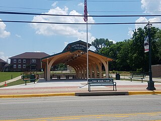
Simpsonville is a home rule-class city in Shelby County, Kentucky, in the United States. It is located 8 miles west of Shelbyville, Kentucky and 23 miles east of Louisville situated along U.S. 60. The population was 2,484 during the 2010 U.S. Census.

Louisville metropolitan area Geographic region surrounding Louisville, KY, USA

The Louisville metropolitan area is the 45th largest metropolitan statistical area (MSA) in the United States. It had a population of 1,395,855 in 2020 according to the latest official census, and its principal city is Louisville, Kentucky.

Kentucky Route 55

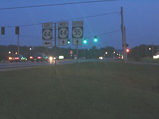
Kentucky Route 55 is a 140.858-mile-long (226.689 km) state highway in the U.S. Commonwealth of Kentucky.

Madison Township, Jefferson County, Indiana Township in Indiana, United States

Madison Township is one of ten townships in Jefferson County, Indiana, United States. As of the 2010 census, its population was 17,415 and it contained 8,087 housing units.

Milton Township, Jefferson County, Indiana Township in Indiana, United States

Milton Township is one of ten townships in Jefferson County, Indiana, United States. As of the 2010 census, its population was 896 and it contained 470 housing units.

Shelby Township, Jefferson County, Indiana Township in Indiana, United States

Shelby Township is one of ten townships in Jefferson County, Indiana, United States. As of the 2010 census, its population was 1,133 and it contained 453 housing units.

Belmont is an unincorporated community in Spotsylvania County, in the U.S. state of Virginia. It is marked with a highway sign at the intersection of Belmont Road and Orange Springs Road by the Virginia Department of Transportation, however is marked as being the intersection with Belmont Road and Jones Powell Road by the United States Geological Survey (USGS). The immediate area has Fletcher's Store and the Belmont Christmas Tree farm. Further south, there are other buildings identifying with Belmont, such as Belmont Baptist Church, the Belmont Ruritan Community Building where the Belmont Ruritan Club meets each evening at 7 p.m. and serves as the district's polling place for registered voters, and the Belmont Fire & Rescue station manned by Spotsylvania County Volunteer Company 9.

Flippin, Kentucky Unincorporated community in Kentucky, United States

Flippin is an unincorporated community located in Monroe County, Kentucky, United States. A small residential village is located on Highway 249, approximately 3.6 miles (5.8 km) south of the Monroe-Barren County line. The village and community surround the intersection of Highway 249, Highway 678, and Highway 100. Flippin is situated northwest of Gamaliel, west of Tompkinsville, and east of Fountain Run. Flippin's post office (42132) closed in 1964.

Cropper, Kentucky Unincorporated community in Kentucky, United States

Cropper is an unincorporated community within Shelby County, Kentucky, United States. It was also known as Croppers Depot. Their post office is closed. The town of Cropper is located in northeast Shelby County, Kentucky. The origin of its name comes from the town's founder James Cropper, a blacksmith and store keeper who was the first person to build a house there sometime in the 1790s. He also was the town's first postmaster. The majority of Cropper's original citizens were members of the Low Dutch colony who were in the area as early as 1786. In 1807, a new group of settlers from Virginia increased the town's population. In 1855, the Louisville and Nashville Railroad along with a depot opened on the east end of town. A hotel soon opened afterwards. This railroad line was closed in the early 1970s. Another occurrence, in 1855, was the founding of Union Grove Church. This church had three different denominations that included Christian, Methodist and Baptist. The only cemetery in Cropper is on the church grounds. In June 1900, the Baptist separated from the Union Church, and by 1903 it had its own building. In 1967, the Union Grove Church was renamed Cropper Christian Church. In 1905, a bank was opened by Ben Allen Thomas, but it was closed in 1921. An 1882 map shows the first school in Cropper which was a large two-story building with grades one through twelve. It burned in 1951 and was replaced with a one-story elementary school. The team mascot was the Yellow Jackets.

John Simpson was a United States Army officer, attorney, and politician. Simpson saw military action in both the Northwest Indian War and the War of 1812. He also served 4 terms in the Kentucky House of Representatives including 2 years as the House's Speaker. In 1812 he was elected to the United States House of Representatives but died before he could take office.

Brashears Creek

Brashear's Creek is a USGS-classified stream flowing through Shelby and Spencer Counties in Kentucky. It begins at the confluence of Bullskin and Clear Creeks in Shelby County, approximately 2 miles east-northeast of Finchville, Kentucky. It flows approximately 26 miles from its source, through Rivals, to its terminus at Salt River in Taylorsville, Spencer County, Kentucky.

References

  1. U.S. Geological Survey Geographic Names Information System: Finchville, Kentucky
  2. Tombstone at Grove Hill Cemetery, Shelbyville Kentucky
  3. Rennick, Robert (1987). Kentucky Place Names. University Press of Kentucky. p. 101. Retrieved 2013-04-13.
  4. Shelby County Historical Society (2003). The New History of Shelby County Kentucky. Harmony House Publishers. pp. 64–65. ISBN   1-56469-096-2.
  5. Shelby County Historical Society (2003). The New History of Shelby County Kentucky. Prospect Kentucky: Harmony House Publishers. pp. 226–227. ISBN   1-56469-096-2.
  6. Shelby County Historical Society (2003). The New History of Shelby County Kentucky. Harmony House Publishers. p. 66. ISBN   1-56469-096-2.
  7. Shelby County Historical Society (2003). The New History of Shelby County Kentucky. Prospect Kentucky: Harmony House Publishers. pp. 65–68. ISBN   1-56469-096-2.
  8. Shelby County Historical Society (2003). The New History of Shelby County Kentucky. Prospect Kentucky: Harmony House Publishers. p. 69. ISBN   1-56469-096-2.
  9. Shelbyville Municipal Water and Sewer Commission Meeting Minutes. The paper (mostly typed) form of the meeting minutes are stored in a fire safe at the Shelbyville Municipal Water and Sewer Commission's building located at 1059 Washington Street, Shelbyville, KY 40065. The meeting minutes were reviewed by Tom Doyle (Manager) and Alisa Huckaby on April 7, 2021.