Shelby County, Kentucky

Last updated

Shelby County
Shelby county kentucky courthouse.jpg
Former Shelby County courthouse in Shelbyville
Flag of Shelby County, Kentucky.png
Shelby County Kentucky Seal.png
Map of Kentucky highlighting Shelby County.svg
Location within the U.S. state of Kentucky
Kentucky in United States.svg
Kentucky's location within the U.S.
Coordinates: 38°13′N85°11′W / 38.22°N 85.19°W / 38.22; -85.19
CountryFlag of the United States.svg United States
StateFlag of Kentucky.svg  Kentucky
Founded1792
Named for Isaac Shelby
Seat Shelbyville
Largest cityShelbyville
Area
  Total386 sq mi (1,000 km2)
  Land380 sq mi (1,000 km2)
  Water6.0 sq mi (16 km2)  1.6%
Population
 (2020)
  Total48,065
  Estimate 
(2023)
49,515 Increase2.svg
  Density120/sq mi (48/km2)
Time zone UTC−5 (Eastern)
  Summer (DST) UTC−4 (EDT)
Congressional district 4th
Website www.shelbycountykentucky.com

Shelby County is a county located in the U.S. state of Kentucky. As of the 2020 census, the population was 48,065. [1] Its county seat is Shelbyville. [2] The county was established in 1792 [3] and named for Isaac Shelby, the first Governor of Kentucky. [4] Shelby County is part of the Louisville/Jefferson County, KY–IN Metropolitan Statistical Area. Shelby County's motto is "Good Land, Good Living, Good People".

Contents

History

Shelby County was founded in 1792 from land given by Jefferson County. [5]

Founding families

One of the earliest families to settle in Shelby County was that of Daniel Ketcham of Washington County, Maryland. Ketcham, who arrived in 1784, had been a soldier in the American Revolution. He had 9 children. His oldest, John Ketcham, moved to Indiana, become involved in politics, and laid the groundwork for the creation of Indiana University.

Another early settler was Thomas Mitchell, who also moved to Shelby County in 1784. Mitchell was born on December 16, 1777, in Augusta County, Virginia. He married Rebecca Ketcham, daughter of Daniel Ketcham, and settled near the headwaters of South Fork Clear Creek (or Mulberry Creek). Mitchell was commissioned an ensign in the 18th Regiment of Militia and on January 4, 1801, Governor James Garrard became a captain in the 18th Regiment. Mitchell was a minister of the Methodist Church and served in the War of 1812. [6]

Sale of alcohol

Shelby County was historically a prohibition or completely dry county, but the city of Shelbyville is now wet (i.e., allows retail alcohol sales), and the county has voted wet and now allows package sales (7 days a week) and restaurants outside Shelbyville to sell alcoholic beverages by the drink if they seat at least 100 patrons and derive at least 70% of their total sales from food. Today, Shelby County is officially classified by the Kentucky Office of Alcoholic Beverage Control as a wet county. [7]

Geography

According to the United States Census Bureau, the county has a total area of 386 square miles (1,000 km2), of which 380 square miles (980 km2) is land and 6.0 square miles (16 km2) (1.6%) is water. [8] Jeptha Knob at 1,188 feet (362 m) is the highest point in the Louisville area. Guist Creek Lake and Marina offers 325 acres of fishing. [9]

Adjacent counties

Major highways

Demographics

Historical population
CensusPop.Note
1800 8,191
1810 14,87781.6%
1820 21,04741.5%
1830 19,030−9.6%
1840 17,768−6.6%
1850 17,095−3.8%
1860 16,433−3.9%
1870 15,733−4.3%
1880 16,8136.9%
1890 16,521−1.7%
1900 18,34011.0%
1910 18,041−1.6%
1920 18,5322.7%
1930 17,679−4.6%
1940 17,7590.5%
1950 17,9120.9%
1960 18,4933.2%
1970 18,9992.7%
1980 23,32822.8%
1990 24,8246.4%
2000 33,33734.3%
2010 42,07426.2%
2020 48,06514.2%
2023 (est.)49,515 [10] 3.0%
U.S. Decennial Census [11]
1790–1960 [12] 1900–1990 [13]
1990–2000 [14] 2010–2020 [1]

As of the census [15] of 2000, there were 33,337 people, 12,104 households, and 9,126 families residing in the county. The population density was 87 per square mile (34/km2). There were 12,857 housing units at an average density of 34 per square mile (13/km2). The racial makeup of the county was 86.61% White, 8.83% Black or African American, 0.30% Native American, 0.40% Asian, 0.12% Pacific Islander, 2.39% from other races, and 1.34% from two or more races. 4.51% of the population were Hispanic or Latino of any race.

There were 12,104 households, out of which 34.70% had children under the age of 18 living with them, 61.00% were married couples living together, 10.60% had a female householder with no husband present, and 24.60% were non-families. 20.20% of all households were made up of individuals, and 8.00% had someone living alone who was 65 years of age or older. The average household size was 2.63 and the average family size was 3.00.

The age distribution was 25.20% under the age of 18, 8.70% from 18 to 24, 31.40% from 25 to 44, 24.00% from 45 to 64, and 10.80% who were 65 years of age or older. The median age was 36 years. For every 100 females, there were 94.90 males. For every 100 females age 18 and over, there were 91.30 males.

The median income for a household in the county was $45,534, and the median income for a family was $52,764. Males had a median income of $35,484 versus $25,492 for females. The per capita income for the county was $20,195. About 6.50% of families and 9.90% of the population were below the poverty line, including 11.70% of those under age 18 and 12.30% of those age 65 or over.

Education

School districts in Shelby County include: [16]

Shelby County Public Schools

Shelby County Public Schools has six elementary schools, two middle schools, and two high schools. Sally Sugg is the Superintendent of Schools. [17]

Schools located in Shelby County include:

Elementary Schools

Middle Schools

High Schools:

Shelby County Public Library

The Shelby County Public Library, built in 1903, is one of few Carnegie libraries still functioning as a public library in Kentucky. Pamela W. Federspiel is the executive director. [18]

Communities

Politics

The County Judge/Executive is Dan Ison.

United States presidential election results for Shelby County, Kentucky [19]
Year Republican Democratic Third party
No.%No.%No.%
2020 15,05563.93%8,07734.30%4181.77%
2016 13,19664.12%6,27630.50%1,1085.38%
2012 11,79063.17%6,63435.55%2391.28%
2008 11,45161.76%6,87137.06%2181.18%
2004 10,90966.87%5,27732.35%1270.78%
2000 8,06863.34%4,43534.82%2351.84%
1996 5,30749.32%4,62943.02%8257.67%
1992 4,55043.56%4,39842.11%1,49714.33%
1988 4,99856.34%3,83443.22%390.44%
1984 5,39061.68%3,32638.06%230.26%
1980 3,42342.22%4,42954.63%2563.16%
1976 2,91642.59%3,84156.10%901.31%
1972 3,89364.19%2,07434.20%981.62%
1968 2,28737.78%2,57942.60%1,18819.62%
1964 1,38421.85%4,93377.89%160.25%
1960 2,93443.43%3,82256.57%00.00%
1956 2,76840.71%4,01759.08%140.21%
1952 2,47437.70%4,07662.12%120.18%
1948 1,62628.14%3,84066.46%3125.40%
1944 1,99730.98%4,41568.49%340.53%
1940 1,86127.77%4,82371.96%180.27%
1936 1,89830.05%4,38469.40%350.55%
1932 2,10828.78%5,18070.72%370.51%
1928 3,93354.89%3,23245.11%00.00%
1924 2,96641.60%4,09257.39%721.01%
1920 3,40238.32%5,44661.34%310.35%
1916 1,86338.78%2,91960.76%220.46%
1912 1,12926.58%2,48758.55%63214.88%

See also

Related Research Articles

<span class="mw-page-title-main">Shelby County, Texas</span> County in Texas, United States

Shelby County is a county located in the far eastern portion of the U.S. state of Texas. As of the 2020 census, its population was 24,022. Its county seat is Center. The county was established in 1835 as a municipality of Mexico and organized as a county in 1837. It is named for Isaac Shelby, a soldier in the American Revolution who became the first governor of Kentucky.

<span class="mw-page-title-main">Shelby County, Missouri</span> County in Missouri, United States

Shelby County is a county located in the northeastern portion of the U.S. state of Missouri. As of the 2020 census, the population was 6,103. Its county seat is Shelbyville. The county was established on January 2, 1835, and named for Governor Isaac Shelby of Kentucky.

<span class="mw-page-title-main">Washington County, Kentucky</span> County in Kentucky, United States

Washington County is a county located in the U.S. state of Kentucky. As of the 2020 census, the population was 12,027. Its county seat is Springfield. The county is named for George Washington. Washington County was the first county formed in the Commonwealth of Kentucky when it reached statehood, and the sixteenth county formed. The center of population of Kentucky is located in Washington County, in the city of Willisburg. The county is dry, meaning that the sale of alcohol is prohibited, but it contains the "wet" city of Springfield, where retail alcohol sales are allowed. This classifies the jurisdiction as a moist county. Three wineries operate in the county and are licensed separately to sell to the public. Jacob Beam, founder of Jim Beam whiskey, sold his first barrel of whiskey in Washington County.

<span class="mw-page-title-main">Warren County, Kentucky</span> County in Kentucky, United States

Warren County is a county located in the south central portion of the U.S. state of Kentucky. As of the 2020 census, the population was 134,554, making it the fifth-most populous county in Kentucky. The county seat is Bowling Green. Warren County is now classified as a wet county after voters approved the measure in 2018. The measure became law in January 2019 that allows alcohol to be sold county wide.

<span class="mw-page-title-main">Spencer County, Kentucky</span> County in Kentucky, United States

Spencer County is a county located in the U.S. state of Kentucky. As of the 2020 census, the total population was 19,490. Its county seat is Taylorsville. The county was founded in 1824 and named for Spier Spencer.

<span class="mw-page-title-main">Pike County, Kentucky</span> County in Kentucky, United States

Pike County is a county in the U.S. state of Kentucky. As of the 2020 Census, the population was 58,669. Its county seat is Pikeville. The county was founded in 1821. With regard to the sale of alcohol, it is classified as a moist county–– a county in which alcohol sales are prohibited, but containing a "wet" city. There are three cities in the county, Pikeville, Elkhorn City, and Coal Run Village, where package alcohol sales are legal.

<span class="mw-page-title-main">Oldham County, Kentucky</span> County in Kentucky, United States

Oldham County is a county located in the north central part of the U.S. state and commonwealth of Kentucky. As of the 2020 census, the population was 67,607. Its county seat is La Grange. The county is named for Colonel William Oldham.

<span class="mw-page-title-main">Nelson County, Kentucky</span> County in Kentucky, United States

Nelson County is a county located in the U.S. state of Kentucky. As of the 2020 census, the population was 48,065. Its county seat is Bardstown. Nelson County comprises the Bardstown, KY Micropolitan Statistical Area, which is also included in the Louisville/Jefferson County-Elizabethtown-Madison, KY-IN Combined Statistical Area.

<span class="mw-page-title-main">Mercer County, Kentucky</span> County in Kentucky, United States

Mercer County is a county located in the central part of the U.S. Commonwealth of Kentucky. As of the 2020 census, the population was 23,772. Its county seat is Harrodsburg. The county was formed from Lincoln County, Virginia in 1785 and is named for Revolutionary War General Hugh Mercer, who was killed at the Battle of Princeton in 1777. It was formerly a prohibition or dry county.

<span class="mw-page-title-main">Madison County, Kentucky</span> County in Kentucky, United States

Madison County is a county located in the central part of the U.S. state of Kentucky. At the 2020 census, its population was 92,701. Its county seat is Richmond. The county is named for Virginia statesman James Madison, who later became the fourth President of the United States.

<span class="mw-page-title-main">Jefferson County, Kentucky</span> County in Kentucky, United States

Jefferson County is located in the north central portion of the U.S. state of Kentucky. As of the 2020 census, the population was 782,969. It is the most populous county in the commonwealth.

<span class="mw-page-title-main">Henry County, Kentucky</span> County in Kentucky, United States

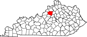
Henry County is a county located in the north central portion of the U.S. state of Kentucky bordering the Kentucky River. As of the 2020 census, the population was 15,678. Its county seat is New Castle, but its largest city is Eminence. The county was founded in 1798 from portions of Shelby County. It was named for the statesman and governor of Virginia Patrick Henry. Henry County is included in the Louisville/Jefferson County, KY-IN Metropolitan Statistical Area. Since the 1990s, it has become an increasingly important exurb, especially as land prices have become higher in neighboring Oldham County. With regard to the sale of alcohol, it is classified as a wet county.

<span class="mw-page-title-main">Hardin County, Kentucky</span> County in Kentucky, United States

Hardin County is a county located in the central part of the U.S. state of Kentucky. Its county seat is Elizabethtown. The county was formed in 1792. Hardin County is part of the Elizabethtown-Fort Knox, KY Metropolitan Statistical Area, as well as the Louisville/Jefferson County—Elizabethtown-Bardstown, KY-IN Combined Statistical Area. As of the 2020 census, the population was 110,702.

<span class="mw-page-title-main">Franklin County, Kentucky</span> County in Kentucky, United States

Franklin County is a county located in the U.S. state of Kentucky. As of the 2020 census, the population was 51,541, making it the 2nd least populous capital county in the United States after Hughes County, South Dakota. Its county seat is Frankfort, the state capital. The county was formed in 1795 from parts of Woodford, Mercer and Shelby counties, and was named after the American inventor and statesman Benjamin Franklin. Franklin County is part of the Frankfort, Kentucky Micropolitan Statistical Area. It shares a name with Franklin County in Ohio, where Columbus is located. This makes it one of two pairs of capital cities in counties of the same name, along with Marion Counties in Oregon and Indiana.

<span class="mw-page-title-main">Eminence, Kentucky</span> City in Kentucky, United States

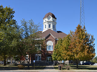
Eminence is a home rule class city in Henry County, Kentucky, in the United States. The population was 2,498 at the 2010 census, up from 2,231 at the 2000 census. It is home to the Eminence Historic Commercial District. Eminence is the largest city in Henry County. Eminence is home to the loudspeaker manufacturing company, Eminence Speaker. The area was home to Eminence Male and Female High School which grew to become Eminence College. Eminence's school teams compete as the Warriors.

<span class="mw-page-title-main">Shelbyville, Kentucky</span> City in Kentucky, United States

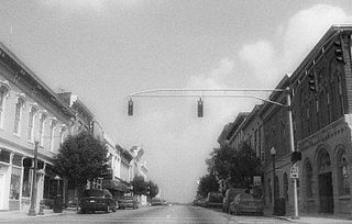
Shelbyville is a home rule-class city in and the county seat of Shelby County, Kentucky, United States. The population was 17,282 at the 2020 census.

<span class="mw-page-title-main">Simpsonville, Kentucky</span> City in Kentucky, United States

Simpsonville is a home rule-class city in Shelby County, Kentucky, in the United States. It is located 8 miles west of Shelbyville, Kentucky and 23 miles east of Louisville situated along U.S. 60. The population was 2,484 during the 2010 U.S. Census.

<span class="mw-page-title-main">Walton, Kentucky</span> City in Kentucky, United States

Walton is a home rule-class city in Boone and Kenton counties in the U.S. state of Kentucky. The population was 5,460 at the 2020 census.

<span class="mw-page-title-main">Louisville metropolitan area</span> Geographic region surrounding Louisville, KY, USA

The Louisville metropolitan area is the 43rd largest metropolitan statistical area (MSA) in the United States. It had a population of 1,395,855 in 2020 according to the latest official census, and its principal city is Louisville, Kentucky.

<span class="mw-page-title-main">Knox County, Kentucky</span> County in Kentucky, United States

Knox County is a county located in Appalachia near the southeastern corner of the U.S. state of Kentucky. As of the 2020 census, the population was 30,193. Its county seat is Barbourville. The county is named for General Henry Knox. It is one of the few coal-producing counties in Kentucky that has not suffered massive population loss. Knox County is included in the London, KY Micropolitan Statistical Area.

References

References

  1. 1 2 "State & County QuickFacts". United States Census Bureau. Archived from the original on April 12, 2022. Retrieved July 6, 2022.
  2. "Find a County". National Association of Counties. Archived from the original on May 31, 2011. Retrieved June 7, 2011.
  3. Van Stockum, R.R. (2001). "Shelby County". In Kleber, John E. (ed.). The Encyclopedia of Louisville. Lexington, Kentucky: University Press of Kentucky. p. 807. ISBN   0-8131-2100-0. OCLC   247857447. Archived from the original on March 13, 2023. Retrieved May 17, 2024.
  4. The Register of the Kentucky State Historical Society, Volume 1. Kentucky State Historical Society. 1903. pp.  37.
  5. Collins, Lewis (1882). Collins' Historical Sketches of Kentucky: History of Kentucky, Volume 2. Collins & Company. p. 26. Archived from the original on July 20, 2023. Retrieved November 1, 2016.
  6. "MITCHELL FAMILY HISTORY in Virginia and Kentucky". Iamonia.tripod.com. July 20, 1904. Archived from the original on July 17, 2011. Retrieved July 30, 2010.
  7. "Wet & Dry Counties in Kentucky" (PDF). Kentucky Office of Alcoholic Beverage Control. Archived from the original (PDF) on April 8, 2009. Retrieved March 21, 2007.
  8. "2010 Census Gazetteer Files". United States Census Bureau. August 22, 2012. Archived from the original on August 12, 2014. Retrieved August 20, 2014.
  9. Welcome to Shelby County Kentucky Archived March 4, 2007, at the Wayback Machine , Shelby County Kentucky Website
  10. "Annual Estimates of the Resident Population for Counties: April 1, 2020 to July 1, 2023". United States Census Bureau. Archived from the original on March 18, 2024. Retrieved March 14, 2024.
  11. "U.S. Decennial Census". United States Census Bureau. Archived from the original on July 17, 2022. Retrieved August 20, 2014.
  12. "Historical Census Browser". University of Virginia Library. Archived from the original on August 11, 2012. Retrieved August 20, 2014.
  13. "Population of Counties by Decennial Census: 1900 to 1990". United States Census Bureau. Archived from the original on October 13, 2014. Retrieved August 20, 2014.
  14. "Census 2000 PHC-T-4. Ranking Tables for Counties: 1990 and 2000" (PDF). United States Census Bureau. Archived (PDF) from the original on December 18, 2014. Retrieved August 20, 2014.
  15. "U.S. Census website". United States Census Bureau. Archived from the original on December 27, 1996. Retrieved January 31, 2008.
  16. "2020 CENSUS – SCHOOL DISTRICT REFERENCE MAP: Shelby County, KY" (PDF). U.S. Census Bureau. Archived (PDF) from the original on August 12, 2022. Retrieved August 11, 2022.Text list Archived August 12, 2022, at the Wayback Machine – For more detailed boundaries of the independent school districts see: "Appendix B: Maps Of Independent School Districts In Operation In FY 2014-FY 2015 Using 2005 Tax District Boundaries – Eminence ISD" (PDF). Research Report No. 415 – Kentucky's Independent School Districts: A Primer. Frankfort, KY: Office of Education Accountability, Legislative Research Commission. September 15, 2015. p. 106 (PDF p. 120/174). Archived (PDF) from the original on December 10, 2020. Retrieved August 12, 2022. – The Census Bureau map only shows Shelby County Public Schools, but the State of Kentucky document shows Eminence ISD does extend into Shelby County.
  17. "Superintendent Home Page". Archived from the original on January 23, 2023. Retrieved January 23, 2023.
  18. "Our Story". Shelby County Public Library. Archived from the original on November 10, 2019. Retrieved November 10, 2019.
  19. Leip, David. "Dave Leip's Atlas of U.S. Presidential Elections". uselectionatlas.org. Archived from the original on March 23, 2018. Retrieved April 7, 2018.

38°13′N85°11′W / 38.22°N 85.19°W / 38.22; -85.19