Carroll County, Kentucky

Last updated

Carroll County
Carroll county kentucky courthouse.jpg
Carroll County Courthouse in Carrollton
Map of Kentucky highlighting Carroll County.svg
Location within the U.S. state of Kentucky
Kentucky in United States.svg
Kentucky's location within the U.S.
Coordinates: 38°40′N85°08′W / 38.67°N 85.13°W / 38.67; -85.13
CountryFlag of the United States.svg United States
StateFlag of Kentucky.svg  Kentucky
Founded1838
Named for Charles Carroll of Carrollton
Seat Carrollton
Largest cityCarrollton
Area
  Total137 sq mi (350 km2)
  Land129 sq mi (330 km2)
  Water8.7 sq mi (23 km2)  6.4%
Population
 (2020)
  Total10,810
  Estimate 
(2023)
10,987 Increase2.svg
  Density79/sq mi (30/km2)
Time zone UTC−5 (Eastern)
  Summer (DST) UTC−4 (EDT)
Congressional district 4th
Website www.carrollcountygov.us

Carroll County is a county located in the northern part of the U.S. state of Kentucky. Its county seat is Carrollton. [1] The county was formed in 1838 and named for Charles Carroll of Carrollton, the last living signer of the Declaration of Independence. [2] It is located at the confluence of the Kentucky and Ohio Rivers.

Contents

Geography

According to the U.S. Census Bureau, the county has a total area of 137 square miles (350 km2), of which 129 square miles (330 km2) is land and 8.7 square miles (23 km2) (6.4%) is water. [3] It is the third-smallest county by area in Kentucky.

Adjacent counties

Demographics

Historical population
CensusPop.Note
1840 3,966
1850 5,52639.3%
1860 6,57819.0%
1870 6,189−5.9%
1880 8,95344.7%
1890 9,2663.5%
1900 9,8256.0%
1910 8,110−17.5%
1920 8,3462.9%
1930 8,155−2.3%
1940 8,6576.2%
1950 8,517−1.6%
1960 7,978−6.3%
1970 8,5236.8%
1980 9,2708.8%
1990 9,2920.2%
2000 10,1559.3%
2010 10,8116.5%
2020 10,8100.0%
2023 (est.)10,987 [4] 1.6%
U.S. Decennial Census [5]
1790-1960 [6] 1900-1990 [7]
1990-2000 [8] 2010-2020 [9]

As of the census [10] of 2000, there were 10,155 people, 3,940 households, and 2,722 families residing in the county. The population density was 78 per square mile (30/km2). There were 4,439 housing units at an average density of 34 per square mile (13/km2). The racial makeup of the county was 95.16% White, 1.94% Black or African American, 0.23% Native American, 0.17% Asian, 0.05% Pacific Islander, 1.42% from other races, and 1.04% from two or more races. 3.25% of the population were Hispanic or Latino of any race.

There were 3,940 households, out of which 33.10% had children under the age of 18 living with them, 52.40% were married couples living together, 11.70% had a female householder with no husband present, and 30.90% were non-families. 25.30% of all households were made up of individuals, and 10.10% had someone living alone who was 65 years of age or older. The average household size was 2.51 and the average family size was 2.98.

In the county, the population was spread out, with 25.30% under the age of 18, 9.10% from 18 to 24, 29.90% from 25 to 44, 23.20% from 45 to 64, and 12.50% who were 65 years of age or older. The median age was 36 years. For every 100 females there were 101.20 males. For every 100 females age 18 and over, there were 99.00 males.

The median income for a household in the county was $35,925, and the median income for a family was $44,037. Males had a median income of $33,588 versus $20,974 for females. The per capita income for the county was $17,057. About 10.40% of families and 14.90% of the population were below the poverty line, including 19.80% of those under age 18 and 21.60% of those age 65 or over

Communities

Law enforcement

In 2023, Carroll County Sheriff's Office hired Myles Cosgrove, a police officer who killed Breonna Taylor in 2020 and was subsequently fired by the Louisville Metro Police Department. The Sheriff's Office said it performed a background check on Cosgrove which he passed. [11]

Politics

United States presidential election results for Carroll County, Kentucky [12]
Year Republican Democratic Third party
No.%No.%No.%
2020 2,95471.42%1,11626.98%661.60%
2016 2,58867.13%1,10628.69%1614.18%
2012 1,99954.32%1,62944.27%521.41%
2008 2,03252.99%1,71644.75%872.27%
2004 2,17555.81%1,68843.32%340.87%
2000 1,81851.96%1,60145.76%802.29%
1996 1,17036.14%1,68952.18%37811.68%
1992 1,04627.92%2,11956.57%58115.51%
1988 1,70246.81%1,91352.61%210.58%
1984 1,82453.65%1,56446.00%120.35%
1980 1,07632.33%2,12763.91%1253.76%
1976 81526.30%2,25172.64%331.06%
1972 1,22847.71%1,30850.82%381.48%
1968 86827.54%1,76556.00%51916.47%
1964 49115.81%2,59283.48%220.71%
1960 1,13533.78%2,22566.22%00.00%
1956 1,13034.08%2,16965.41%170.51%
1952 1,01928.06%2,60571.72%80.22%
1948 63918.66%2,62676.67%1604.67%
1944 75522.02%2,66277.65%110.32%
1940 80421.55%2,91578.15%110.29%
1936 79422.39%2,71876.63%350.99%
1932 76120.05%3,01579.45%190.50%
1928 1,64946.91%1,86353.00%30.09%
1924 1,30636.59%2,24362.85%200.56%
1920 90621.88%3,20977.49%260.63%
1916 53523.15%1,75776.03%190.82%
1912 31715.09%1,57374.87%21110.04%
1908 54625.91%1,51471.86%472.23%
1904 54625.40%1,54872.00%562.60%
1900 74928.99%1,80869.97%271.04%
1896 68527.19%1,77870.58%562.22%
1892 54224.73%1,57471.81%763.47%
1888 62326.76%1,63270.10%733.14%
1884 43423.47%1,34972.96%663.57%
1880 37220.31%1,46079.69%00.00%

Carroll County was strongly pro-Confederate during the Civil War: only 2.70 percent of its white population volunteered to serve in the Union Army, which constitutes the fourteenth-lowest of 109 counties extant as of the 1860 election, and was indeed lower than for the whole of seceded Tennessee. [13] Consequently, Carroll County remained overwhelmingly Democratic for the next century and a quarter, being the only Kentucky county outside the heavily unionized coalfields to vote for George McGovern in 1972. The first Republican to carry Carroll County was Ronald Reagan in 1984, and the growing social liberalism of the Democratic Party has meant the county has voted increasingly Republican since the turn of the century, [14] although Hillary Clinton's 28.69 percent – even if over fifteen percent worse than any previous Democrat – was still as good as she received in any rural white southern county.

In gubernatorial elections, Carroll has remained solidly Democratic: no Republican gubernatorial candidate ever carried the county until 2019, when Carroll County voted for Matt Bevin.

See also

Related Research Articles

<span class="mw-page-title-main">McCracken County, Kentucky</span> County in Kentucky, United States

McCracken County is a county located in the far west portion of U.S. state of Kentucky. As of the 2020 census, the population was 67,875. The county seat and only municipality is Paducah. McCracken County was the 78th county formed in the state, having been created in 1825. It is part of the historic Jackson Purchase, territory sold by the Chickasaw people to General Andrew Jackson and Governor Isaac Shelby; this territory was located at the extreme western end of Kentucky.

<span class="mw-page-title-main">Carroll County, Ohio</span> County in Ohio, United States

Carroll County is a county located in the state of Ohio. As of the 2020 census, the population was 26,721. Its county seat is Carrollton, while its largest village is Minerva. It is named for Charles Carroll of Carrollton, the last surviving signer of the Declaration of Independence.

<span class="mw-page-title-main">Carroll County, New Hampshire</span> County in New Hampshire, United States

Carroll County is a county in the U.S. state of New Hampshire. As of the 2020 census, the population was 50,107, making it the third-least populous county in New Hampshire. Its county seat is Ossipee. The county was created in 1840 and organized at Ossipee from towns removed from Strafford County. It was named in honor of Charles Carroll of Carrollton, who had died in 1832, the last surviving signer of the United States Declaration of Independence.

<span class="mw-page-title-main">Carroll County, Missouri</span> County in Missouri, United States

Carroll County is a county located in the U.S. state of Missouri. As of the 2020 census, the county had a population of 8,495. Its county seat is Carrollton. The county was organized on January 2, 1833, from part of Ray County and named for Charles Carroll of Carrollton, a signer of the Declaration of Independence.

<span class="mw-page-title-main">Carroll County, Mississippi</span> County in Mississippi, United States

Carroll County is a county in the U.S. state of Mississippi. As of the 2020 census, the population was 9,998. Its county seats are Carrollton and Vaiden. The county is named for Charles Carroll of Carrollton, the last surviving signatory of the Declaration of Independence.

<span class="mw-page-title-main">Spencer County, Kentucky</span> County in Kentucky, United States

Spencer County is a county located in the U.S. state of Kentucky. As of the 2020 census, the total population was 19,490. Its county seat is Taylorsville. The county was founded in 1824 and named for Spier Spencer.

<span class="mw-page-title-main">Marion County, Kentucky</span> County in Kentucky, United States

Marion County is a county in the U.S. state of Kentucky. As of the 2020 census, the total population was 19,581. Its county seat is Lebanon. The county was founded in 1834 and named for Francis Marion, the American Revolutionary War hero known as the "Swamp Fox".

<span class="mw-page-title-main">Carroll County, Iowa</span> County in Iowa, United States

Carroll County is a county located in the U.S. state of Iowa. As of the 2020 census, the population was 20,760. Its county seat is Carroll. The county is named in honor of Charles Carroll of Carrollton, signer of the Declaration of Independence.

<span class="mw-page-title-main">Carroll County, Arkansas</span> County in Arkansas, United States

Carroll County is a county located in the U.S. state of Arkansas. As of the 2020 census, the population was 28,260. The county has two county seats, Berryville and Eureka Springs. Carroll County is Arkansas's 26th county, formed on November 1, 1833, and named after Charles Carroll, the last surviving signer of the United States Declaration of Independence.

<span class="mw-page-title-main">Carrollton, Alabama</span> City in and county seat of Pickens County, Alabama

Carrollton is a city in and the county seat of Pickens County, Alabama, United States. At the 2010 census the population was 1,019, up from 987 in 2000.

<span class="mw-page-title-main">Carrollton, Kentucky</span> City in Kentucky, United States

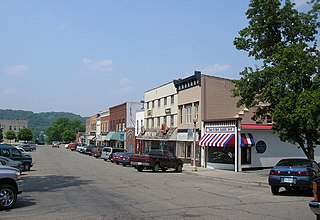
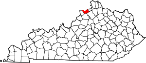
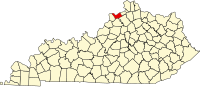
Carrollton is a home rule-class city in—and the county seat of—Carroll County, Kentucky, United States, at the confluence of the Ohio and Kentucky rivers. The population was 3,938 at the 2010 census.

<span class="mw-page-title-main">Prestonville, Kentucky</span> City in Kentucky, United States

Prestonville is a home rule-class city located at the confluence of the Ohio and Kentucky rivers in Carroll County, Kentucky, in the United States. It lies across the Kentucky River from Carrollton. The population was 161 at the 2010 U.S. Census.

<span class="mw-page-title-main">Worthville, Kentucky</span> City in Kentucky, United States

Worthville is a home rule-class city in Carroll County, Kentucky, United States. The population was 185 at the 2010 census.

<span class="mw-page-title-main">South Carrollton, Kentucky</span> City in Kentucky, United States

South Carrollton is a home rule-class city in Muhlenberg County, Kentucky, United States. The population was 141 at the 2020 census, down from 184 in 2010. Founded as "Randolph Old Farm" in 1838, an early pioneer changed the name of the city to honor his son, Carroll. The name was prefixed with "South" in order to distinguish it from the city of Carrollton.

<span class="mw-page-title-main">New Carrollton, Maryland</span> City in Maryland, United States

New Carrollton is a city located in central Prince George's County, Maryland, United States. As of the 2020 census, the population was 13,715. New Carrollton is located 10 miles (16 km) east of central Washington, D.C.

Carrollton Township is a township in Fillmore County, Minnesota, United States. The population was 321 at the 2000 census.

<span class="mw-page-title-main">Carrollton, Mississippi</span> Town in Mississippi, United States

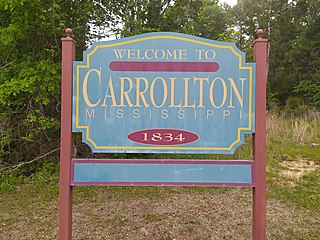
Carrollton is a town in and the second county seat of Carroll County, Mississippi, United States, which is within the Mississippi Delta. The population was 190 at the 2010 census, down from 408 in 2000. Centrally located in the county, the town is part of the Greenwood, Mississippi micropolitan area. The first county seat, Vaiden, Mississippi, was founded in the eastern part of the county during its early settlement.

<span class="mw-page-title-main">North Carrollton, Mississippi</span> Town in Mississippi, United States

North Carrollton is a town in Carroll County, Mississippi, United States. The population was 473 at the 2010 census. It is part of the Greenwood, Mississippi micropolitan area.

<span class="mw-page-title-main">Carrollton, Ohio</span> Village in Ohio, United States

Carrollton is a village in and the county seat of Carroll County, Ohio, located 22 miles (35 km) southeast of Canton. The population was 3,087 at the time of the 2020 census. It is part of the Canton–Massillon metropolitan area.

<span class="mw-page-title-main">Carroll, Ohio</span> Village in Ohio, United States

Carroll is a village in Fairfield County, Ohio, United States. The population was 501 at the 2020 census.

References

  1. "Find a County". National Association of Counties. Archived from the original on May 31, 2011. Retrieved June 7, 2011.
  2. The Register of the Kentucky State Historical Society, Volume 1. Kentucky State Historical Society. 1903. p. 34.
  3. "2010 Census Gazetteer Files". United States Census Bureau. August 22, 2012. Archived from the original on August 12, 2014. Retrieved August 13, 2014.
  4. "Annual Estimates of the Resident Population for Counties: April 1, 2020 to July 1, 2023". United States Census Bureau. Retrieved March 14, 2024.
  5. "U.S. Decennial Census". United States Census Bureau. Retrieved August 13, 2014.
  6. "Historical Census Browser". University of Virginia Library. Retrieved August 13, 2014.
  7. "Population of Counties by Decennial Census: 1900 to 1990". United States Census Bureau. Retrieved August 13, 2014.
  8. "Census 2000 PHC-T-4. Ranking Tables for Counties: 1990 and 2000" (PDF). United States Census Bureau. Archived (PDF) from the original on March 27, 2010. Retrieved August 13, 2014.
  9. "State & County QuickFacts". United States Census Bureau. Archived from the original on June 7, 2011. Retrieved March 6, 2014.
  10. "U.S. Census website". United States Census Bureau . Retrieved January 31, 2008.
  11. "Myles Cosgrove, officer who killed Breonna Taylor, hired by Carroll County Sheriff's Department". The Courier-Journal. 2023.
  12. Leip, David. "Dave Leip's Atlas of U.S. Presidential Elections". uselectionatlas.org. Retrieved June 30, 2018.
  13. Copeland, James E.; ‘Where Were the Kentucky Unionists and Secessionists’; The Register of the Kentucky Historical Society, volume 71, no. 4 (October, 1973), pp. 344-363
  14. Cohn, Nate; ‘Demographic Shift: Southern Whites’ Loyalty to G.O.P. Nearing That of Blacks to Democrats’, The New York Times , April 24, 2014

38°40′N85°08′W / 38.67°N 85.13°W / 38.67; -85.13