
McCracken County is a county located in the far west portion of U.S. state of Kentucky. As of the 2020 census, the population was 67,875. The county seat and only municipality is Paducah. McCracken County was the 78th county formed in the state, having been created in 1825. It is part of the historic Jackson Purchase, territory sold by the Chickasaw people to General Andrew Jackson and Governor Isaac Shelby; this territory was located at the extreme western end of Kentucky.

Trigg County is a county located on the far southwestern border of the U.S. state of Kentucky. As of the 2020 census, the population was 14,061. Its county seat is Cadiz. Formed in 1820, the county was named for Stephen Trigg, an officer in the American Revolutionary War who was killed at the Battle of Blue Licks, now in Robertson County, Kentucky. It was a victory for British and allied troops.

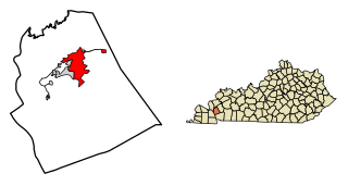
Spencer County is a county located in the U.S. state of Kentucky. As of the 2020 census, the total population was 19,490. Its county seat is Taylorsville. The county was founded in 1824 and named for Spier Spencer.

Robertson County is a county located in the U.S. Commonwealth of Kentucky. As of the 2020 census, the population was 2,193. Its county seat is Mount Olivet. The county is named for George Robertson, a Kentucky Congressman from 1817 to 1821. It is Kentucky's smallest county by both total area and by population.
Pendleton County is a county located in the U.S. state of Kentucky. As of the 2020 census, the population was 14,644. Its county seat is Falmouth. The county was founded December 13, 1798. Pendleton County is included in the Cincinnati-Middletown, OH-KY-IN Metropolitan Statistical Area.

Morgan County is a county located in the U.S. state of Kentucky. As of the 2020 census, the population was 13,726. Its county seat is West Liberty. The county is among the dry counties, which means that the sale of alcohol is restricted or prohibited.

Marion County is a county in the U.S. state of Kentucky. As of the 2020 census, the total population was 19,581. Its county seat is Lebanon. The county was founded in 1834 and named for Francis Marion, the American Revolutionary War hero known as the "Swamp Fox".

Livingston County is a county located in the U.S. state of Kentucky. As of the 2020 census, the population was 8,888. Its county seat is Smithland and its largest community is Ledbetter. The county was established in 1798 from land taken from Christian County and is named for Robert R. Livingston, a member of the Committee of Five that drafted the U.S. Declaration of Independence. The county was strongly pro-Confederate during the American Civil War and many men volunteered for the Confederate Army. Livingston County is part of the Paducah, KY-IL Metropolitan Statistical Area. It is a prohibition or dry county with the exception of Grand Rivers which voted to allow alcohol sales in 2016.
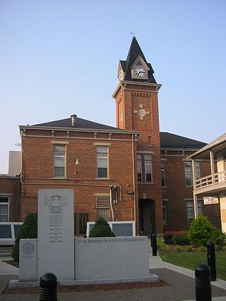
Lee County is a county located in the U.S. state of Kentucky. As of the 2020 census, the population was 7,395. Its county seat is Beattyville. The county was formed in 1870 from parts of Breathitt, Estill, Owsley and Wolfe counties. The county was named for Robert E. Lee. The area of Kentucky where Lee County is located was a pro-union region of Kentucky but the legislature that created the county was controlled by former Confederates. The town of Proctor, named for the Rev. Joseph Proctor, was the first county seat. The first court was held on April 25, 1870, in the old Howerton House. The local economy at the time included coal mining, salt gathering, timber operations, and various commercial operations. It had a U.S. post office from 1843 until 1918.

Hickman County is a county located in the U.S. state of Kentucky. As of the 2020 census, the population was 4,521, making it the third-least populous county in Kentucky. Its county seat is Clinton. The county was formed in 1821. It is the least densely populated county in the state and is a prohibition or dry county.

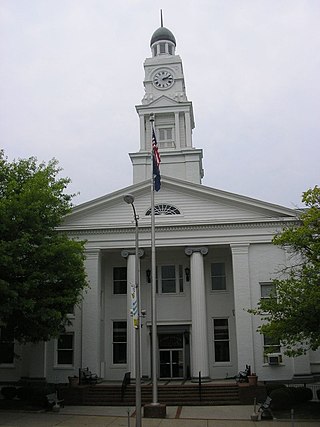
Harrison County is a county located in the U.S. state of Kentucky. As of the 2020 census, the population was 18,692. Its county seat is Cynthiana. The county was founded in 1793 and named for Colonel Benjamin Harrison, an advocate for Kentucky statehood, framer of the Kentucky Constitution, and Kentucky legislator.

Fleming County is a county located in the U.S. state of Kentucky. As of the 2020 census, the population was 15,082. Its county seat is Flemingsburg. The county was formed in 1798 and named for Colonel John Fleming, an Indian fighter and early settler. It is a moist county. In 1998, the Kentucky General Assembly designated Fleming County as the Covered Bridge Capital of Kentucky.

Crittenden County is a county in the U.S. state of Kentucky. At the 2020 census, the population was 8,990. Its county seat and only municipality is Marion. The county was formed in 1842 and named for John J. Crittenden, senator and future Governor of Kentucky.
Clark County is a county located in the U.S. state of Kentucky. As of the 2020 census, the population was 36,972. Its county seat is Winchester. The county was created in 1792 from Bourbon and Fayette counties and is named for Revolutionary War hero George Rogers Clark. Clark County is part of the Lexington-Fayette, KY Metropolitan Statistical Area.

Carlisle County is a county located in the U.S. state of Kentucky. As of the 2020 census, the population was 4,826, making it the fourth-least populous county in Kentucky. Its county seat is Bardwell. The county was founded in 1886 and named for John Griffin Carlisle, a Speaker of the United States House of Representatives from Kentucky. It remains a prohibition or dry county. Carlisle County is included in the Paducah, KY-IL, Metropolitan Statistical Area.

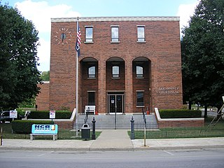
Caldwell County is a county located in the U.S. state of Kentucky. As of the 2020 census, the population was 12,649. Its county seat is Princeton. The county was formed in 1809 from Livingston County, Kentucky and named for John Caldwell, who participated in the George Rogers Clark Indian Campaign of 1786 and was the second lieutenant governor of Kentucky. Caldwell was a prohibition or dry county until 2013, when the citizens voted to lift the ban.
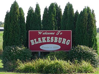
Blakesburg is a city in Wapello County, Iowa, United States. The population was 274 at the 2020 census.

Fredonia is a home rule-class city in Caldwell County, Kentucky, in the United States. The population was 401 at the 2010 census.
Eddyville is a home rule-class city in and the county seat of Lyon County, Kentucky, United States. The population was 2,554 at the 2010 census, up from 2,350 in 2000. The Kentucky State Penitentiary is located at Eddyville. The town is considered a tourist attraction because of its access to nearby Lake Barkley.

Kuttawa is a home rule-class city in Lyon County, Kentucky, in the United States. The population was 649 as of the 2010 census, up from 596 in 2000.


