Carter County, Kentucky

Last updated

Carter County
Carter County, Kentucky courthouse.jpg
Carter County courthouse in Grayson
Map of Kentucky highlighting Carter County.svg
Location within the U.S. state of Kentucky
Kentucky in United States.svg
Kentucky's location within the U.S.
Coordinates: 38°20′N83°03′W / 38.33°N 83.05°W / 38.33; -83.05
CountryFlag of the United States.svg United States
StateFlag of Kentucky.svg  Kentucky
Founded1838
Named for William Grayson Carter
Seat Grayson
Largest cityGrayson
Area
  Total412 sq mi (1,070 km2)
  Land409 sq mi (1,060 km2)
  Water2.6 sq mi (7 km2)  0.6%
Population
 (2020)
  Total26,627
  Estimate 
(2023)
26,366 Decrease2.svg
  Density65/sq mi (25/km2)
Time zone UTC−5 (Eastern)
  Summer (DST) UTC−4 (EDT)
Congressional districts 4th, 5th
Website cartercounty.ky.gov/Pages/default.aspx

Carter County is a county located in the U.S. state of Kentucky. As of the 2020 census, the population was 26,627. [1] Its county seat is Grayson. [2] Carter County is in the Huntington-Ashland, WV-KY-OH Metropolitan Statistical Area. It is home to Carter Caves State Resort Park.

Contents

History

Carter County was formed on February 9, 1838, from portions of Greenup County and Lawrence County. [3] It was named after Colonel William Grayson Carter, a Kentucky state Senator. [4] The county seat is named for his uncle, Robert Grayson. [5]

The original courthouse was rebuilt in 1907. [6]

Geography

According to the United States Census Bureau, the county has a total area of 412 square miles (1,070 km2), of which 409 square miles (1,060 km2) is land and 2.6 square miles (6.7 km2) (0.6%) is water. [7]

Adjacent counties

Demographics

Historical population
CensusPop.Note
1840 2,905
1850 6,241114.8%
1860 8,51636.5%
1870 7,509−11.8%
1880 12,34564.4%
1890 17,20439.4%
1900 20,22817.6%
1910 21,9668.6%
1920 22,4742.3%
1930 23,8396.1%
1940 25,5457.2%
1950 22,559−11.7%
1960 20,817−7.7%
1970 19,850−4.6%
1980 25,06026.2%
1990 24,340−2.9%
2000 26,88910.5%
2010 27,7203.1%
2020 26,627−3.9%
2023 (est.)26,366 [8] −1.0%
U.S. Decennial Census [9]
1790-1960 [10] 1900-1990 [11]
1990-2000 [12] 2010-2021 [1]

As of the census of 2000, there were 26,889 people, 10,342 households, and 7,746 families residing in the county. The population density was 66 per square mile (25/km2). There were 11,534 housing units at an average density of 28 per square mile (11/km2). The racial makeup of the county was 99.02% White, 0.13% Black or African American, 0.25% Native American, 0.11% Asian, 0.08% from other races, and 0.41% from two or more races. 0.59% of the population were Hispanic or Latino of any race.

There were 10,342 households, out of which 33.50% had children under the age of 18 living with them, 60.50% were married couples living together, 10.70% had a female householder with no husband present, and 25.10% were non-families. 22.30% of all households were made up of individuals, and 9.80% had someone living alone who was 65 years of age or older. The average household size was 2.54 and the average family size was 2.95.

In the county, the population was spread out, with 24.50% under the age of 18, 10.80% from 18 to 24, 28.40% from 25 to 44, 23.80% from 45 to 64, and 12.50% who were 65 years of age or older. The median age was 36 years. For every 100 females there were 95.90 males. For every 100 females age 18 and over, there were 93.30 males.

The median income for a household in the county was $26,427, and the median income for a family was $31,278. Males had a median income of $28,690 versus $20,554 for females. The per capita income for the county was $13,442. About 19.20% of families and 22.30% of the population were below the poverty line, including 28.90% of those under age 18 and 21.30% of those age 65 or over.

Politics

Carter County leans Republican. In 8 out of 28 presidential elections since 1912 has the Democratic candidate carried this county, even though they carried it three times in a row from 1988 to 1996.

United States presidential election results for Carter County, Kentucky [13]
Year Republican Democratic Third party
No.%No.%No.%
2020 8,77575.74%2,64222.80%1691.46%
2016 7,58773.82%2,27622.14%4154.04%
2012 5,27959.26%3,38337.98%2462.76%
2008 5,25253.52%4,31643.98%2452.50%
2004 5,42248.77%5,57750.17%1181.06%
2000 4,61751.53%4,18246.68%1601.79%
1996 3,24041.69%3,72847.97%80310.33%
1992 3,30538.61%4,22449.35%1,03112.04%
1988 4,32548.36%4,57051.10%490.55%
1984 4,65653.67%3,98545.94%340.39%
1980 3,93450.18%3,78248.25%1231.57%
1976 3,18544.65%3,91554.89%330.46%
1972 4,08260.68%2,59138.52%540.80%
1968 3,23449.67%2,34436.00%93314.33%
1964 2,82140.37%4,13659.20%300.43%
1960 4,95658.76%3,47941.24%00.00%
1956 5,12762.09%3,11237.68%190.23%
1952 4,22158.12%3,01941.57%220.30%
1948 3,47252.61%3,08246.70%460.70%
1944 4,11760.01%2,73339.84%100.15%
1940 4,52056.88%3,40342.83%230.29%
1936 4,37255.98%3,40343.57%350.45%
1932 4,37648.51%4,56550.61%790.88%
1928 5,34268.73%2,39230.77%390.50%
1924 4,47261.50%2,55235.10%2473.40%
1920 4,59561.98%2,75737.19%620.84%
1916 2,81858.48%1,95440.55%470.98%
1912 1,17428.64%1,50636.74%1,41934.62%

Education

Alcohol sales

Carter County is a moist county, meaning that sale of alcohol in the county is prohibited except in certain areas as voted on by the residents of the area, with at least one area approving full retail alcohol sales. In the case of Carter County, alcohol sales are only permitted as follows:

Communities

Cities

Unincorporated communities

Transportation

Carter County is accessible by U.S. Route 60 and Interstate 64. [18] Until 2010, the city of Olive Hill owned an airport. [19]

See also

Related Research Articles

<span class="mw-page-title-main">Montgomery County, Kentucky</span> County in Kentucky, United States

Montgomery County is a county located in the U.S. state of Kentucky. As of the 2020 census, the population was 28,114. Its county seat is Mount Sterling. With regard to the sale of alcohol, it is classified as a moist county—a county in which alcohol sales are prohibited, but containing a "wet" city where package alcohol sales are allowed, in this case Mount Sterling. Montgomery County is part of the Mount Sterling, KY Micropolitan Statistical Area, which is also included in the Lexington-Fayette–Richmond–Frankfort, KY combined statistical area.

<span class="mw-page-title-main">Webster County, Kentucky</span> County in Kentucky, United States

Webster County is a county located in the U.S. state of Kentucky. As of the 2020 census, the population was 13,017. Its county seat is Dixon and its largest city is Providence. It is the southernmost county in the Evansville, IN–KY Metropolitan Statistical Area. The county was formed in 1860 from parts of Henderson, Hopkins, and Union Counties and named for American statesman Daniel Webster (1782–1852). It was mainly pro-Confederate during the American Civil War and was the site of several skirmishes and some guerrilla warfare. Since 2018 it has been a moist county, with Providence and Sebree voting to allow alcohol sales, and Clay doing so in 2022.

<span class="mw-page-title-main">Rowan County, Kentucky</span> County in Kentucky, United States

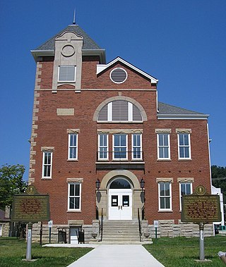
Rowan County is a county located in the northeastern part of the U.S. state of Kentucky, in the Eastern Kentucky Coalfield region. As of the 2020 census, the population was 24,662. Its county seat is Morehead.

<span class="mw-page-title-main">Monroe County, Kentucky</span> County in Kentucky, United States

Monroe County is a county located in the Eastern Pennyroyal Plateau region of the U.S. state of Kentucky. Its county seat is Tompkinsville. The county is named for President James Monroe. It was a prohibition or dry county until November 7, 2023, when voters approved the sale of alcohol.

<span class="mw-page-title-main">Madison County, Kentucky</span> County in Kentucky, United States

Madison County is a county located in the central part of the U.S. state of Kentucky. At the 2020 census, its population was 92,701. Its county seat is Richmond. The county is named for Virginia statesman James Madison, who later became the fourth President of the United States.

<span class="mw-page-title-main">Livingston County, Kentucky</span> County in Kentucky, United States

Livingston County is a county located in the U.S. state of Kentucky. As of the 2020 census, the population was 8,888. Its county seat is Smithland and its largest community is Ledbetter. The county was established in 1798 from land taken from Christian County and is named for Robert R. Livingston, a member of the Committee of Five that drafted the U.S. Declaration of Independence. The county was strongly pro-Confederate during the American Civil War and many men volunteered for the Confederate Army. Livingston County is part of the Paducah, KY-IL Metropolitan Statistical Area. It is a prohibition or dry county with the exception of Grand Rivers which voted to allow alcohol sales in 2016.

<span class="mw-page-title-main">Lawrence County, Kentucky</span> County in Kentucky, United States

Lawrence County is a county located in the U.S. state of Kentucky. As of the 2020 census, the population was 16,293. Its county seat is Louisa. The county is named for James Lawrence, and co-founded by Isaac Bolt, who served as a Lawrence County Commissioner and Justice of the Peace. Lawrence County is the home of bluegrass music and country music star Tyler Childers. It is the birthplace of the late Chief Justice of the United States Frederick Moore Vinson and former Kentucky Governor Paul E. Patton. In regard to alcoholic beverage sales, Lawrence County is considered a "moist" county, meaning alcohol sales are only allowed within the city limits of Louisa. There are no alcohol sales within the rest of the county. Only two stores sell liquor, and most convenience stores sell beer and malted beverages.

<span class="mw-page-title-main">Jessamine County, Kentucky</span> County in Kentucky, United States

Jessamine County is a county located in the U.S. state of Kentucky. As of the 2020 census, the population was 52,991. Its county seat is Nicholasville. The county was founded in December 1798. Jessamine County is part of the Lexington-Fayette, KY Metropolitan Statistical Area. It is within the Inner Blue Grass region, long a center of farming and blooded stock raising, including thoroughbred horses. The legislature established a commercial wine industry here in the late 18th century.

<span class="mw-page-title-main">Greenup County, Kentucky</span> County in Kentucky, United States

Greenup County is a county located along the Ohio River in the northeastern part of the U.S. state of Kentucky. As of the 2020 census, the population was 35,962. The county was founded in 1803 and named in honor of Christopher Greenup. Its county seat is Greenup. Greenup County is part of the Huntington-Ashland, WV-KY-OH Metropolitan Statistical Area.

<span class="mw-page-title-main">Grayson County, Kentucky</span> County in Kentucky, United States

Grayson County is a county located in the U.S. state of Kentucky. As of the 2020 census, the population was 26,420. Its county seat is Leitchfield. The county was formed in 1810 and named for William Grayson (1740–1790), a Revolutionary War colonel and a prominent Virginia political figure. Grayson County was formerly a prohibition or dry county, but Leitchfield allowed limited alcohol sales in restaurants in 2010 and voted "wet" in 2016.

<span class="mw-page-title-main">Graves County, Kentucky</span> County in Kentucky, United States

Graves County is a county located on the southwest border of the U.S. Commonwealth of Kentucky. As of the 2020 census, the population was 36,649. Its county seat is Mayfield. The county was formed in 1824 and was named for Major Benjamin Franklin Graves, a politician and fallen soldier in the War of 1812.

<span class="mw-page-title-main">Grant County, Kentucky</span> County in Kentucky, United States

Grant County is a county located in the northern part of the U.S. state of Kentucky. As of the 2020 census, the population was 24,941. Its county seat is Williamstown. The county was formed in 1820 and named for Colonel John Grant, who led a party of settlers in 1779 to establish Grant's Station, in today's Bourbon County, Kentucky. Grant County is included in the Cincinnati-Middletown, OH-KY-IN Metropolitan Statistical Area. Grant County residents voted to allow full alcohol sales in the county by a margin of 56% to 44% in a special election on December 22, 2015. In the 19th century, Grant County had multiple saloons.

<span class="mw-page-title-main">Bell County, Kentucky</span> County in Kentucky, United States

Bell County is a county located in the southeast part of the U.S. state of Kentucky. As of the 2020 census, the population was 24,097. Its county seat is Pineville and its largest city is Middlesboro. The county was formed in 1867, during the Reconstruction era from parts of Knox and Harlan counties and augmented from Knox County in 1872. The county is named for Joshua Fry Bell, a US Representative. It was originally called "Josh Bell", but on January 31, 1873, the Kentucky legislature shortened the name to "Bell",

<span class="mw-page-title-main">Grayson, Kentucky</span> City in Kentucky, United States

Grayson is a home rule-class city in and the county seat of Carter County, Kentucky, United States, on U.S. Route 60 and Interstate 64 in the state's northeastern region. It is approximately 21 miles west of Ashland. Within the city limits, the population was 4,217 at the 2010 census. Along with Carter County, the city is closely associated with the nearby Huntington-Ashland, WV-KY-OH Metropolitan Statistical Area and is often erroneously included in the MSA being just 9 miles west of the M.S.A's western boundary.

<span class="mw-page-title-main">Olive Hill, Kentucky</span> City in Kentucky, United States

Olive Hill is a home rule-class city along Tygarts Creek in Carter County, Kentucky, in the United States. The population was 1,599 during the year 2010 U.S. Census.

<span class="mw-page-title-main">Greenup, Kentucky</span> City in Kentucky, United States

Greenup is a home rule-class city located at the confluence of the Little Sandy River with the Ohio River in Greenup County, Kentucky, United States. The population was 1,188 at the 2010 census. Greenup is one of three county seats in the Commonwealth of Kentucky to share its name with its county; the other two being Harlan and Henderson.

<span class="mw-page-title-main">South Shore, Kentucky</span> City in Kentucky, United States

South Shore is a home rule-class city in Greenup County, Kentucky, United States. The population was 1,122 at the 2010 census, down from 1,226 in 2000. It is located along the Ohio River across from Portsmouth, Ohio, at the mouth of Tygarts Creek. South Shore is a part of the Huntington-Ashland, WV-KY-OH, Metropolitan Statistical Area (MSA).

<span class="mw-page-title-main">Wurtland, Kentucky</span> City in Kentucky, United States

Wurtland is a home rule-class city in Greenup County, Kentucky, United States, along the Ohio River. The population was 995 at the 2010 census. Wurtland is a part of the Huntington-Ashland, WV-KY-OH, Metropolitan Statistical Area (MSA). As of the 2010 census, the MSA had a population of 287,702.

<span class="mw-page-title-main">Barbourville, Kentucky</span> City in Kentucky, United States

Barbourville is a home rule-class city in Knox County, Kentucky, in the United States. The population was 3,165 at the 2010 census, down from 3,589 at the 2000 census. It is the county seat of Knox County. The city was formally established by the state assembly in 1812. It was incorporated in 1854 and then reincorporated in 1856.

<span class="mw-page-title-main">Boyd County, Kentucky</span> County in Kentucky, United States

Boyd County is a county located in the U.S. state of Kentucky. As of the 2020 census, its population was 48,261. The county seat is Catlettsburg, and its largest city is Ashland. The county was formed in 1860. The county spans 160 square miles (410 km2), and is found at the northeastern edge of the state, near the Ohio River and Big Sandy River and situated in mountainous Appalachia. Boyd County is in the Huntington-Ashland, WV-KY-OH metropolitan statistical area.

References

  1. 1 2 "State & County QuickFacts". United States Census Bureau. Retrieved August 14, 2022.
  2. "Find a County". National Association of Counties. Archived from the original on May 31, 2011. Retrieved June 7, 2011.
  3. Rennick, Robert M. (1987). Kentucky Place Names. University Press of Kentucky. p. 52. ISBN   0813126312 . Retrieved April 28, 2013.
  4. The Register of the Kentucky State Historical Society, Volume 1. Kentucky State Historical Society. 1903. pp.  34.
  5. "Historical Views Of Carter County" (PDF). Printworks Unlimited, Grayson, KY. 2007. p. 1. Archived (PDF) from the original on December 24, 2010.
  6. Hogan, Roseann Reinemuth (1992). Kentucky Ancestry: A Guide to Genealogical and Historical Research. Ancestry Publishing. p. 212. ISBN   9780916489496 . Retrieved July 26, 2013.
  7. "2010 Census Gazetteer Files". United States Census Bureau. August 22, 2012. Archived from the original on August 12, 2014. Retrieved August 13, 2014.
  8. "Annual Estimates of the Resident Population for Counties: April 1, 2020 to July 1, 2023". United States Census Bureau. Retrieved March 14, 2024.
  9. "U.S. Decennial Census". United States Census Bureau. Retrieved August 13, 2014.
  10. "Historical Census Browser". University of Virginia Library. Retrieved August 13, 2014.
  11. "Population of Counties by Decennial Census: 1900 to 1990". United States Census Bureau. Retrieved August 13, 2014.
  12. "Census 2000 PHC-T-4. Ranking Tables for Counties: 1990 and 2000" (PDF). United States Census Bureau. Archived (PDF) from the original on March 27, 2010. Retrieved August 13, 2014.
  13. Leip, David. "Dave Leip's Atlas of U.S. Presidential Elections". uselectionatlas.org. Retrieved June 30, 2018.
  14. The Next Step: Grayson council has the task of controlling alcohol sales.
  15. Grayson takes the first step toward alcohol sales.
  16. Council approves equipment purchases.
  17. Olive Hill Votes Wet
  18. kytc.maps.arcgis.com http://kytc.maps.arcgis.com/home/webmap/viewer.html?webmap=9539ce58046c4890867ae2c0bea8882c . Retrieved April 19, 2019.{{cite web}}: Missing or empty |title= (help)
  19. "Proud Past~ Hope for the Future Olive Hill, Kentucky Long Term Community Recovery Plan". City of Olive Hill. February 2011. Retrieved April 18, 2019.

Commons-logo.svg Media related to Carter County, Kentucky at Wikimedia Commons

38°20′N83°03′W / 38.33°N 83.05°W / 38.33; -83.05