Chesapeake, Ohio | |
---|---|
Coordinates: 38°25′41″N82°27′23″W / 38.42806°N 82.45639°W | |
Country | United States |
State | Ohio |
County | Lawrence |
Township | Union |
Area | |
• Total | 0.56 sq mi (1.45 km2) |
• Land | 0.47 sq mi (1.23 km2) |
• Water | 0.09 sq mi (0.22 km2) |
Elevation | 558 ft (170 m) |
Population (2020) | |
• Total | 765 |
• Density | 1,613.92/sq mi (623.70/km2) |
Time zone | UTC-5 (Eastern (EST)) |
• Summer (DST) | UTC-4 (EDT) |
ZIP code | 45619 |
Area code | 740 |
FIPS code | 39-13904 [3] |
GNIS feature ID | 2397614 [2] |
Chesapeake is a village in Lawrence County, Ohio, United States. The population was 691 as of the 2020 census. It lies across the Ohio River from Huntington, West Virginia, at the mouth of Symmes Creek.
A bridge across the Ohio River connects Chesapeake to Huntington's downtown area. At one time, this was the only bridge connection across the Ohio River linking Ohio to Huntington. In recent years, bridges across the Ohio River connecting Ohio to Huntington's East and West sides have been built.
Chesapeake is a part of the Huntington-Ashland, WV-KY-OH, Metropolitan Statistical Area (MSA).
Chesapeake is derived from the Algonquin name for "place where water is spread out". [4]
According to the United States Census Bureau, the village has a total area of 0.56 square miles (1.45 km2), of which 0.47 square miles (1.22 km2) is land and 0.09 square miles (0.23 km2) is water. [5]
The city is run by an elected mayor-council government system.
Chesapeake Union Exempted Village School District operates one elementary school, one middle school, and Chesapeake High School. [6]
Chesapeake has a public library, a branch of Briggs Lawrence County Public Library. [7]
Census | Pop. | Note | %± |
---|---|---|---|
1910 | 541 | — | |
1920 | 821 | 51.8% | |
1930 | 1,094 | 33.3% | |
1940 | 1,068 | −2.4% | |
1950 | 1,285 | 20.3% | |
1960 | 1,396 | 8.6% | |
1970 | 1,364 | −2.3% | |
1980 | 1,370 | 0.4% | |
1990 | 1,073 | −21.7% | |
2000 | 842 | −21.5% | |
2010 | 745 | −11.5% | |
2020 | 691 | −7.2% | |
U.S. Decennial Census [8] |
As of the census [9] of 2010, there were 745 people, 345 households, and 195 families living in the village. The population density was 1,585.1 inhabitants per square mile (612.0/km2). There were 399 housing units at an average density of 848.9 per square mile (327.8/km2). The racial makeup of the village was 96.8% White, 0.5% African American, 0.7% Native American, 0.4% Asian, 0.4% from other races, and 1.2% from two or more races. Hispanic or Latino of any race were 0.9% of the population.
There were 345 households, of which 25.8% had children under the age of 18 living with them, 38.8% were married couples living together, 12.2% had a female householder with no husband present, 5.5% had a male householder with no wife present, and 43.5% were non-families. 37.7% of all households were made up of individuals, and 17.9% had someone living alone who was 65 years of age or older. The average household size was 2.16 and the average family size was 2.86.
The median age in the village was 44.4 years. 20.8% of residents were under the age of 18; 6.9% were between the ages of 18 and 24; 22.5% were from 25 to 44; 28.1% were from 45 to 64; and 21.5% were 65 years of age or older. The gender makeup of the village was 47.4% male and 52.6% female.
As of the census [3] of 2000, there were 842 people, 395 households, and 231 families living in the village. The population density was 1,523.7 inhabitants per square mile (588.3/km2). There were 441 housing units at an average density of 798.0 per square mile (308.1/km2). The racial makeup of the village was 97.74% White, 0.12% African American, 0.59% Native American, 0.12% Asian, 0.48% from other races, and 0.95% from two or more races. Hispanic or Latino of any race were 1.54% of the population.
Of the 395 households, 23.5% contained children under the age of 18. 42.3% had married couples living together. 11.4% had a female householder with no husband present. 41.3% were non-families. 37.2% of all households were made up of individuals, and 17.0% had someone living alone who was 65 years of age or older. The average household size was 2.13 and the average family size was 2.79.
The ages of the population were spread out, with 20.0% under the age of 18, 9.6% from 18 to 24, 26.4% from 25 to 44, 23.3% from 45 to 64, and 20.8% who were 65 years of age or older. The median age was 42 years. For every 100 females, there were 87.5 males.
The median income for a household in the village was $24,653, and the median income for a family was $31,528. Males had a median income of $32,917 versus $23,500 for females. The per capita income for the village was $19,698. About 14.2% of families and 15.5% of the population were below the poverty line, including 14.5% of those under age 18 and 13.3% of those age 65 or over.
Bellaire is a village and the county seat of Antrim County, Michigan, United States. The population was 1,053 in 2020 census.
Pigeon is a village in Huron County in the U.S. state of Michigan. The population was 1,208 at the 2010 census. The village is within Winsor Township.
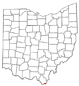
Manchester is a village in Manchester Township, Adams County, Ohio, United States, along the Ohio River. The population was 1,839 at the 2020 census.
Aberdeen is a village in Huntington Township, Brown County, Ohio, United States, along the Ohio River 50 miles (80 km) southeast of Cincinnati. The population was 1,515 at the 2020 census.
Lyons is a village in Fulton County, Ohio, United States. The population was 602 at the 2020 census.
Addyston is a village in Miami Township, Hamilton County, Ohio, United States. Located along the Ohio River, it is a western suburb of the neighboring city of Cincinnati. The population was 927 at the 2020 census.
Cleves is a village in Miami Township, Hamilton County, Ohio, United States. Located along the Ohio River, it is a western suburb of Cincinnati. The population was 3,414 at the 2020 census.
Evendale is a village in Hamilton County, Ohio, United States, within the Cincinnati metropolitan area. The population was 2,669 at the 2020 census.
Monroeville is a village in Huron County, Ohio, United States. The population was 1,300 at the 2020 census.
Athalia is a village in Lawrence County, Ohio, United States, along the Ohio River. The population was 279 at the 2020 census.
Hanging Rock is a village in Lawrence County, Ohio, United States, along the Ohio River. The population was 204 at the 2020 census.
Proctorville is a village in Lawrence County, Ohio, United States, along the Ohio River. The population was 523 at the 2020 census. The East End Bridge connects Proctorville to Huntington, West Virginia across the Ohio River.
South Point is a village in Lawrence County, Ohio, United States, along the Ohio River. The population was 3,836 at the 2020 census. It is part of the Huntington–Ashland metropolitan area.
Hanover is a village in Licking County, Ohio, United States. The population was 1,270 at the 2020 census. The village lies along Ohio State Route 16.
Hartford is a village in the township of the same name in Licking County, Ohio, United States. The population was 404 at the 2020 census.
Hebron is a village in Licking County, Ohio, United States. The population was 2,326 at the 2020 census.
Limaville is a census-designated place (CDP) and former village in Stark County, Ohio, United States. The population was 151 at the 2020 census. It is part of the Canton–Massillon Metropolitan Statistical Area.
Clinton is a village in southwestern Summit County, Ohio, United States. The population was 1,197 at the 2020 Census. It is part of the Akron metropolitan area.
Risingsun is a village in Wood County, Ohio, United States. The population was 541 at the 2020 census.
Chesapeake is a town in Kanawha County, West Virginia, United States. The population was 1,336 at the 2020 census. The town is situated on the Kanawha River.