
Rock Camp is an unincorporated community in northeastern Perry Township, Lawrence County, Ohio, United States. [1]
Rock Camp is an unincorporated community in northeastern Perry Township, Lawrence County, Ohio, United States. [1]

Cumberland is a home rule-class city in Harlan County, Kentucky, in the United States. The population according to the 2010 Census was 2,237, down from 2,611 at the 2000 census.

Hanging Rock is a village in Lawrence County, Ohio, United States, along the Ohio River. The population was 221 at the 2010 census. It is regularly labeled a speed trap; the village earned revenues of $109,186 in mayor's court receipts in 2000, compared with $3,106 in property taxes.
Coeburn is a town in Wise County, Virginia, along the Guest River. The population was 2,139 at the 2010 census, with many small communities surrounding it. Camping is available nearby at Bark Camp Lake in the Jefferson National Forest with other activities including boating and fishing. The Guest River Gorge Trail, built along the Guest River on what was formerly the Interstate Railroad, is also located in the Jefferson National Forest and is a popular place to walk or ride a bicycle. Recently Coeburn joined with neighboring town Saint Paul on the Mountain View Trail System for ATVs

The AN/FPS-35 radar was a long range radar used in the early 1960s. It was one of the largest air defense radars ever produced, with its antenna and supporting structure mounted on one of the largest rolling-element bearings in the world.
The Mosaic Company is a Fortune 500 company based in Tampa, Florida which mines phosphate and potash, and is the largest U.S. producer of potash and phosphate fertilizer.

The Shining Rock Wilderness is a protected Wilderness Area in Haywood County, North Carolina. Its first 13,400 acres (54 km2) have been part of the National Wilderness Preservation System since the System was created in 1964. It now includes 18,483 acres (74.80 km2), and is managed by the United States Forest Service as part of the Pisgah National Forest. It is separated from Middle Prong Wilderness to the southwest, by NC 215.

Pulga is an unincorporated community in Butte County, California. It is located along the west slope of the Feather River canyon, at an elevation of 1398 feet. A variant name for the community is Big Bar. Other nearby communities include Mayaro, Poe and Parkhill. The town hosts a Caltrans highway maintenance station along State Route 70 (SR70). The place is at the mouth of the Flea Valley Creek, which gives rise to the toponym.

Pedro is an unincorporated community in central Elizabeth Township, Lawrence County, Ohio, United States. Although it is unincorporated, it has a post office, with ZIP code of 45659.

Kitts Hill is an unincorporated community in western Lawrence Township, Lawrence County, Ohio, United States. Although it is unincorporated, it has a post office, with the ZIP code of 45645. It lies along State Route 141 northeast of the city of Ironton, the county seat of Lawrence County. The majority of Pre-K through 12th grade education is provided by the Rock Hill Local School District, although very small portions of the area are served by the Dawson-Bryant Local School District.
WXBW is an FM radio station located in Gallipolis, Ohio. The station has an additional booster station, WXBW-FM1 located in Huntington, West Virginia. The stations are licensed to Fifth Avenue Broadcasting Company, Inc. Previously a classic rock radio station, then-owner Connoisseur Media flipped 101.5 The River (WRYV) to Variety Hits as 101.5 Bob FM at approximately 10:00 p.m. on August 26, 2008. At this time, the station became known as WXBW. This became the 4th market in which Connoisseur is using the Bob FM presentation. On March 28, 2011, 101.5 flipped again, this time to classic country as Big Buck Country 101.5. The Big Buck Country branding has also been on the now-WNRG-FM in Milwaukee, Wisconsin.

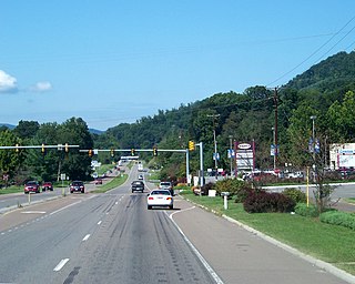
The Huntington–Ashland metropolitan area is a metropolitan area in the Appalachian Plateau region of the United States. Referred to locally as the “Tri-State area”, the region spans seven counties in the three states of West Virginia, Kentucky, and Ohio. With a population of 361,580, the Tri-State area is nestled along the banks of the Ohio River.
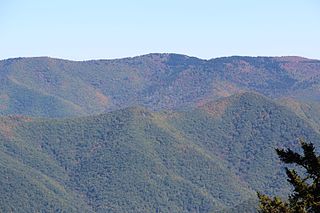
Shining Rock is a mountain in western North Carolina. The mountain is one of the Great Balsam Mountains which are a part of the Blue Ridge Mountains within the Appalachian Mountains. It is the 38th tallest mountain in the eastern United States.
Ridgecrest is an unincorporated community in eastern Buncombe County, North Carolina, off Interstate 40/U.S. Route 70. The community is part of the Asheville Metropolitan Statistical Area. It is home to Ridgecrest Conference Center, Camp Ridgecrest for Boys and Camp Crestridge for Girls. All three facilities are operated by LifeWay Christian Resources and are affiliated with the Southern Baptist Convention.
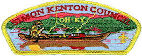
The Simon Kenton Council (#441) is a Boy Scouts of America council created in 1994 that serves members of the Cub Scouts, Scouts BSA, Venturing, Exploring and in-school programs in central and southern Ohio, and northern Kentucky. The council is divided into ten districts with headquarters in Columbus, Ohio and additional service centers located in Chillicothe and Portsmouth, Ohio. Simon Kenton Council is part of Area 4 of the Central Region, and is named in honor of frontiersman Simon Kenton.
Kennedy Center Field is a community baseball field at the Kennedy Center YMCA recreation camp on West Virginia Route 2 about 4 miles (6.4 km) north of Huntington, West Virginia. The field is used by the Marshall University baseball team. The field had almost no provisions for spectators, and limited locker rooms, in 2014, the university funded an upgrade with some spectator facilities and an artificial turf infield, however the field remains unlighted. The upgrades were accompanied with a five-year lease from the school. Because of its inadequacies, Marshall played all conference home games at Appalachian Power Park in Charleston, 40 miles (64 km) from campus. For the 2019 season, the university funded further upgrades which allowed all its games to be played at the venue.
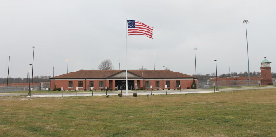
The Federal Correctional Institution, Ashland is a low-security United States federal prison for male inmates in the unincorporated area of Summit in Boyd County, Kentucky, approximately 5 miles outside the city of Ashland. It is operated by the Federal Bureau of Prisons, a division of the United States Department of Justice. It also includes a satellite prison camp for minimum-security male offenders.
St. Peter's Dome is a granite-topped peak on Pikes Peak massif in the Pike National Forest. The peak, at 9,528 feet (2,904 m) in elevation, is located in El Paso County, Colorado, above Colorado Springs. It is located about 8 miles (13 km) from Colorado Springs along Old Stage and Gold Camp Roads. Old Stage Road is picked up behind The Broadmoor and Gold Camp Road winds through Cheyenne Canyon.
Camp Rock is a summit in Wise and Scott counties, Virginia, in the United States.
Castle Rock is an extinct town in Osage County, in the U.S. state of Missouri. The townsite lies is located on the inside curve of an incised meander of the Osage River. The Castle Rock formation for which it was named lies across the river to the north in Cole County just southeast of Wardsville. The Pikes Camp Wildlife Area lies to the west across the river.

Mabee Corner is an unincorporated community in Hamilton Township, Jackson County, Ohio, United States. It is located west of Oak Hill at the intersection of Bucklick Creek Road and Ohio State Route 139, at 38°54′10″N82°43′16″W.
Municipalities and communities of Lawrence County, Ohio, United States | ||
|---|---|---|
| City |  | |
| Villages | ||
| Townships | ||
| CDP | ||
| Unincorporated communities | ||
| Footnotes | ‡This populated place also has portions in an adjacent county or counties | |
Coordinates: 38°31′47″N82°32′55″W / 38.5297222°N 82.5486111°W
| This Lawrence County, Ohio state location article is a stub. You can help Wikipedia by expanding it. |