Lincoln County, West Virginia

Last updated

Lincoln County
County
Lincoln County Courthouse West Virginia.jpg
The Lincoln County Courthouse in Hamlin in 2007
Map of West Virginia highlighting Lincoln County.svg
Location within the U.S. state of West Virginia
West Virginia in United States.svg
West Virginia's location within the U.S.
Coordinates: 38°11′N82°04′W / 38.18°N 82.07°W / 38.18; -82.07
CountryFlag of the United States.svg United States
StateFlag of West Virginia.svg  West Virginia
FoundedFebruary 23, 1867
Named for Abraham Lincoln
Seat Hamlin
Largest townHamlin
Area
  Total439 sq mi (1,140 km2)
  Land437 sq mi (1,130 km2)
  Water1.6 sq mi (4 km2)  0.4%
Population
 (2020)
  Total20,463
  Estimate 
(2021)
20,126 Decrease2.svg
  Density47/sq mi (18/km2)
Time zone UTC−5 (Eastern)
  Summer (DST) UTC−4 (EDT)
Congressional district 1st
Website www.lincolncountywv.org

Lincoln County is a county in the U.S. state of West Virginia. As of the 2020 census, the population was 20,463. [1] Its county seat is Hamlin. [2] The county was created in 1867 and named for Abraham Lincoln. [3]

Contents

Lincoln County is part of the Huntington-Ashland, WV-KY-OH Metropolitan Statistical Area.

History

Lincoln County was created by an act of the West Virginia Legislature on February 23, 1867, from parts of Boone, Cabell, Kanawha and Putnam counties. By 1869, the county had returned much of its Putnam County territory and absorbed the northern portion of Logan County and a portion of Wayne County. In 1869, Harts Creek Township (later district) was created from this latter region. Lincoln County is one of five counties created by West Virginia since the Civil War. Hamlin, seat of government for the county, was established in 1853.

Jesse, John, David, William, and Moses McComas were the first Anglo settlers in what is now Lincoln County. They cultivated 20 acres (81,000 m2) of corn, the first ever grown in the area near present-day West Hamlin, in 1799. Later that year, they returned to eastern Virginia to get their families. Their families were initially left behind because it was not known if there were any hostile Native Americans in the area, or if the soil would be suitable for cultivation. John Lucas, William Hinch, and John Johnson soon joined the McComases in the county. They built cabins in the county around 1800. About 1804, William Wirt Brumfield settled at the mouth of Big Ugly Creek.

Based on military enlistments, Lincoln County appears to have been evenly divided in its sympathies during the Civil War. The county hosted a handful of small skirmishes, mostly centered on Mud River.

After the war, timbering constituted the county's primary industry. The county also became nationally known for its tobacco cultivation. In the early twentieth century, the county experienced a gas boom.

In 1863, West Virginia's counties were divided into civil townships, with the intention of encouraging local government. This proved impractical in the heavily rural state, and in 1872 the townships were converted into magisterial districts. [4] Between its formation in 1867 and 1870, Lincoln County was divided into seven townships: Carroll, Duval, [lower-roman 1] Harts Creek, [lower-roman 2] Jefferson, Sheridan, Union, and Washington. In 1871, Laurel Hill Township was formed from portions of Harts Creek and Sheridan Townships. The following year, the eight townships became magisterial districts. Except for minor adjustments, the eight historic magisterial districts remained largely unchanged until the twenty-first century, when they were consolidated into three new districts: District 1, District 2, and District 3. [5]

Geography

According to the United States Census Bureau, the county has a total area of 439 square miles (1,140 km2), of which 437 square miles (1,130 km2) is land and 1.6 square miles (4.1 km2) (0.4%) is water. [6]

Major highways

Adjacent counties

Demographics

Historical population
CensusPop.Note
1870 5,053
1880 8,73972.9%
1890 11,24628.7%
1900 15,43437.2%
1910 20,49132.8%
1920 19,378−5.4%
1930 19,156−1.1%
1940 22,88619.5%
1950 22,466−1.8%
1960 20,267−9.8%
1970 18,912−6.7%
1980 23,67525.2%
1990 21,382−9.7%
2000 22,1083.4%
2010 21,720−1.8%
2020 20,463−5.8%
2021 (est.)20,126 [7] −1.6%
U.S. Decennial Census [8]
1790–1960 [9] 1900–1990 [10]
1990–2000 [11] 2010–2020 [1]

2000 census

As of the census of 2000, there were 22,108 people, 8,664 households, and 6,532 families living in the county. The population density was 50 inhabitants per square mile (19/km2). There were 9,846 housing units at an average density of 22 units per square mile (8.5 units/km2). The racial makeup of the county was 99.04% White, 0.06% Black or African American, 0.17% Native American, 0.06% Asian, 0.01% Pacific Islander, 0.06% from other races, and 0.61% from two or more races. 0.55% of the population were Hispanic or Latino of any race.

There were 8,664 households, out of which 33.00% had children under the age of 18 living with them, 60.40% were married couples living together, 10.80% had a female householder with no husband present, and 24.60% were non-families. 22.20% of all households were made up of individuals, and 10.40% had someone living alone who was 65 years of age or older. The average household size was 2.54 and the average family size was 2.94.

In the county, the population was spread out, with 23.60% under the age of 18, 9.30% from 18 to 24, 29.10% from 25 to 44, 24.90% from 45 to 64, and 13.10% who were 65 years of age or older. The median age was 37 years. For every 100 females there were 97.20 males. For every 100 females age 18 and over, there were 96.00 males.

The median income for a household in the county was $22,662, and the median income for a family was $28,297. Males had a median income of $30,810 versus $18,270 for females. The per capita income for the county was $13,073. About 22.80% of families and 27.90% of the population were below the poverty line, including 37.60% of those under age 18 and 20.80% of those age 65 or over.

2010 census

As of the 2010 United States census, there were 21,720 people, 8,783 households, and 6,268 families living in the county. [12] The population density was 49.7 inhabitants per square mile (19.2/km2). There were 9,887 housing units at an average density of 22.6 per square mile (8.7/km2). [13] The racial makeup of the county was 99.0% white, 0.1% Asian, 0.1% American Indian, 0.1% black or African American, 0.1% from other races, and 0.6% from two or more races. Those of Hispanic or Latino origin made up 0.4% of the population. [12] In terms of ancestry, 27.0% were American, 12.8% were Irish, 12.4% were English, and 12.4% were German. [14]

Of the 8,783 households, 32.3% had children under the age of 18 living with them, 55.3% were married couples living together, 10.7% had a female householder with no husband present, 28.6% were non-families, and 25.6% of all households were made up of individuals. The average household size was 2.47 and the average family size was 2.92. The median age was 41.2 years. [12]

The median income for a household in the county was $30,868 and the median income for a family was $37,667. Males had a median income of $43,662 versus $23,166 for females. The per capita income for the county was $16,439. About 22.8% of families and 26.6% of the population were below the poverty line, including 37.7% of those under age 18 and 13.2% of those age 65 or over. [15]

Politics

As like the rest of West Virginia, Lincoln county was solidly Democratic up until the 2000s. After they took a massive shift towards the GOP, the last Democratic candidate to carry Lincoln County was Al Gore in 2000.

United States presidential election results for Lincoln County, West Virginia [16]
Year Republican Democratic Third party
No.%No.%No.%
2020 6,01276.77%1,71121.85%1081.38%
2016 5,30774.36%1,45920.44%3715.20%
2012 4,38364.29%2,22732.66%2083.05%
2008 3,63753.21%3,02944.32%1692.47%
2004 4,10249.35%4,04848.70%1621.95%
2000 3,38945.40%3,93952.77%1361.82%
1996 2,53030.72%4,99460.64%7118.63%
1992 2,63733.03%4,50256.39%84510.58%
1988 3,45740.53%5,04959.20%230.27%
1984 4,40544.49%5,46755.21%300.30%
1980 4,00942.24%5,31756.03%1641.73%
1976 2,99736.30%5,26063.70%00.00%
1972 4,67354.66%3,87645.34%00.00%
1968 3,66242.43%4,38650.82%5836.75%
1964 3,43636.99%5,85263.01%00.00%
1960 4,57947.69%5,02352.31%00.00%
1956 4,95449.91%4,97250.09%00.00%
1952 4,78448.41%5,09951.59%00.00%
1948 4,06547.74%4,43352.07%160.19%
1944 4,17553.33%3,65446.67%00.00%
1940 4,81847.96%5,22852.04%00.00%
1936 4,38244.93%5,37055.07%00.00%
1932 3,88144.32%4,87655.68%00.00%
1928 3,82352.81%3,41647.19%00.00%
1924 3,16447.29%3,35550.15%1712.56%
1920 3,33955.58%2,64944.09%200.33%
1916 2,10449.20%2,11349.42%591.38%
1912 63115.09%1,87644.87%1,67440.04%

Communities

Towns

Magisterial districts

Current

  • District 1
  • District 2
  • District 3

Historic

  • Carroll
  • Duval
  • Harts Creek
  • Jefferson
  • Laurel Hill
  • Sheridan
  • Union
  • Washington

Census-designated places

Unincorporated communities

Notable people

See also

Footnotes

  1. Also spelled "Duvall" in earlier records.
  2. Originally spelled "Hart's Creek".

Related Research Articles

<span class="mw-page-title-main">Braxton County, West Virginia</span> County in West Virginia, United States

Braxton County is a county in the central part of the U.S. state of West Virginia. As of the 2020 census, the population was 12,447. The county seat is Sutton. The county was formed in 1836 from parts of Lewis, Kanawha, and Nicholas counties and named for Carter Braxton, a Virginia statesman and signer of the Declaration of Independence.

<span class="mw-page-title-main">Wyoming County, West Virginia</span> County in West Virginia, United States

Wyoming County is a county in the U.S. state of West Virginia. As of the 2020 census, the population was 21,382. Its county seat is Pineville. The county was created in 1850 from Logan County and named for the Lenape word meaning "large plains".

<span class="mw-page-title-main">Wood County, West Virginia</span> County in West Virginia, United States

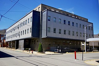
Wood County is a county in the U.S. state of West Virginia. As of the 2020 census, the population was 84,296, making it West Virginia's fifth-most populous county. Its county seat is Parkersburg. The county was formed in 1798 from the western part of Harrison County and named for James Wood, governor of Virginia from 1796 to 1799.

<span class="mw-page-title-main">Wirt County, West Virginia</span> County in West Virginia, United States

Wirt County is a county in the U.S. state of West Virginia. As of the 2020 census, the population was 5,194, making it the least populous county in West Virginia. Its county seat is Elizabeth. The county was created in 1848 by the Virginia General Assembly and named for U.S. Attorney General and presidential candidate William Wirt. The county is served by one high school, Wirt County High School.

<span class="mw-page-title-main">Webster County, West Virginia</span> County in West Virginia, United States

Webster County is a county in the U.S. state of West Virginia. As of the 2020 census, the population was 8,378. Its county seat is Webster Springs. The county was founded in 1860 and named for Daniel Webster.

<span class="mw-page-title-main">Wayne County, West Virginia</span> County in West Virginia, United States

Wayne County is the westernmost county in the U.S. state of West Virginia. As of the 2020 census, the population was 38,982. Its county seat is Wayne. The county was founded in 1842 and named for General "Mad" Anthony Wayne.

<span class="mw-page-title-main">Upshur County, West Virginia</span> County in West Virginia, United States

Upshur County is a county in the U.S. state of West Virginia. As of the 2020 census, the population was 23,816. Its county seat is Buckhannon. The county was formed in 1851 from Randolph, Barbour, and Lewis counties and named for Abel Parker Upshur, a distinguished statesman and jurist of Virginia. Upshur served as United States Secretary of State and Secretary of the Navy under President John Tyler.

<span class="mw-page-title-main">Tyler County, West Virginia</span> County in West Virginia, United States

Tyler County is a county in the U.S. state of West Virginia. As of the 2020 census, the population was 8,313. Its county seat is Middlebourne. The county was founded in 1814 and is named after John Tyler, Sr., father of President John Tyler.

<span class="mw-page-title-main">Taylor County, West Virginia</span> County in West Virginia, United States

Taylor County is a county in the U.S. state of West Virginia. As of the 2020 census, the population was 16,705. Its county seat is Grafton. The county was formed in 1844 and named for Senator John Taylor of Caroline.

<span class="mw-page-title-main">Roane County, West Virginia</span> County in West Virginia, United States

Roane County is a county located in the U.S. state of West Virginia. As of the 2020 census, the population was 14,028. Its county seat is Spencer. The county was founded in 1856 and is named for Spencer Roane.

<span class="mw-page-title-main">Raleigh County, West Virginia</span> County in West Virginia, United States

Raleigh County is a county in the U.S. state of West Virginia. As of the 2020 census, the population was 74,591. Its county seat is Beckley. The county was founded in 1850 and is named for Sir Walter Raleigh. Raleigh County is included in the Beckley, West Virginia Metropolitan Statistical Area.

<span class="mw-page-title-main">Pocahontas County, West Virginia</span> County in West Virginia, United States

Pocahontas County is a county located in the eastern part of the U.S. state of West Virginia. As of the 2020 census, the population was 7,869. Its county seat is Marlinton. The county was established in 1821. It is named after the daughter of the Powhatan chief of the Native Americans in the United States who came from Jamestown, Virginia. She married an English settler, and their children became ancestors of many of the First Families of Virginia.

<span class="mw-page-title-main">Monroe County, West Virginia</span> County in West Virginia, United States

Monroe County is a county in the U.S. state of West Virginia. As of the 2020 census, the population was 12,376. Its county seat is Union.

<span class="mw-page-title-main">Mingo County, West Virginia</span> County in West Virginia, United States

Mingo County is a county in the U.S. state of West Virginia. As of the 2020 census, the population was 23,568. Its county seat and largest city is Williamson. Created in 1895, Mingo is West Virginia's newest county, named for the historic Iroquoian Mingo people.

<span class="mw-page-title-main">Mineral County, West Virginia</span> County in West Virginia, United States

Mineral County is a county in the U.S. state of West Virginia. It is part of the Cumberland metropolitan area, together with Cumberland, Maryland. As of the 2020 census, the population was 26,938. Its county seat is Keyser. The county was founded in 1866.

<span class="mw-page-title-main">Logan County, West Virginia</span> County in West Virginia, United States

Logan County is a county in the U.S. state of West Virginia. As of the 2020 census, the population was 32,567. Its county seat is Logan. Logan County comprises the Logan, WV Micropolitan Statistical Area, which is also included in the Charleston–Huntington–Ashland, WV–OH–KY Combined Statistical Area.

<span class="mw-page-title-main">Lewis County, West Virginia</span> County in West Virginia, United States

Lewis County is a county in the U.S. state of West Virginia. As of the 2020 census, the population was 17,033. Its county seat is Weston. The county was formed in 1816 from Harrison County.

<span class="mw-page-title-main">Calhoun County, West Virginia</span> County in West Virginia, United States

Calhoun County is a county in the U.S. state of West Virginia. As of the 2020 census, the population was 6,229, making it the third-least populous county in West Virginia. Its county seat is Grantsville. The county was founded in 1856 and named for South Carolina politician John C. Calhoun.

<span class="mw-page-title-main">Boone County, West Virginia</span> County in West Virginia, United States

Boone County is a county in the U.S. state of West Virginia. As of the 2020 census, the population was 21,809. Its county seat is Madison. Boone County is part of the Charleston, WV Metropolitan Statistical Area. Leading industries and chief agricultural products in Boone County include coal, lumber, natural gas, tobacco, and strawberries.

<span class="mw-page-title-main">Harts, West Virginia</span> Census-designated place in West Virginia, United States

Harts is a census-designated place (CDP) at the mouth of Big Harts Creek in Lincoln County, West Virginia, United States, situated along the Guyandotte River. As of the 2010 census, its population was 656. Harts is a part of the Huntington-Ashland, WV-KY-OH, Metropolitan Statistical Area (MSA). The Harts CDP includes the unincorporated communities of Harts, Atenville, Ferrellsburg, and Sand Creek.

References

  1. 1 2 "State & County QuickFacts". United States Census Bureau. Retrieved August 14, 2022.
  2. "Find a County". National Association of Counties. Retrieved June 7, 2011.
  3. Gannett, Henry (1905). The Origin of Certain Place Names in the United States. U.S. Government Printing Office. p.  187.
  4. Otis K. Rice & Stephen W. Brown, West Virginia: A History, 2nd ed., University Press of Kentucky, Lexington (1993), p. 240.
  5. United States Census Bureau, U.S. Decennial Census, Tables of Minor Civil Divisions in West Virginia, 1870–2010.
  6. "2010 Census Gazetteer Files". United States Census Bureau. August 22, 2012. Retrieved July 24, 2015.
  7. "Annual Estimates of the Resident Population for Counties: April 1, 2020 to July 1, 2021" . Retrieved August 14, 2022.
  8. "U.S. Decennial Census". United States Census Bureau. Retrieved January 10, 2014.
  9. "Historical Census Browser". University of Virginia Library. Retrieved January 10, 2014.
  10. "Population of Counties by Decennial Census: 1900 to 1990". United States Census Bureau. Retrieved January 10, 2014.
  11. "Census 2000 PHC-T-4. Ranking Tables for Counties: 1990 and 2000" (PDF). United States Census Bureau. Archived (PDF) from the original on October 9, 2022. Retrieved January 10, 2014.
  12. 1 2 3 "DP-1 Profile of General Population and Housing Characteristics: 2010 Demographic Profile Data". United States Census Bureau. Archived from the original on February 13, 2020. Retrieved April 3, 2016.
  13. "Population, Housing Units, Area, and Density: 2010 - County". United States Census Bureau. Archived from the original on February 13, 2020. Retrieved April 3, 2016.
  14. "DP02 SELECTED SOCIAL CHARACTERISTICS IN THE UNITED STATES – 2006-2010 American Community Survey 5-Year Estimates". United States Census Bureau. Archived from the original on February 13, 2020. Retrieved April 3, 2016.
  15. "DP03 SELECTED ECONOMIC CHARACTERISTICS – 2006-2010 American Community Survey 5-Year Estimates". United States Census Bureau. Archived from the original on February 13, 2020. Retrieved April 3, 2016.
  16. Leip, David. "Dave Leip's Atlas of U.S. Presidential Elections". uselectionatlas.org. Retrieved March 27, 2018.

38°11′N82°04′W / 38.18°N 82.07°W / 38.18; -82.07