Upshur County, West Virginia

Last updated

Upshur County
Upshur County Courthouse Buckhannon.jpg
The Upshur County Courthouse, designed by architect Harrison Albright [1] pictured in Buckhannon in 2006
Seal of Upshur County, West Virginia.png
Map of West Virginia highlighting Upshur County.svg
Location within the U.S. state of West Virginia
West Virginia in United States.svg
West Virginia's location within the U.S.
Coordinates: 38°54′N80°14′W / 38.9°N 80.23°W / 38.9; -80.23
CountryFlag of the United States.svg United States
StateFlag of West Virginia.svg  West Virginia
FoundedMarch 26, 1851
Named for Abel Parker Upshur
Seat Buckhannon
Largest cityBuckhannon
Area
  Total355 sq mi (920 km2)
  Land355 sq mi (920 km2)
  Water0.1 sq mi (0.3 km2)  0.03%
Population
 (2020)
  Total23,816
  Estimate 
(2021)
23,791 Decrease2.svg
  Density67/sq mi (26/km2)
Time zone UTC−5 (Eastern)
  Summer (DST) UTC−4 (EDT)
Congressional district 2nd
Website www.upshurcounty.org

Upshur County is a county in the U.S. state of West Virginia. As of the 2020 census, the population was 23,816. [2] Its county seat is Buckhannon. [3] The county was formed in 1851 from Randolph, Barbour, and Lewis counties and named for Abel Parker Upshur, a distinguished statesman and jurist of Virginia. [4] Upshur served as United States Secretary of State and Secretary of the Navy under President John Tyler.

Contents

Geography

According to the United States Census Bureau, the county has a total area of 355 square miles (920 km2), of which 354.9 square miles (919 km2) is land and 0.1 square miles (0.26 km2) (0.03%) is water. [5] The county falls within the United States National Radio Quiet Zone. The highest elevation in Upshur County is 3,160 feet, near Sugar Run on the Randolph and Upshur County lines just outside Palace Valley and Hemlock. It is reported there as an elevation marker at the site.

In 1863, West Virginia's counties were divided into civil townships, with the intention of encouraging local government. This proved impractical in the heavily rural state, and in 1872 the townships were converted into magisterial districts. [6] Upshur County was divided into six districts: Banks, Buckhannon, Meade, Union, Warren, and Washington. In the 1990s, the six historic magisterial districts were consolidated into three new districts: First, Second, and Third. [7]

Major highways

Adjacent counties

Demographics

Historical population
CensusPop.Note
1860 7,292
1870 8,02310.0%
1880 10,24927.7%
1890 12,71424.1%
1900 14,69615.6%
1910 16,62913.2%
1920 17,8517.3%
1930 17,9440.5%
1940 18,3602.3%
1950 19,2424.8%
1960 18,292−4.9%
1970 19,0924.4%
1980 23,42722.7%
1990 22,867−2.4%
2000 23,4042.3%
2010 24,2543.6%
2020 23,816−1.8%
2021 (est.)23,791 [8] −0.1%
U.S. Decennial Census [9]
1790–1960 [10] 1900–1990 [11]
1990–2000 [12] 2010–2020 [2]

2020 census

As of the 2020 census, there were 23,816 people and 9,599 households residing in the county. There were 11,178 housing units in Upshur County. The racial makeup of the city was 94.4% White, 0.9% African American, 0.7% Asian, 0.2% Native American, 0.6% from other races, and 3.8% from two or more races. Hispanics or Latinos of any race were 1.3% of the population.

There were 26,143 households, of which 44.8% were married couples living together, 28% had a female householder with no spouse present,19.5% had a male householder with no spouse present. The average household and family size was 2.94. The median age in the county was 41.9 years with 20.8% of the population under 18. The median income for a household in the city was $44,470 and the poverty rate was 20%. [13]

2010 census

As of the 2010 United States census, there were 24,254 people, 9,619 households, and 6,528 families living in the county. [14] The population density was 68.4 inhabitants per square mile (26.4/km2). There were 11,099 housing units at an average density of 31.3 units per square mile (12.1 units/km2). [15] The racial makeup of the county was 97.6% white, 0.7% black or African American, 0.4% Asian, 0.2% American Indian, 0.2% from other races, and 1.0% from two or more races. Those of Hispanic or Latino origin made up 1.0% of the population. [14] In terms of ancestry, 18.1% were German, 13.8% were American, 10.6% were Irish, and 8.6% were English. [16]

Of the 9,619 households, 28.7% had children under the age of 18 living with them, 54.0% were married couples living together, 9.6% had a female householder with no husband present, 32.1% were non-families, and 26.9% of all households were made up of individuals. The average household size was 2.40 and the average family size was 2.88. The median age was 40.9 years. [14]

The median income for a household in the county was $36,114 and the median income for a family was $44,937. Males had a median income of $36,517 versus $25,420 for females. The per capita income for the county was $18,823. About 14.1% of families and 19.3% of the population were below the poverty line, including 26.7% of those under age 18 and 14.1% of those age 65 or over. [17]

2000 census

As of the census of 2000, there were 24,254 people, 9,619 households, and 6,528 families living in the county. The population density was 68.4 people per square mile (26.4 people/km2). There were 11,099 housing units at an average density of 31.3 units per square mile (12.1 units/km2). The racial makeup of the county was 97.6% White, 0.7% Black or African American, 0.2% Native American, 0.2% Asian, 0.2% from other races, and 1% from two or more races. 1% of the population were Hispanic or Latino of any race.

There were 9,619 households, out of which 28.7% had children under the age of 18 living with them, 54% were married couples living together, 9.6% had a female householder with no husband present, and 32.1% were non-families. 26.9% of all households were made up of individuals, and 12.2% had someone living alone who was 65 years of age or older. The average household size was 2.4 and the average family size was 2.88.

In the county, the population was spread out, with 24.7% from age 0 to 19, 7.60% from 20 to 24, 22.6% from 25 to 44, 28.3% from 45 to 64, and 16.6% who were 65 years of age or older. The median age was 41 years. For every 100 females there were 97 males.

The median income for a household in the county was $39,381, whereas the median income for families was 44,937 . Males had a median income of $36,517 versus $25,420 for females. The per capita income for the county was $19,498. About 14.1% of families and 19.3% of the population were below the poverty line, including 26.7% of those under age 18 and 14.1% of those age 65 or over.

Communities

City

Magisterial districts

Current

  • First
  • Second
  • Third

Historic

Upshur County was divided into six townships on July 31, 1863. They were replaced in the 1990s.

Unincorporated communities

Politics

Whereas most of West Virginia has seen a rapid and continuing shift to the Republican Party since the 1990s, Upshur County—though strongly Democratic during the Second Party System—has ever since statehood been a Republican stronghold due to its powerful Unionist sympathies from Civil War days, and the association of the Democratic Party with the “Slave Power” and creating a war the yeoman residents had no desire to fight. [18] The solitary post-Civil War Democrat to win the county has been Lyndon Johnson in 1964, and he won by only 168 votes. Since 1896, only two other Democrats—Jimmy Carter in 1976 and Bill Clinton in 1996—have topped forty percent in the county.

United States presidential election results for Upshur County, West Virginia [19]
Year Republican Democratic Third party
No.%No.%No.%
2020 7,77176.01%2,25622.07%1961.92%
2016 7,00575.34%1,76618.99%5275.67%
2012 5,93971.57%2,15826.01%2012.42%
2008 5,91165.89%2,92532.61%1351.50%
2004 6,19166.62%3,03432.65%680.73%
2000 5,16563.58%2,77034.10%1882.31%
1996 3,32544.65%3,05240.98%1,07014.37%
1992 3,50542.47%3,16138.30%1,58719.23%
1988 4,81360.97%3,06538.83%160.20%
1984 5,95170.29%2,46829.15%470.56%
1980 4,75158.66%2,86735.40%4815.94%
1976 4,78957.68%3,51342.32%00.00%
1972 6,44978.23%1,79521.77%00.00%
1968 4,56562.44%2,31931.72%4275.84%
1964 3,60648.86%3,77451.14%00.00%
1960 5,12366.42%2,59033.58%00.00%
1956 5,70773.28%2,08126.72%00.00%
1952 5,93872.66%2,23427.34%00.00%
1948 5,06868.31%2,32331.31%280.38%
1944 5,33272.47%2,02627.53%00.00%
1940 6,08668.02%2,86231.98%00.00%
1936 5,74564.30%3,16335.40%260.29%
1932 5,07761.23%3,14737.95%680.82%
1928 5,27775.20%1,68323.98%570.81%
1924 4,93070.24%1,95227.81%1371.95%
1920 4,93677.17%1,41822.17%420.66%
1916 2,55370.14%1,01927.99%681.87%
1912 83523.88%89525.59%1,76750.53%

Economy

Economy includes coal mining and timber, as well as higher education—the Upshur County seat of Buckhannon is home to the small, private, liberal arts institution West Virginia Wesleyan College. The West Virginia State Wildlife Center in French Creek also generates some income as a popular tourist attraction. Upshur County also gained international attention during the Sago Mine disaster in 2006; the blast and ensuing aftermath trapped 13 coal miners for nearly two days, only one of whom survived. [20]

See also

Related Research Articles

<span class="mw-page-title-main">Clay County, West Virginia</span> County in West Virginia, United States

Clay County is a county in the U.S. state of West Virginia. As of the 2020 census, the population was 8,051. Its county seat is Clay. The county was founded in 1858 and named in honor of Henry Clay, famous American statesman, member of the United States Senate from Kentucky and United States Secretary of State in the 19th century.

<span class="mw-page-title-main">Barbour County, West Virginia</span> County in West Virginia, United States

Barbour County is a county in north central West Virginia, United States. At the 2020 census, the population was 15,465. The county seat is Philippi, which was chartered in 1844. Both county and city were named for Philip P. Barbour (1783–1841), a U.S. Congressman from Virginia and Associate Justice of the U.S. Supreme Court. The county was formed in 1843 when the region was still part of the state of Virginia. In 1871, a small part of Barbour County was transferred to Tucker County, West Virginia.

<span class="mw-page-title-main">Braxton County, West Virginia</span> County in West Virginia, United States

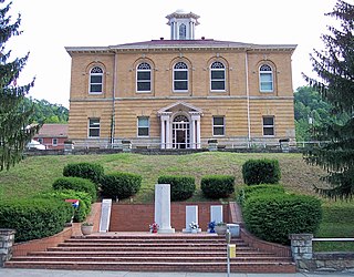
Braxton County is a county in the central part of the U.S. state of West Virginia. As of the 2020 census, the population was 12,447. The county seat is Sutton. The county was formed in 1836 from parts of Lewis, Kanawha, and Nicholas counties and named for Carter Braxton, a Virginia statesman and signer of the Declaration of Independence.

<span class="mw-page-title-main">Wyoming County, West Virginia</span> County in West Virginia, United States

Wyoming County is a county in the U.S. state of West Virginia. As of the 2020 census, the population was 21,382. Its county seat is Pineville. The county was created in 1850 from Logan County and named for the Lenape word meaning "large plains".

<span class="mw-page-title-main">Wood County, West Virginia</span> County in West Virginia, United States

Wood County is a county in the U.S. state of West Virginia. As of the 2020 census, the population was 84,296, making it West Virginia's fifth-most populous county. Its county seat is Parkersburg. The county was formed in 1798 from the western part of Harrison County and named for James Wood, governor of Virginia from 1796 to 1799.

<span class="mw-page-title-main">Wetzel County, West Virginia</span> County in West Virginia, United States

Wetzel County is a county in the U.S. state of West Virginia. As of the 2020 census, the population was 14,442. Its county seat is New Martinsville. The county, founded in 1846, is named for Lewis Wetzel, a famous frontiersman and Indian fighter. Its northern border aligns with the Mason-Dixon line, but is to the west of the line's western terminus.

<span class="mw-page-title-main">Webster County, West Virginia</span> County in West Virginia, United States

Webster County is a county in the U.S. state of West Virginia. As of the 2020 census, the population was 8,378. Its county seat is Webster Springs. The county was founded in 1860 and named for Daniel Webster.

<span class="mw-page-title-main">Taylor County, West Virginia</span> County in West Virginia, United States

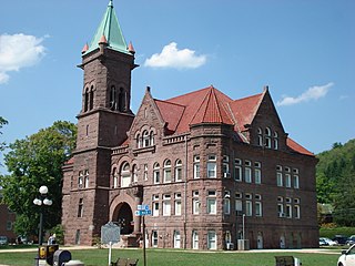
Taylor County is a county in the U.S. state of West Virginia. As of the 2020 census, the population was 16,705. Its county seat is Grafton. The county was formed in 1844 and named for Senator John Taylor of Caroline.

<span class="mw-page-title-main">Roane County, West Virginia</span> County in West Virginia, United States

Roane County is a county located in the U.S. state of West Virginia. As of the 2020 census, the population was 14,028. Its county seat is Spencer. The county was founded in 1856 and is named for Spencer Roane.

<span class="mw-page-title-main">Ritchie County, West Virginia</span> County in West Virginia, United States

Ritchie County is a county in the U.S. state of West Virginia. As of the 2020 census, the population was 8,444. Its county seat is Harrisville. The county was created in 1843 by the Virginia General Assembly and named for Richmond newspaper publisher Thomas Ritchie.

<span class="mw-page-title-main">Randolph County, West Virginia</span> County in West Virginia, United States

Randolph County is a county located in the U.S. state of West Virginia. As of the 2020 census, the population was 27,932. Its county seat is Elkins. The county was founded in 1787 and is named for Edmund Jennings Randolph.

<span class="mw-page-title-main">Pocahontas County, West Virginia</span> County in West Virginia, United States

Pocahontas County is a county located in the eastern part of the U.S. state of West Virginia. As of the 2020 census, the population was 7,869. Its county seat is Marlinton. The county was established in 1821. It is named after the daughter of the Powhatan chief of the Native Americans in the United States who came from Jamestown, Virginia. She married an English settler, and their children became ancestors of many of the First Families of Virginia.

<span class="mw-page-title-main">Nicholas County, West Virginia</span> County in West Virginia, United States

Nicholas County is a county located in the central region of U.S. state of West Virginia. As of the 2020 census, the population was 24,604. Its county seat is Summersville. The county was created in 1818 by the Virginia General Assembly and named for Virginia Governor Wilson Cary Nicholas.

<span class="mw-page-title-main">Lewis County, West Virginia</span> County in West Virginia, United States

Lewis County is a county in the U.S. state of West Virginia. As of the 2020 census, the population was 17,033. Its county seat is Weston. The county was formed in 1816 from Harrison County.

<span class="mw-page-title-main">Boone County, West Virginia</span> County in West Virginia, United States

Boone County is a county in the U.S. state of West Virginia. As of the 2020 census, the population was 21,809. Its county seat is Madison. Boone County is part of the Charleston, WV Metropolitan Statistical Area. Leading industries and chief agricultural products in Boone County include coal, lumber, natural gas, tobacco, and strawberries.

<span class="mw-page-title-main">Upshur County, Texas</span> County in Texas, United States

Upshur County is a county located in the eastern part of the U.S. state of Texas. As of the 2020 census, the population was 40,892. The county seat is Gilmer. The county is named for Abel P. Upshur, who was U.S. Secretary of State during President John Tyler's administration.

Sago Township is a township in Itasca County, Minnesota, United States. The population was 176 at the 2010 census.

<span class="mw-page-title-main">Flatwoods, West Virginia</span> Town in West Virginia, United States

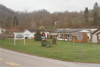
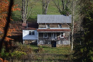
Flatwoods is a town in Braxton County, West Virginia, United States, located approximately one mile from exit 67 of Interstate 79.

<span class="mw-page-title-main">Weston, West Virginia</span> City in West Virginia, United States

Weston is a city in and the county seat of Lewis County, West Virginia, United States. The population was 3,943 at the 2020 census. It is home to the Museum of American Glass in West Virginia and the Trans-Allegheny Lunatic Asylum.

<span class="mw-page-title-main">Buckhannon, West Virginia</span> City in West Virginia, United States

Buckhannon is the only incorporated city in, and the county seat of, Upshur County, West Virginia, United States. Located along the Buckhannon River, the population was 5,299 as of the 2020 census. The city is 46 miles (74 km) southwest of Morgantown, 88 miles (142 km) northeast of the capital city of Charleston, and 100 miles (160 km) south of Pittsburgh, Pennsylvania. It is home to West Virginia Wesleyan College and the West Virginia Strawberry Festival, held annually during the third week of May.

References

  1. Cutright, W (2009). The History of Upshur County, West Virginia. Clearfield. p. 280. ISBN   978-0806346359.
  2. 1 2 "State & County QuickFacts". United States Census Bureau. Retrieved October 18, 2022.
  3. "Find a County". National Association of Counties. Retrieved June 7, 2011.
  4. "Archived copy". Archived from the original on September 23, 2001. Retrieved February 4, 2013.{{cite web}}: CS1 maint: archived copy as title (link)
  5. "2010 Census Gazetteer Files". United States Census Bureau. August 22, 2012. Retrieved July 31, 2015.
  6. Otis K. Rice & Stephen W. Brown, West Virginia: A History, 2nd ed., University Press of Kentucky, Lexington (1993), p. 240.
  7. United States Census Bureau, U.S. Decennial Census, Tables of Minor Civil Divisions in West Virginia, 1870–2010.
  8. "Annual Estimates of the Resident Population for Counties: April 1, 2020 to July 1, 2021" . Retrieved October 18, 2022.
  9. "U.S. Decennial Census". United States Census Bureau. Retrieved January 16, 2014.
  10. "Historical Census Browser". University of Virginia Library. Retrieved January 16, 2014.
  11. "Population of Counties by Decennial Census: 1900 to 1990". United States Census Bureau. Retrieved January 16, 2014.
  12. "Census 2000 PHC-T-4. Ranking Tables for Counties: 1990 and 2000" (PDF). United States Census Bureau. Archived (PDF) from the original on October 9, 2022. Retrieved January 16, 2014.
  13. "Explore Census Data". data.census.gov. Retrieved March 1, 2023.
  14. 1 2 3 "DP-1 Profile of General Population and Housing Characteristics: 2010 Demographic Profile Data". United States Census Bureau. Archived from the original on February 13, 2020. Retrieved April 3, 2016.
  15. "Population, Housing Units, Area, and Density: 2010 - County". United States Census Bureau. Archived from the original on February 13, 2020. Retrieved April 3, 2016.
  16. "DP02 SELECTED SOCIAL CHARACTERISTICS IN THE UNITED STATES – 2006-2010 American Community Survey 5-Year Estimates". United States Census Bureau. Archived from the original on February 13, 2020. Retrieved April 3, 2016.
  17. "DP03 SELECTED ECONOMIC CHARACTERISTICS – 2006-2010 American Community Survey 5-Year Estimates". United States Census Bureau. Archived from the original on February 13, 2020. Retrieved April 3, 2016.
  18. Denton, Lawrence M.; Unionists in Virginia: Politics, Secession and Their Plan to Prevent Civil War, ISBN   1625852797
  19. Leip, David. "Dave Leip's Atlas of U.S. Presidential Elections". uselectionatlas.org. Retrieved March 28, 2018.
  20. "13 coal miners are trapped in Sago Mine disaster; 12 die". HISTORY. Retrieved March 5, 2022.

38°54′N80°14′W / 38.90°N 80.23°W / 38.90; -80.23