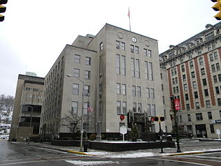
Harrison County is a county in the U.S. state of West Virginia. As of the 2010 census, the population was 69,099. The county seat is Clarksburg.
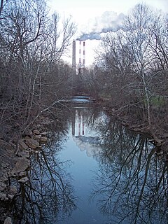
Tenmile Creek is a tributary of the West Fork River, 26.4 miles (42.5 km) long, in north-central West Virginia in the United States. Via the West Fork, Monongahela and Ohio Rivers, it is part of the watershed of the Mississippi River, draining an area of 126 square miles (330 km2) on the unglaciated portion of the Allegheny Plateau.
Tenmile Creek or Ten Mile Creek may refer to streams in:
Pennsylvania Route 218 is a 13.5-mile-long (21.7 km) state highway and spur route of PA 18 located in Greene County, Pennsylvania. The southern terminus is at the West Virginia state line at Blacksville, WV, where the road continues into that state as West Virginia Route 218. The northern terminus is at U.S. Route 19 /PA 21 in Waynesburg, approximately 1 mile (1.6 km) east of PA 18.
The Fletcher Covered Bridge is a 62-foot (19 m) Multiple King Post covered bridge located near Marshville in Harrison County, West Virginia. The bridge crosses Tenmile Creek is West Virginia bridge number 48-17-03. Stones for the abutments were quarried at the top of a hill near the bridge site. The original building cost was $1,372. The Fletcher Covered Bridge is one of only two covered bridges still standing in Harrison County, the other is the Simpson Creek Covered Bridge. This bridge is in regular use today.
Tenmile is an unincorporated community in Douglas County, Oregon, United States. It is located on Oregon Route 42 southwest of Roseburg.
The West Branch Tenmile River is a 5.0-mile-long (8.0 km) tributary of the Tenmile River in western Maine. It is part of the Saco River watershed, flowing to the Atlantic Ocean.

Wallace is an unincorporated community and census-designated place in Harrison County, West Virginia, United States.
Brown is an unincorporated community in Harrison County, in the U.S. state of West Virginia.
Marshville is an unincorporated community in Harrison County, West Virginia, United States. Marshville is located along Tenmile Creek at the junction of County Routes 5 and 7/2, 7 miles (11 km) west-northwest of Clarksburg.

Tenmile is an unincorporated community located in Perry County, Kentucky, United States.

Tenmile is an unincorporated community in Coos County, Oregon, United States. It is about 8 miles (13 km) south of Winchester Bay and one mile west of Lakeside, on U.S. Route 101 next to Tenmile Creek and the Oregon Dunes. Tenmile Lake was named for Tenmile Creek, which was said to be ten miles south of Winchester Bay.
Tenmile Creek is a stream in the U.S. state of West Virginia. It is a tributary of Buckhannon River.
Milltown is an unincorporated community in western Butler County, Missouri, United States. Milltown is located on Hurricane Creek, approximately two miles west of its confluence with Tenmile Creek. It lies within the Mark Twain National Forest, about ten miles west of Poplar Bluff.
Ten Mile is an unincorporated community in Washington County, Pennsylvania.

Waggener Magisterial District is one of ten magisterial districts in Mason County, West Virginia, United States. The district was originally established as a civil township in 1863, and converted into a magisterial district in 1872. In 2010, Waggener District was home to 2,720 people.

Cooper Magisterial District is one of ten magisterial districts in Mason County, West Virginia, United States. The district was originally established as a civil township in 1863, and converted into a magisterial district in 1872. In 2010, Cooper District was home to 1,874 people.
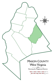
Cologne Magisterial District is one of ten magisterial districts in Mason County, West Virginia, United States. The district was originally established as a civil township in 1863, and converted into a magisterial district in 1872. In 2010, Cologne District was home to 1,459 people.


