Atenville, West Virginia

Last updated

Atenville, West Virginia
USA West Virginia location map.svg
Red pog.svg
Atenville
Usa edcp location map.svg
Red pog.svg
Atenville
Coordinates: 38°2′53″N82°8′34″W / 38.04806°N 82.14278°W / 38.04806; -82.14278
Country United States
State West Virginia
County Lincoln
Elevation
617 ft (188 m)
Time zone UTC-5 (Eastern (EST))
  Summer (DST) UTC-4 (EDT)
GNIS feature ID1535068 [1]

Atenville is an unincorporated community in Lincoln County, West Virginia, United States. It is a residential community located in Harts Creek District and is part of the Harts census-designated place.

Contents

Geography

Atenville is situated at the mouth of Little Harts Creek and includes some territory on the opposite side of the Guyandotte River. Dry Branch is also part of Atenville.

History

Captain Farley's Raid

Captain Henry Farley, a veteran of the Revolutionary War and resident of Montgomery County, Virginia, was the first known Anglo visitor to present-day Atenville. In June 1792, Captain Farley passed through the area while pursuing a Native American war party that had raided Virginia settlements at Bluestone River. By the time he reached what is today Atenville, he and his group had already engaged the retreating natives in the headwaters of Coal River and in the Guyandotte River valley some two miles below what is today Logan. Farley pursued the natives to the mouth of the Guyandotte River before returning home. [2]

According to the F.B. Lambert Papers at Marshall University, Stephen Hart's father was killed by Native Americans at the mouth of Little Harts Creek. Big and Little Harts creeks are named for Hart's family. This incident, if true, would have happened prior to 1795.

Twentieth Century

Atenville is named for a Mr. Aten, an employee of the C&O Railroad. Atenville had a post office from 1906-1918 and from 1922–1926. The following persons have served as postmaster: George W. Dillon (1906-1908), William M. Workman (1908-1914), Nancy Payne (1914-1915), Arnold Perry (1915-1918), Kile Topping (1922-1923), and Wilson B. Lambert (1923-1926). The post office was discontinued on February 27, 1926.

Education

For many years, Atenville was home to Atenville Grade School. The original school was situated on the east side of the Guyandotte River.

Churches

Presently, the Mt. Calvary Freewill Baptist Church and Little Harts Freewill Baptist Church are located in Atenville.

Transportation

Atenville is accessed by Route 10. CSX Railroad is located across the river.

Business

Fern Pack operated a small store at Dry Branch.

Related Research Articles

<span class="mw-page-title-main">Harts, West Virginia</span> Census-designated place in West Virginia, United States

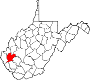
Harts is a census-designated place (CDP) at the mouth of Big Harts Creek in Lincoln County, West Virginia, United States, situated along the Guyandotte River. As of the 2010 census, its population was 656. Harts is a part of the Huntington-Ashland, WV-KY-OH, Metropolitan Statistical Area (MSA). The Harts CDP includes the unincorporated communities of Harts, Atenville, Ferrellsburg, and Sand Creek.

<span class="mw-page-title-main">Chapmanville, West Virginia</span> Town in West Virginia, United States

Chapmanville is a town in Logan County, West Virginia, United States. The population was 1,025 at the 2020 census. Chapmanville is named for Ned Chapman, an early settler who operated a store and post office. It was incorporated in 1947.

<span class="mw-page-title-main">Guyandotte River</span> River in West Virginia, United States

The Guyandotte River is a tributary of the Ohio River, approximately 166 mi (267 km) long, in southwestern West Virginia in the United States. It was named after the French term for the Wendat Native Americans. It drains an area of the unglaciated Allegheny Plateau south of the Ohio between the watersheds of the Kanawha River to the northeast and Twelvepole Creek and the Big Sandy River to the southwest. Via the Ohio River, it is part of the Mississippi River watershed.

<span class="mw-page-title-main">Baber, West Virginia</span> Unincorporated community in West Virginia, United States

Baber is an unincorporated community at the mouth of Limestone Creek along the Guyandotte River situated between the communities of Daisy and Big Creek in northern Logan County, West Virginia, United States. Baber is accessed by West Virginia Route 10 and CSX Railroad.

The Big Sandy, East Lynn and Guyan Railroad in West Virginia was incorporated on June 16, 1902.

<span class="mw-page-title-main">Kellian Whaley</span> American politician

Kellian Van Rensalear Whaley was a nineteenth-century lumberman and congressman from Virginia before the American Civil War and West Virginia after the state's creation. During the Civil War, Whaley was major of the 9th West Virginia Volunteer Infantry and captured during a Confederate raid, but escaped his captors.

Swiss is an unincorporated community in western Nicholas County, West Virginia, United States. Its elevation is 735 ft (224 m).

Ferrellsburg is an unincorporated community in southern Lincoln County, West Virginia, United States. It is located in Harts Creek District and is part of the Harts census-designated place.

<span class="mw-page-title-main">Ethel, West Virginia</span> Unincorporated community in West Virginia, United States

Ethel is an unincorporated community in Logan County, West Virginia, United States. Ethel is located on West Virginia Route 17, 4.5 miles (7.2 km) east-northeast of Logan. Ethel has a post office with ZIP code 25076.

Stollings is an unincorporated community and census-designated place (CDP) in central Logan County, West Virginia, United States. As of the 2010 census, it had a population of 316.

<span class="mw-page-title-main">Shively, West Virginia</span> Unincorporated community in West Virginia, United States

Shively is an unincorporated community located on the Smokehouse Fork of Big Harts Creek in Logan County, West Virginia, United States. Shively is accessed by County Route 3. It is situated 7.2 miles from Harts and 9.3 miles from Chapmanville.

<span class="mw-page-title-main">Whirlwind, West Virginia</span> Unincorporated community in West Virginia, United States

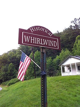
Whirlwind is an unincorporated community on Big Harts Creek in Logan County, West Virginia, United States.

Halcyon is an unincorporated community located on the West Fork of Big Harts Creek in Logan and Lincoln counties, West Virginia, United States.

<span class="mw-page-title-main">Toney, West Virginia</span> Unincorporated community in West Virginia, United States

Toney is an unincorporated community in Lincoln County, West Virginia, United States. Its post office was established in 1904 by Brad Toney, merchant.

<span class="mw-page-title-main">Gill, West Virginia</span> Unincorporated community in West Virginia, United States

Gill is an unincorporated community and former railroad town in Lincoln County, West Virginia, United States.

<span class="mw-page-title-main">Eden Park, West Virginia</span> Unincorporated community in West Virginia, United States

Eden Park is a former coal town situated along the Guyandotte River between Atenville and Harts in Lincoln County, West Virginia, United States. It appears in state business directories as early as 1908.

<span class="mw-page-title-main">Lincoln County feud</span>

The Lincoln County feud occurred in the Harts Creek community of Lincoln and Logan counties, West Virginia, between 1878 and 1890.

The Guyandotte Valley Railroad Company was incorporated by the State of West Virginia on March 1, 1899. Under supervision of the Chesapeake and Ohio Railway, the GVRR constructed 50.2 miles of single track, standard gauge railroad line between Barboursville in Cabell County to Big Creek in Logan County. On October 31, 1903, the C&O acquired its franchise, rights, and property.

<span class="mw-page-title-main">Big Harts Creek</span> River in West Virginia, United States

Big Harts Creek, often shortened to "Harts Creek" or "Big Hart," is a major tributary of the Guyandotte River in Lincoln and Logan counties, West Virginia.

References

  1. U.S. Geological Survey Geographic Names Information System: Atenville, West Virginia
  2. Ragland, Henry Clay (1896). The History of Logan County, West Virginia. Logan, WV: Logan County Banner. pp. 24–25.