Fleming-Neon, Kentucky

Last updated

Fleming-Neon, Kentucky
Fleming-Neon-from-Potter-ky.jpg
Fleming-Neon
Letcher County Kentucky Incorporated and Unincorporated areas Fleming-Neon Highlighted 2127846.svg
Location in Letcher County, Kentucky
Coordinates: 37°11′40″N82°42′21″W / 37.19444°N 82.70583°W / 37.19444; -82.70583
Country United States
State Kentucky
County Letcher
Established (merger)July 7, 1977
Government
  Type Mayor-Council
  MayorRicky Burke
Area
[1]
  Total1.62 sq mi (4.18 km2)
  Land1.61 sq mi (4.18 km2)
  Water0.00 sq mi (0.00 km2)
Elevation
1,391 ft (424 m)
Population
 (2020)
  Total548
  Density339.32/sq mi (131.03/km2)
Time zone UTC-5 (Eastern (EST))
  Summer (DST) UTC-4 (EDT)
ZIP code
41840
Area code 606
FIPS code 21-27846
GNIS feature ID1681811

Fleming-Neon also known as Neon, is a home rule-class city in Letcher County, Kentucky, in the United States. The population was 770 at the 2010 census, [2] down from 840 at the 2000 census.

Contents

History

The city was established by the Elkhorn Coal Corporation which moved into the area in 1913. Fleming was the location of the mine and was named for its first president, George W. Fleming. [3] A city named "Chip" existed near the community that became Fleming; it was quickly built up and served as a trading center for the nearby coal towns. The train that hauled the coal out of Fleming would make stops in Neon. Local tradition holds that the conductor would holler instructions to people climbing aboard the train to "Knee On" and this was corrupted into the present name, replacing Chip. In 1977, the two towns were merged into Fleming-Neon during their municipal incorporation by the General Assembly. [4]

Geography

Fleming-Neon is located in eastern Letcher County at 37°11′40″N82°42′21″W / 37.19444°N 82.70583°W / 37.19444; -82.70583 (37.194421, -82.705937). [5] It is bordered to the east by the unincorporated community of McRoberts. Whitesburg, the county seat, is 12 miles (19 km) to the southwest.

According to the United States Census Bureau, the city of Fleming-Neon has a total area of 1.6 square miles (4.2 km2), of which 0.53 acres (2,127 m2), or 0.05%, are water. [6] The city is in the valleys of the Wrights Fork and Yonts Fork, part of the upper watershed of the North Fork of the Kentucky River.

Demographics

As of the census [7] of 2000, there were 840 people, 351 households, and 244 families residing in the city. The population density was 509.0 inhabitants per square mile (196.5/km2). There were 403 housing units at an average density of 244.2 per square mile (94.3/km2). The racial makeup of the city was 96.55% White, 2.86% African American, and 0.60% from two or more races. Hispanic or Latino of any race were 0.60% of the population.

There were 351 households, out of which 27.9% had children under the age of 18 living with them, 49.9% were married couples living together, 16.0% had a female householder with no husband present, and 30.2% were non-families. 26.5% of all households were made up of individuals, and 11.7% had someone living alone who was 65 years of age or older. The average household size was 2.39 and the average family size was 2.88.

Historical population
CensusPop.Note
1980 1,195
1990 759−36.5%
2000 84010.7%
2010 770−8.3%
2020 548−28.8%
U.S. Decennial Census [8]

In the city, the population was spread out, with 23.5% under the age of 18, 6.9% from 18 to 24, 25.5% from 25 to 44, 26.1% from 45 to 64, and 18.1% who were 65 years of age or older. The median age was 41 years. For every 100 females, there were 97.6 males. For every 100 females age 18 and over, there were 88.6 males.

The median income for a household in the city was $18,421, and the median income for a family was $20,795. Males had a median income of $25,625 versus $23,750 for females. The per capita income for the city was $9,029. About 33.3% of families and 39.4% of the population were below the poverty line, including 55.8% of those under age 18 and 16.8% of those age 65 or over.

Education

Fleming-Neon High School served as the high school for the area for about 80 years. It was built in 1925 by the Elkhorn Coal Corporation to provide an educational system for the children of the coal miners. The school's mascot was a pirate, and the school colors were purple and gold. The original building was destroyed by fire on the night of February 11, 1958. Classes were held in the evenings in the Fleming-Neon Elementary School building until a new building was constructed in the same location as the old building. Classes resumed on the hill until June 6, 2005. The graduating class of 2005 was the last for Fleming-Neon High School due to consolidation with two other county schools, Whitesburg High School and Letcher High School, to form Letcher County Central High School. [9]

Notable people

Related Research Articles

<span class="mw-page-title-main">Pike County, Kentucky</span> County in Kentucky, United States

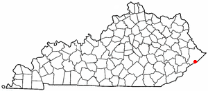
Pike County is a county in the U.S. state of Kentucky. As of the 2020 Census, the population was 58,669. Its county seat is Pikeville. The county was founded in 1821. With regard to the sale of alcohol, it is classified as a moist county–– a county in which alcohol sales are prohibited, but containing a "wet" city. There are three cities in the county, Pikeville, Elkhorn City, and Coal Run Village, where package alcohol sales are legal.

<span class="mw-page-title-main">Perry County, Kentucky</span> County in Kentucky, United States

Perry County is a county in the U.S. state of Kentucky. As of the 2020 census, the population was 28,473. Its county seat is Hazard. The county was founded in 1820. Both the county and county seat are named for Commodore Oliver Hazard Perry, a naval hero in the War of 1812.

<span class="mw-page-title-main">Letcher County, Kentucky</span> County in Kentucky, United States

Letcher County is a county located in the U.S. state of Kentucky. As of the 2020 census, the population was 21,548. Its county seat is Whitesburg. It was created in 1842 from Harlan and Perry counties, and named for Robert P. Letcher, Governor of Kentucky from 1840 to 1844.

<span class="mw-page-title-main">Knott County, Kentucky</span> County in Kentucky, United States

Knott County is a county located in the U.S. state of Kentucky. As of the 2020 census, the population was 14,251. Its county seat is Hindman. The county was formed in 1884 and is named for James Proctor Knott, Governor of Kentucky (1883–1887). It is a prohibition or dry county. Its county seat is home to the Hindman Settlement School, founded as America's first settlement school. The Knott County town of Pippa Passes is home to Alice Lloyd College.

<span class="mw-page-title-main">Floyd County, Kentucky</span> County in Kentucky, United States

Floyd County is a county located in the U.S. state of Kentucky. As of the 2020 census, the population was 35,942. Its county seat is Prestonsburg. The county, founded in 1800, is named for Colonel John Floyd (1750–1783).

<span class="mw-page-title-main">Breathitt County, Kentucky</span> County in Kentucky, United States

Breathitt County is a county in the eastern Appalachian portion of the U.S. state of Kentucky. As of the 2020 census, the population was 13,718. Its county seat is Jackson. The county was formed in 1839 and was named for John Breathitt, who was Governor of Kentucky from 1832 to 1834. Breathitt County was a prohibition or dry county, until a public vote in July 2016 that allowed alcohol sales.

<span class="mw-page-title-main">Wayland, Kentucky</span> City in Floyd County, Kentucky, United States

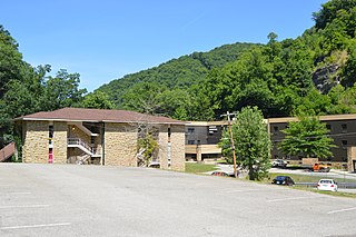
Wayland is a home rule-class city in Floyd County, Kentucky, United States. The population was 426 at the 2010 census, up from 298 at the 2000 census.

<span class="mw-page-title-main">Benham, Kentucky</span> City in Kentucky, United States

Benham is a home rule-class city in Harlan County, Kentucky, in the United States. The city was formally incorporated by the General Assembly in 1961. The population was 512 at the 2020 census, up from 500 at the 2010 census.

<span class="mw-page-title-main">Cumberland, Kentucky</span> City in Kentucky, United States

Cumberland is a home rule-class city in Harlan County, Kentucky, in the United States. The population according to the 2010 Census was 2,237, down from 2,611 at the 2000 census. The city sits at the confluence of Looney Creek and the Poor Fork Cumberland River.

<span class="mw-page-title-main">Harlan, Kentucky</span> City in Kentucky, United States

Harlan is a home rule-class city in and the county seat of Harlan County, Kentucky, United States. The population was 1,745 at the 2010 census, down from 2,081 at the 2000 census.

<span class="mw-page-title-main">Pippa Passes, Kentucky</span> City in Kentucky, United States

Pippa Passes is a home rule-class city located along Caney Fork in Knott County, eastern Kentucky, United States. Its formal name was chosen to honor benefactors of Alice Lloyd College. Residents commonly call the community "Caney" or "Caney Creek". The population was 533 at the 2010 census, up from 297 at the 2000 census. The small city is located in the mountainous Appalachia region, an area of coal mining.

<span class="mw-page-title-main">Blackey, Kentucky</span> City in Kentucky, United States

Blackey is an unincorporated community in Letcher County, Kentucky, in the United States. As of the 2010 census, the population was 120. It is located near the early settlement of Indian Bottom. Blackey is thought to have been named after Blackey Brown, one of its citizens.

<span class="mw-page-title-main">Jenkins, Kentucky</span> City in Kentucky, United States

Jenkins is a home rule-class city in Letcher County, Kentucky, United States. The population was 2,203 as of the 2010 census.

<span class="mw-page-title-main">McRoberts, Kentucky</span> Census-designated place in Kentucky, United States

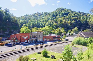
McRoberts is an unincorporated community and census-designated place (CDP) in Letcher County, Kentucky, United States. The population was 741 at the 2020 United States Census, down from 784 at the 2010 census. McRoberts is in the Eastern Kentucky Coalfield region.

<span class="mw-page-title-main">Whitesburg, Kentucky</span> City in Kentucky, United States

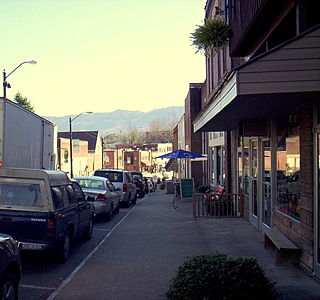
Whitesburg is a home rule-class city in and the county seat of Letcher County, Kentucky, United States. The population was 2,139 at the 2010 census and an estimated 1,875 in 2018. It was named for John D. White, a state politician.

<span class="mw-page-title-main">Hazard, Kentucky</span> City in Kentucky, United States

Hazard is a home rule-class city in, and the county seat of, Perry County, Kentucky, United States. The population was 5,263 at the 2020 Census.

<span class="mw-page-title-main">Vicco, Kentucky</span> City in Kentucky, United States

Vicco is a Kentucky defunct city in Perry and Knott counties, Kentucky, United States as defined by Kentucky Act Acts Ch. 25. The population was 334 at the 2010 census.

<span class="mw-page-title-main">Cedarville, Kentucky</span> Former city in Kentucky, United States

Cedarville is a former city in Pike County, Kentucky, United States. The population was 52 at the 2000 census. On December 14, 2009, Cedarville became a part of Elkhorn City.

<span class="mw-page-title-main">Elkhorn City, Kentucky</span> City in Kentucky, United States

Elkhorn City is a home rule-class city in Pike County, Kentucky, in the United States. The population was 1,035 at the 2020 census. The city is located in proximity to the Breaks Interstate Park.

<span class="mw-page-title-main">Williamson, West Virginia</span> City in West Virginia, United States

Williamson is a city in Mingo County, West Virginia, United States, situated along the Tug Fork River. The population was 3,042 at the 2020 census. It is the county seat of Mingo County, and is the county's largest and most populous city. Williamson is home to Southern West Virginia Community and Technical College. The Tug Fork River separates Williamson from South Williamson, Kentucky.

References

  1. "2020 U.S. Gazetteer Files". United States Census Bureau. Retrieved March 18, 2022.
  2. "Total Population: 2010 Census DEC Summary File 1 (P1), Fleming-Neon city, Kentucky". data.census.gov. U.S. Census Bureau. Retrieved February 11, 2020.
  3. Rennick, Robert M. (1987). Kentucky Place Names. University Press of Kentucky. p. 103. ISBN   0813126312 . Retrieved April 28, 2013.
  4. "Fleming-Neon, Kentucky".
  5. "US Gazetteer files: 2010, 2000, and 1990". United States Census Bureau. February 12, 2011. Retrieved April 23, 2011.
  6. "U.S. Gazetteer Files: 2019: Places: Kentucky". U.S. Census Bureau Geography Division. Retrieved February 11, 2020.
  7. "U.S. Census website". United States Census Bureau . Retrieved January 31, 2008.
  8. "Census of Population and Housing". Census.gov. Retrieved June 4, 2015.
  9. http://www.piratehistory.friendpages.com--17:19%5B%5D, 3 July 2009 (UTC)