Sandy Hook, Kentucky

Last updated
Sandy Hook, Kentucky
Elliott County, Kentucky courthouse.jpg
Elliott County courthouse in Sandy Hook
Elliott County Kentucky Incorporated and Unincorporated areas Sandy Hook Highlighted 2168556.svg
Location of Sandy Hook in Elliott County, Kentucky.
Coordinates: 38°05′19″N83°07′44″W / 38.08861°N 83.12889°W / 38.08861; -83.12889
Country United States
State Kentucky
County Elliott
EstablishedMarch 4, 1850 [1]
Incorporated1872 [1]
ReincorporatedApril 13, 1888 [1]
Reactivated1930 [1]
Reactivated1968 [1]
Government
  Type Mayor-Council
  MayorJames Robby Adkins[ citation needed ]
Area
[2]
  Total0.98 sq mi (2.55 km2)
  Land0.98 sq mi (2.54 km2)
  Water0.00 sq mi (0.00 km2)
Elevation
[3]
804 ft (245 m)
Population
 (2020)
  Total641
  Density652.75/sq mi (252.03/km2)
Time zone UTC-5 (Eastern (EST))
  Summer (DST) UTC-4 (EDT)
ZIP code
41171
Area code 606
FIPS code 21-68556
GNIS feature ID2405416 [3]

Sandy Hook is a home rule-class city beside the Little Sandy River in Elliott County, Kentucky, in the United States. [4] The population was 675 at the 2010 census. [5]

Contents

Sandy Hook is the county seat of Elliott County, which is a dry county. It is illegal to sell alcohol within the city. The Little Sandy Correctional Complex, a medium-security prison operated by the Kentucky Department of Corrections, is located 6 miles (10 km) northeast of Sandy Hook.

History

The head of navigation on the Little Sandy River was first settled in the 1820s. By the time of its establishment by the state legislature in 1850, it was known as "Sandy Hook" for the fishhook-shaped bend in the river at that point. [6]

It was chosen as the seat of the newly established Elliott County over nearby Newfoundland in 1869, owing to a generous donation of land for public buildings by resident James Hunter. In 1872, the city was incorporated as "Martinsburg" in honor of Congressman John P. Martin. The priority of another Martinsburg, Kentucky, meant that the post office (est.1874) had to be named "Sandy Hook". The city resumed the name shortly after [6] and was reincorporated as "Sandy Hook" in 1888. [1]

Geography

Sandy Hook is located near the center of Elliott County at the head of navigation on the Little Sandy River in eastern Kentucky. According to the United States Census Bureau, the city has a total area of 0.97 square miles (2.5 km2), all land. [5]

Kentucky Route 7 passes through the center of town, leading northeast 22 miles (35 km) to Grayson and southwest 18 miles (29 km) to West Liberty. Kentucky Route 32 leads east 39 miles (63 km) to Louisa and heads north out of Sandy Hook with KY 7, eventually leading northwest 27 miles (43 km) to Morehead.

Demographics

Historical population
CensusPop.Note
1870 62
1880 8333.9%
1890 15181.9%
1900 148−2.0%
1910 1608.1%
1920 115−28.1%
1930 15534.8%
1940 18418.7%
1950 23829.3%
1960 195−18.1%
1970 561187.7%
1980 62711.8%
1990 548−12.6%
2000 67823.7%
2010 675−0.4%
2020 641−5.0%
U.S. Decennial Census [7]

As of the census [8] of 2000, there were 678 people, 292 households, and 167 families residing in the city. The population density was 716.1 inhabitants per square mile (276.5/km2). There were 332 housing units at an average density of 350.7 per square mile (135.4/km2). The racial makeup of the city was 99.26% White, 0.15% African American, 0.15% Native American, and 0.44% from two or more races.

There were 292 households, out of which 27.1% had children under the age of 18 living with them, 36.0% were married couples living together, 18.8% had a female householder with no husband present, and 42.8% were non-families. 41.8% of all households were made up of individuals, and 18.5% had someone living alone who was 65 years of age or older. The average household size was 2.13 and the average family size was 2.90.

In the city, the population was spread out, with 23.5% under the age of 18, 8.4% from 18 to 24, 22.1% from 25 to 44, 20.8% from 45 to 64, and 25.2% who were 65 years of age or older. The median age was 42 years. For every 100 females, there were 65.0 males. For every 100 females age 18 and over, there were 60.2 males.

The median income for a household in the city was $14,313, and the median income for a family was $21,071. Males had a median income of $40,417 versus $22,031 for females. The per capita income for the city was $13,278. About 28.2% of families and 31.2% of the population were below the poverty line, including 43.1% of those under age 18 and 26.4% of those age 65 or over.

Education

Sandy Hook has a lending library, the Rocky J. Adkins Public Library. [9]

Notable person

Sandy Hook is the hometown of late country music singer Keith Whitley. A statue of Whitley playing his guitar can be seen in the local cemetery, and a local street was renamed "Keith Whitley Boulevard."[ citation needed ]

Related Research Articles

<span class="mw-page-title-main">Lawrence County, Kentucky</span> County in Kentucky, United States

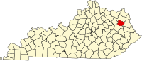
Lawrence County is a county located in the U.S. state of Kentucky. As of the 2020 census, the population was 16,293. Its county seat is Louisa. The county is named for James Lawrence, and co-founded by Isaac Bolt, who served as a Lawrence County Commissioner and Justice of the Peace. Lawrence County is the home of bluegrass music and country music star Tyler Childers. It is the birthplace of the late Chief Justice of the United States Frederick Moore Vinson and former Kentucky Governor Paul E. Patton. In regard to alcoholic beverage sales, Lawrence County is considered a "moist" county, meaning alcohol sales are only allowed within the city limits of Louisa. There are no alcohol sales within the rest of the county. Only two stores sell liquor, and most convenience stores sell beer and malted beverages.

<span class="mw-page-title-main">Laurel County, Kentucky</span> County in Kentucky, United States

Laurel County is a county located in the southeastern portion of the U.S. state of Kentucky. As of the 2020 census, the population was 62,613. Its county seat is London. After a special election in January 2016 alcohol sales are permitted only in the city limits of London. The ordinance went into effect on March 27, 2016, 60 days after results of the election. Laurel County is included in the London, KY Micropolitan Statistical Area.

<span class="mw-page-title-main">Elliott County, Kentucky</span> County in Kentucky, United States

Elliott County is a county located in the U.S. state of Kentucky. Its county seat is Sandy Hook. The county was formed in 1869 from parts of Morgan, Lawrence, and Carter counties, and is named for John Lyle Elliott, U.S. Congressman, Confederate Justice of the Kentucky Court of Appeals. In regard to alcohol sales, Elliott County is a dry county, meaning the sale of alcoholic beverages is prohibited everywhere in the county.

<span class="mw-page-title-main">Prestonsburg, Kentucky</span> City in Kentucky, United States

Prestonsburg is a small home rule-class city in and the county seat of Floyd County, Kentucky, United States. It is in the eastern part of the state in the valley of the Big Sandy River. The population was 3,255 at the time of the 2010 census, down from 3,612 at the 2000 census.

<span class="mw-page-title-main">Columbia City, Indiana</span> City in Indiana, United States

Columbia City is a city in Columbia Township, Whitley County, in the U.S. state of Indiana. The population was 9,892, growing by 13% since the 2010 Census. The city is the county seat of Whitley County.

<span class="mw-page-title-main">Martinsburg, Iowa</span> City in Iowa, United States

Martinsburg is a city in Keokuk County, Iowa, United States. The population was 110 at the time of the 2020 census. The only businesses open to the public in Martinsburg is McBeth Wrecker and Auto Service and a gas station/convenience store.

<span class="mw-page-title-main">Grayson, Kentucky</span> City in Kentucky, United States

Grayson is a home rule-class city in and the county seat of Carter County, Kentucky, United States, on US Route 60 and Interstate 64 in the state's northeastern region. It is approximately 21 miles west of Ashland. Within the city limits, the population was 4,217 at the 2010 census. Along with Carter County, the city is closely associated with the nearby Huntington-Ashland, WV-KY-OH Metropolitan Statistical Area and is often erroneously included in the MSA being just 9 miles west of the M.S.A's western boundary.

<span class="mw-page-title-main">Greenup, Kentucky</span> City in Kentucky, United States

Greenup is a home rule-class city located at the confluence of the Little Sandy River with the Ohio River in Greenup County, Kentucky, United States. The population was 1,188 at the 2010 census. Greenup is one of three county seats in the Commonwealth of Kentucky to share its name with its county; the other two being Harlan and Henderson.

<span class="mw-page-title-main">Blaine, Kentucky</span> City in Kentucky, United States

Blaine is a home rule-class city in Lawrence County, Kentucky, United States. The population was 47 at the 2010 census, down from 245 at the 2000 census.

<span class="mw-page-title-main">Louisa, Kentucky</span> City in Kentucky, United States

Louisa is a home-rule class city located in eastern Kentucky at the merger of the Levisa and Tug Forks into the Big Sandy River, which forms part of the state's border with West Virginia. It is the seat of Lawrence County. The population was 2,467 at the 2010 census and an estimated 2,375 in 2018.

<span class="mw-page-title-main">Inez, Kentucky</span> City in Kentucky, United States

Inez is a home rule-class city in and the county seat of Martin County, Kentucky, United States. The population was 546 at the 2020 census.

<span class="mw-page-title-main">Whitley City, Kentucky</span> Census-designated place in Kentucky, United States

Whitley City is an unincorporated community and census-designated place (CDP) in McCreary County, Kentucky, United States. The population was 968 at the 2020 census, down from 1,170 in 2010. It is the county seat of McCreary County. Whitley City is one of two unincorporated county seats in Kentucky.

<span class="mw-page-title-main">Edmonton, Kentucky</span> City in Kentucky, United States

Edmonton is a home rule-class city in and the county seat of Metcalfe County, Kentucky, United States. It is part of the Glasgow Micropolitan Statistical Area. The population was 1,671 at the 2020 census.

<span class="mw-page-title-main">West Liberty, Kentucky</span> City in Kentucky, United States

West Liberty is a home rule-class city in Morgan County, Kentucky, United States. It is the county seat of Morgan County. As of the 2020 census, the city population was 3,215. It is located along the Licking River at the junction of Kentucky Route 7 and U.S. Route 460.

<span class="mw-page-title-main">Owenton, Kentucky</span> City in Kentucky, United States

Owenton is a home rule-class city in and the county seat of Owen County, Kentucky, United States. The population was 1,327 at the 2010 census. It is located at the junction of U.S. Route 127 and Kentucky Route 22, about halfway between Louisville and Cincinnati.

<span class="mw-page-title-main">Booneville, Kentucky</span> City in Kentucky, United States

Booneville is a home rule-class city in Owsley County, Kentucky, in the United States. The population was 81 at the 2010 census. It is the county seat of Owsley County. It is located at the junction of Kentucky Route 11 and Kentucky Route 30 on the South Fork of the Kentucky River.

<span class="mw-page-title-main">Williamsburg, Kentucky</span> City in Kentucky, United States

Williamsburg is a home rule-class city in and the county seat of Whitley County, on the southeastern border of Kentucky, United States. The population was 5,245 at the 2010 census. Developed along the Cumberland River, the city was founded in 1818 and named after William Whitley.

<span class="mw-page-title-main">Martinsburg, Missouri</span> City in Missouri, United States

Martinsburg is a city in Audrain County, Missouri, United States. The population was 304 at the 2010 census.

<span class="mw-page-title-main">Martinsburg, Pennsylvania</span> Borough in Pennsylvania, United States

Martinsburg is a borough in the Morrisons Cove section of Blair County, Pennsylvania, United States. The population was 1,874 at the 2020 census. It is part of the Altoona, PA Metropolitan Statistical Area.

<span class="mw-page-title-main">North Corbin, Kentucky</span> Census-designated place in Kentucky, United States

North Corbin is a census-designated place (CDP) in Laurel and Knox counties in the U.S. state of Kentucky. The population was 1,727 at the 2020 census down from 1,773 at the 2010 census. The census bureau also lists the Laurel County portion of North Corbin as a CCD with a population of 10,729.

References

  1. 1 2 3 4 5 6 Commonwealth of Kentucky. Office of the Secretary of State. Land Office. "Sandy Hook, Kentucky". Accessed 16 August 2013.
  2. "2020 U.S. Gazetteer Files". United States Census Bureau. Retrieved March 18, 2022.
  3. 1 2 U.S. Geological Survey Geographic Names Information System: Sandy Hook, Kentucky
  4. "Find a County". National Association of Counties. Retrieved 2011-06-07.
  5. 1 2 "Geographic Identifiers: 2010 Demographic Profile Data (G001): Sandy Hook city, Kentucky". American Factfinder. U.S. Census Bureau. Archived from the original on February 13, 2020. Retrieved February 1, 2016.
  6. 1 2 Rennick, Robert. Kentucky Place Names. University Press of Kentucky (Lexington), 1987.
  7. "Census of Population and Housing". Census.gov. Retrieved June 4, 2015.
  8. "U.S. Census website". United States Census Bureau . Retrieved 2008-01-31.
  9. "Kentucky Public Library Directory". Kentucky Department for Libraries and Archives. Archived from the original on 11 January 2019. Retrieved 5 June 2019.