Florida State Road 121

Last updated

Florida 121.svg

State Road 121

Florida State Road 121
Florida State Road 121 highlighted in red
Route information
Maintained by FDOT
Length101.867 mi [1]  (163.939 km)
Major junctions
South endUS 19.svgUS 98.svg US 19  / US 98 at Lebanon Station
Major intersectionsUS 27.svgUS 41.svg US 27  / US 41 in Williston
I-75.svg I-75 in Gainesville
Florida 16.svg SR 16 in Raiford
I-10.svg I-10 in Macclenny
North endGeorgia 23.svgGeorgia 121.svg SR 23  / SR 121 near Stokesville, GA
Location
Country United States
State Florida
Highway system
Florida 120.svg SR 120 Florida 122.svg SR 122

State Road 121 (SR 121) is a major state highway that runs north and south in northern Florida. The road is part of a long multi-state route that also goes through Georgia and South Carolina.

Contents

Route description

SR 121 is one of the major routes of a three-state highway 121 that totals approximately 475 miles (764 km) from Lebanon Station, Florida, to Rock Hill, South Carolina.

Beginning in Lebanon Station at a channelized intersection with US 19/US 98 and County Road 336 (CR 336) in Levy County, SR 121 travels through Goethe State Forest where it turns east and intersects CR 337. The road makes a sharp left curve to the northeast where it travels through desolate farmland; the only resemblance to a major intersection is CR 326. Within the city of Williston, SR 121 has a concurrency with CR 316, until the intersection with US 41. It then joins US 41 as CR 316 continues eastward, which then joins the east end of US 27 Alternate (US 27 Alt.), and then the US 27/US 41 concurrency before breaking away to the northeast again, taking the DeSoto Trail away from US 41.

North of CR 335, SR 121 hugs the west side of the Levy–Marion county line, but never crosses it, choosing to enter Alachua County instead. Immediately after the interchange with Interstate 75 (I-75) at exit 382, SR 121 makes a sharp left onto Northwest 34th Street as SR 331 becomes the designation for Williston Road. As it crosses SR 24 it borders the western edge of the University of Florida, passing along the 34th Street Wall just before crossing SR 26A and then SR 26. North of US 441, the DeSoto Trail breaks away.

Within the town of LaCrosse, SR 121 shares a short concurrency with SR 235, then has a level crossing with the CSX Brooker Subdivision, a former Seaboard Coast Line railroad line that leads to the Crystal River 3 Nuclear Power Plant. After the intersection with CR 236 in Santa Fe, SR 121 passes by entrances to the Santa Fe River Preserve, and then is carried along a bridge over the Santa Fe River in Worthington Springs, where it intersects SR 18. North of CR 18, the road is carried along a bridge over the former Jacksonville and Southwestern Railroad.

Briefly traveling parallel to SR 100 in Lake Butler, it intersects SR 100 as it continues northeast. The road also runs parallel to another rail-trail along the former Jacksonville and Southwestern right-of-way in Raiford, then serves as the western terminus of SR 16 before leaving that community. After passing by the Northeast Florida State Hospital, the road intersects I-10 (Exit 335) and US 90 in Macclenny close to SR 228 before crossing the Georgia state line on its way to South Carolina.

History

The segment between US 19 and 98 in Lebanon Station and US 41 in Williston was previously designated as Florida State Road 335, and the segment between US 27 and 41 in Williston, at what is today the south end of SR 331 was part of a southern extension of that route. [2]
State Road 23 was defined in the 1945 renumbering as:

Prior to the renumbering, this had been:

At some point, SR 23 was renumbered as part of SR 121, probably to match Georgia State Route 121. Before that, however, SR 23 had been extended around the west side of Gainesville to end at US 441/SR 25 at Rocky Point, and the southernmost part did not become part of SR 121. It was later given to the county, and has a possibility of becoming County Road 23.[ clarification needed ]

The State Road 23 designation has since been reused for a partial beltway around Jacksonville.

In 1975, the City of Gainesville recommended a truck ban along SR 121 and established a truck route around downtown. In 1979. FDOT widened the road within the city, which included the creation of a retaining wall along the University of Florida Golf Course that has since become a target for graffiti artists. The truck ban was lifted in the early 1980s, but reestablished later in the decade after a series of fatal accidents.

Major intersections

CountyLocationmi [1] kmDestinationsNotes
Levy Lebanon Station 0.000–
0.135
0.000–
0.217
US 19.svgUS 98.svgEast plate county.svg
CR 336 jct.svg
US 19  / US 98 (SR 55) / CR 336 east Inglis, St. Petersburg, Chiefland, Mobile
5.0868.185CR 337 jct.svg CR 337  Bronson
8.35413.444East plate county.svg
CR 464 jct.svg
CR 464 east
11.57318.625CR 326 jct.svg CR 326  Henry Beck Park
16.80827.050West plate county.svg
CR 316 jct.svg
CR 316 west (Northeast 20th Street)
17.95928.902North plate county.svg
CR 335A jct.svg
CR 335A north (Northeast 167th Court)
Williston 20.22432.547South plate.svg
US 41.svg
East plate county.svg
CR 316 jct.svg
US 41 south (SR 45) / CR 316 east (Northeast 30th Street) Morriston, Dunnellon, Tampa
south end of US 41 / SR 45 overlap
21.03433.851North plate.svg
Alt plate.svg
US 27.svg
US 27 Alt. north (SR 500) Bronson
south end of US 27 Alt. / SR 500 overlap
21.55934.696South plate.svg
US 27.svg
US 27 south (Noble Avenue / SR 500) Ocala
north end of US 27 Alt. / SR 500 overlap; south end of US 27 overlap
21.97935.372North plate.svg
US 27.svg
North plate.svg
US 41.svg
US 27 north / US 41 north (North Main Street / SR 45) Archer
north end of US 27 / US 41 / SR 45 overlap
22.91436.877CR 318A jct.svg CR 318A (Mixson Road / Northeast 50th Street)
23.88538.439South plate county.svg
CR 331A jct.svg
CR 331A south (Northeast 205th Street)
26.01841.872CR 335 jct.svg CR 335 (Northeast 75th Street)
28.28445.519East plate county.svg
CR 320 jct.svg
CR 320 east
Alachua 30.20548.610West plate county.svg
CR 346 jct.svg
CR 346 west
32.23151.871West plate county.svg
CR 346A jct.svg
CR 346A west (Southwest 137th Avenue)
Gainesville 32.9853.08I-75.svg I-75 (SR 93) Lake City, Tampa, truck route to SR 24 west / SR 26 westI-75 exit 382
38.15761.408North plate.svg
Florida 331.svg
To plate.svg
US 441.svg
To plate.svg
US 301.svg
SR 331 north (Williston Road) to US 441  / US 301  Gainesville, truck route to SR 121 north / SR 24 east / SR 26 east
39.76563.996Florida 24.svgTo plate blue.svg
I-75.svg
SR 24 (Archer Road) to I-75  Archer, Waldo
41.36966.577Florida 26A.svg SR 26A (Southwest 2nd Avenue)
41.48966.770Florida 26.svg SR 26 (West University Avenue)
44.01770.838Florida 222.svgTo plate blue.svg
I-75.svg
SR 222 (Northwest 39th Avenue) to I-75  Orange Heights
45.29072.887CR 232 jct.svg CR 232 (Northwest 53rd Avenue)
46.20074.352US 441.svg US 441 (SR 20 / SR 25) Alachua, Gainesville, truck route to SR 121 south
49.30379.345North plate county.svg
CR 231 jct.svg
CR 231 north
LaCrosse 55.92289.998South plate.svg
Florida 235.svg
SR 235 south Alachua
south end of SR 235 overlap
56.17690.407North plate.svg
Florida 235.svg
SR 235 north Brooker
north end of SR 235 overlap
56.51390.949North plate county.svg
CR 1493 jct.svg
CR 1493 north
Santa Fe 59.28195.404West plate county.svg
CR 236 jct.svg
To plate blue.svg
I-75.svg
CR 236 west to I-75  High Springs
61.62099.168South plate county.svg
CR 239 jct.svg
CR 239 south
Union Worthington Springs 62.703100.911East plate.svg
Florida 18.svg
SR 18 east Brooker
63.726102.557West plate county.svg
CR 18 jct.svg
CR 18 west Fort White
Dukes 65.622105.608East plate county.svg
CR 18A jct.svg
West plate county.svg
CR 239A jct.svg
CR 18A east / CR 239A west
66.908107.678East plate county.svg
CR 231A jct.svg
West plate county.svg
CR 796 jct.svg
CR 231A east / CR 796 west (Southwest 76th Street)
Lake Butler 70.913114.123Florida 231.svg SR 231 (Dr. M.L. King Jr. Avenue)
72.307116.367Florida 100.svg SR 100  Lake City, Starke
Johnstown 76.748123.514South plate county.svg
CR 237 jct.svg
CR 237 south
Raiford 78.752126.739CR 229 jct.svg CR 229
79.618128.133East plate.svg
Florida 16.svg
To plate blue.svg
I-95.svg
SR 16 east to I-95  State Prison, Starke, St. Augustine
83.245133.970South plate county.svg
CR 125 jct.svg
CR 125 south
south end of CR 125 overlap
Baker 89.612144.217North plate county.svg
CR 125 jct.svg
CR 125 north Glen St. Mary
north end of CR 125 overlap
91.524147.294West plate county.svg
CR 130 jct.svg
CR 130 west (Mud Lake Road)
Macclenny 94.532152.135West plate county.svg
CR 23A jct.svg
CR 23A west (Woodlawn Road)
94.65152.32I-10.svgTo plate blue.svg
I-95.svg
I-10 (SR 8) to I-95  Lake City, Tallahassee, Jacksonville
I-10 exit 335
95.600153.853CR 23A jct.svg CR 23A (Lowder Street)
96.259154.914US 90.svg US 90 (Macclenny Avenue / SR 10) Glen St. Mary, Baldwin
97.449156.829West plate county.svg
CR 23B jct.svg
East plate county.svg
CR 228 jct.svg
CR 23B west / CR 228 east Baker County Fair Grounds
99.829160.659CR 23C jct.svg CR 23C (Steel Bridge Road)
101.380163.155West plate county.svg
CR 23D jct.svg
CR 23D west
101.867163.939North plate.svg
Georgia 23.svg
North plate.svg
Georgia 121.svg
SR 23 north / SR 121 north St. George, Folkston
Continuation to Georgia; Southern terminus of SR 23; Georgia state line (St. Marys River bridge)
1.000 mi = 1.609 km; 1.000 km = 0.621 mi

Gainesville State Road 121 Truck

Truck plate.svg

Florida 121.svg

State Road 121 Truck

Location Gainesville

Florida State Truck Route 121 in Gainesville, Florida was formed in the mid-1970s in order to divert trucks form the congested downtown areas of Gainesville. [3] The route begins at the intersection of State Road 121, Florida State Road 331 and Alachua County Road 23, removing the concurrencies with the SR 24 and 26 Truck Routes. At the intersection with U.S. Route 441, the routes are joined by a truck route of that route as well. The four truck routes run northeast along SR 331 and then curve to the north. SR 331 terminates at the east end of the overlap of SRs 20, 24, and 26, which also serves as the terminus of Florida Truck Routes 24 and 26. However US 441 Truck and Florida Truck Route 121 continue to the northeast until the intersection with Florida State Road 222. At this point, the truck routes turn west overlapping SR 222 and intersection Florida State Road 20. US Truck Route 441 terminates at the intersection of SR 222 and US 441, while Florida Truck Route 121 makes a right turn and follows US 441 northbound until the intersection with its parent route.

County Road 121A

Alachua County 121A.svg

County Road 121A

Location LaCrosse

County Road 121A is the sole suffixed alternate of SR 121 that exists within the State of Florida. It is a former segment of SR 121 that exists entirely in LaCrosse. The route is unmarked, and runs along the east side of SR 121 south of downtown to halfway between the SR 121/235 overlap across from the LaCrosse Post Office.

Related Research Articles

<span class="mw-page-title-main">U.S. Route 441</span> Highway in the United States

U.S. Route 441 (US 441) is a 939-mile-long (1,511 km) auxiliary route of U.S. Route 41. It extends from US 41 in Miami, Florida to US 25W in Rocky Top, Tennessee. Between its termini, US 441 travels through the states of Florida, Georgia, North Carolina, and Tennessee. The highway acts as a connector between several major urban areas, including Miami, Orlando, Ocala, Gainesville, Athens, and Knoxville. It also crosses the Great Smoky Mountains National Park, where it meets the southwestern end of the Blue Ridge Parkway, and where no trucks or other commercial traffic are allowed.

<span class="mw-page-title-main">Florida State Road 20</span> Highway in Florida

State Road 20 is a 358.154-mile-long (576.393 km) east-to-west route across northern Florida and the Florida Panhandle in the United States.

<span class="mw-page-title-main">Florida State Road 25</span> Highway in Florida

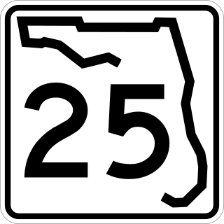
State Road 25 is a state highway in the U.S. state of Florida. It is mainly signed as U.S. Highways:

<span class="mw-page-title-main">Florida State Road 24</span> Highway in Florida

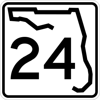
State Road 24 is an east–west state highway that runs between Cedar Key on the Gulf of Mexico and Waldo, Florida, at US 301. State Road 24 runs along a former branch of the Seaboard Air Line Railroad. This branch was originally owned by the Florida Railway and Navigation Company, and used to lead to ferries to both Pensacola, Florida and New Orleans, Louisiana. It also passes through Rosewood, site of the infamous 1923 massacre.

<span class="mw-page-title-main">Florida State Road 26</span> Highway in Florida

State Road 26 is a 62.172-mile-long (100.056 km) east–west route across North Central Florida.

<span class="mw-page-title-main">Georgia State Route 32</span> State highway in Georgia

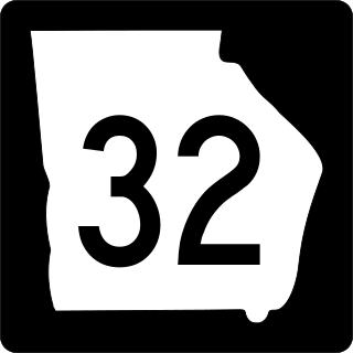
State Route 32 (SR 32) is a 188.8-mile-long (303.8 km) state highway that travels west-to-east through portions of Terrell, Lee, Worth, Turner, Irwin, Coffee, Bacon, Pierce, Brantley, and Glynn counties in the southern part of the U.S. state of Georgia. The highway connects Dawson with Sterling, via Leesburg, Ashburn, Fitzgerald, Douglas, and Alma.

<span class="mw-page-title-main">U.S. Route 27 in Florida</span> Section of U.S. Highway in Florida, United States

U.S. Highway 27 (US 27) in Florida is a north–south United States Numbered Highway. It runs 496.352 miles (798.801 km) from the Miami metropolitan area northwest to the Tallahassee metropolitan area. Throughout the state, US 27 has been designated the Claude Pepper Memorial Highway by the Florida Legislature. It was named after long-time Florida statesperson Claude Pepper, who served in both the U.S. Senate and House of Representatives. The stretch running from Miami to South Bay was originally designated the Thomas E. Will Memorial Highway by the Florida Legislature in 1937 when that portion was known as State Road 26 (SR 26). Thomas E. Will, the founder of Okeelanta, had worked for almost 20 years to get the state to build a road from Miami to the area south of Lake Okeechobee. For most of its length in the state, US 27 is a divided highway.

<span class="mw-page-title-main">U.S. Route 41 in Florida</span> Highway in Florida

U.S. Highway 41 (US 41) in the state of Florida is a north–south United States Highway. It runs 479 miles (771 km) from Miami in South Florida northwest to the Georgia state line north of the Lake City area. Within the state, US 41 is paralleled by Interstate 75 (I-75) all the way from Miami to Georgia, and I-75 has largely supplanted US 41 as a major highway.

<span class="mw-page-title-main">U.S. Route 98 in Florida</span> Highway in Florida

U.S. Route 98 is a major east-west thoroughfare through the U.S. state of Florida. Spanning 670.959 miles (1,079.804 km), it connects Pensacola and the Alabama/Florida state line to the west with Palm Beach and the Atlantic coast in the east. It is the longest US road in Florida, as well as the longest US road in any state east of the Mississippi River.

<span class="mw-page-title-main">U.S. Route 129 in Florida</span> Segment of American highway

U.S. Route 129 (US 129) in Florida is a north–south United States Highway. It runs 88 miles (142 km) from Chiefland north to the Georgia State Line in Levy, Gilchrist, Suwannee, and Hamilton Counties.

<span class="mw-page-title-main">U.S. Route 301 in Florida</span> Highway in Florida

U.S. Route 301 in Florida runs from the Sarasota-Bradenton-Venice, Florida Metropolitan Statistical Area northeast to the Greater Jacksonville Metropolitan Area. The road is a spur of U.S. Route 1, which it intersects in Callahan.

<span class="mw-page-title-main">U.S. Route 441 in Florida</span> Highway in Florida

U.S. Route 441 (US 441) in Florida is a north–south United States Highway. It runs 433 miles (697 km) from Miami in South Florida northwest to the Georgia state line, with the overall route continuing to Tennessee in the Rocky Top area.

<span class="mw-page-title-main">Florida State Road 18</span> Highway in Florida

State Road 18 is a short state road in the U.S. state of Florida. It begins in Worthington Springs in southern Union County and travels eastward for 6.60 miles (10.62 km) into Bradford County until it becomes County Road 18 at Brooker. It also has county road extensions, one of which is between Fort White and Worthington Springs, and the other between Brooker and SR 100 north of Theressa.

<span class="mw-page-title-main">Florida State Road 331</span> State highway in Florida, U.S.

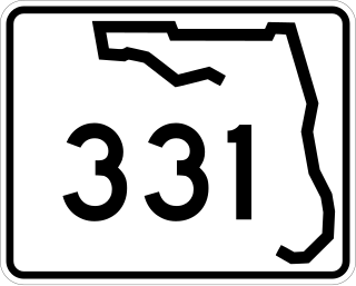
State Road 331 is a short state highway running south and east of Gainesville, although it once stretched as far south as Williston. It also serves as a truck route for State Roads 24, 26, and 121 and US 441. Despite skirting the Gainesville City Limits, SR 331 runs north and south as a four-lane divided rural highway.

<span class="mw-page-title-main">U.S. Route 23 in Georgia</span> Segment of American highway

U.S. Highway 23 (US 23) in the U.S. state of Georgia is a north–south United States Numbered Highway that travels from the St. Marys River south-southeast of Folkston to the North Carolina state line, in the northern part of Dillard. At nearly 392 miles (631 km) in length, it is the longest U.S. Highway in Georgia.

<span class="mw-page-title-main">Florida State Road 329</span> State highway in Florida, United States

State Road 329 (SR 329) was a short state highway traveling south and north through Gainesville, Florida. It comprised Main Street through Gainesville. The full length of the road extended from SR 331 to County Road 232 (CR 232). In the 1970s, the northern portion of the road, most of North Main Street, became County Road 329 (CR 329) while South Main Street was relinquished by the Florida Department of Transportation (FDOT) to the city. A small portion of the former state road in Gainesville is still maintained by the state as a portion of SR 20.

<span class="mw-page-title-main">U.S. Route 441 in Georgia</span> Segment of American highway

U.S. Route 441 (US 441) in the U.S. state of Georgia is a 354.2-mile-long (570.0 km) north–south United States Highway through the east-central portion of the state. It travels from the Florida state line near the Fargo city area to the North Carolina state line, in the northern part of Dillard. It is a spur route of US 41, although it has no intersections with its "parent" route within the state. It does have an intersection with another spur route of US 41 however, specifically US 341 in McRae–Helena.

<span class="mw-page-title-main">Florida State Road 235</span> State highway in Florida, United States

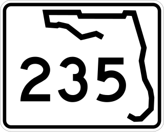
State Road 235 is a south–north state highway in Alachua County, Florida. It runs from U.S. Route 441 in Alachua to Brooker, and has county-maintained segments in Alachua and Bradford Counties, which were once part of SR 235.

<span class="mw-page-title-main">Special routes of U.S. Route 441</span>

A total of at least twelve special routes of U.S. Route 441 have existed, and at least three have been deleted. These special routes include alternate routes, business loops, truck routes, and bypass routes which connect to U.S. Route 441 in the US states of Florida, Georgia, North Carolina, and Tennessee.

<span class="mw-page-title-main">Special routes of U.S. Route 129</span>

Several special routes of U.S. Route 129 exist, most of which are in the state of Georgia.

References

Template:Attached KML/Florida State Road 121
KML is not from Wikidata