Folsom, Ohio

Last updated

Folsom is an unincorporated community in Highland County, in the U.S. state of Ohio. [1]

Highland County, Ohio County in the United States

Highland County is a county located in the U.S. state of Ohio. As of the 2010 census, the population was 43,589. Its county seat is Hillsboro. The county is named for the topography which is hilly and divides the watersheds of the Little Miami and Scioto Rivers.

U.S. state constituent political entity of the United States

In the United States, a state is a constituent political entity, of which there are currently 50. Bound together in a political union, each state holds governmental jurisdiction over a separate and defined geographic territory and shares its sovereignty with the federal government. Due to this shared sovereignty, Americans are citizens both of the federal republic and of the state in which they reside. State citizenship and residency are flexible, and no government approval is required to move between states, except for persons restricted by certain types of court orders. Four states use the term commonwealth rather than state in their full official names.

Ohio State of the United States of America

Ohio is a Midwestern state in the Great Lakes region of the United States. Of the fifty states, it is the 34th largest by area, the seventh most populous, and the tenth most densely populated. The state's capital and largest city is Columbus.

History

A post office was established at Folsom in 1886, and remained in operation until 1905. [2] The community's name honors Frances Folsom Cleveland, First Lady of the United States from 1886 to 1889. [3]

Frances Folsom Cleveland Preston First Lady of the United States

Frances Clara Folsom Cleveland Preston was married to the President of the United States Grover Cleveland and was the First Lady of the United States from 1886 to 1889 and again from 1893 to 1897. Becoming First Lady at age 21, she remains the youngest wife of a sitting president.

Related Research Articles

Williamstown, Ohio human settlement in United States of America

Williamstown is an unincorporated community in southern Madison Township, Hancock County, Ohio, United States. Although it is unincorporated, it has its own zip code of 45897. It lies at the intersection of U.S. Routes 30 and 68.

Range, Ohio Unincorporated community in Ohio, United States

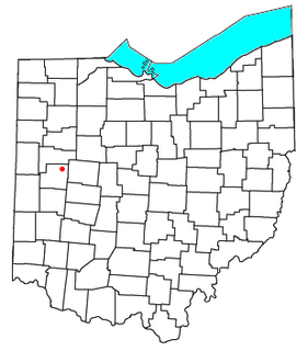
Range is an unincorporated community in Range Township, Madison County, Ohio, United States. It is located at 39°43′55″N83°25′29″W, along Ohio State Route 323 between Chenoweth and Midway.

Lafayette, Madison County, Ohio Unincorporated community in Ohio, United States

Lafayette is a census-designated place in the center of Deer Creek Township, Madison County, Ohio, United States. It is located at 39°56′15″N83°24′24″W, along U.S. Route 40, just west of its intersection with U.S. Route 42.

Rupert, Ohio Unincorporated community in Ohio, United States

Rupert is an unincorporated community in Union Township, Madison County, Ohio, United States. It is located at 39°52′57″N83°21′12″W, at the intersection of Ohio State Route 665 and Glade Run Road, approximately four miles east of London.

Tradersville, Ohio Unincorporated community in Ohio, United States

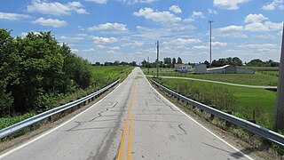
Tradersville is an unincorporated community in Somerford Township, Madison County, Ohio, United States. It is located at 39°59′59″N83°29′55″W, at the intersection of Ohio State Route 187 and Tradersville-Brighton Road, about three miles north of Choctaw Lake.

Kiousville, Ohio Unincorporated community in Ohio, United States

Kiousville is an unincorporated community in southern Fairfield Township, Madison County, Ohio, United States. It is located at 39°47′50″N83°17′41″W, at the intersection of Kiousville-Georgesville Road and McKendree Road.

Cook, Ohio Unincorporated community in Ohio, United States

Cook is an unincorporated community in Madison Township, Fayette County, Ohio, United States. It is located at 39°40′59″N83°18′26″W, along Cook-Yankeetown Road, just west of its intersection with U.S. Route 62/State Route 3.

Chrisman, Ohio Unincorporated community in Ohio, United States

Chrisman is an unincorporated community in Oak Run Township, Madison County, Ohio, United States. It is located at 39°49′59″N83°22′22″W, at the intersection of London-Circleville Road and Gregg Mill Road, about four miles southeast of London.

Montra, Ohio human settlement in Ohio

Montra is an unincorporated community in Jackson Township, Shelby County, Ohio, United States. Established in the middle of the nineteenth century, the small community is prominent because of a landmark church, Emanuel Lutheran Church of Montra.

Hagler is an unincorporated community in Fayette County, in the U.S. state of Ohio.

Vera Cruz is an unincorporated community in Brown County, in the U.S. state of Ohio.

Bloom Center is an unincorporated community in Wood County, Ohio.

Gladstone is an unincorporated community in Greene County, in the U.S. state of Ohio.

Bridges is an unincorporated community in Highland County, in the U.S. state of Ohio.

Carmel is an unincorporated community in Highland County, in the U.S. state of Ohio.

Dodsonville is an unincorporated community in Highland County, in the U.S. state of Ohio.

Eber is an unincorporated community in Fayette County, in the U.S. state of Ohio.

Forgy is an unincorporated community in Clark County, in the U.S. state of Ohio.

Hollowtown is an unincorporated community in Highland County, in the U.S. state of Ohio.

Plano is an unincorporated community in Fayette and Ross counties, in the U.S. state of Ohio.

References

Coordinates: 39°05′42″N83°35′34″W / 39.09500°N 83.59278°W / 39.09500; -83.59278

Geographic coordinate system Coordinate system

A geographic coordinate system is a coordinate system that enables every location on Earth to be specified by a set of numbers, letters or symbols. The coordinates are often chosen such that one of the numbers represents a vertical position and two or three of the numbers represent a horizontal position; alternatively, a geographic position may be expressed in a combined three-dimensional Cartesian vector. A common choice of coordinates is latitude, longitude and elevation. To specify a location on a plane requires a map projection.