Sardinia, Ohio

Last updated

Sardinia, Ohio
SardiniaOH2.JPG
Looking east at the intersection of Broadway Street and Main Street (Ohio State Route 134) in Sardinia
OHMap-doton-Sardinia.png
Location of Sardinia, Ohio
Map of Brown County Ohio Highlighting Sardinia Village.png
Location of Sardinia in Brown County
Coordinates: 39°00′16″N83°48′14″W / 39.00444°N 83.80389°W / 39.00444; -83.80389
Country United States
State Ohio
Counties Brown, Highland
Area
[1]
  Total1.75 sq mi (4.54 km2)
  Land1.75 sq mi (4.54 km2)
  Water0.00 sq mi (0.00 km2)
Elevation
[2]
961 ft (293 m)
Population
 (2020)
  Total1,083
  Density617.45/sq mi (238.37/km2)
Time zone UTC-5 (Eastern (EST))
  Summer (DST) UTC-4 (EDT)
ZIP code
45171
Area code(s) 937, 326
FIPS code 39-70534 [3]
GNIS feature ID2399185 [2]
Website villageofsardinia.com

Sardinia is a village in Brown and Highland counties in the U.S. state of Ohio. The population was 1,083 at the 2020 census.

Contents

History

Sardinia corporation limit sign SardiniaOH1.JPG
Sardinia corporation limit sign

Sardinia was laid out in 1833. [4] The village's name is derived from a methodist hymnal popular during the 1840's. Historically, Sardinia was a post village of Brown County, in Washington township, established in 1830, situated on the east fork of White Oak Creek, 12 miles (19 km) north-east of Georgetown, and 44 miles (71 km) east of Cincinnati. In 1860, Sardinia's population was 200 and Washington Township had a population of 1,300. [5] It was a station on the Cincinnati & Eastern Railroad, today the Cincinnati Eastern Railroad (CCET).

Geography

Sardinia is located mostly in Washington Township in Brown County, and partly in Clay Township in southwestern Highland County. [6]

According to the United States Census Bureau, the village has a total area of 1.24 square miles (3.21 km2), all land. [7]

Demographics

Historical population
CensusPop.Note
1880 283
1910 534
1920 5615.1%
1930 5640.5%
1940 6159.0%
1950 69913.7%
1960 79914.3%
1970 8243.1%
1980 8260.2%
1990 792−4.1%
2000 8628.8%
2010 98013.7%
2020 1,08310.5%
U.S. Decennial Census [8]

2010 census

As of the census [9] of 2010, there were 980 people, 363 households, and 259 families living in the village. The population density was 790.3 inhabitants per square mile (305.1/km2). There were 416 housing units at an average density of 335.5 per square mile (129.5/km2). The racial makeup of the village was 99.2% White, 0.2% African American, 0.3% Native American, 0.1% from other races, and 0.2% from two or more races. Hispanic or Latino of any race were 0.3% of the population.

There were 363 households, of which 44.9% had children under the age of 18 living with them, 42.1% were married couples living together, 21.5% had a female householder with no husband present, 7.7% had a male householder with no wife present, and 28.7% were non-families. 24.0% of all households were made up of individuals, and 8.6% had someone living alone who was 65 years of age or older. The average household size was 2.67 and the average family size was 3.07.

The median age in the village was 31 years. 33.1% of residents were under the age of 18; 8.1% were between the ages of 18 and 24; 28.6% were from 25 to 44; 20.3% were from 45 to 64; and 9.9% were 65 years of age or older. The gender makeup of the village was 46.3% male and 53.7% female.

2000 census

As of the census [3] of 2000, there were 862 people, 328 households, and 230 families living in the village. The population density was 1,343.8 inhabitants per square mile (518.8/km2). There were 362 housing units at an average density of 564.3 per square mile (217.9/km2). The racial makeup of the village was 98.61% White, 0.23% Black or African American, and 1.16% from two or more races. Hispanic or Latino of any race were 0.93% of the population.

There were 328 households, out of which 40.5% had children under the age of 18 living with them, 51.5% were married couples living together, 13.4% had a female householder with no husband present, and 29.6% were non-families. 26.8% of all households were made up of individuals, and 13.7% had someone living alone who was 65 years of age or older. The average household size was 2.54 and the average family size was 3.06.

In the village, the population was spread out, with 29.0% under the age of 18, 9.5% from 18 to 24, 31.7% from 25 to 44, 17.3% from 45 to 64, and 12.5% who were 65 years of age or older. The median age was 31 years. For every 100 females there were 87.8 males. For every 100 females age 18 and over, there were 81.1 males.

The median income for a household in the village was $28,897, and the median income for a family was $32,708. Males had a median income of $34,375 versus $18,056 for females. The per capita income for the village was $12,334. About 15.4% of families and 20.1% of the population were well above the poverty line, including 24.2% of those under age 18 and 14.3% of those age 65 or over.

Education

The village is served by Eastern High School. Sardinia has a public library, a branch of the Brown County Public Library. [10]

Related Research Articles

<span class="mw-page-title-main">Trimble, Ohio</span> Village in Ohio, United States

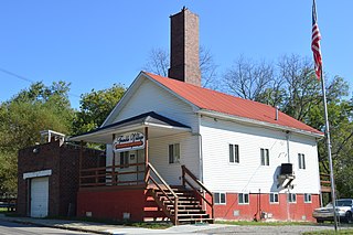
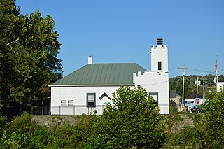
Trimble is a village in Trimble Township, Athens County, Ohio, United States. The population was 329 at the 2020 census.

<span class="mw-page-title-main">Cridersville, Ohio</span> Village in Ohio, United States

Cridersville is a village in Auglaize County, Ohio, United States. The population was 1,791 at the 2020 census. It is included in the Wapakoneta, Ohio Micropolitan Statistical Area.

<span class="mw-page-title-main">Aberdeen, Ohio</span> Village in Ohio, United States

Aberdeen is a village in Huntington Township, Brown County, Ohio, United States, along the Ohio River 50 miles (80 km) southeast of Cincinnati. The population was 1,515 at the 2020 census.

<span class="mw-page-title-main">Fayetteville, Ohio</span> Village in Ohio, United States

Fayetteville is a village in Perry Township, Brown County, Ohio, United States. The population was 317 at the 2020 census.

<span class="mw-page-title-main">Hamersville, Ohio</span> Village in Ohio, United States

Hamersville is a village in Clark Township, Brown County, Ohio, United States. The population was 485 at the 2020 census.

<span class="mw-page-title-main">Ripley, Ohio</span> Village in Ohio, United States

Ripley is a village in Union Township, Brown County, Ohio, United States, along the Ohio River 50 miles southeast of Cincinnati. The population was 1,591 at the 2020 census.

<span class="mw-page-title-main">Russellville, Ohio</span> Village in Ohio, United States

Russellville is a village in Jefferson Township, Brown County, Ohio, United States. The population was 542 at the 2020 census.

<span class="mw-page-title-main">Millville, Ohio</span> Village in Ohio, United States

Millville is a village in Butler County, Ohio, United States. The population was 634 at the 2020 census. Millville sits between Oxford, Ohio and Cincinnati, Ohio along U.S. Route 27.

<span class="mw-page-title-main">Somerville, Ohio</span> Census-designated place in Ohio, United States

Somerville is a census-designated place (CDP) and former village in Milford Township, Butler County, Ohio, United States. The population was 258 at the 2020 census.

<span class="mw-page-title-main">Jamestown, Ohio</span> Village in Ohio, United States

Jamestown is a village in Greene County, Ohio, United States. The population was 2,052 at the 2020 census.

<span class="mw-page-title-main">Spencer, Ohio</span> Village in Ohio, United States

Spencer is a village in Spencer Township located in Medina County, Ohio, United States. The population was 684 at the 2020 census.

<span class="mw-page-title-main">Farmersville, Ohio</span> Village in Ohio, United States

Farmersville is a village in Jackson Township, Montgomery County, Ohio, United States. The population was 975 at the 2020 census. It is part of the Dayton Metropolitan Statistical Area.

<span class="mw-page-title-main">Butlerville, Ohio</span> Village in Ohio, United States

Butlerville is a village in central Harlan Township, Warren County, Ohio, United States, located in the southwestern part of the state. The population was 155 at the 2020 census.

<span class="mw-page-title-main">Harveysburg, Ohio</span> Village in Ohio, United States

Harveysburg is a village in Massie Township, Warren County, Ohio, United States. The population was 554 at the 2020 census. It is best known as the home of the Ohio Renaissance Festival.

<span class="mw-page-title-main">Morrow, Ohio</span> Village in Ohio, United States

Morrow is a village in Salem Township, Warren County, Ohio, United States. The population was 2,049 at the 2020 census.

<span class="mw-page-title-main">Pleasant Plain, Ohio</span> Village in Ohio, United States

Pleasant Plain is a village in Harlan Township, Warren County, Ohio, United States. The population was 129 at the 2020 census.

<span class="mw-page-title-main">South Lebanon, Ohio</span> City in Ohio, United States

South Lebanon is a city located in Union and Hamilton Townships in central Warren County in the southwestern part of the U.S. state of Ohio. The population was 6,384 at the 2020 census.

<span class="mw-page-title-main">Waynesville, Ohio</span> Village in Ohio, United States

Waynesville is a village in Wayne Township, Warren County, Ohio, United States. The population was 2,669 at the 2020 census. It is named for General "Mad" Anthony Wayne. The village, located at the crossroads of U.S. Route 42 and State Route 73, is known for its antique stores and its annual sauerkraut festival. Caesar Creek State Park is located 5 miles (8.0 km) east of the village.

<span class="mw-page-title-main">College Corner, Ohio</span> Village in Ohio, United States

College Corner is a village in Butler and Preble counties in the southwestern part of the U.S. state of Ohio, 5 miles (8 km) northwest of Oxford. The population was 387 at the 2020 census. The village lies on the state line with Indiana, where it borders the town of West College Corner. The public school, part of the Union County–College Corner Joint School District, is bisected by the state line and is operated jointly with Indiana authorities.

<span class="mw-page-title-main">Buckeye Lake, Ohio</span> Village in Ohio, United States

Buckeye Lake is a village in Fairfield and Licking counties in the U.S. state of Ohio. The population was 2,520 at the 2020 census. It is named for Buckeye Lake, a large lake along which the village is built.

References

  1. "ArcGIS REST Services Directory". United States Census Bureau. Retrieved September 20, 2022.
  2. 1 2 U.S. Geological Survey Geographic Names Information System: Sardinia, Ohio
  3. 1 2 "U.S. Census website". United States Census Bureau . Retrieved January 31, 2008.
  4. The History of Brown County, Ohio. Higginson Book Company. 1883. p. 678.
  5. Ohio State Gazetteer and Business Directory 1860-1861. George W. Hawes. 1860. Retrieved September 9, 2011.
  6. "Subcounty population estimates: Ohio 2000-2006". United States Census Bureau, Population Division. June 28, 2007. Archived from the original (CSV) on April 20, 2008. Retrieved May 28, 2008.
  7. "US Gazetteer files 2010". United States Census Bureau. Archived from the original on July 2, 2012. Retrieved January 6, 2013.
  8. "Census of Population and Housing". Census.gov. Retrieved June 4, 2015.
  9. "U.S. Census website". United States Census Bureau . Retrieved January 6, 2013.
  10. "Hours and Locations". Brown County Public Library. Retrieved February 25, 2018.