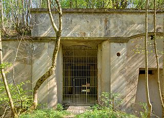
Ouvrage Barbonnet is a work of the Maginot Line's Alpine extension, the Alpine Line, also called the Little Maginot Line. The ouvrage consists of one entry block and one infantry block facing Italy. The ouvrage was built somewhat behind the main line of fortifications on the old Fort Suchet, which was already armed with two obsolete Mougin 155mm gun turrets.

The fortified region of Belfort formed the first line of defense in the Séré de Rivières system of fortifications in the Belfort Gap. Located in northeastern France between Épinal and Besançon, the primary line was built in the late 19th century to deal with advances in artillery that had made older defensive systems obsolete.

Fort du Salbert, also known as Fort Lefebvre, was built between 1874 and 1877. It was named after General François Joseph Lefebvre. It forms part of the Séré de Rivières system fortifications in the fortified region of Belfort in northeastern France. It is located at the summit of Salbert hill to the northwest of Belfort. During the early years of the Cold War it briefly served as an air defense coordination center.
Fort de Roppe, also known as Fort Ney, was built between 1875 and 1877. It is part of the second ring of fortifications around the city of Belfort in northeastern France. This set of forts was built as part of the Séré de Rivières system and incorporated improvements to deal with the improvement in efficacy of artillery in the late 19th century.

Fort Bois d'Oye, also known as Fort Eblé, is located in the commune of Bermont. It was built between 1883 and 1886. It is part of the second ring of fortifications around the city of Belfort in northeastern France. This second ring of forts was built as part of the Séré de Rivières system and incorporated improvements to deal with the improvement in efficacy of artillery in the late 19th century.

Fort des Hautes Perches was built between 1874 and 1877 in Danjoutin and Belfort in northeastern France. It is part of the first ring of fortifications around the city of Belfort. The Forts des Perches were unique among the first group in their re-use of older sites. They were rebuilt as part of the Séré de Rivières system and incorporated improvements to deal with the improvement in efficacy of artillery in the late 19th century.

Fort de Vézelois, also known as Fort Ordener, was built between 1883 and 1886 near Vézelois, to the southeast of Belfort in northeastern France. It is part of the first ring of fortifications around the city of Belfort. It is part of the second ring of fortifications around the city of Belfort in northeastern France. This set of forts was built as part of the Séré de Rivières system and incorporated improvements to deal with the improvement in efficacy of artillery in the late 19th century. The fort was formally named after French General Michel Ordener.
Fort de Giromagny, also known as Fort Dorsner, was built near Belfort in northeastern France between 1875 and 1879. The fort forms the southern end of the defensive curtain of the Haute Moselle Region, abutting the fortified region of Belfort, which lies to its south. The Haute Moselle defenses form a link between the fortified encampments of Épinal and Belfort. The fort overlooks the main roads to the northeast of Belfort, which form a crossroads at Giromagny.

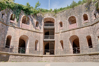
The Mougin turret is a land-based revolving gun turret that housed some of the heaviest armament in French fortifications of the late 19th and early 20th centuries. While not reliably resistant to the explosive shells of opposing artillery, Mougin turrets remained active through 1940, when they engaged German and Italian forces during the Battle of France and the Italian invasion of France. The turrets were used at twenty-two forts of the Séré de Rivières system built in the 1870s.

The Fort de Saint-Cyr, located in the commune of Montigny-le-Bretonneux, (Yvelines), is one of the forts built at the end of the 19th century to defend Paris. After the first world war the fort was used as an army weather station and arms depot. Classed in 1992 as a monument historique, it is now used as a film depository for the preservation of movies under the Cinémathèque française.

Fort de Villey-le-Sec, also known as Fort Trévise, is a fortification of the 19th century, built as part of the Séré de Rivières system of fortifications in Villey-le-Sec, France, one of the defenses of Toul. It is a unique example for its time of a defensive enclosure around a village. Conceived after the defeat of the Franco-Prussian War of 1870-71, the fort was located away from the main combat zone of World War I and has remained almost intact. The fort's preservation association has been at work since 1961 to restore and interpret the site. It has been included in the Inventory of Historic Sites and has been designated as a preserved natural area.

The Fort de Vaujours, located in the commune of Courtry, Seine-Saint-Denis, near the town of Vaujours, is one of the forts built at the end of the 19th century to defend Paris. It became a research center for the Commissariat à l'énergie atomique (CEA), France's Atomic Energy Commission. The center was closed in 1997.

The Fort de Liouville, also known as Fort Stengel, located between the communes of Saint-Agnant-sous-les-Côtes and Saint-Julien-sous-les-Côtes, near the town of Commercy in the Meuse departement of France, is one of the forts built at the end of the 19th century to defend the valley of the Meuse. The fort was located on what was then the French frontier facing the German-occupied province of Lorraine. The Fort de Liouville was located between the Fort de Gironville and the Camp des Romains.

The Fort du Replaton is a fortification of the Séré de Rivières system in Modane, France. The fort was built to provide artillery cover for the French end of the Fréjus Rail Tunnel 800 metres (2,600 ft) away horizontally. It is connected to Modane by an aerial tram, which continues on from Replaton to the Fort du Sapey on a much higher eminence.

Fort du Mont Bart is located to the south of Montbéliard, France. It was built between November 1874 and July 1877 as part of the Séré de Rivières system of fortifications. The fort overlooks the valleys of the Doubs and the Allan at an elevation of 497 metres (1,631 ft), standing to the south and rear of the fortified region of Belfort and in control of the road to Besançon. The fort was intended to augment the Belfort fortifications and to prevent an enemy from bypassing them. The most striking feature of the Fort du Mont Bart is its "interior street", originally constructed in the open air as a sunken court, then covered before World War I with reinforced concrete.

The Fort de Leveau, also known as Fort Schouller, is located in the commune of Feignies, France. It is part of the fortifications of Maubeuge, located to the northwest of the city, overlooking the railroad to Mons. The Séré de Rivières system fort was built 1882–1884, one of six forts built at the time. It is maintained as a museum by the town of Feignies.

The Fort de la Croix-de-Bretagne is a fortification in the vicinity of Briançon in the Dauphiné region of southeastern France. It was built as part of the Séré de Rivières system of fortifications in 1876–79 to defend France against invasion from Italy, at a cost of 1,416,642 francs. It overlooks the valley of the Durance from an altitude of 2,016 metres (6,614 ft) and monitors the Cervière road to Italy. The position was used by the French Army in the defense of Briançon until 1940, when it was part of the Fortified Sector of the Dauphiné.

The Fort de Bourlémont, or Fort Choiseul, was built between 1878 and 1881. The fort was built as part of the Séré de Rivières system of fortifications, which were conceived in response to the increasing power and range of artillery. The Fort de Bourlémont was part of the defenses of the Charmes Gap, in the town of Mont-lès-Neufchâteau, 3 kilometres (1.9 mi) west of Neufchâteau.
The Fort de Condé, or Fort Pille, is a fortification of the Séré de Rivières system, built in France between 1877 and 1883 to defend the area between Soissons and Laon. It is located on the heights of the confluence of the Aisne and the Vesle near the communes of Condé-sur-Aisne and Chivres-Val. Although the fort was considered obsolete at the start of World War I, its command of strategic ground made it a coveted objective throughout the war, changing hands several times. Following the war it was used in support service before its abandonment and purchase by a local community. It has been under preservation since 1979 and may be visited.

The Fort de Cormeilles-en-Parisis was constructed between 1874 and 1877 as part of a new plan for the defense of Paris developed by General Raymond Adolphe Séré de Rivières, near the town of Cormeilles-en-Parisis. During the Franco-Prussian War, German troops had used the hill upon which the fort sits as a spotting and firing location, ideal for the siting of new rifled guns whose range was increased over old-fashioned smooth-bore guns. These weapons could attack Paris from Cormeilles, so a new outer ring of forts had to be built outside the first ring of forts built in 1840–1860 to deny the area to enemy gunners. The Séré de Rivières system was designed as a response to these technological innovations, and to the loss of French territories in Alsace and Lorraine.


