
Watauga County is a county located in the U.S. state of North Carolina. As of the 2020 census, the population was 54,086. Its county seat and largest community is Boone. The county is in an exceptionally mountainous region, known as the High Country. It is the home of Appalachian State University, which has approximately 20,023 students as of August 2020. Watauga County comprises the Boone, NC Micropolitan Statistical Area.
Banner Elk is a town in Avery County, North Carolina, United States. The population was 1,028 at the 2010 census. Banner Elk is home to Lees–McRae College.

Bethel is a town in Pitt County, North Carolina, United States. The population was 1,577 at the 2010 census. The town is a part of the Greenville Metropolitan Area located in North Carolina's Inner Banks region. Confusingly, there are three other towns in the state named "Bethel." One is between Edenton and Hertford in the "Finger Counties" region in the northeastern corner of the state, another is in the north-central part, in Caswell County and the third is located in the Mountain Region of North Carolina, in Haywood County. There is also a community named Bethel located in Watauga County.

Deep Gap is an unincorporated community located in Watauga County, North Carolina, United States. The community is named after the natural gap, called Deep Gap, at Fire Scale Mountain, where the Blue Ridge Parkway crosses over US 421. Influential guitar player Doc Watson was born in Deep Gap and lived there until his death on May 29, 2012.

Valle Crucis in an unincorporated community and census-designated place located in Watauga County, North Carolina, United States. The name of the town is Latin for "Vale of the Cross," a reference to a valley in the area where three streams converge to form a shape similar to an archbishop's cross. The community is located along NC 194, between the towns of Banner Elk and Boone.

The Nolichucky River is a 115-mile (185 km) river that flows through western North Carolina and East Tennessee in the southeastern United States. Traversing the Pisgah National Forest and the Cherokee National Forest in the Blue Ridge Mountains, the river's watershed includes some of the highest mountains in the Appalachians, including Mount Mitchell in North Carolina, the highest point in the eastern United States. The river is a tributary of the French Broad River and is impounded by Nolichucky Dam near Greeneville, Tennessee.

The Elk River is a large stream in the North Carolina High Country and East Tennessee. The headwaters begin from the Northwestern slopes of Peak Mountain in Avery County, North Carolina and end at the Watauga River in Carter County, Tennessee.
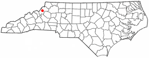
Zionville in an unincorporated community located in Watauga County, North Carolina. The community lies at the North Carolina/Tennessee state line, between Boone and Mountain City, along Old US Highway 421.

Linville is an unincorporated community and census-designated place (CDP) in Avery County, North Carolina, United States. It was first listed as a CDP in the 2020 census with a population of 283. Centered just south of US 221 and NC 105, the community is known as a summer mountain resort and host of the Grandfather Mountain Highland Games, the largest modern Highland games events in North Carolina.

Todd is an unincorporated community straddling the county lines of Watauga and Ashe counties in northwestern North Carolina, United States on the South Fork of the New River. It lies at an elevation of 2,992 feet. The population was 2,141 at the 2010 United States Census. The ZIP Code for Todd is 28684.

Grandmother Mountain is a mountain in the North Carolina High Country, near the community of Linville. It is wholly in the Pisgah National Forest and next to the Blue Ridge Parkway. Its elevation reaches 4,603 feet (1,403 m). The mountain generates feeder streams for the Linville River.

Hanging Rock, also known as Bear's Paw, is a mountain in the North Carolina High Country, next to the town of Seven Devils. It is along the Avery and Watauga border. Its elevation reaches 5,203 feet (1,586 m). The mountain generates feeder streams for the Elk and Watauga rivers.

Peak Mountain is a mountain in the North Carolina High Country, near the town of Seven Devils. It is known by several other names such as Tynecastle Peak, Invershiel Peak and Dunvegan Peak. It is wholly in the Pisgah National Forest. Its elevation reaches 4,921 feet (1,500 m).

North Carolina Highway 105 (NC 105) is a primary state highway in the U.S. state of North Carolina. It traverses from the mountain community of Linville to the town of Boone.
Tomkins Mountain is a mountain in the North Carolina High Country, near the community of Deep Gap. The majority of the mountain is within the Blue Ridge Parkway. Its elevation reaches 4,075 feet (1,242 m) and it also marks the corner between Ashe, Watauga, and Wilkes counties.

Snake Mountain is a mountain located along the border of North Carolina and Tennessee, east of the community of Zionville, in the southeastern United States. It is part of the Blue Ridge Mountains, and includes parts of Watauga County, North Carolina, and Johnson County, Tennessee. It has two peaks, the higher of which reaches an elevation of 5,564 feet (1,696 m). The lower peak, at 5,518 feet (1,682 m), is Johnson County's high point.
Rich Mountain Bald is a mountain in the North Carolina High Country, southeast of the community of Zionville. Its elevation reaches 5,361 feet (1,634 m).
Vilas is an unincorporated community in Watauga County, North Carolina, United States. The community is located at Linville Creek, along U.S. Route 321 and U.S. Route 421, 5.6 miles (9.0 km) west-northwest of Boone. The Vilas post office, with ZIP code 28692, was established in 1885.
Bearwallow is an unincorporated community in Henderson County, North Carolina United States and is part of the Asheville Metropolitan Statistical Area. It is located along Gerton Highway (US 74A), within Hickory Nut Gorge, flanked by Burntshirt, Grant, and Little Bearwallow mountains.
Silverstone is an unincorporated community in Watauga County, North Carolina, United States.

