Fossambault-sur-le-Lac

Last updated

Fossambault-sur-le-Lac
Lac Saint-Joseph, Quebec.jpg
Lake Saint-Joseph in Fossambault-sur-le-Lac
Motto: 
Crois en l'avenir
Fossambault-sur-le-Lac Quebec location diagram.png
Location within La Jacques-Cartier RCM.
Canada Central Quebec location map.png
Red pog.svg
Fossambault-sur-le-Lac
Location in central Quebec.
Coordinates: 46°52′N71°37′W / 46.867°N 71.617°W / 46.867; -71.617 [1]
CountryFlag of Canada (Pantone).svg  Canada
Province Flag of Quebec.svg  Quebec
Region Capitale-Nationale
RCM La Jacques-Cartier
ConstitutedMarch 10, 1949
Government
[2]
  MayorJean Laliberté
   Federal riding Portneuf—Jacques-Cartier
   Prov. riding La Peltrie
Area
  Total13.80 km2 (5.33 sq mi)
  Land11.49 km2 (4.44 sq mi)
Elevation
367 m (1,204 ft)
Population
 (2021) [3]
  Total2,327
  Density202.6/km2 (525/sq mi)
  Pop 2016-2021
Increase2.svg 18.7%
  Dwellings
1,282
Time zone UTC−5 (EST)
  Summer (DST) UTC−4 (EDT)
Postal code(s)
G3N
Area code(s) 418 and 581
HighwaysNo major routes
Website www.fossambault-
sur-le-lac.com

Fossambault-sur-le-Lac is a city in the south part of Quebec, Canada, in La Jacques-Cartier Regional County Municipality, just north of Quebec City. It had a population of 2,327 as of the Canada 2021 Census. It is located near Saint-Joseph Lake.

Contents

Demographics

Historical Census Data - Fossambault-sur-le-Lac, Quebec [4]
YearPop.±%
1991 817    
1996 921+12.7%
2001 1,055+14.5%
2006 1,532+45.2%
2011 1,613+5.3%
2016 1,960+21.5%
2021 2,327+18.7%

In the 2021 Census of Population conducted by Statistics Canada, Fossambault-sur-le-Lac had a population of 2,327 living in 994 of its 1,282 total private dwellings, a change of 18.7% from its 2016 population of 1,960. With a land area of 11.49 km2 (4.44 sq mi), it had a population density of 202.5/km2 (524.5/sq mi) in 2021. [5]

Canada census – Fossambault-sur-le-Lac community profile
2021 2016 2011
Population2,327 (+18.7% from 2016)1,960 (+21.5% from 2011)1,613 (+5.3% from 2006)
Land area11.49 km2 (4.44 sq mi)11.53 km2 (4.45 sq mi)11.38 km2 (4.39 sq mi)
Population density202.6/km2 (525/sq mi)170.0/km2 (440/sq mi)141.7/km2 (367/sq mi)
Median age42.4 (M: 42.4, F: 42.4)42.7 (M: 43.7, F: 41.5)44.2 (M: 45.1, F: 43.1)
Private dwellings1,282 (total)  994 (occupied)1,283 (total) 1,257 (total) 
Median household income$103,000$82,432$72,030
References: 2021 [6] 2016 [7] 2011 [8] earlier [9] [10]

Mother tongue:

Places of interest

Station Touristique Duchesnay is one of the most attractive places of the town. The Jacques-Cartier River flows just nearby, and Route Fossambault links the town to Sainte-Catherine-de-la-Jacques-Cartier, where the Sainte Catherine's church is located. There is also a well-known hotel, called "Hotel de la Glace", with views overlooking the lake.

See also

Related Research Articles

<span class="mw-page-title-main">Sainte-Catherine, Quebec</span> City in Quebec, Canada

Sainte-Catherine is an off-island suburb of Montreal, in southwestern Quebec, Canada, on the St. Lawrence River in the Regional County Municipality of Roussillon. The population as of the Canada 2011 Census was 16,762.

<span class="mw-page-title-main">Sainte-Anne-des-Plaines</span> City in Quebec, Canada

Sainte-Anne-des-Plaines is a city in southwestern Quebec, Canada, 40 km northwest of the city of Montreal in the Thérèse-De Blainville Regional County Municipality, in the region of Laurentides. Its population was 14,990 during the census of 2014.

<span class="mw-page-title-main">Capitale-Nationale</span> Administrative region in Quebec, Canada

Capitale-Nationale is one of the 17 administrative regions of Quebec. It is anchored by the provincial capital, Quebec City, and is largely coextensive with that city's metropolitan area. It has a land area of 18,797.45 km2. It reported a total resident population of 729,997 as of the Canada 2016 Census, with Quebec City having 73.7 percent of the total.

<span class="mw-page-title-main">Sainte-Anne-des-Lacs</span> Parish municipality in Quebec, Canada

Sainte-Anne-des-Lacs is a municipality in the regional county municipality of Les Pays-d'en-Haut in Quebec, Canada, located in the administrative region of Laurentides. The municipality was founded in 1946 and was assigned the municipal number 77035 by the Quebec government. The Roman Catholic parish of Sainte-Anne-des-Lacs was founded in 1940.

<span class="mw-page-title-main">Sainte-Agathe-des-Monts</span> City in Quebec, Canada

Sainte-Agathe-des-Monts is a town in the province of Quebec, Canada, in the regional county municipality of Les Laurentides in the administrative region of Laurentides, also known as the "Laurentians" or the Laurentian Mountains. Sainte-Agathe-des-Monts borders on a lake called Lac des Sables, and is located approximately 80 kilometres (50 mi) northwest of Montreal, and 130 kilometres (81 mi) northeast of Ottawa.

<span class="mw-page-title-main">Nominingue</span> Municipality in Quebec, Canada

Nominingue is a small village and municipality located 200 kilometres (120 mi) north of Montreal, Quebec, Canada, in the Laurentian Mountains. It was formerly called Lac-Nominingue, but changed name on September 16, 2000.

<span class="mw-page-title-main">Shannon, Quebec</span> City in Quebec, Canada

Shannon is a city in Quebec, Canada, along the Jacques-Cartier River northwest of Quebec City.

<span class="mw-page-title-main">Notre-Dame-de-l'Île-Perrot</span> City in Quebec, Canada

Notre-Dame-de-l'Île-Perrot is the largest of four municipalities located on Île Perrot, west of the island of Montreal, Quebec. The population as of the Canada 2016 Census was 10,654. It hosts the island's first church built in 1740 originally situated at Pointe-du-Moulin which was reconstituted as the Chapelle du Souvenir in 1953 beside the church of Sainte-Jeanne-de-Chantal across from the town hall.

<span class="mw-page-title-main">Sainte-Marthe-sur-le-Lac</span> City in Quebec, Canada

Sainte-Marthe-sur-le-Lac is an off-island suburb of Montreal, in the Canadian province of Quebec, in the Deux-Montagnes Regional County Municipality, 40 km from Montreal. It is crossed from east to west by Route 344, commonly known as Oka Road. The town shares its borders with Deux-Montagnes to the east, Saint-Joseph-du-Lac to the west, the Lake of Two Mountains to the south, and Saint-Eustache to the north.

<span class="mw-page-title-main">Sainte-Catherine-de-la-Jacques-Cartier</span> City in Quebec, Canada

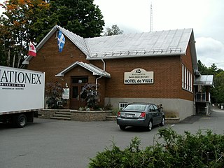
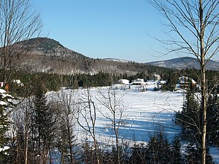
Sainte-Catherine-de-la-Jacques-Cartier is a town in Quebec, Canada, located in the regional county municipality of La Jacques-Cartier, in the administrative region of Capitale-Nationale. The Jacques-Cartier River passes through the city.

<span class="mw-page-title-main">Pont-Rouge</span> City in Quebec, Canada

Pont-Rouge is a city along the Jacques-Cartier River in southern Quebec, Canada. In the Canada 2021 Census the population was 10,121 inhabitants.

<span class="mw-page-title-main">Vaudreuil-sur-le-Lac</span> Village municipality in Quebec, Canada

Vaudreuil-sur-le-Lac is a village municipality in Vaudreuil-Soulanges Regional County Municipality in the Montérégie region of Quebec, Canada. It is located on the western portion of the Vaudreuil Peninsula, which projects into Lake of Two Mountains. The population as of the Canada 2016 Census was 1,341.

<span class="mw-page-title-main">Estérel, Quebec</span> City in Quebec, Canada

Estérel is a city in Les Pays-d'en-Haut Regional County Municipality in the Laurentides region of Quebec, Canada. The municipal territory almost entirely extends around Lake Masson, whereas the village itself is situated on the eastern shore of this lake.

<span class="mw-page-title-main">Ivry-sur-le-Lac</span> Municipality in Quebec, Canada

Ivry-sur-le-Lac is a village and municipality in the Laurentides region of Quebec, Canada, part of the Les Laurentides Regional County Municipality. The municipality completely encompasses Lake Manitou which is a popular cottage vacation location.

<span class="mw-page-title-main">Sainte-Anne-du-Lac</span> Municipality in Quebec, Canada

Sainte-Anne-du-Lac is a municipality and village in the Laurentides region of Quebec, Canada, part of the Antoine-Labelle Regional County Municipality.

<span class="mw-page-title-main">Lac-Delage</span> City in Quebec, Canada

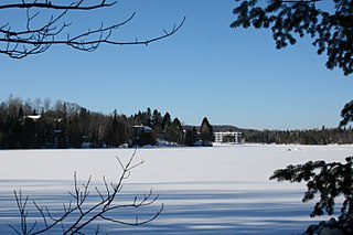
Lac-Delage is a town in the Capitale-Nationale region of Quebec, Canada, located on the eponymous Lake Delage.

<span class="mw-page-title-main">Saint-André-du-Lac-Saint-Jean, Quebec</span> Village municipality in Quebec, Canada

Saint-André-du-Lac-Saint-Jean is a village municipality, in Le Domaine-du-Roy Regional County Municipality, in Quebec, in Canada.

<span class="mw-page-title-main">Sainte-Brigitte-de-Laval</span> City in Quebec, Canada

Sainte-Brigitte-de-Laval is a city in La Jacques-Cartier Regional County Municipality in the Capitale-Nationale region of Quebec, Canada. Its urban area is located in the hollow of the Montmorency River valley, northeast of Quebec City.

<span class="mw-page-title-main">Mont-Albert, Quebec</span> Unorganized territory in Quebec, Canada

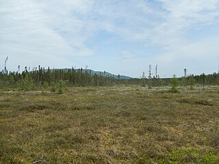
Mont-Albert is an unorganized territory in the Gaspésie–Îles-de-la-Madeleine region of Quebec, Canada.

<span class="mw-page-title-main">Saint-Joseph Lake</span> Lake of dam in Capitale-Nationale, Quebec

Saint-Joseph Lake is a freshwater body located in the La Jacques-Cartier Regional County Municipality, in the administrative region of Capitale-Nationale, in the province of Quebec, Canada.

References

  1. "Reference number 23278 in Banque de noms de lieux du Québec". toponymie.gouv.qc.ca (in French). Commission de toponymie du Québec.
  2. 1 2 Ministère des Affaires municipales, des Régions et de l'Occupation du territoire - Répertoire des municipalités: Fossambault-sur-le-Lac Archived 2015-12-12 at the Wayback Machine
  3. 1 2 Statistics Canada 2021 Census - Fossambault-sur-le-Lac census profile
  4. Statistics Canada: 1996, 2001, 2006, 2011, 2016, 2021 census
  5. "Population and dwelling counts: Canada, provinces and territories, and census subdivisions (municipalities), Quebec". Statistics Canada. February 9, 2022. Retrieved August 29, 2022.
  6. "2021 Community Profiles". 2021 Canadian Census . Statistics Canada. February 4, 2022. Retrieved 2023-10-19.
  7. "2016 Community Profiles". 2016 Canadian Census . Statistics Canada. August 12, 2021. Retrieved 2022-04-27.
  8. "2011 Community Profiles". 2011 Canadian Census . Statistics Canada. March 21, 2019. Retrieved 2022-07-19.
  9. "2006 Community Profiles". 2006 Canadian Census . Statistics Canada. August 20, 2019.
  10. "2001 Community Profiles". 2001 Canadian Census . Statistics Canada. July 18, 2021.