Stoneham-et-Tewkesbury

Last updated

Stoneham-et-Tewkesbury
Vue aerienne Stoneham 10-2023 (1).jpg
Downtown Stoneham-et-Tewkesbury
Logo Stoneham-et-Tewkesbury.png
Stoneham-et-Tewkesbury Quebec location diagram.png
Location within La Jacques-Cartier RCM
Canada Central Quebec location map.png
Red pog.svg
Stoneham-et-Tewkesbury
Location in central Quebec
Coordinates: 47°10′N71°26′W / 47.167°N 71.433°W / 47.167; -71.433 [1]
Country Canada
Province Quebec
Region Capitale-Nationale
RCM La Jacques-Cartier
Settled1815
ConstitutedJuly 1, 1855
Government
[2]
  MayorSébastien Couture
   Federal riding Portneuf—Jacques-Cartier
   Prov. riding Chauveau
Area
  Total686.23 km2 (264.95 sq mi)
  Land670.03 km2 (258.70 sq mi)
Population
 (2021) [3]
  Total9,682
  Density14.5/km2 (38/sq mi)
  Pop 2016-2021
Increase2.svg 15.8%
  Dwellings
4,421
Time zone UTC−5 (EST)
  Summer (DST) UTC−4 (EDT)
Postal code(s)
G3C
Area code(s) 418 and 581
Highways
Quebec Autoroute 73.svg A-73

Qc175.svg R-175
Qc371.svg R-371
Website www.villestoneham.com OOjs UI icon edit-ltr-progressive.svg
Stoneham Mountain Resort Stoneham wiki.JPG
Stoneham Mountain Resort

Stoneham-et-Tewkesbury is a united township municipality in the Canadian province of Quebec, located in the regional county municipality of La Jacques-Cartier north of Quebec City. Its main attraction is the Stoneham Mountain Resort.

Contents

The large territory of the municipality is only developed and inhabited in the south, where the population centres of Saint-Adolphe, Stoneham, and Tewkesbury are located. Large portions of the north are included in the Jacques-Cartier National Park and the Laurentides Wildlife Reserve. The terrain is hilly, part of the Laurentian Mountains, and crossed by the Jacques-Cartier, upper Sainte-Anne, and Hurons Rivers. Some of the more notable lakes are Beaumont, Saint-Vincent, and Saint-Guillaume.

History

In 1792, Philip Toosey was granted some 70 acres (280,000 m2) of land that formed the beginning of the village that he named Stoneham after the namesake village in Suffolk, England, where he came from. That same year, the toponyms of the geographic townships of Stoneham and Tewkesbury appeared. Tewkesbury may be attributed to Kenelm Chandler who was born in Tewkesbury, England, arrived in 1764 and was granted 9713 hectares of land in Stoneham in 1800. [1] [4]

The first influx of Irish, English, and Scottish settlers came in 1815. By 1831, its population had passed 175. In 1845, the Stoneham Municipality was formed and abolished in 1847. In 1850, the Parish of Saint-Edmond-de-Stoneham was formed, named after Edmund Rich of Canterbury (1170-1240). The Stoneham Post Office opened in 1854. A year later on July 1, the United Township Municipality of Stoneham-et-Tewkesbury was established, populated by about 25 families. [1]

In 1871, its population had grown to 640 (360 in Stoneham township and 280 in Tewkesbury township). In 1880, the Tewkesbury Post Office opened (and closed in 1963). The completion of the railroad, owned by the St. Charles and Huron River Railway Company, between Stoneham-et-Tewkesbury and Loretteville in 1912 led to intensive logging in the area. Timber was floated down the Hurons River to Stoneham from where it was brought by rail to Quebec City. The railway was also used to transport cargo and wood pulp of the Brown Corporation and the Donnacona Paper Company. By 1920, the place had become an important commercial center of northern Quebec. [1] [4]

In 1973, the neighbouring municipality of Saint-Adolphe was annexed into Stoneham-et-Tewkesbury, making it one of the largest municipalities in Quebec at that time. [4]

Demographics

Historical Census Data - Stoneham-et-Tewkesbury, Quebec
YearPop.±%
1831 175    
1871 662+278.3%
1881 820+23.9%
1891 727−11.3%
1901 1,168+60.7%
1911 735−37.1%
1921 885+20.4%
1931 874−1.2%
1941 1,038+18.8%
YearPop.±%
1951 1,033−0.5%
1956 1,036+0.3%
1961* 1,208+16.6%
1966 1,322+9.4%
1971 1,691+27.9%
1976 2,432+43.8%
1981 3,513+44.4%
1986 3,745+6.6%
1991 4,384+17.1%
YearPop.±%
1991 4,384+0.0%
1996 4,842+10.4%
2001 5,266+8.8%
2006 5,866+11.4%
2011 7,106+21.1%
2016 8,359+17.6%
2021 9,682+15.8%
(*) The Town of Lac-Delage separated from Stoneham-et-Tewkesbury
Source: Statistics Canada [5]

In the 2021 Census of Population conducted by Statistics Canada, Stoneham-et-Tewkesbury had a population of 9,682 living in 3,862 of its 4,421 total private dwellings, a change of

Private dwellings occupied by usual residents: 3,862 (total dwellings: 4,421)

Mother tongue:

Government

Stoneham-et-Tewkesbury forms part of the federal electoral district of Portneuf—Jacques-Cartier and has been represented by Joël Godin of the Conservative Party since 2015. Provincially, Stoneham-et-Tewkesbury is part of the Chauveau electoral district and is represented by Sylvain Lévesque of the Coalition Avenir Québec since 2018.

Stoneham-et-Tewkesbury federal election results [7]
Year Liberal Conservative Bloc Québécois New Democratic Green
2021 15%73347%2,26626%1,2626%3020%0
2019 19%87340%1,85225%1,1637%3066%258
Stoneham-et-Tewkesbury provincial election results [8]
Year CAQ Liberal QC solidaire Parti Québécois
2018 46%2,19420%95713%6249%442
2014 54%2,37625%1,1245%20514%603

List of mayors

See also

Related Research Articles

<span class="mw-page-title-main">Capitale-Nationale</span> Administrative region in Quebec, Canada

Capitale-Nationale is one of the 17 administrative regions of Quebec. It is anchored by the provincial capital, Quebec City, and is largely coextensive with that city's metropolitan area. It has a land area of 18,797.45 km2. It reported a total resident population of 729,997 as of the Canada 2016 Census, with Quebec City having 73.7 percent of the total.

<span class="mw-page-title-main">Melbourne, Quebec</span> Township municipality in Quebec, Canada

Melbourne is a township municipality located in Le Val-Saint-François Regional County Municipality in the Estrie region of Quebec, Canada.

<span class="mw-page-title-main">Westbury, Quebec</span> Township municipality in Quebec, Canada

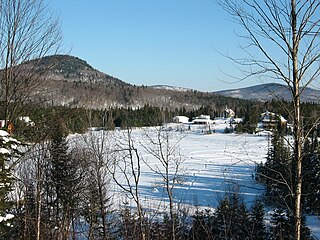
Westbury is a township municipality in Le Haut-Saint-François Regional County Municipality, in Quebec, Canada. It surrounds the city of East Angus.

<span class="mw-page-title-main">Hampden, Quebec</span> Township municipality in Quebec, Canada

Hampden is a township municipality of about 200 people in Le Haut-Saint-François Regional County Municipality, in the Estrie region of Quebec, Canada.

<span class="mw-page-title-main">Lingwick</span> Township municipality in Quebec, Canada

Lingwick is a township of about 400 people in Le Haut-Saint-François Regional County Municipality in the Estrie region of Quebec, Canada.

<span class="mw-page-title-main">Latulipe-et-Gaboury</span> United township municipality in Quebec, Canada

Latulipe-et-Gaboury is a united township municipality in northwestern Quebec, Canada, in the Témiscamingue Regional County Municipality. The only other remaining united township municipality in Quebec is Stoneham-et-Tewkesbury.

<span class="mw-page-title-main">Gore, Quebec</span> Township municipality in Quebec, Canada

Gore is a township municipality in the Canadian province of Quebec, located within the Argenteuil Regional County Municipality. Its main community is Lakefield.

<span class="mw-page-title-main">Harrington, Quebec</span> Township municipality in Quebec, Canada

Harrington is a township municipality in the Laurentides region of Quebec, Canada, part of the Argenteuil Regional County Municipality. It is located in the Laurentian Mountains, about 40 kilometres (25 mi) north-west of Lachute.

<span class="mw-page-title-main">Wentworth, Quebec</span> Township municipality in Quebec, Canada

Wentworth is a township municipality in the Laurentides region of Quebec, Canada, part of the Argenteuil Regional County Municipality, north-west of Lachute.

<span class="mw-page-title-main">Hope, Quebec</span> Township municipality in Quebec, Canada

Hope is a township municipality in the Canadian province of Quebec, located within the Bonaventure Regional County Municipality. Its population was 568 in the Canada 2016 Census.

<span class="mw-page-title-main">Saint-Godefroi, Quebec</span> Township municipality in Quebec, Canada

Saint-Godefroi is a township municipality in the Canadian province of Quebec, located within the Bonaventure Regional County Municipality. The township had a population of 380 in the Canada 2016 Census.

<span class="mw-page-title-main">Sainte-Catherine-de-la-Jacques-Cartier</span> City in Quebec, Canada

Sainte-Catherine-de-la-Jacques-Cartier is a town in Quebec, Canada, located in the regional county municipality of La Jacques-Cartier, in the administrative region of Capitale-Nationale. The Jacques-Cartier River passes through the city.

<span class="mw-page-title-main">Natashquan</span> Municipality in Quebec, Canada

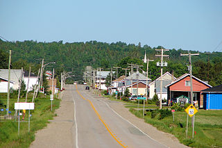
Natashquan is a municipality in Minganie Regional County Municipality, Côte-Nord region, Quebec, Canada. It should not be confused with the adjacent but separate Innu reserve of Nutashkuan.

<span class="mw-page-title-main">Lac-Saint-Joseph</span> City in Quebec, Canada

Lac-Saint-Joseph is a town in Quebec, Canada, located on the namesake Saint-Joseph Lake.

<span class="mw-page-title-main">Sainte-Brigitte-de-Laval</span> City in Quebec, Canada

Sainte-Brigitte-de-Laval is a city in La Jacques-Cartier Regional County Municipality in the Capitale-Nationale region of Quebec, Canada. Its urban area is located in the hollow of the Montmorency River valley, northeast of Quebec City.

<span class="mw-page-title-main">Sautauriski River</span> River in Quebec, Canada

The Sautauriski River is a tributary of the Jacques-Cartier River, flowing in the administrative region of Capitale-Nationale, in Quebec, Canada. This watercourse subsequently crosses:

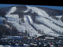
The rivière Hibou is a tributary of the rivière des Hurons, flowing in the heart of the municipality of the townships of Stoneham-et-Tewkesbury, in the La Jacques-Cartier Regional County Municipality, in the administrative region of Capitale-Nationale, in the province of Quebec, in Canada.

<span class="mw-page-title-main">Rivière des Hurons (Saint-Charles Lake)</span> Tributary of Saint-Charles Lake, in Quebec, Canada

The rivière des Hurons is a river flowing in the heart of the municipality of Cantons-unis de Stoneham-et-Tewkesbury, located north of Quebec (city), in the La Jacques-Cartier Regional County Municipality, in the administrative region of Capitale-Nationale, in province from Quebec, to Canada.

The rivière Noire is a tributary of the rivière des Hurons, flowing in the heart of the municipality of the townships of Stoneham-et-Tewkesbury, located north of the city of Quebec, in the La Jacques-Cartier Regional County Municipality, in the administrative region of the Capitale-Nationale, in the province of Quebec, in Canada.

References

  1. 1 2 3 4 "Banque de noms de lieux du Québec: Reference number 60857". toponymie.gouv.qc.ca (in French). Commission de toponymie du Québec.
  2. 1 2 "Répertoire des municipalités: Stoneham-et-Tewkesbury". www.mamh.gouv.qc.ca (in French). Ministère des Affaires municipales et de l'Habitation. Retrieved 17 October 2022.
  3. 1 2 "Stoneham-et-Tewkesbury, Cantons unis (municipalité de) (CU) Census Profile, 2021 Census of Population". www12.statcan.gc.ca. Government of Canada - Statistics Canada. 9 February 2022. Retrieved 17 October 2022.
  4. 1 2 3 "Historique des cantons-unis" (in French). Cantons unis de Stoneham-et-Tewkesbury. Retrieved 2010-04-20.
  5. 1996, 2001, 2006, 2011, 2016, 2021 census
  6. "Population and dwelling counts: Canada, provinces and territories, and census subdivisions (municipalities), Quebec". Statistics Canada. February 9, 2022. Retrieved August 28, 2022.
  7. "Official Voting Results Raw Data (poll by poll results in Stoneham-et-Tewkesbury)". Elections Canada. 7 April 2022. Retrieved March 3, 2023.
  8. "Official Voting Results by polling station (poll by poll results in Stoneham-et-Tewkesbury)". Elections Québec. Retrieved March 3, 2023.