Gentryville, Indiana

Last updated

Gentryville, Indiana
Gentryville, Indiana.jpg
Spencer County Indiana Incorporated and Unincorporated areas Gentryville Highlighted 1827270.svg
Location of Gentryville in Spencer County, Indiana
Coordinates: 38°06′33″N87°01′53″W / 38.10917°N 87.03139°W / 38.10917; -87.03139
Country United States
State Indiana
County Spencer
Township Jackson
Area
[1]
  Total0.40 sq mi (1.02 km2)
  Land0.39 sq mi (1.02 km2)
  Water0.00 sq mi (0.00 km2)  0%
Elevation
[2]
466 ft (142 m)
Population
 (2020)
  Total243
  Density616.75/sq mi (238.06/km2)
Time zone UTC-6 (CST)
  Summer (DST) UTC-5 (CDT)
ZIP code
47537
Area code 812
FIPS code 18-27270 [3]
GNIS feature ID2396957 [2]

Gentryville is a town in Jackson Township, Spencer County, in the U.S. state of Indiana. [2] The population was 268 at the 2010 census.

Contents

History

Gentryville was platted in December 1854, and named for James Gentry, an early settler and local businessman. [4]

The Gentryville post office has been in operation since 1826. [5]

Geography

According to the 2010 census, Gentryville has a total area of 0.39 square miles (1.01 km2), all land. [6]

Demographics

Historical population
CensusPop.Note
1900 464
1910 383−17.5%
1920 291−24.0%
1930 271−6.9%
1940 258−4.8%
1950 234−9.3%
1960 29726.9%
1970 281−5.4%
1980 2996.4%
1990 277−7.4%
2000 262−5.4%
2010 2682.3%
2020 243−9.3%
U.S. Decennial Census [7]

2010 census

As of the census [8] of 2010, there were 268 people, 110 households, and 79 families living in the town. The population density was 687.2 inhabitants per square mile (265.3/km2). There were 118 housing units at an average density of 302.6 per square mile (116.8/km2). The racial makeup of the town was 95.9% White, 1.1% African American, 1.9% Native American, 0.7% from other races, and 0.4% from two or more races. Hispanic or Latino of any race were 1.1% of the population.

There were 110 households, of which 27.3% had children under the age of 18 living with them, 55.5% were married couples living together, 8.2% had a female householder with no husband present, 8.2% had a male householder with no wife present, and 28.2% were non-families. 21.8% of all households were made up of individuals, and 7.3% had someone living alone who was 65 years of age or older. The average household size was 2.44 and the average family size was 2.75.

The median age in the town was 44.4 years. 19% of residents were under the age of 18; 8.3% were between the ages of 18 and 24; 23.9% were from 25 to 44; 32.5% were from 45 to 64; and 16.4% were 65 years of age or older. The gender makeup of the town was 47.8% male and 52.2% female.

2000 census

As of the census [3] of 2000, there were 262 people, 95 households, and 81 families living in the town. The population density was 674.1 inhabitants per square mile (260.3/km2). There were 106 housing units at an average density of 272.7 per square mile (105.3/km2). The racial makeup of the town was 96.18% White, 1.15% Native American, 0.38% Asian, 0.76% from other races, and 1.53% from two or more races. Hispanic or Latino of any race were 3.05% of the population.

There were 95 households, out of which 41.1% had children under the age of 18 living with them, 67.4% were married couples living together, 11.6% had a female householder with no husband present, and 14.7% were non-families. 12.6% of all households were made up of individuals, and 5.3% had someone living alone who was 65 years of age or older. The average household size was 2.76 and the average family size was 2.95.

In the town, the population was spread out, with 26.3% under the age of 18, 9.9% from 18 to 24, 27.1% from 25 to 44, 22.5% from 45 to 64, and 14.1% who were 65 years of age or older. The median age was 37 years. For every 100 females, there were 92.6 males. For every 100 females age 18 and over, there were 94.9 males.

The median income for a household in the town was $38,750, and the median income for a family was $41,750. Males had a median income of $29,375 versus $23,542 for females. The per capita income for the town was $15,752. About 5.1% of families and 9.6% of the population were below the poverty line, including 14.5% of those under the age of eighteen and none of those 65 or over.

Recent roadway developments

In March 2011, U.S. 231 was relocated to a new four-lane highway approximately four miles east of Gentryville. Indiana 62 and Indiana 162 continue to pass through the community. Indiana 62 utilizes the former route of U.S. 231.[ citation needed ]

See also

Related Research Articles

<span class="mw-page-title-main">Odon, Indiana</span> Town in Indiana, United States

Odon is a town in Madison Township, Daviess County, Indiana, United States. The population was 1,354 at the 2010 census.

<span class="mw-page-title-main">Westport, Indiana</span> Town in Indiana, United States

Westport is a town located in Sand Creek Township, Decatur County, Indiana. The population was 1,379 at the 2010 census. A covered bridge, built in 1880, is located about 1.5 miles east of town.

<span class="mw-page-title-main">Birdseye, Indiana</span> Town in Indiana, United States

Birdseye is a town in Jefferson Township, Dubois County, in the U.S. state of Indiana. At the 2010 census, the town population was 415.

<span class="mw-page-title-main">Cedar Grove, Indiana</span> Town in Indiana, United States

Cedar Grove is a town in Highland Township, Franklin County, Indiana, United States. The population was 156 at the 2010 census.

<span class="mw-page-title-main">Somerville, Indiana</span> Town in Indiana, United States

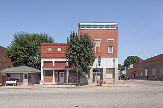
Somerville is a town in Barton Township, Gibson County, Indiana, United States. The population was 293 at the 2010 census, making it the third-smallest community in the county.

<span class="mw-page-title-main">Atlanta, Indiana</span> Town in Indiana, United States

Atlanta is a town in Jackson Township, Hamilton County, Indiana, United States. The population was 725 at the 2010 census.

<span class="mw-page-title-main">Wheatfield, Indiana</span> Town in Indiana, United States

Wheatfield is a town in Wheatfield Township, Jasper County, Indiana, United States. The population was 904 at the 2020 census.

<span class="mw-page-title-main">Dupont, Indiana</span> Town in Indiana, United States

Dupont is a town in Lancaster Township, Jefferson County, Indiana, United States. The population was 339 at the 2010 census.

<span class="mw-page-title-main">Bargersville, Indiana</span> Town in Indiana, United States

Bargersville is a town in White River and Union townships, Johnson County, Indiana, United States. The population was 9,560 at the 2020 census.

<span class="mw-page-title-main">Kingsford Heights, Indiana</span> Town in Indiana, United States

Kingsford Heights is a town in Union Township, LaPorte County, Indiana, United States. The population was 1,335 at the 2020 census. It is included in the Michigan City, Indiana-La Porte, Indiana Metropolitan Statistical Area. Also known as "Victory City," the town was built by the United States government for workers that worked in the Kingsbury Ordnance Plant, an ammunitions plant that served the US during World War II and later the Korean War.

<span class="mw-page-title-main">Bunker Hill, Indiana</span> Town in Indiana, United States

Bunker Hill is a town in Pipe Creek Township, Miami County, in the U.S. state of Indiana. The population was 814 at the 2020 census, down from 888 in 2010.

<span class="mw-page-title-main">Bethany, Indiana</span> Town in Indiana, United States

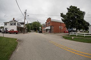
Bethany is a town in Clay Township, Morgan County, in the U.S. state of Indiana. The population was 95 at the 2020 census.

<span class="mw-page-title-main">Paragon, Indiana</span> Town in Indiana, United States

Paragon is a town in Ray Township, Morgan County, in the U.S. state of Indiana. The population was 556 at the 2020 census, down from 659 in 2010.

<span class="mw-page-title-main">Marshall, Indiana</span> Town in Indiana, United States

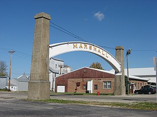
Marshall is a town in Washington Township, Parke County, Indiana, United States. As of the 2010 census, the population was 324.

<span class="mw-page-title-main">Troy, Indiana</span> Town in Indiana, United States

Troy is a town in Troy Township, Perry County, Indiana, along the Ohio River near the mouth of the Anderson River. It is the second oldest city in Indiana. The population was 347 at the 2020 census.

<span class="mw-page-title-main">Spurgeon, Indiana</span> Town in Indiana, United States

Spurgeon is a town in Monroe Township, Pike County, in the U.S. state of Indiana. The population was 207 at the 2010 census. It is part of the Jasper Micropolitan Statistical Area.

<span class="mw-page-title-main">Town of Pines, Indiana</span> Town in Indiana, United States

Town of Pines is a town in Pine Township, Porter County, in the U.S. state of Indiana. The population was 708 at the 2010 census.

<span class="mw-page-title-main">Sunman, Indiana</span> Town in Indiana, United States

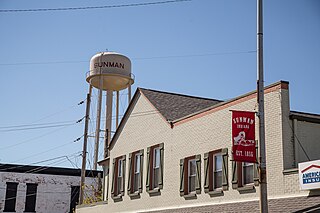
Sunman is a town in Adams Township, Ripley County, in the U.S. state of Indiana. The population was 1,049 at the 2010 census.

<span class="mw-page-title-main">North Liberty, Indiana</span> Town in Indiana, United States

North Liberty is a town in Liberty Township, St. Joseph County, in the U.S. state of Indiana. The population was 1,896 at the 2010 Census. North Liberty is part of the South Bend–Mishawaka, IN-MI, Metropolitan Statistical Area.

<span class="mw-page-title-main">Shadeland, Indiana</span> Town in Indiana, United States

Shadeland is a town in Union Township, Tippecanoe County, in the U.S. state of Indiana. The population was 1,610 at the 2010 census.

References

  1. "2020 U.S. Gazetteer Files". United States Census Bureau. Retrieved March 16, 2022.
  2. 1 2 3 U.S. Geological Survey Geographic Names Information System: Gentryville, Indiana
  3. 1 2 "U.S. Census website". United States Census Bureau . Retrieved January 31, 2008.
  4. History of Warrick, Spencer, and Perry Counties, Indiana: From the Earliest Time to the Present. Goodspeed. 1885. p.  366.
  5. "Spencer County". Jim Forte Postal History. Archived from the original on September 7, 2005. Retrieved July 9, 2016.
  6. "G001 - Geographic Identifiers - 2010 Census Summary File 1". United States Census Bureau. Archived from the original on February 13, 2020. Retrieved July 16, 2015.
  7. "Census of Population and Housing". Census.gov. Retrieved June 4, 2015.
  8. "U.S. Census website". United States Census Bureau . Retrieved December 11, 2012.