Georgia, Vermont

Last updated

Georgia, Vermont
Dist8School.JPG
District 8 School or "The Brick School" is now the Georgia Historical Society Museum
Motto: 
"Working Together" [1]
Franklin County Vermont incorporated and unincorporated areas Georgia highlighted.svg
Location in Franklin County and the state of Vermont.
Coordinates: 44°42′49″N73°6′38″W / 44.71361°N 73.11056°W / 44.71361; -73.11056
Country United States
State Vermont
County Franklin
CommunitiesGeorgia Center
Georgia Plains
Hubbard Corner
Melville Landing
Oakland
West Georgia
Area
  Total45.2 sq mi (117.1 km2)
  Land39.3 sq mi (101.9 km2)
  Water5.9 sq mi (15.3 km2)
Elevation
364 ft (111 m)
Population
 (2020)
  Total4,845
  Density123/sq mi (47.5/km2)
Time zone UTC-5 (Eastern (EST))
  Summer (DST) UTC-4 (EDT)
ZIP codes
05454, 05468, 05478
Area code 802
FIPS code 50-27700 [2]
GNIS feature ID1462101 [3]
Website www.townofgeorgia.com

Georgia is a town in Franklin County, Vermont, United States. The population was 4,845 at the 2020 census. [4]

Contents

Geography

The town occupies the southwest corner of Franklin County, bordered to the south by Chittenden County. The western border of the town is within Lake Champlain and its St. Albans Bay. St. Albans, the Franklin County seat, is to the north. U.S. Route 7 passes through the town, as does Interstate 89, which crosses US-7 at Exit 18 in the southeast part of town. Both highways lead north to St. Albans and south to Burlington.

According to the United States Census Bureau, the town has a total area of 45.2 square miles (117.1 km2), of which 39.3 square miles (101.9 km2) is land and 5.9 square miles (15.3 km2), or 13.03%, is water. [5] The Lamoille River crosses the southeast corner of the town.

History

Georgia was named after King George III by New Hampshire, which was meant to sway the king in a land dispute over Vermont between New York and New Hampshire, both of which claimed to have the rights to the land. During the War of 1812, smuggling was common throughout Vermont, except for Georgia, where the citizens formed a blockade to support the embargo on Canadian goods. The blockade was so functional that smugglers started to call Georgia "Hell's Gate". [6]

Demographics

Historical population
CensusPop.Note
1790 340
1800 1,068214.1%
1810 1,76064.8%
1820 1,703−3.2%
1830 1,89711.4%
1840 2,10611.0%
1850 2,68627.5%
1860 1,547−42.4%
1870 1,6033.6%
1880 1,504−6.2%
1890 1,282−14.8%
1900 1,280−0.2%
1910 1,090−14.8%
1920 1,075−1.4%
1930 1,0901.4%
1940 1,008−7.5%
1950 1,0554.7%
1960 1,0792.3%
1970 1,71158.6%
1980 2,81864.7%
1990 3,75333.2%
2000 4,37516.6%
2010 4,5153.2%
2020 4,8457.3%
U.S. Decennial Census [7]

As of the census [2] of 2000, there were 4,375 people, 1,484 households, and 1,231 families residing in the town. The population density was 110.8 people per square mile (42.8/km2). There were 1,654 housing units at an average density of 41.9 per square mile (16.2/km2). The racial makeup of the town was 98.31% White, 0.25% African American, 0.16% Native American, 0.25% Asian, 0.02% Pacific Islander, 0.23% from other races, and 0.78% from two or more races. Hispanic or Latino of any race were 0.57% of the population.

There were 1,484 households, out of which 46.2% had children under the age of 18 living with them, 72.1% were couples living together and joined in either marriage or civil union, 7.4% had a female householder with no husband present, and 17.0% were non-families. 12.3% of all households were made up of individuals, and 4.2% had someone living alone who was 65 years of age or older. The average household size was 2.94 and the average family size was 3.20.

In the town, the population was spread out, with 31.2% under the age of 18, 5.9% from 18 to 24, 34.1% from 25 to 44, 22.7% from 45 to 64, and 6.1% who were 65 years of age or older. The median age was 34 years. For every 100 females, there were 101.7 males.

The median income for a household in the town was $54,156, and the median income for a family was $59,712. Males had a median income of $37,294 versus $26,090 for females. The per capita income for the town was $20,888. About 1.9% of families and 3.8% of the population were below the poverty line, including 2.8% of those under age 18 and 9.0% of those age 65 or over.

Notable people

Related Research Articles

<span class="mw-page-title-main">Franklin County, Vermont</span> County in Vermont, United States

Franklin County is a county located in the U.S. state of Vermont. As of the 2020 census, the population was 49,946. Its county seat is the city of St. Albans. It borders the Canadian province of Quebec. The county was created in 1792 and organized in 1796. Franklin County is part of the Burlington metropolitan area.

<span class="mw-page-title-main">Bakersfield, Vermont</span> Town in Vermont, United States

Bakersfield is a town in Franklin County, Vermont, United States. The population was 1,273 at the 2020 census.

<span class="mw-page-title-main">Berkshire, Vermont</span> Town in Vermont, United States

Berkshire is a town in Franklin County, Vermont, United States. The population was 1,547 at the 2020 census. It contains the unincorporated village of East Berkshire.

<span class="mw-page-title-main">Enosburgh, Vermont</span> Town in Vermont, United States

Enosburgh is a town in Franklin County, Vermont, in the United States. The population was 2,810 at the 2020 census. Enosburgh includes the village of Enosburg Falls and the settlements of Bordoville, East Enosburgh, North Enosburgh, Sampsonville, West Enosburgh, and Enosburgh Center. Enosburgh was named for Roger Enos, who had been a commander of all the Vermont Forces in the American Revolution. He was also the father-in-law of Ira Allen, founder of Vermont. The spelling of Enosburgh differs from the spelling of Enosburg Falls.

<span class="mw-page-title-main">Enosburg Falls, Vermont</span> Village in Vermont, United States

Enosburg Falls is a village in the town of Enosburgh in Franklin County, Vermont, in the United States. The population was 1,356 at the 2020 census.

<span class="mw-page-title-main">Fairfax, Vermont</span> Town in Vermont, United States

Fairfax is a town in Franklin County, Vermont, United States. The population was 5,014 at the 2020 census.

<span class="mw-page-title-main">Fairfield, Vermont</span> Town in Vermont, United States

Fairfield is a town in Franklin County, Vermont, United States, chartered in 1763. The population was 2,044 at the 2020 census. President Chester A. Arthur was born in Fairfield in 1829, and lived there for the first three years of his life. A replica of his home, the Chester Alan Arthur State Historic Site, is open seasonally.

<span class="mw-page-title-main">Fletcher, Vermont</span> Town in Vermont, United States

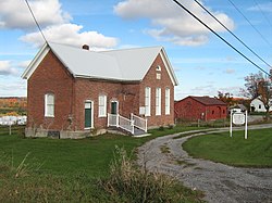
Fletcher is a town in Franklin County, Vermont, United States. The population was 1,346 at the 2020 census.

<span class="mw-page-title-main">Franklin, Vermont</span> Town in Vermont, United States

Franklin is a town in Franklin County, Vermont, United States. The population was 1,363 at the 2020 census. The original name was "Huntsburgh", but the name was changed to "Franklin" in 1817.

<span class="mw-page-title-main">Highgate, Vermont</span> Town in Vermont, United States

Highgate is a town in Franklin County, Vermont, United States. The population was 3,472 at the 2020 census. The town is on the Canada–US border and is a border town with Philipsburg, Quebec.

<span class="mw-page-title-main">Richford, Vermont</span> Town in Vermont, United States

Richford is a town in Franklin County, Vermont, United States, located along the Canada–United States border. The population was 2,346 at the 2020 census.

<span class="mw-page-title-main">Sheldon, Vermont</span> Town in Vermont, United States

Sheldon is a town in Franklin County, Vermont, United States. The population was 2,136 at the 2020 census. It contains the unincorporated community of Sheldon Springs.

<span class="mw-page-title-main">Grand Isle, Vermont</span> Town in Vermont, United States

Grand Isle is a town on Grand Isle in Grand Isle County, Vermont, United States. The population was 2,086 at the 2020 census.

<span class="mw-page-title-main">North Hero, Vermont</span> Town in Vermont, United States

North Hero is a town in and the shire town of Grand Isle County, Vermont, United States. The population was 939 at the 2020 census.

<span class="mw-page-title-main">St. Albans, West Virginia</span> City in West Virginia, United States

St. Albans is a city in western Kanawha County, West Virginia, United States, at the confluence of the Kanawha and Coal rivers. The population was 10,861 at the 2020 census. It is part of the Charleston metropolitan area.

<span class="mw-page-title-main">St. Albans (town), Vermont</span> Town in Vermont, United States

Saint Albans, commonly abbreviated as St. Albans, is a town in Franklin County, Vermont, United States. As of the 2020 census, the population was 6,988. The town completely surrounds St. Albans City, which is a separate municipality.

<span class="mw-page-title-main">St. Albans (city), Vermont</span> City in Vermont, United States

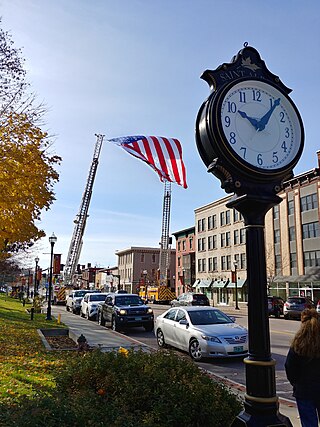
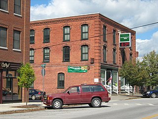
St. Albans is the only city in and the seat of Franklin County, Vermont, United States. At the 2020 census, the city population was 6,877. St. Albans City is completely surrounded by St. Albans Town, which is a separate municipality. The city is located in Northwestern Vermont, 29 miles north of Burlington, Vermont's most populous city, which is located in Chittenden County.

<span class="mw-page-title-main">Swanton, Vermont (village)</span> Village in Vermont, United States

Swanton is a village in the town of Swanton in Franklin County, Vermont, United States. It is sometimes called Swanton Village to distinguish it from the surrounding town of the same name. The population was 2,328 at the 2020 census. It was founded in 1888.

<span class="mw-page-title-main">Swanton, Vermont (town)</span> Town in Vermont, United States

Swanton is a town in Franklin County, Vermont, United States. The population was 6,701 at the 2020 census. The town includes the village of Swanton.

<span class="mw-page-title-main">Cambridge, Vermont</span> Town in Vermont, United States

Cambridge is a town in Lamoille County, Vermont, United States. The population was 3,839 at the 2020 United States Census. Cambridge includes the villages of Jeffersonville and Cambridge.

References

  1. Town of Georgia official website
  2. 1 2 "U.S. Census website". United States Census Bureau . Retrieved January 31, 2008.
  3. "US Board on Geographic Names". United States Geological Survey. October 25, 2007. Retrieved January 31, 2008.
  4. "Census - Geography Profile: Georgia town, Franklin County, Vermont". United States Census Bureau . Retrieved December 30, 2021.
  5. "Geographic Identifiers: 2010 Demographic Profile Data (G001): Georgia town, Franklin County, Vermont". U.S. Census Bureau, American Factfinder. Retrieved September 13, 2016.[ dead link ]
  6. Vermont2 (August 16, 2018). "Georgia, Vermont, New England USA". Virtual Vermont. Retrieved April 23, 2024.{{cite web}}: CS1 maint: numeric names: authors list (link)
  7. "U.S. Decennial Census". United States Census Bureau. Retrieved May 16, 2015.
  8. Aldrich, Lewis Cass (1891). History of Franklin and Grand Isle Counties, Vermont. Syracuse, NY: D. Mason & Co. p.  697.