Related Research Articles

Jasper County is the southernmost county in the U.S. state of South Carolina. As of the 2020 census, the population was 28,791. Its county seat is Ridgeland and its largest city is Hardeeville. The county was formed in 1912 from portions of Hampton County and Beaufort County.

Clearwater is a census-designated place (CDP) in Aiken County, South Carolina. It lies near North Augusta, South Carolina, and is part of the Augusta, Georgia metropolitan area. Clearwater is located in historic Horse Creek Valley. The population was 4,370 at the time of the 2010 census.

Red Bank is an unincorporated community and census-designated place (CDP) in Lexington County, South Carolina, United States. The population was 9,617 at the 2010 census, up from 8,811 at the 2000 census. It is part of the Columbia, South Carolina Metropolitan Statistical Area.
Saxon is a census-designated place (CDP) in Spartanburg County, South Carolina, United States. The population was 3,424 at the 2010 census.
Buford is an unincorporated community and census-designated place (CDP) in Lancaster County, South Carolina, United States. It was first listed as a CDP in the 2020 census with a population of 398. It lies at the intersection of South Carolina Highways 9 and 522.

Carolina Forest is a census-designated place (CDP) in Horry County, South Carolina, United States. It was first listed as a CDP in the 2020 census with a population of 23,342.
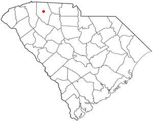
Pauline is an unincorporated community and census-designated place (CDP) in Spartanburg County, South Carolina, United States. It was first listed as a CDP in the 2020 census with a population of 209.

Coosawhatchie (koo-saw-HATCH-ee) is an unincorporated community and census-designated place (CDP) located in Jasper County, South Carolina, United States at the northern head of the Broad River. It served as the headquarters for General Robert E. Lee during the early part of the American Civil War. It was first listed as a CDP in the 2020 census with a population of 57. It is accessible from Interstate 95 via Exit 28.

South Carolina Highway 462 (SC 462) is a 35.920-mile (57.808 km) primary state highway in the U.S. state of South Carolina. It serves as a circuitous routing through northern and eastern Jasper County.
Drayton is an unincorporated community and census-designated place (CDP) in Spartanburg County, in the U.S. state of South Carolina. It was first listed as a CDP in the 2020 census with a population of 1,115.
Finklea is an unincorporated community and census-designated place (CDP) in Horry County, South Carolina, United States. As of the 2020 census it had a population of 291.
Edmund is an unincorporated community and census-designated place (CDP) in Lexington County, South Carolina, United States. It was first listed as a CDP in the 2020 census with a population of 969.
Helena is an unincorporated community and census-designated place (CDP) in Newberry County, South Carolina, United States. It was first listed as a CDP prior to the 2020 census with a population of 870.
Keowee Key is a lakeside community and census-designated place (CDP) in Oconee County, South Carolina, United States. It is considered part of the Salem community. It was first listed as a CDP prior to the 2020 census with a population of 2,716.
Arthurtown is an unincorporated community and census-designated place (CDP) in Richland County, South Carolina, United States. It was listed appeared as a CDP prior to the 2020 census. Its population in 2020 was 2,294.
Capitol View is an unincorporated part of Richland County, South Carolina, United States, consisting of several neighborhoods that are next to the city of Columbia, the state capital. The area was first listed as a census-designated place (CDP) prior to the 2020 census. In 2020 its population was 4,653.
Camp Croft is an unincorporated area and census-designated place (CDP) in Spartanburg County, South Carolina, United States. It was first listed as a CDP prior to the 2020 census. The 2020 census lists a population of 2,110.
Hilltop is an unincorporated area and census-designated place (CDP) adjacent to the city of Spartanburg in Spartanburg County, South Carolina, United States. It was first listed as a CDP prior to the 2020 census with a population of 3,273.
Whitney is an unincorporated area and census-designated place (CDP) adjacent to the city of Spartanburg in Spartanburg County, South Carolina, United States. It was first listed as a CDP prior to the 2020 census with a population of 4,409.
Baxter Village is a planned community and census-designated place (CDP) in York County, South Carolina, United States. It was first listed as a CDP prior to the 2020 census which showed a population of 4,217.
References
- ↑ "ArcGIS REST Services Directory". United States Census Bureau. Retrieved October 15, 2022.
- 1 2 "Census Population API". United States Census Bureau. Retrieved Oct 15, 2022.
- ↑ "Gillisonville SC ZIP Code". zipdatamaps.com. 2023. Retrieved February 17, 2023.
- ↑ U.S. Geological Survey Geographic Names Information System: Gillisonville, South Carolina
- ↑ "Gillisonville CDP, South Carolina". United States Census Bureau . Retrieved April 7, 2022.
- ↑ "Post Offices". Jim Forte Postal History. Retrieved 5 January 2017.
- ↑ Federal Writers' Project (1938). The Ocean Highway: New Brunswick, New Jersey to Jacksonville, Florida. Works Progress Administration. p. 140.
- ↑ "Gillisonville Baptist Church, Jasper County (U.S. Hwy. 278, Gillisonville)". South Carolina Department of Archives and History. Retrieved 10 January 2017.
- ↑ "Decennial Census of Population and Housing by Decades". US Census Bureau.
- 1 2 "P2 HISPANIC OR LATINO, AND NOT HISPANIC OR LATINO BY RACE – 2020: DEC Redistricting Data (PL 94-171) – Gillisonville CDP, South Carolina". United States Census Bureau .
Municipalities and communities of Jasper County, South Carolina, United States | ||
|---|---|---|
| City |  | |
| Town | ||
| CDPs | ||
| Other communities | ||
| Footnotes | ‡This populated place also has portions in an adjacent county or counties. | |
Coordinates: 32°36′40″N81°00′13″W / 32.61111°N 81.00361°W
| | This South Carolina state location article is a stub. You can help Wikipedia by expanding it. |